In the realm of environmental science and sustainable land management, the use of Geographic Information Systems (GIS) has become increasingly critical. A recent study conducted by Tasew, Belete, and Nigussie aims to enhance our understanding of gully severity in the Meqebesa sub-catchment, located within the Lake Hawassa watershed in Ethiopia. By employing Analytic Hierarchy Process (AHP) techniques alongside GIS tools, the researchers have pioneered a methodology that not only maps, but also quantifies the extent of gully erosion — a significant phenomenon affecting land degradation worldwide.
The study originates from the pressing need to address soil erosion, which represents one of the foremost threats to environmental sustainability. Gullies form as a result of concentrated runoff eroding the land, leading to the loss of nutrients, soil structure, and ultimately, agricultural productivity. The Meqebesa sub-catchment, with its unique topographical and climatic characteristics, provides an ideal location for this investigation, given its susceptibility to erosion processes coupled with ongoing agricultural activities.
To initiate their research, the authors conducted an extensive literature review which highlighted several previous studies on gully erosion. They uncovered the limitations associated with traditional methods of evaluating soil erosion — often reliant on field surveys which can be labor-intensive and time-consuming. This revelation inspired the integration of AHP and GIS, hoping to address these challenges while offering a more holistic and efficient approach to mapping gully severity.
The AHP technique serves as a multi-criteria decision-making tool. By utilizing this methodology, the researchers were able to rank various factors influencing soil erosion, including slope angle, land use, soil type, and rainfall intensity. This ranking formed the basis for their subsequent GIS analysis, and the combination not only enhanced the efficiency of data processing but also increased the accuracy of the findings.
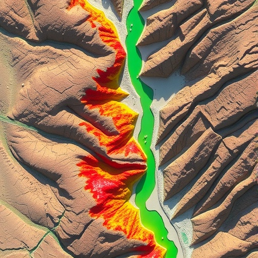
GIS, on the other hand, allowed for the visualization and spatial interpretation of the data. With the aid of satellite imagery and remote sensing, the researchers generated detailed maps that illustrated gully locations and severity levels across the study area. Such visual representation is crucial, as it aids in identifying critical areas that require immediate intervention and further investigation.
One of the significant findings of the study was the relationship between land use and gully formation. The researchers found that areas with intensive agricultural practices experienced higher rates of erosion compared to more naturally vegetated regions. These findings emphasize the importance of sustainable land management practices, promoting the need for educational initiatives aimed at farmers — illustrating the long-term benefits of adopting erosion control techniques that could mitigate the detrimental impacts of gully formation.
Furthermore, the researchers explored the implications of rainfall variability on soil erosion. With climate change posing threats to weather patterns globally, understanding how fluctuations in rainfall impact gully formation is essential. Their analysis indicated that episodes of intense rainfall significantly accelerated the rate of soil erosion, highlighting the urgent need for adaptive strategies that cater to changing climatic conditions.
As the study progressed, the researchers also conducted a sensitivity analysis, ensuring the robustness of their model. This step is critical in applied research, particularly when decisions based on the findings could influence land management policies. The outcomes of their analyses confirmed that the integration of AHP and GIS yields a reliable framework for assessing gully severity.
The authors also detail the importance of community involvement in their study. Engaging local stakeholders throughout the research process allowed for the inclusion of indigenous knowledge and observations that enhanced the study’s relevance. By fostering a collaborative approach, the research team ensured that future land management strategies would have stronger community backing, essential for successful implementation.
In reflecting on future directions, the study emphasizes the necessity for continued research into the interplay between gully erosion, land use, and climate dynamics. It foresees the potential for scaling their methodology to larger regions, thus aiding other areas in Ethiopia and beyond that face similar challenges. Moreover, it calls for the development of policy frameworks that prioritize erosion control and sustainable land management practices.
The implications of this research are profound, particularly as nations across the globe grapple with the effects of land degradation. By providing a comprehensive framework for identifying and mapping gully severity, the researchers have equipped policymakers and land managers with valuable tools. Such tools not only enhance our understanding of erosion but also pave the way for proactive strategies capable of addressing environmental challenges before they escalate.
In conclusion, the integration of AHP and GIS in mapping gully severity represents a significant advancement in the field of environmental management. This innovative approach not only enhances our understanding of soil erosion processes but also emphasizes the role of technological integration in tackling some of the most pressing challenges facing our landscapes today. By adopting these methodologies, we can forge pathways towards more resilient ecosystems and sustainable agricultural practices.
While there continues to be much work ahead to fully address the complexities of gully erosion and land degradation, the findings from Tasew and colleagues illuminate the potential for science and technology to drive meaningful change. Such advancements reinforce the critical role that research will play as we strive to foster a more sustainable future, one where land is managed with care and respect for both people and the planet.
Subject of Research: Mapping gully severity areas using AHP techniques and GIS at Meqebesa sub-catchment, Lake Hawassa watershed, Ethiopia.
Article Title: Mapping gully severity areas using AHP techniques and GIS at Meqebesa sub-catchment, Lake Hawassa watershed, Ethiopia.
Article References:
Tasew, A.G., Belete, M.D., Nigussie, T.A. et al. Mapping gully severity areas using AHP techniques and GIS at Meqebesa sub-catchment, Lake Hawassa watershed, Ethiopia.
Discov Sustain (2025). https://doi.org/10.1007/s43621-025-02519-5
Image Credits: AI Generated
DOI: 10.1007/s43621-025-02519-5
Keywords: gully erosion, GIS, AHP, land management, sustainable practices, soil degradation, Ethiopia, environmental science.
