In a groundbreaking study published in Environmental Earth Sciences, researchers have unveiled a comprehensive assessment of erosion susceptibility within the Nyong watershed area, located in Southern Cameroon. This research presents an innovative approach combining advanced morphometric analysis with sub-watershed prioritization techniques to establish a detailed understanding of erosion risks and landscape vulnerability. The findings promise to be instrumental in formulating sustainable land management strategies crucial for the ecological and socio-economic stability of the region.
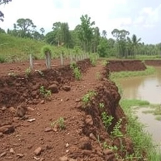
Erosion, a persistent environmental challenge affecting soil fertility and natural habitats, has long threatened the agricultural productivity and water quality in numerous parts of the world. Southern Cameroon, with its diverse topography and climatic conditions, represents a quintessential region for studying erosion dynamics. The high spatial variability in rainfall patterns and land use practices in this area exacerbates erosion processes, necessitating targeted interventions. The study harnesses quantitative morphometric parameters—a set of measurable features describing the shape, drainage networks, and relief characteristics of watersheds—to map and analyze erosion-prone zones with a high degree of precision.
The research team employed digital elevation models (DEMs) combined with Geographic Information Systems (GIS) technology to extract critical morphometric data across the Nyong watershed. Such parameters include relative relief, drainage density, stream frequency, bifurcation ratio, and texture ratio, among others. By leveraging these parameters, the team achieved a nuanced characterization of the terrain’s susceptibility to erosion. The morphometric analysis not only quantified the landscape’s physical attributes but also elucidated the inherent hydrological behaviors that influence runoff and sediment transport.
One of the pivotal aspects of this work lies in the segmentation of the Nyong watershed into numerous sub-watersheds. This subdivision facilitated a granular prioritization process, enabling the identification of hotspots where erosion control measures could be most effectively concentrated. The prioritization was based on a weighted scoring system integrating multiple morphometric indicators, reflecting the complex interplay of geomorphological factors contributing to erosion susceptibility. This methodological framework assures a strategic allocation of resources for soil and water conservation, optimizing environmental management interventions.
The application of morphometric analysis in conjunction with GIS has significantly enhanced the accuracy and efficiency of watershed management planning. Through detailed spatial analysis, the study reveals patterns of vulnerability that were previously obscured by the complexities of terrain and hydrology. This high-resolution insight is vital for stakeholders, including policymakers, environmental planners, and local communities, equipping them with actionable intelligence to mitigate erosion impacts effectively.
Moreover, this research addresses the socio-economic ramifications of erosion in Southern Cameroon. By preventing soil degradation and preserving watershed health, the livelihoods of agricultural communities who depend heavily on the land are safeguarded. The conservation efforts guided by morphometric data contribute to maintaining the soil’s productive capacity and sustaining water resources that are fundamental to both human needs and biodiversity conservation.
The study also touches upon the broader implications of erosion susceptibility assessment in the context of climate change. With the increasing frequency of extreme weather events and alterations in rainfall distribution patterns, regions like the Nyong watershed face growing environmental uncertainties. The morphometric-based approach offers a dynamic monitoring tool capable of adapting to changing conditions and supporting proactive environmental stewardship.
In addition to erosion control, the research underscores the utility of sub-watershed prioritization in managing flood risks and sedimentation problems commonly encountered in mountainous and tropical ecosystems. Accurate identification of sensitive sub-watersheds enables coordinated efforts to reduce sediment yield into rivers, which has downstream benefits including improved water quality and reduced reservoir siltation.
The integration of traditional field observations with remote sensing technologies in this investigation exemplifies a modern paradigm in environmental research. The balance between technological innovation and contextual understanding reinforces the reliability of the findings and their relevance to local conditions. The resulting erosion susceptibility maps provide a robust evidence base for framing environmental policies that are both effective and tailored to the specific challenges of the Nyong watershed region.
Notably, this research represents a significant contribution to the scientific community, setting a precedent for similar studies across other African watersheds and tropical environments worldwide. By demonstrating the feasibility and benefits of morphometric analysis in erosion assessment, it opens doors for replicable, cost-effective methodologies that can be scaled and customized according to regional priorities.
Furthermore, this study advocates for an interdisciplinary approach linking geomorphology, hydrology, environmental management, and socio-economic development. The synthesis of these fields within the context of erosion susceptibility fosters holistic solutions that transcend mere technical fixes, promoting resilience and sustainability in vulnerable landscapes.
As the global community intensifies its focus on ecosystem preservation and climate resilience, such research embodies the ideals of informed intervention and adaptive management. The mapping and prioritization efforts detailed in this work provide a replicable example that aligns with international environmental conventions and sustainable development goals aimed at combating land degradation and desertification.
In conclusion, the erosion susceptibility assessment conducted in the Nyong watershed through morphometric analysis and sub-watershed prioritization marks a pivotal advancement in environmental science. It bridges the gap between complex geomorphic processes and practical applications, transforming raw data into strategic insights that protect natural resources and human well-being alike. This study not only enriches scientific understanding but also equips decision-makers with the imperative tools necessary for effective environmental governance in the face of escalating ecological challenges.
Subject of Research:
Erosion susceptibility assessment through morphometric analysis and sub-watershed prioritization within the Nyong watershed in Southern Cameroon.
Article Title:
Erosion susceptibility assessment through morphometric analysis and sub-watershed prioritization in the Nyong watershed, Southern Cameroon.
Article References:
Tonkeu, A.F.A., Takem, G.E., Nguemhe, S.C., et al. Erosion susceptibility assessment through morphometric analysis and sub-watershed prioritization in the Nyong watershed, Southern Cameroon. Environ Earth Sci 85, 60 (2026). https://doi.org/10.1007/s12665-025-12715-1
Image Credits: AI Generated
DOI: https://doi.org/10.1007/s12665-025-12715-1
