In recent years, the increasing frequency of landslides has emerged as a pressing global concern, especially in regions with complex topographies and heavy rainfall. This mounting challenge necessitates advanced methodologies that leverage artificial intelligence (AI) to identify susceptible areas through effective mapping. A groundbreaking study conducted by a team of researchers, namely Mulabbi, Danoedoro, and Samodra, has ventured into this essential domain, integrating interpretable artificial neural networks, geomorphic plausibility, and transfer learning to enhance landslide susceptibility mapping. Their research, focusing on the case study of Pacitan in East Java, has significant implications for sustainable development and disaster management.
The use of artificial neural networks (ANNs) has revolutionized various fields, including environmental science. ANNs, inspired by the biological neural networks in the human brain, can detect complex patterns in large datasets that traditional statistical methods might overlook. However, the challenge remains regarding the interpretability of these models. The research team acknowledged this limitation and aimed to contribute a more comprehensible framework for stakeholders who rely on such predictive tools for decision-making. By integrating geomorphic plausibility into their models, the researchers not only delved into the patterns of past landslides but also included geographic features that inherently contribute to slope failures.
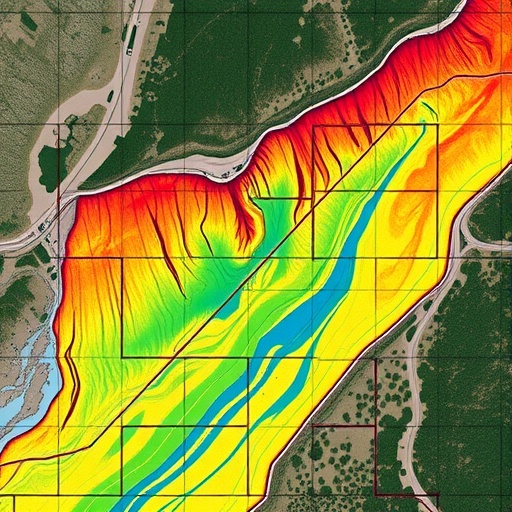
The case study of Pacitan is particularly noteworthy due to its unique geological setting and history of landslides, exacerbated by seasonal tropical rains. Pacitan’s topography, comprised of steep slopes and varied land use patterns, presents a complicated interplay of factors that influence landslide events. By applying their innovative methodology to this region, the researchers managed to produce a refined landslide susceptibility map, highlighting areas at highest risk and enabling authorities to allocate resources more effectively for preventive measures.
One of the central elements of their approach is the interpretability of the artificial neural network models. Interpretable AI is crucial for gaining the trust of stakeholders, especially in sectors like disaster risk reduction, where the consequences of decision-making can be dire. The researchers employed feature importance analyses, which can illuminate which geographic and environmental variables most significantly influence the probability of landslides. This transparency not only enhances confidence in the results but also allows policymakers to understand the underlying factors driving susceptibility assessments.
Moreover, the integration of geomorphic plausibility is a strategic move that adds another layer of analytical rigor to the study. This concept involves using geological and geographical knowledge to validate the model’s predictions against what is realistically expected from the landscape’s characteristics. By aligning empirical data with geomorphological principles, the researchers can ensure that their susceptibility mapping is not just a reflection of machine learning algorithms but is grounded in sound scientific understanding.
Transfer learning is another pivotal aspect of the study, enabling the model to benefit from existing datasets and experiences from other regions. This technique allows AI models trained on one dataset to apply learned features to a different but related dataset, which can drastically reduce training time and improve predictive performance. By employing transfer learning, the researchers demonstrated that even in regions with limited historical landslide data, effective susceptibility maps could still be created. This adaptability is particularly beneficial for regions that are vulnerable to landslides but lack comprehensive geological studies.
The implications of this research extend beyond academic curiosity; they offer practical applications for local governments, urban planners, and disaster management agencies. With more accurate and interpretable landslide susceptibility maps, stakeholders can make informed decisions about land-use planning, infrastructure development, and risk mitigation strategies. Best practices suggest that these maps should regularly be updated to reflect changes in land cover, climate conditions, and anthropogenic activities that may influence landslide risks over time.
Furthermore, the researchers emphasize the importance of collaboration between scientists, local authorities, and communities. It is crucial for outcomes from such studies to be communicated in accessible language, ensuring that local populations understand the risks and are engaged in discussions regarding preventive measures. Community involvement can facilitate ground-level insights, which can further enhance the robustness of predictive models and their acceptance among locals who are often the first responders to natural disasters.
In conclusion, the innovative approach taken by Mulabbi, Danoedoro, and Samodra to integrate artificial neural networks with geomorphic plausibility and transfer learning is a promising advancement in the field of landslide susceptibility mapping. Their work not only showcases the potential of AI in environmental science but also highlights the relevance of interdisciplinary research in addressing complex issues like landslides. As climate change continues to alter precipitation patterns and increase the frequency of extreme weather events, the importance of effective risk mapping becomes even more pronounced, ushering in a new era of safer and more resilient communities.
In sum, the findings and methodologies presented in this study are a significant contribution to the fields of geology, geography, and artificial intelligence. They pave the way for future research and applications that prioritize safety and sustainability in areas beset by geological hazards. The integration of advanced modeling techniques with practical geological insights exemplifies how science and technology can coalesce to tackle real-world challenges and safeguard future generations.
Subject of Research: Landslide susceptibility mapping using artificial neural networks.
Article Title: Integrating interpretable artificial neural networks, geomorphic plausibility and transfer learning for landslide susceptibility mapping: a case study of Pacitan, East Java.
Article References:
Mulabbi, A., Danoedoro, P. & Samodra, G. Integrating interpretable artificial neural networks, geomorphic plausibility and transfer learning for landslide susceptibility mapping: a case study of Pacitan, East Java.
Discov Sustain 6, 1159 (2025). https://doi.org/10.1007/s43621-025-01959-3
Image Credits: AI Generated
DOI:
Keywords: Artificial neural networks, geomorphic plausibility, transfer learning, landslide susceptibility mapping, East Java.
