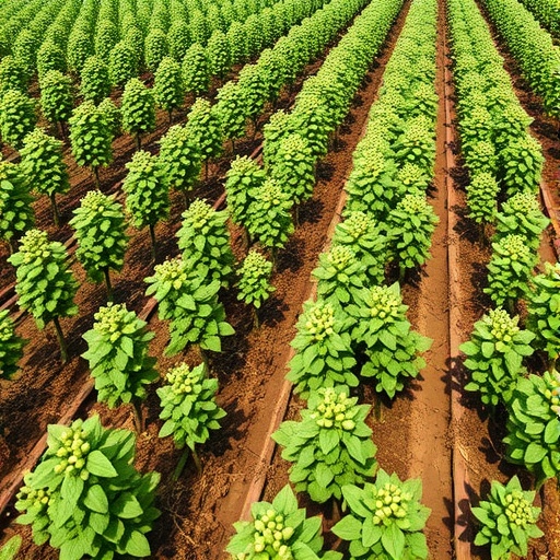
In a groundbreaking advancement for precision agriculture, a new study has unveiled a machine learning-based system that leverages satellite imagery combined with meteorological data to monitor and manage chickpea crop health at unprecedented scales. This novel technology specifically estimates two critical physiological parameters: Leaf Area Index (LAI) and Leaf Water Potential (LWP), which are pivotal indicators of canopy development and water status, respectively. Such insights provide farmers with actionable information to optimize irrigation strategies, potentially transforming chickpea cultivation in semi-arid regions across the globe.
The research, spearheaded by PhD candidate Omer Perach and supervised by Dr. Ittai Herrmann at the Robert H. Smith Institute of Plant Sciences and Genetics in Agriculture, Hebrew University of Jerusalem, marks the first large-scale application of this kind of integrative technological approach within chickpea farming. By harnessing the high-resolution capabilities of Sentinel-2 satellite imagery alongside ground-based weather station data, the team engineered models capable of estimating vital physiological traits across heterogeneous commercial fields.
At the core of the study was the utilization of machine learning algorithms that amalgamate multispectral remote sensing data with environmental variables to capture complex plant responses. This data fusion approach allows the model to discern subtle variations in canopy structure and water status that are not discernible through traditional remote sensing methods alone. The integration of Leaf Area Index and Leaf Water Potential estimations provides a comprehensive physiological profile, essential for understanding crop growth dynamics and stress responses.
One of the methodological highlights is the adoption of a “leave-field-out” cross-validation strategy. This testing framework simulates real-world conditions by training the model on a subset of fields while excluding others entirely during training, thus assessing its predictive robustness on unseen data. By doing so, the researchers ensured that the developed tool would maintain reliability when applied to new, unmonitored fields, enhancing its scalability and practical value for farmers who operate diverse plots.
The capacity to generate spatially explicit maps depicting crop physiological states means that farmers can observe the variation of water stress across their fields with fine granularity. This precision enables informed decision-making, especially in irrigation management, where over- or under-watering can significantly affect yields and resource use efficiency. Instead of relying on subjective assessments or coarse-scale data, growers gain access to objective, data-driven insights delivered directly from space.
In evaluating model performance, the researchers reported impressive accuracy levels for LAI estimation, with the system effectively distinguishing between gradations of water stress by analyzing changes in LWP. These physiological indicators are well-established proxies for photosynthetic activity and drought resistance, meaning that the model can capture subtle physiological shifts that precede visible symptoms of stress. Such early detection is crucial in adapting irrigation schedules to optimize water use while safeguarding crop health.
Dr. Herrmann emphasized the transformative potential of this research: “By detecting within-field variability using freely accessible satellite data in combination with standard meteorological inputs, we open the door to data-driven farming practices that can supersede traditional intuition-based approaches.” This paradigm shift from empirical management to precision agriculture aligns with broader sustainability goals, enabling enhanced productivity while conserving scarce water resources.
Another important aspect of this research lies in its envisaged integration into accessible cloud-based platforms like Google Earth Engine. This platform compatibility means that farmers worldwide, regardless of local technical infrastructure constraints, can potentially utilize the system without substantial investments in hardware or software. By democratizing access to advanced agronomic tools, the technology promises to support smallholder farmers in semi-arid environments that are often vulnerable to climate variability and resource limitations.
Beyond monitoring and irrigation optimization, the crop health data generated by these models hold promise for informing breeding programs and agronomic research by providing large-scale phenotypic datasets for chickpea. Understanding how canopy development and water stress vary in response to environmental conditions can guide the selection of drought-resistant cultivars, ultimately contributing to food security under changing climatic scenarios.
The study draws attention to the increasing convergence of remote sensing, data science, and agronomy, illustrating how multidisciplinary collaboration can address complex agricultural challenges. The researchers underscore that this integration is not merely academic but geared towards field-ready solutions that respond to pressing agricultural needs. By focusing on practical implementation strategies, such as realistic validation protocols and user-friendly platforms, they set a new standard for applied agricultural research.
Financial support from entities including the Hebrew University Intramural Research Fund, the Association of Field Crop Farmers in Israel, and the Chief Scientist of the Israeli Ministry of Agriculture and Food Security was instrumental in bringing this research to fruition. Their backing underscores the strategic importance of developing innovative tools that can enhance crop resilience and sustainability in water-limited environments.
In conclusion, this pioneering work offers a scalable, scientifically rigorous approach to monitoring chickpea crop health from space, integrating remote sensing and meteorological data with machine learning to yield actionable insights. As water scarcity continues to challenge agriculture in semi-arid regions, the deployment of such technologies represents a significant leap forward in precision irrigation management and sustainable crop production.
Subject of Research: Not applicable
Article Title: Integrating Sentinel-2 imagery and meteorological data to estimate leaf area index and leaf water potential, with a leave-field-out validation strategy in chickpea fields
News Publication Date: 10-Apr-2025
Web References: http://dx.doi.org/10.1016/j.eja.2025.127632
Image Credits: Omer Perach
Keywords: Agriculture, Machine learning, Crop science
