

Thursday, November 5, 2026
Science
No Result
View All Result
  • Login
  • HOME
  • SCIENCE NEWS
  • CONTACT US
  • HOME
  • SCIENCE NEWS
  • CONTACT US
No Result
View All Result
Scienmag
No Result
View All Result
Home Science News Earth Science

Machine learning maps post-wildfire debris-flow hazards from lidar and satellite data

October 28, 2026
in Earth Science
Teresa Odom
By Teresa Odom Scienmag Editorial Profile - Machine Learning
Reading Time: 2 mins read
0
Machine learning maps post-wildfire debris-flow hazards from lidar and satellite data

Machine learning maps post-wildfire debris-flow hazards from lidar and satellite data

65
SHARES
587
VIEWS
Share on FacebookShare on Twitter
ADVERTISEMENT

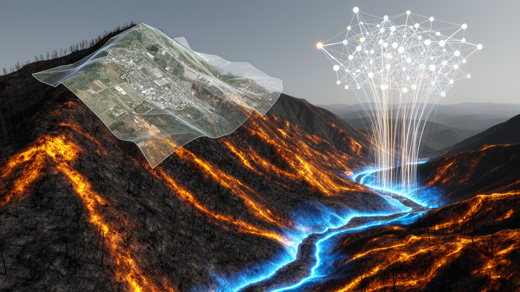
Wildfires are increasing in frequency and intensity, raising the risk of landsliding in burned mountainous terrain and creating a growing need for effective ways to map post-fire debris-flow hazards. A new study in Natural Hazards presents a machine learning framework designed to automate this mapping task, combining multi-temporal airborne lidar digital elevation models with satellite-derived vegetation indices across seven post-wildfire watersheds in the Columbia River Gorge, Oregon.

The researchers evaluated five classifiers: Logistic Regression, Support Vector Machine, K-Nearest Neighbors, Random Forest, and XGBoost. Each model was tested under two class imbalance correction strategies and three spatially structured validation designs, an approach intended to assess how well the framework performs under real-world transferability rather than idealized conditions.

The results showed that multi-temporal features, meaning the difference between data epochs, improved classification by 18 to 40 percent over single-epoch approaches across all models. This suggests that capturing change over time in both terrain and vegetation provides substantially more information for identifying debris-flow signatures than any single snapshot of the landscape.

When comparing strategies for handling imbalanced data, balanced undersampling outperformed oversampling across the performance metrics.

Feature importance analysis ranked topography as the most important set of variables for debris-flow mapping, with vegetation as secondary and hydrologic variables having less impact. The study mapped debris-flow initiation and deposition zones with high inter-model agreement across the classifiers, while transport zones were underclassified, indicating that this intermediate part of the debris-flow pathway remains harder for the models to detect.

According to the authors, these findings contribute to the development of rapid, automated, data-driven tools for post-fire landslide mapping that could aid emergency response and land-use planning in mountainous regions at risk of fire. The work was led by Sanjaya Paudel, Maryn Sanders, Michael J. Olsen, and Ben A. Leshchinsky, and published as an original research paper in Natural Hazards in October 2026.

Subject of Research: Machine learning-based mapping of post-wildfire debris-flow hazards using lidar and satellite data in Oregon watersheds

Article Title: Post-wildfire debris-flow hazard mapping using machine learning in mountainous watersheds

Article References: Paudel, S., Sanders, M., Olsen, M. J., & Leshchinsky, B. A. (2026). Post-wildfire debris-flow hazard mapping using machine learning in mountainous watersheds. Natural Hazards, 122(22), Article 692. https://doi.org/10.1007/s11069-026-08409-x

Image Credits: AI Generated

DOI: 10.1007/s11069-026-08409-x

Keywords: post-wildfire debris flows, machine learning, lidar, vegetation indices, Columbia River Gorge, XGBoost, Random Forest, class imbalance, topography, hazard mapping, landslides, Natural Hazards

Cite Scienmag News

Teresa Odom. (October 28, 2026). Machine learning maps post-wildfire debris-flow hazards from lidar and satellite data. Scienmag. https://scienmag.com/machine-learning-maps-post-wildfire-debris-flow-hazards-from-lidar-and-satellite-data/

Teresa Odom. "Machine learning maps post-wildfire debris-flow hazards from lidar and satellite data." Scienmag, 28 October 2026, https://scienmag.com/machine-learning-maps-post-wildfire-debris-flow-hazards-from-lidar-and-satellite-data/. Accessed 5 November 2026.

Teresa Odom. "Machine learning maps post-wildfire debris-flow hazards from lidar and satellite data." Scienmag. October 28, 2026. https://scienmag.com/machine-learning-maps-post-wildfire-debris-flow-hazards-from-lidar-and-satellite-data/

Tags: automated hazard mapping frameworksclass imbalanceclass imbalance correction in hazard modelingColumbia River Gorgeenvironmental change detection using remote sensingfeature importance in debris-flow predictionhazard mappingimpact of wildfire on mountainous terrainlandslidesLiDARlidar and satellite data analysisMachine learningmachine learning wildfire risk assessmentmulti-temporal remote sensing for hazard mappingnatural hazardspost-wildfire debris flowspost-wildfire terrain instability predictionRandom Forestsupervised classification models for hazard mappingtopographyvegetation indiceswatersheds in Columbia River Gorgewildfire debris-flow hazard mappingXGBoost
Share26Tweet16
Previous Post

German Divorce Reform Reshaped Women’s and Men’s Earnings After Separation

Next Post

Low-Energy Spectral CT Sharply Improves Imaging of the Gastrocolic Trunk of Henle

Related Posts

Wildlife conflict is a governance failure, not just a biology problem, review finds
Earth Science

Wildlife conflict is a governance failure, not just a biology problem, review finds

November 5, 2026
Fracture Deflection in Sandstone-Shale Layers Driven by Dip Angle and Interfacial Shear Stress
Earth Science

Fracture Deflection in Sandstone-Shale Layers Driven by Dip Angle and Interfacial Shear Stress

November 5, 2026
Trace Elements Reveal Mining Hotspots in Lake Sevan’s River Basin
Earth Science

Trace Elements Reveal Mining Hotspots in Lake Sevan’s River Basin

November 5, 2026
Oklahoma Researchers Lead NASA Projects to Improve United States Irrigation Mapping
Earth Science

Oklahoma Researchers Lead NASA Projects to Improve United States Irrigation Mapping

November 5, 2026
New open-access journal targets intelligent, sustainable subsurface energy
Earth Science

New open-access journal targets intelligent, sustainable subsurface energy

November 5, 2026
Random Forest Model Predicts Qanat Water Flow in Iranian Watershed
Earth Science

Random Forest Model Predicts Qanat Water Flow in Iranian Watershed

November 5, 2026
Next Post
Low-Energy Spectral CT Sharply Improves Imaging of the Gastrocolic Trunk of Henle

Low-Energy Spectral CT Sharply Improves Imaging of the Gastrocolic Trunk of Henle

  • Mothers who receive childcare support from maternal grandparents show more optimized

    Mothers who receive childcare support from maternal grandparents show more parental warmth, finds NTU Singapore study

    27656 shares
    Share 11059 Tweet 6912
  • University of Seville Breaks 120-Year-Old Mystery, Revises a Key Einstein Concept

    1061 shares
    Share 424 Tweet 265
  • Bee body mass, pathogens and local climate influence heat tolerance

    682 shares
    Share 273 Tweet 171
  • Researchers record first-ever images and data of a shark experiencing a boat strike

    546 shares
    Share 218 Tweet 137
  • Groundbreaking Clinical Trial Reveals Lubiprostone Enhances Kidney Function

    531 shares
    Share 212 Tweet 133
Science

Embark on a thrilling journey of discovery with Scienmag.com—your ultimate source for cutting-edge breakthroughs. Immerse yourself in a world where curiosity knows no limits and tomorrow’s possibilities become today’s reality!

RECENT NEWS

  • Teclistamab-Daratumumab Combo Outperforms Standard Proteasome Inhibitor Regimens in Adjusted Myeloma Analysis
  • Houseplant and potting soil strip ammonia from air, study finds
  • Wildlife conflict is a governance failure, not just a biology problem, review finds
  • Single-cell study reveals mTOR-linked microglial states in human mTORopathies

Categories

  • Agriculture
  • Anthropology
  • Archaeology
  • Athmospheric
  • Biology
  • Biotechnology
  • Blog
  • Bussines
  • Cancer
  • Chemistry
  • Climate
  • Earth Science
  • Editorial Policy
  • Marine
  • Mathematics
  • Medicine
  • Pediatry
  • Policy
  • Psychology & Psychiatry
  • Science Education
  • Science News
  • Social Science
  • Space
  • Technology and Engineering

Subscribe to Blog via Email

Enter your email address to subscribe to this blog and receive notifications of new posts by email.

Join 5,149 other subscribers

© 2025 Scienmag - Science Magazine

Welcome Back!

Login to your account below

Forgotten Password?

Retrieve your password

Please enter your username or email address to reset your password.

Log In
No Result
View All Result
  • HOME
  • SCIENCE NEWS
  • CONTACT US

© 2025 Scienmag - Science Magazine

Discover more from Science

Subscribe now to keep reading and get access to the full archive.

Continue reading

