


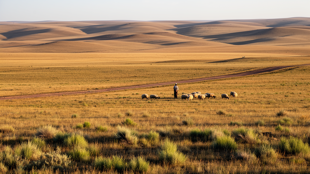
Across the mountains and valleys of Tajikistan and Kyrgyzstan, the landscape is overwhelmingly treeless. For thousands of years, pastoralists have grazed sheep, goats, cattle and horses across these lands, and the result is a region now dominated by open vegetation: steppes, grasslands, mires, salt marshes and tall-forb communities. At the heart of these ecosystems stand the graminoids, the grass-like plants that include grasses (Poaceae), sedges (Cyperaceae) and rushes (Juncaceae). They anchor ecosystem processes, stabilise soils and, crucially, provide the bulk of forage on which Middle Asian livestock economies depend. A new study published in Vegetation Classification and Survey has now mapped, in unprecedented detail, how the cover of these plants varies across five open vegetation types, and how climate and grazing pressure shape that variation.
The research team drew on the Vegetation of Middle Asia Database, extracting 1,525 vegetation plots sampled between 2006 and 2019 in Tajikistan and Kyrgyzstan. Each plot contained a complete list of vascular plant species with estimates of cover, recorded on standardized scales and georeferenced to within about five metres. After excluding plots with more than fifty percent shrub cover and those not typically grazed, the dataset comprised five vegetation types: 527 steppe plots, 489 mire plots, 191 salt marsh plots, 168 tall-forb community plots and 150 pseudosteppe plots. Meadow plots were too few, at just 26 records, and were left out of the analysis.
The scale of the underlying flora is remarkable. Middle Asia hosts roughly 9,300 vascular plant species, and the Mountains of Central Asia hotspot recognized by Conservation International covers most of Tajikistan and Kyrgyzstan. Kyrgyzstan’s flora of around 4,000 species includes about 430 graminoids, of which 120 are endemic or sub-endemic. Tajikistan’s flora of roughly 4,300 species contains 438 graminoids, 70 of them endemics or sub-endemics and 133 nationally endangered. In total, the study recorded 255 graminoid species across the open habitats examined, with steppes the richest at 136 species, or 53.3 percent of the total graminoid flora, followed by pseudosteppes with 94 species.
Relative cover told a subtler story. The highest median relative cover of graminoids appeared in steppes at 47.8 percent, mires at 43.06 percent and pseudosteppes at 39 percent, but the distributions were broad, with no single sharp peak. Grasses of the family Poaceae dominated almost everywhere, mirroring the pattern for all graminoids combined. The striking exception was mires, where sedges took over, with a median relative cover of 31 percent. Rushes contributed least in every vegetation type. Salt marshes and tall-forb communities fell below the 25 percent coverage threshold often used to define grasslands, revealing that not all broadly grass-like Middle Asian habitats are actually graminoid-dominated.
To explain these patterns, the researchers tested four drivers: mean annual temperature, sum of annual precipitation, the Global Aridity Index and livestock density, the last serving as a surrogate for grazing intensity. Temperature and precipitation data came from the CHELSA dataset at 30 arc second resolution, aridity from the Global-PET geospatial dataset, and livestock numbers from the Gridded Livestock of the World database, combining sheep, goats and cattle. The team fitted linear and polynomial models for each vegetation type and variable separately, comparing them by coefficient of determination and root mean-squared error, then applied commonality analysis to split the explained variance into unique and shared contributions of each predictor.
The statistical verdict was clear: curvilinear, polynomial models consistently outperformed simple linear ones, underscoring that graminoid responses to environment are rarely straight-line. Mean annual temperature produced the single best-fitting model of the study for salt marshes, explaining 31.6 percent of variance, with 65.3 percent of the regression effect unique to that variable. Graminoid cover in salt marshes declined as temperature rose, while in pseudosteppes it increased. In steppes the temperature relationship was hump-shaped, peaking between roughly 0 and 10 degrees Celsius, with cover falling off both in the cold conditions above 3,000 metres and in the warmer lowland steppes where dwarf shrubs take hold.
Precipitation, aridity and livestock each left their own fingerprints. Annual precipitation was statistically significant for all five vegetation types, though with modest model fits between 5 and 11 percent of variance, acting negatively in pseudosteppes and tall-forb communities and positively in salt marshes and steppes. Aridity Index models fitted best for pseudosteppes and steppes, and in mires aridity showed the highest unique effect of any variable at 46.2 percent. Livestock density produced its strongest model for pseudosteppes, explaining 23.6 percent of variance, with graminoid cover peaking at around 9,000 animals per square kilometre; steppes showed a similar hump at roughly 4,000 animals, while salt marshes and mires displayed U-shaped patterns with minima near 1,500 and 2,500 animals per square kilometre respectively.
The grazing result carries particular ecological weight for pseudosteppes. These secondary grasslands arose where natural thermophilous open woodlands and scrub, including pistachio groves, were cleared and then continuously grazed, and the new data confirm their anthropogenic origin. Intensive sheep and goat grazing favours grazing-resistant species such as Poa bulbosa, Carex pachystylis and Cynodon dactylon, along with ephemeral grasses like Avena sterilis subsp. ludoviciana, Bromus lanceolatus and Vulpia persica that are dispersed by animals and tolerate drought and heat. Notably, the unique effect of livestock density in pseudosteppes was relatively small at 7.4 percent, but its shared effect with climatic factors, at 57.4 percent, was the highest among all vegetation types, showing that grazing and climate act together in shaping these communities.
By contrast, the natural steppes responded mainly to climate rather than grazing, and heavier grazing there may actually reduce graminoid share in favour of spiny, grazing-tolerant Astragalus species. Mires, fed by seeping groundwater, buffer rainfall variation and so showed weak or no clear climatic signal, although their sedge-dominated vegetation held the highest graminoid share in the driest, high-altitude Pamir settings where long-rhizomatous alpine species prevail. Tall-forb communities, dominated by Apiaceae such as Prangos pabularia and Ferula kuhistanica, resisted explanation altogether; many of their forbs are tasteless or poisonous, so grazers avoid them, suppressing grasses indirectly, and local soil and microclimatic conditions not measured here likely govern their composition.
The study’s broader message is that there is no universal rule governing graminoid abundance in Middle Asian open habitats; each vegetation type follows its own logic, rooted in biogeography, evolutionary history of grazing and local climate. That nuance matters as pressures mount. Ongoing climate change may shift graminoid shares in salt marshes, steppes and pseudosteppes, potentially threatening endemic species, while expanding human and livestock populations drive overgrazing and soil erosion across pastures. Because food and economic security in the region rest almost entirely on livestock, the authors argue that this line of research must continue, extending to alpine meadows and Kobresia mats that remain unanalysed. Understanding where and why grasses and sedges thrive is, in Middle Asia, a question of ecological science and human livelihood alike.
Subject of Research: Distribution and relative cover of graminoids in open vegetation types of Tajikistan and Kyrgyzstan under climatic and grazing gradients
Article Title: Distribution of graminoids in open habitats in Tajikistan and Kyrgyzstan
Article References: Świerszcz, S., Swacha, G., Raduła, M. W., & Nowak, S. (2022). Distribution of graminoids in open habitats in Tajikistan and Kyrgyzstan. Vegetation Classification and Survey, 3, 273-286. https://doi.org/10.3897/vcs.95767
Image Credits: AI Generated
DOI: 10.3897/VCS.95767
Keywords: graminoids, Poaceae, Cyperaceae, steppes, pseudosteppes, salt marshes, mires, grazing, aridity, Middle Asia, Tajikistan, Kyrgyzstan
Cite Scienmag News
William Thompson. (October 19, 2026). Grasses, sedges and sheep: mapping the open habitats of Middle Asia. Scienmag. https://scienmag.com/grasses-sedges-and-sheep-mapping-the-open-habitats-of-middle-asia/
William Thompson. "Grasses, sedges and sheep: mapping the open habitats of Middle Asia." Scienmag, 19 October 2026, https://scienmag.com/grasses-sedges-and-sheep-mapping-the-open-habitats-of-middle-asia/. Accessed 19 October 2026.
William Thompson. "Grasses, sedges and sheep: mapping the open habitats of Middle Asia." Scienmag. October 19, 2026. https://scienmag.com/grasses-sedges-and-sheep-mapping-the-open-habitats-of-middle-asia/


