


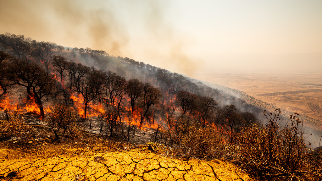
The oak forests that drape the mountains of the Kurdistan Region of Iraq are burning at an accelerating pace, and a new 24-year analysis shows exactly how fast. Using satellite records of burned area from 2001 to 2024, researchers have found that fires consumed an average of 687 square kilometers of land across the region every year, and that the annual burned area has been climbing by a statistically significant 31 square kilometers per year. When the analysis was restricted to forested land alone, the picture was equally stark: forest fires burned an average of 356 square kilometers annually, equivalent to roughly 3.3 percent of the region’s forest cover going up in smoke each year, with a significant upward trend of 15 square kilometers per year. The findings, published in Environmental Monitoring and Assessment, provide the most detailed long-term quantification yet of fire dynamics in this understudied corner of the Middle East.
The study, led by Azad Rasul of Soran University and Salahaddin University in Erbil together with Ismahil Shkur Zahir, relied on the MODIS MCD64A1 Version 6.1 burned-area product, a widely used satellite dataset that maps the monthly location and extent of vegetation fires worldwide. To isolate forest fires from fires in grasslands, croplands, and shrublands, the team masked the burned-area data to a forest mask derived from 2024 vegetation greenness measurements, yielding a forested area of approximately 10,660 square kilometers. All processing was carried out on the Google Earth Engine platform, which allows planetary-scale geospatial analysis without the need to download and process terabytes of raw satellite imagery locally. Over the full 24-year record, cumulative burned area across the entire region reached 16,486 square kilometers, while forest-specific burned area totaled 8,541 square kilometers.
Detecting a genuine trend in noisy fire data requires more than eyeballing a time series, and the researchers applied two complementary statistical tests. The Theil–Sen slope estimator, a robust non-parametric method that resists distortion by extreme fire years, quantified the magnitude of change, while the Mann–Kendall test assessed whether the trend was statistically significant rather than a product of random interannual variability. For total burned area across the region, the Mann–Kendall test returned a p-value of 0.026, and for forest burned area it returned 0.021, both below the conventional 0.05 threshold for significance. The high year-to-year variability, reflected in a standard deviation of 640 square kilometers around the 687 square kilometer mean for total burned area, underscores why robust trend methods are essential in fire science: a single catastrophic season can otherwise dominate the apparent trajectory.
Geography mattered as much as time. The governorates of Duhok and Sulaymaniyah together accounted for 77 percent of the cumulative forest burned area over the study period, and both displayed the strongest upward trends in the region. This spatial concentration is consistent with the distribution of the Zagros oak forests, which form the ecological backbone of Kurdistan’s mountainous terrain. These forests, dominated by oak species such as Quercus aegilops, are not only biodiversity reservoirs but also support grazing, fuelwood collection, and a suite of characteristic wildlife, including the endangered Persian leopard. Repeated burning at the observed rate of over 3 percent of forest cover per year raises serious questions about whether these ecosystems can regenerate between fires, particularly as climate change pushes growing conditions toward the physiological limits of the oaks themselves.
To identify the climatic drivers behind the trends, the researchers modeled burned area as a function of monthly maximum temperature and drought severity, the latter expressed as the negated Palmer Drought Severity Index, so that positive values indicate drier conditions. Because burned-area data are counts of burned pixels with many zero values in wet or cool months, the team employed a zero-inflated count model, a statistical framework that simultaneously estimates the probability that a fire occurs at all and the expected size of the fire when one does occur. The results were unambiguous on the temperature side: each 1 degree Celsius rise in monthly maximum temperature increased expected burned area by 14.3 percent, an incidence-rate ratio of 1.143 with a p-value below 0.001. This temperature sensitivity aligns with a large body of global research showing that warmer conditions dry out fuels, extend fire seasons, and increase the probability of ignition and spread.
The drought result was more surprising and scientifically intriguing. In the count model predicting fire magnitude, drought severity was significantly and negatively associated with burned area, with an incidence-rate ratio of 0.787, meaning each unit increase in drought severity reduced expected fire size by 21.3 percent, and the zero-inflation component showed a similar but non-significant pattern with a p-value of 0.417. At first glance, a negative drought-fire relationship seems counterintuitive, since drought is conventionally associated with heightened fire risk. Yet similar non-linear relationships have been documented in Mediterranean-type climates, where moderate drought stimulates the growth of grasses and shrubs that later cure into abundant fine fuel, whereas extreme, prolonged drought suppresses vegetation productivity so severely that there is simply less biomass available to burn. In Kurdistan’s semi-arid mountains, this fuel-limitation dynamic appears to shape the fire regime as strongly as atmospheric dryness does.
The model outputs also revealed pronounced non-linear escalation of predicted fire activity above approximately 32 degrees Celsius in monthly maximum temperature and above a negated PDSI value of 2, corresponding to severe drought conditions. Below these thresholds, predicted fire activity remained comparatively modest; above them, expected burned area climbed steeply. This threshold behavior has practical implications for fire management, because it suggests that relatively small additional increments of warming in already-hot months could push the region across a fire-activity tipping point. The Eastern Mediterranean and Middle East are among the fastest-warming regions on Earth, and climate projections for northern Iraq indicate continued increases in temperature and greater frequency of extreme heat events, making the observed 14.3 percent per degree sensitivity a sobering baseline for future risk.
The Kurdistan Region’s fire regime cannot be understood through climate alone, and the study’s findings sit within a broader context of conflict, land use, and environmental change. Previous research has documented how decades of armed conflict in the Zagros forests, including the Iran–Iraq war era, reshaped land use and forest management, and how fire has been used both as collateral damage and as a deliberate instrument of war in the region. Geopolitical analyses of fire in Kurdistan have highlighted the challenges of environmental peacebuilding when burning is entangled with territorial disputes and agricultural practices. While the new study focuses on climatic predictors rather than attributing specific fires to human causes, the strong upward trends in Duhok and Sulaymaniyah likely reflect an interaction between a warming, drying climate and socio-economic pressures on forest landscapes, from expansion of agriculture to changes in traditional grazing and land stewardship.
Methodologically, the study demonstrates the power of combining freely available satellite products with cloud-based computation and rigorous trend statistics to build a fire-climate baseline in data-sparse regions. The MODIS burned-area algorithm detects changes in surface spectral properties following fire, and its Collection 6 version incorporates improvements in burn date assignment and small-fire detection. Pairing this with TerraClimate and ERA5-Land reanalysis data for temperature and drought indices allowed the researchers to link fire outcomes to monthly climatic conditions at fine spatial resolution. The zero-inflated modeling approach, though less common in fire-climate studies than simple regression, is well suited to the skewed, zero-heavy distribution of burned-area data and helps separate the question of whether fires occur from the question of how large they become.
For the oak forests of Kurdistan, the message of the analysis is that fire is no longer an occasional disturbance but a growing, climate-linked pressure that demands proactive management. The identification of temperature and drought thresholds offers concrete early-warning markers: months exceeding 32 degrees Celsius in maximum temperature, especially when combined with severe drought conditions, are the periods when fire activity escalates most dramatically. As regional temperatures continue to rise under climate change, the frequency with which those thresholds are crossed will only increase, and the 15 square kilometer annual growth in forest burned area may prove to be a conservative indicator of what lies ahead. Protecting these forests will require not only firefighting capacity but also land-use policies that reduce fuel accumulation and human ignition sources, informed by the kind of quantitative, long-term evidence this study now provides for one of the Middle East’s most ecologically and culturally significant mountain forest systems.
Subject of Research: Long-term trends and climatic drivers of forest burned area in the Kurdistan Region of Iraq from 2001 to 2024
Article Title: Assessing trends and drivers of burned areas in forest areas in the Kurdistan Region
Article References: Rasul, A., & Zahir, I. S. (2026). Assessing trends and drivers of burned areas in forest areas in the Kurdistan Region. Environmental Monitoring and Assessment, 198(9), Article 1016. https://doi.org/10.1007/s10661-026-15838-5
Image Credits: AI Generated
DOI: 10.1007/s10661-026-15838-5
Keywords: wildfire, Kurdistan Region, MODIS burned area, oak forests, climate change, drought, Palmer Drought Severity Index, remote sensing, Mann-Kendall trend, Zagros forests, fire ecology, Iraq
Cite Scienmag News
Violet Maxwell. (October 19, 2026). Kurdistan’s oak forests are burning more each year as heat and drought intensify. Scienmag. https://scienmag.com/kurdistans-oak-forests-are-burning-more-each-year-as-heat-and-drought-intensify/
Violet Maxwell. "Kurdistan’s oak forests are burning more each year as heat and drought intensify." Scienmag, 19 October 2026, https://scienmag.com/kurdistans-oak-forests-are-burning-more-each-year-as-heat-and-drought-intensify/. Accessed 19 October 2026.
Violet Maxwell. "Kurdistan’s oak forests are burning more each year as heat and drought intensify." Scienmag. October 19, 2026. https://scienmag.com/kurdistans-oak-forests-are-burning-more-each-year-as-heat-and-drought-intensify/


