


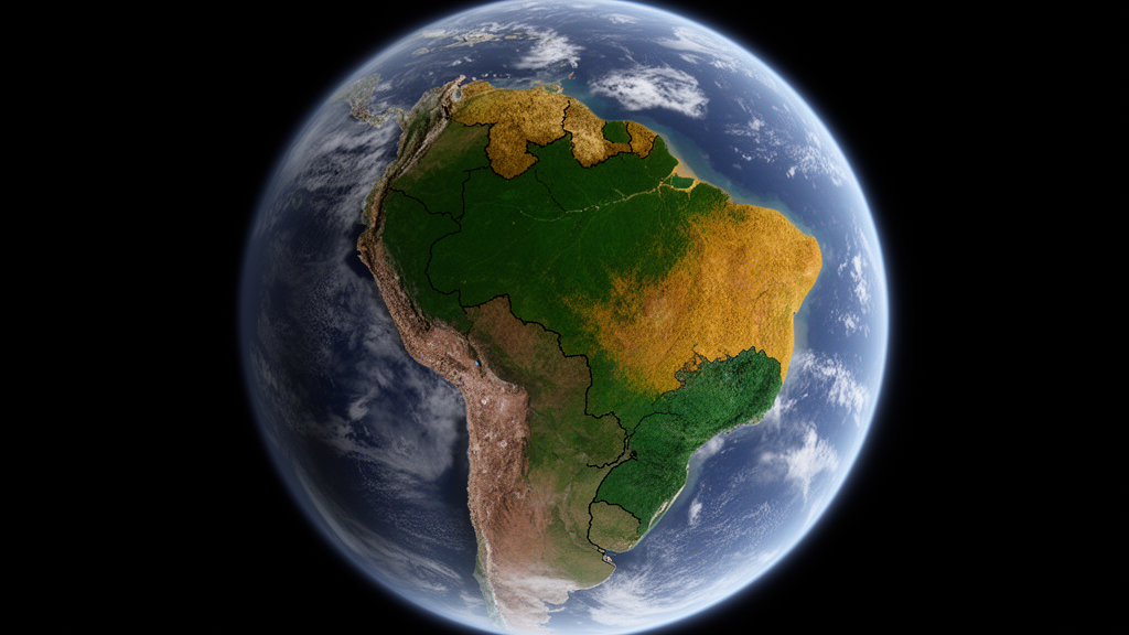
In the backlands of north-east Brazil, the boundaries between biomes have long frustrated ecologists. Tropical dry forest, savanna and shrubland intermingle across a semi-arid landscape where rainfall alone cannot explain what grows where. Now a research team has shown that satellite remote sensing, combined with an unsupervised clustering method, can map these tangled ecosystems objectively — and in doing so has uncovered evidence that the world’s leading ecosystem classification scheme is missing an entire category. The study, published in Frontiers of Biogeography, demonstrates how the IUCN Global Ecosystem Typology can be turned from a conceptual framework into a wall-to-wall map, using one of the planet’s most biome-diverse regions as its proving ground.
Biomes are traditionally defined by climate, following classic schemes that delineate vegetation zones using temperature and precipitation. But this approach breaks down in dry tropical regions, where multiple vegetation states can persist under identical climatic conditions. The South American ‘dry diagonal’, stretching from north-eastern Brazil through Paraguay and Bolivia to Argentina, is a notorious example: several studies have found climate to be a poor predictor of biome distribution there. Instead, soil properties and disturbance regimes such as fire and herbivory drive the pattern. Because global soil data are heavily interpolated and herbivory is intrinsically hard to quantify, fine-scale biome maps have remained out of reach for the land managers and conservation planners who need them most.
The IUCN Global Ecosystem Typology 2.0, or GET, was designed to address some of these shortcomings. It organises ecosystems hierarchically into realms, biomes and ecosystem functional groups, or EFGs, the latter defined by assembly drivers such as resource availability, disturbance regimes and biotic interactions. EFGs are the level at which local and global classification systems can be reconciled, and Brazil’s national statistics institute has already compared them with national biome maps. Yet while indicative maps of EFG occurrence exist, the Typology’s fifth criterion — providing spatially explicit units at a resolution suitable for monitoring change and designing conservation — remains largely unfulfilled, particularly across contiguous areas where several contrasting EFGs interdigitate.
The new study tackles this gap head-on. Rather than assuming in advance which vegetation types should occur in the region, the researchers let the data speak. They compiled seven satellite-derived attributes describing what they call ‘vegetation expression’: above-ground woody biomass from a Globbiomass product, the spatial heterogeneity of that biomass, NDVI seasonality calculated from two decades of MODIS imagery, wet- and dry-season leaf area index from the Copernicus Global Land Service, fire frequency derived from MODIS burned-area records, and canopy height interpolated from GEDI LiDAR and Landsat time series. Fire count served as a proxy for a grassy understorey, which is otherwise nearly impossible to detect directly from orbit but is critical for distinguishing flammable savannas from non-flammable forests.
All data layers were resampled to one-kilometre resolution, and areas of non-natural land cover were masked out using the MapBiomas product to prevent human-dominated landscapes from being conflated with naturally distinct vegetation groups. The team then applied fuzzy spatial clustering, a technique that allows each pixel to hold partial membership in multiple groups — a natural fit for the continuous transitions characteristic of dry tropical vegetation, and one that aligns theoretically with the GET’s own acknowledgment that locations can belong partially to multiple EFGs. Using silhouette, explained inertia and Xie-Beni indices to tune the algorithm, the researchers settled on seven clusters. Only 0.24 percent of the clustered area remained unclassified.
The seven groups that emerged were named scrubby caatinga, hyper-seasonal caatinga, heterogeneous caatinga, transition caatinga, arboreal caatinga, cerrado and rain forest. The groups are distinguished primarily by canopy height, biomass and leaf area, with fire frequency the decisive factor separating cerrado savanna — whose pixels burned on average 1.3 times between 2001 and 2021 — from everything else. Rain forest, corresponding largely to the Atlantic Forest on the coast with patches reaching the eastern Amazon, showed the highest biomass at 74 megagrams per hectare and a canopy 13 metres tall, with the lowest seasonality. At the other extreme, heterogeneous caatinga carried just low, patchy biomass across a canopy less than two metres high, possibly reflecting human disturbance or encroachment by invasive species.
To understand what determines these patterns, the team ran random forest classification against a suite of climatic, edaphic, geological and human-disturbance variables. The model achieved 81 percent accuracy on held-out test data, and the standout predictor was soil pH, with a mean decrease in Gini coefficient far exceeding all other variables. Rain forest and arboreal caatinga favoured acidic soils with pH below 5.5, while hyper-seasonal and heterogeneous caatinga were strongly associated with pH above 5.8. Precipitation in the wettest month and precipitation seasonality ranked next, with hyper-seasonal caatinga showing a marked affinity for areas where wettest-month rainfall falls below 200 millimetres and seasonality exceeds 95. The finding reinforces a growing consensus that climate alone cannot explain vegetation distribution in the dry tropics — soil chemistry, likely through its relationship with fertility, plays the leading role.
When the researchers matched their structural groups to the IUCN GET, three EFGs accommodated most of the landscape: rain forest mapped to tropical-subtropical lowland rainforests, cerrado to pyric tussock savannas, and the forest-like arboreal and transition caatingas to tropical-subtropical dry forests and thickets. But three caatinga groups — scrubby, hyper-seasonal and heterogeneous — fit nowhere comfortably. Structurally they resemble the GET’s seasonally dry tropical shrublands, with low canopies under six metres, yet they show no fire, a defining process of that EFG. Functionally they resemble dry forests, but their short stature and low biomass disqualify them from that category. The authors propose that these vegetation types represent a previously undescribed EFG, which they provisionally term tropical-subtropical non-pyric thickets and shrublands — a fire-free, grass-poor, succulent-rich formation analogous to the ‘succulent biome’ concept, occupying the drier end of the seasonally dry tropical forest spectrum.
The implications extend well beyond Brazil. The IUCN’s Red List of Ecosystems, a growing instrument for global conservation prioritisation, depends on accurate ecosystem mapping to function. By starting from an unsupervised, remotely sensed classification rather than expert opinion, the approach reduces subjective bias while remaining anchored to the ecological drivers that define EFGs. It also links cleanly to Brazil’s MapBiomas classification, which is increasingly used in legislative processes, allowing structural groups and EFGs alike to be spatially related to policy. The researchers caution that labelling unsupervised clusters still requires interpretation, that verifying the groups against field data would demand extensive effort in a human-modified landscape, and that SoilGrids variables carry uncertainty in dry ecosystems — with some potential circularity arising because soil products themselves incorporate vegetation indices as covariates.
Nevertheless, the study marks a step change in how the world’s most complex biome mosaics can be catalogued. North-east Brazil, home to the world’s most populated semi-arid land and one of the country’s poorest regions, faces rising temperatures and deepening aridity under climate change, with the interaction of human disturbance and drying expected to hit woody plant diversity hard. Up to 60 percent of the Caatinga region has already been converted to anthropogenic ecosystems. A repeatable, satellite-driven method that can delineate biomes where climate fails — and that can flag gaps in global classification frameworks — offers a template for conservation planning wherever ecosystems interdigitate, from the dry diagonal of South America to the mosaics of Africa and beyond.
Subject of Research: Satellite remote sensing of biome and ecosystem functional group delineation in north-east Brazil using the IUCN Global Ecosystem Typology
Article Title: Satellite remote sensing can operationalise the IUCN Global Ecosystem Typology in the biome-diverse north-east of Brazil
Article References: Wells, L. H., Dexter, K. G., Pennington, R. T., Coutinho, Í. A. C., Ramos, D., Phillips, O. L., Baker, T., & Ryan, C. M. (2025). Satellite remote sensing can operationalise the IUCN Global Ecosystem Typology in the biome-diverse north-east of Brazil. Frontiers of Biogeography, 18, Article e145498. https://doi.org/10.21425/fob.18.145498
Image Credits: AI Generated
Keywords: remote sensing, IUCN Global Ecosystem Typology, caatinga, biome classification, ecosystem functional groups, north-east Brazil, savanna, tropical dry forest, soil pH, fuzzy clustering, vegetation structure, conservation mapping
Cite Scienmag News
Gavin Prescott. (October 18, 2026). Satellites map Brazil’s tangled biomes and reveal a missing ecosystem type. Scienmag. https://scienmag.com/satellites-map-brazils-tangled-biomes-and-reveal-a-missing-ecosystem-type/
Gavin Prescott. "Satellites map Brazil’s tangled biomes and reveal a missing ecosystem type." Scienmag, 18 October 2026, https://scienmag.com/satellites-map-brazils-tangled-biomes-and-reveal-a-missing-ecosystem-type/. Accessed 18 October 2026.
Gavin Prescott. "Satellites map Brazil’s tangled biomes and reveal a missing ecosystem type." Scienmag. October 18, 2026. https://scienmag.com/satellites-map-brazils-tangled-biomes-and-reveal-a-missing-ecosystem-type/


