


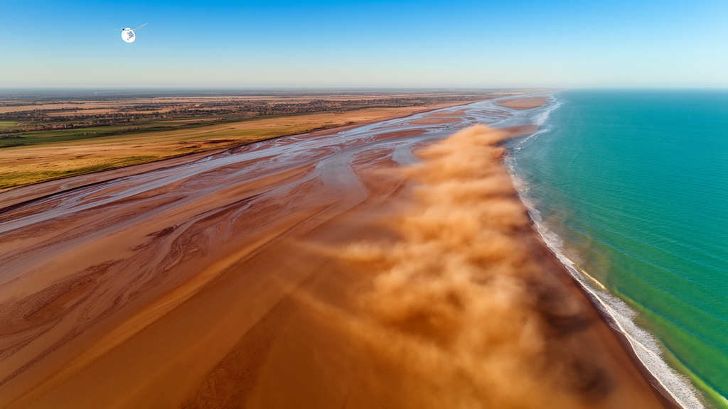
From the snow-fed headwaters of mountain ranges to the muddy deltas where rivers meet the sea, Earth’s landscapes are connected by an unbroken chain of moving water, sediment, and nutrients. Scientists call this the source-to-sink system, and understanding it has long required laborious field campaigns, scattered gauging stations, and educated guesswork about what happens in the vast stretches in between. A keynote presentation scheduled for the 1st International Conference on Technological and Research Advancements in Coastal and Estuarine Systems 2025, known as TRACE2025, argues that the view from orbit is now mature enough to change that, offering researchers a way to watch entire river basins and coastal bays evolve in near-real time.
Remote sensing, in its broadest sense, refers to any technique that gathers information about the Earth’s surface without direct contact. The modern toolkit is remarkably diverse. It spans large institutional satellites and miniaturised cubesats, airborne sensors mounted on crewed and uncrewed aircraft, light detection and ranging instruments known as LiDAR, interferometric synthetic aperture radars that measure ground deformation at millimetre scales, and an expanding family of optical and multispectral cameras. What unites these platforms is spatial coverage: no ground-based method can match the sheer extent of territory a satellite can observe in a single pass, and repeated orbits turn that coverage into a continuous record stretching back decades.
According to the keynote summary published in the journal Estuarine Management and Technologies, this breadth of coverage is precisely what makes remote sensing indispensable for environmental modelling. Satellite observations feed directly into numerical models that simulate different scenarios, from flood response to long-term morphological change. Yet the author, Michael Nones of the Institute of Geophysics at the Polish Academy of Sciences, is careful to note that satellites rarely work alone. The most powerful applications fuse orbital data with land-based sensor networks, dedicated field campaigns, and other complementary sources, so that each stream of information leverages the strengths of the others rather than merely filling gaps.
That fusion matters because remote sensing, for all its reach, carries well-documented limitations. Cloud cover blocks optical sensors, spatial resolution may be too coarse for narrow channels, and inferring a physical quantity such as sediment concentration from reflected light always involves assumptions that must be validated on the ground. The keynote argues that a common understanding of these strengths and weaknesses is still limited across the water resources community, partly because practitioners lack a shared entry point into the literature. Bridging that gap, the summary suggests, requires an explicitly interdisciplinary perspective in which hydrologists, geomorphologists, remote sensing specialists, and coastal engineers compare notes on what each technique can and cannot deliver.
The first case study in the presentation turns to large European watercourses. Work on the Vistula in Poland and the Po in Italy, drawing on satellite imagery analysed in earlier studies, reveals a striking pattern: both rivers are becoming morphologically simpler. Their multi-thread, braided, or island-strewn planforms are giving way to single, incised channels, a process the keynote attributes to oversimplification driven by changing hydrology under the combined pressure of human intervention and climate change. Regulation, damming, gravel extraction, and altered flow regimes have all conspired to strip these rivers of the complexity that once characterised them.
Compounding that simplification, satellite time series show riparian vegetation overgrowing bars and banks, effectively locking the simplified morphology in place. Where sediment once migrated freely and channels shifted across their floodplains, stabilised vegetated surfaces now resist reworking. The keynote stresses that this is not merely an aesthetic or academic concern. River planform dynamics govern bank erosion, water quality, sediment supply to downstream reaches, and the stability of bridges, levees, and other infrastructure. As climate change intensifies floods and prolongs droughts, understanding how large rivers will behave at basin scale becomes a matter of practical urgency, and only satellite archives offer the multi-decadal, multi-scale perspective needed to project those dynamics forward.
From planform and vegetation, the presentation moves into the water itself. An ongoing study of the Changjiang River in China, presented as a work in progress, explores whether satellite measurements can extrapolate sparse local information about suspended sediment transport into extensive maps of suspended sediment concentration across the entire river. The approach couples satellite retrievals with in-field sampling in turbulent reaches, calibrating optical signals against direct measurements. If successful, the technique would allow managers to track sediment loads continuously rather than at isolated gauging points, a capability with direct consequences for hydropower reservoirs, where sediment accumulation erodes storage capacity and abrades turbines, and for ecology, since suspended particles carry nutrients, contaminants, and the light regime on which aquatic ecosystems depend.
The keynote then shifts from rivers to transitional coastal waters with a case study of Ha Long Bay in Vietnam, a UNESCO-listed landscape and heavily visited tourist destination that has suffered visible depletion of water quality. Combining remote sensing with machine learning, recent work on the bay demonstrates that water quality there is strongly modulated by seasonality, and that this seasonal signal is entangled with human drivers: surges in tourism, urban runoff, aquaculture, and industrial activity all leave detectable fingerprints in the satellite record. Machine learning models trained on satellite spectra can classify water constituents across the entire bay repeatedly and cheaply, something no fleet of research vessels could achieve, offering authorities a tool to separate natural variability from anthropogenic pressure.
Taken together, the examples span multiple environmental compartments but share one unifying idea: satellite data can depict source-to-sink dynamics, the processes that transport and deposit material from its source, whether mountains, rivers, or coastlines, to its sink in oceans, basins, or floodplains. Large-scale, continuous, and increasingly detailed observations make it possible to follow sediment, water, and pollutants along the entire pathway rather than inferring the journey from endpoints alone. The keynote, delivered both as a video and a live summary at the conference, aims to convince practitioners that these tools are ready for standard practice, not just experimental studies.
The implications reach well beyond academia. Environmental agencies charged with managing land and water resources, engineers designing resilient infrastructure, and policymakers negotiating climate adaptation all need evidence at scales that fieldwork alone cannot supply. As the TRACE2025 keynote makes clear, the orbital archive is already rich enough to reveal how decades of human pressure and climate change have reshaped some of Europe’s largest rivers, how sediment moves through one of Asia’s great watercourses, and how tourism and industry imprint themselves on a celebrated bay. The remaining challenge, the presentation suggests, is not technological but cultural: building the interdisciplinary habits and shared vocabulary that let satellite specialists and water managers read the same data and act on what it shows.
Subject of Research: Using satellite remote sensing to study source-to-sink sediment and water dynamics in rivers, bays, and coastal systems.
Article Title: Remote sensing to detect source-to-sink dynamics
Article References: Nones, M. (2025). Remote sensing to detect source-to-sink dynamics. Estuarine Management and Technologies, 2, 1-3. https://doi.org/10.3897/emt.2.149362
Image Credits: AI Generated
DOI: 10.3897/emt.2.149362
Keywords: remote sensing, satellite data, source-to-sink, sediment transport, river morphology, water quality, machine learning, coastal systems, climate change, estuarine management, Vistula River, Po River
Cite Scienmag News
Violet Maxwell. (October 17, 2026). Satellites Track How Rivers and Coasts Move Sediment From Source to Sink. Scienmag. https://scienmag.com/satellites-track-how-rivers-and-coasts-move-sediment-from-source-to-sink/
Violet Maxwell. "Satellites Track How Rivers and Coasts Move Sediment From Source to Sink." Scienmag, 17 October 2026, https://scienmag.com/satellites-track-how-rivers-and-coasts-move-sediment-from-source-to-sink/. Accessed 17 October 2026.
Violet Maxwell. "Satellites Track How Rivers and Coasts Move Sediment From Source to Sink." Scienmag. October 17, 2026. https://scienmag.com/satellites-track-how-rivers-and-coasts-move-sediment-from-source-to-sink/


