


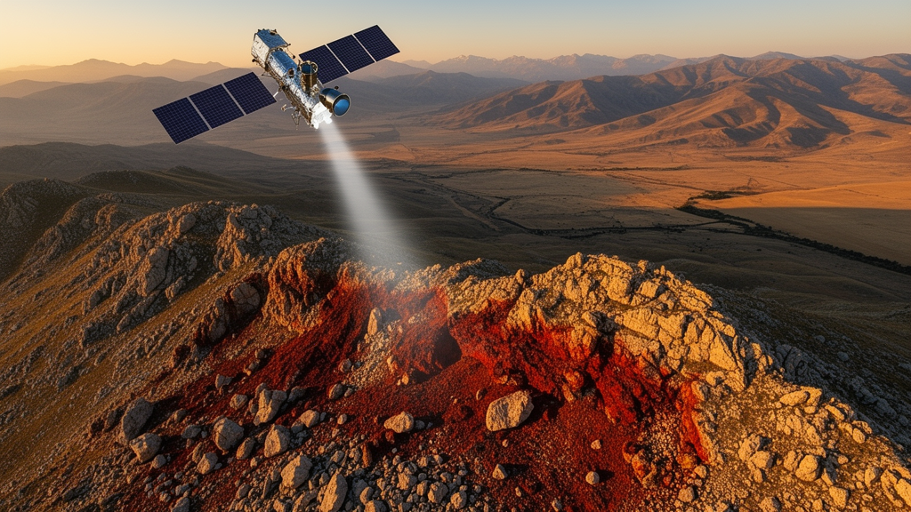
Some of the most dramatic discoveries in modern geology now happen from orbit. In the rugged hills of the Keban district near Elazığ in Eastern Türkiye, a team of researchers has shown that a single satellite image acquired in 2003—years before any mining equipment arrived—flagged the precise zones where iron-rich skarn ore would later be excavated. The study, published in Environmental Earth Sciences, demonstrates that multispectral satellite data can act as a predictive tool for buried mineralization, not merely a way to map deposits already exposed at the surface.
The research, led by Melek Ural of Fırat University together with Sedat İnal of the Mineral Research and Exploration General Directorate and Mustafa Eğri of Pamukkale University, focused on four key areas: Aşvan (Muratçık), Fatmalı, Üçağaç, and Ulupınar (Birvan). These zones sit along the contacts where the Upper Cretaceous Baskil Magmatic Suite—dominated by gabbro and diorite—intruded the Paleozoic Keban Metamorphics, a sequence of marbles, schists, and graphitic shales. Where hot magmatic fluids met carbonate country rock, they generated classic contact-metasomatic skarn systems rich in magnetite and ilmenite, the iron oxides that make these deposits economically interesting.
The technical heart of the study lies in ASTER band ratioing. The Advanced Spaceborne Thermal Emission and Reflection Radiometer captures reflected sunlight in the visible and near-infrared (VNIR) and short-wave infrared (SWIR) regions, and different minerals absorb and reflect light at diagnostic wavelengths. The team applied three ratios: B2/B1 to enhance ferric iron (Fe³⁺) minerals such as hematite and goethite, which absorb strongly around 0.52–0.60 µm but reflect more in the 0.63–0.69 µm range; B5/B4 to highlight iron silicates and hydroxyl-bearing minerals through the Fe–OH absorption near 2.2 µm; and B4/B5 to detect lateritic zones, the weathered surface caps that form when skarn ore is exposed to tropical-style chemical weathering. Statistical thresholds were derived from the histograms of each ratio image, isolating the brightest anomalous pixels that deviate from the background population.
To validate these spectral anomalies, the researchers collected four representative rock samples (MEU series) and cross-referenced them with six previously analyzed skarn samples (MS series) from earlier work in the same region. Petrographic thin sections revealed the alteration paragenesis in detail: albitization, carbonatization, and sericitization in feldspars, chloritization in biotite, and uralitization in pyroxenes, all accompanied by widespread hematitization. The primary ore assemblage is dominated by magnetite and ilmenite, with martitized magnetite—magnetite rims replaced by hematite—characteristic of endoskarn zones, while ilmenite and hematite alteration dominate the exoskarns hosted in the marbles.
X-ray diffraction analysis confirmed the mineral phases, identifying magnetite, hematite, ilmenite, and pyrite in the intrusive rocks, along with albite, quartz, diopside, andradite, grossular, tremolite, actinolite, ferro-actinolite, nontronite, vermiculite, and jarosite in the skarn assemblages. The presence of nontronite (an iron-rich smectite) and jarosite (a hydrous iron sulfate) is particularly telling: these minerals form during low-temperature hydrothermal cooling and acidic near-surface oxidation, providing direct mineralogical evidence that the Keban system experienced intense retrograde overprinting after its primary high-temperature mineralization event.
The geochemical data reveal a striking chemical gradient across the skarn system. Total iron content, expressed as FeO, rises sharply from 1–15 percent in the dioritic/gabbroic endoskarn contacts, through 14–24 percent in the exoskarn alteration zones, up to 45–52 percent in the high-grade massive skarn ore bodies. Sample MEU-004, from the Aşvan ore field, recorded 52.77 percent Fe₂O₃ with a pronounced loss on ignition of 8.99 percent and severe alkali depletion (Na₂O down to 0.11 percent, K₂O to 0.05 percent), signaling advanced hydrous alteration and leaching. Mobile trace elements such as copper (up to 145.42 ppm) and zinc (up to 185.32 ppm) are enriched, while resistant elements like cobalt (65.04–95.28 ppm) and nickel (25.08–180.32 ppm) accumulate at the surface—exactly the pattern expected when sulfide-bearing hydrothermal fluids are followed by supergene weathering that strips away silica, calcium, magnesium, and the alkalis.
The multi-stage evolution of the Keban skarn system emerges clearly from this integrated evidence. Stage one was high-temperature prograde skarn formation, in which anhydrous minerals like andradite, grossular, and diopside crystallized at temperatures estimated for comparable regional systems at 473–572 °C. Stage two was retrograde hydrothermal overprinting, when the system opened to mixing of magmatic and meteoric fluids, precipitating hydrous silicates and sulfide ores at shallower depths. Stage three was supergene lateritization, when tectonic uplift exposed the deeper skarn ore to erosion and hot, humid weathering conditions generated a goethite-dominated lateritic cap above the primary mineralization. Jarosite in the samples points to primary pyrite and chalcopyrite that underwent intense oxidation, confirming that pyritic/sulfidic processes were active at depth, not just oxide-facies magnetite.
The most striking validation came from a chronological comparison. The ASTER image used in the study was acquired on 28 September 2003, but mining operations at the two iron sites commenced in 2012 and 2016. Because the deposits were still covered by natural soil and vegetation in 2003, the ferric iron spectral anomalies were largely masked at the exact pit locations. Yet the detection of candidate anomaly pixels immediately surrounding today’s active open pits indicates that the sensor was able to capture near-surface micro-leakage signatures of alteration—faint spectral traces of buried mineralization leaking upward through the overburden. This temporal mismatch, the authors argue, is not a weakness but a demonstration: the methodology functions as a predictive tool for discovering unexposed, blind mineralization, not merely a way to map already-excavated pits.
Quantitatively, four of the ten field samples (40 percent) spatially overlapped with at least one classified ASTER band ratio anomaly. The highest overlap was obtained at the B4/B5 laterite ratio, with four samples coinciding with anomalous pixels, while the B5/B4 iron silicate ratio overlapped with one sample and the B2/B1 ferric iron ratio with none. The authors caution that these overlap ratios were not interpreted as formal classification accuracy measures or Kappa statistics, given the small, targeted sample set, but rather as quantitative indicators of spatial agreement supported by independent petrographic and mineralogical evidence. Notably, sample MEU-001, containing 10–15 percent disseminated magnetite and hematite within silicates, corresponded to a distinct laterite anomaly, whereas sample MEU-002, petrographically richer in primary magnetite, coincided directly with the ferric iron classification.
The implications extend well beyond Keban. Iron ore remains a vital raw material for the global metallurgical and mining sectors, and exploration methods are evolving toward remote detection and predictive capability. Integrating satellite spectral data with field geochemistry reduces the need for costly, time-consuming, and physically demanding conventional fieldwork while enabling focus on overlooked targets. The approach has been validated globally—from Bingham Canyon in the United States to Sarcheshmeh in Iran, and across the Tethyan Metallogenic Belt where ASTER’s SWIR and TIR bands have captured regional alteration trends tied to polymetallic deposits. For future work, the authors recommend ground-based geophysical surveys such as magnetics and resistivity, along with exploratory drilling, to establish subsurface continuity of the skarn and laterite anomalies. Analyzing garnet compositions via LA-ICP-MS would be a logical next step to refine hydrothermal fluid paths and validate the regional satellite anomalies at mineral scale. What the Keban study ultimately proves is that the ground beneath our feet keeps secrets, but the light it reflects tells stories—and sometimes, a satellite reading from two decades ago can point miners to ore they have not yet found.
Subject of Research: Earth Sciences
Article Title: ASTER-based mapping of iron skarn mineralization in Keban (Elazığ), Eastern Türkiye: Insights from mineralogical, geochemical, and spectral validation
Article References: Ural, M., İnal, S., & Eğri, M. (2026). ASTER-based mapping of iron skarn mineralization in Keban (Elazığ), Eastern Türkiye: Insights from mineralogical, geochemical, and spectral validation. Environmental Earth Sciences, 85(17), Article 433. https://doi.org/10.1007/s12665-026-13162-2
Image Credits: AI Generated
DOI: 10.1007/s12665-026-13162-2
Keywords: remote sensing, ASTER, iron skarn, mineral exploration, Keban, Türkiye, geochemistry, spectral validation, ASTER-based, mapping, iron, skarn
Cite Scienmag News
Violet Maxwell. (October 17, 2026). Satellite Spots Buried Iron Skarns in Eastern Türkiye Before Miners Ever Dug. Scienmag. https://scienmag.com/satellite-spots-buried-iron-skarns-in-eastern-turkiye-before-miners-ever-dug/
Violet Maxwell. "Satellite Spots Buried Iron Skarns in Eastern Türkiye Before Miners Ever Dug." Scienmag, 17 October 2026, https://scienmag.com/satellite-spots-buried-iron-skarns-in-eastern-turkiye-before-miners-ever-dug/. Accessed 17 October 2026.
Violet Maxwell. "Satellite Spots Buried Iron Skarns in Eastern Türkiye Before Miners Ever Dug." Scienmag. October 17, 2026. https://scienmag.com/satellite-spots-buried-iron-skarns-in-eastern-turkiye-before-miners-ever-dug/


