


Autonomous vehicles promise to transform transportation, but their safety hinges on a single critical capability: seeing and understanding the world around them in real time. Now, a research team at Huanghe Jiaotong University in China has unveiled a new perception system that dramatically improves how self-driving cars detect objects on the road, even in the most challenging conditions. The study, published in Frontiers in Mechanical Engineering, tackles one of the field’s most persistent problems—how to reliably identify vehicles, pedestrians, and other traffic participants when cameras struggle with poor lighting and radar sensors falter with sparse data.
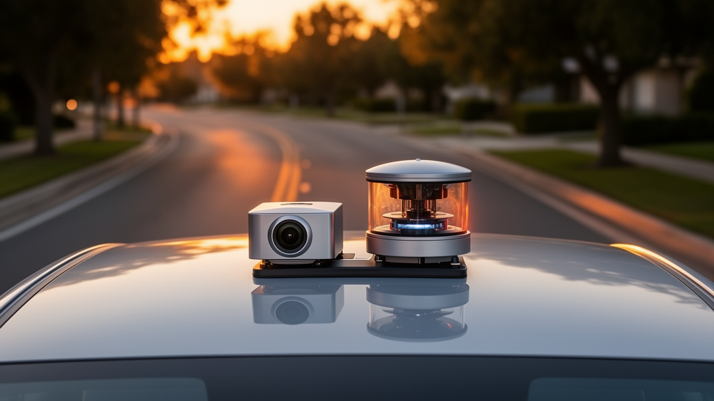
The environmental perception system is often described as the “visual nerve” of an autonomous vehicle. It continuously gathers information about surrounding traffic conditions, feeding data to downstream processes like path planning and speed regulation. Current self-driving cars typically rely on a suite of sensors—visual cameras, LiDAR (Light Detection and Ranging), millimeter-wave radar, and ultrasonic radar—each with distinct strengths and weaknesses. Cameras offer rich texture detail and excellent object classification at low cost, but they are highly vulnerable to variations in light intensity, rain, snow, fog, and occlusions. LiDAR provides precise three-dimensional distance measurements, yet its point clouds are sparse, making fine-grained object recognition difficult. The sheer volume of raw LiDAR data also creates computational bottlenecks that threaten real-time performance.
Previous approaches to this problem have generally fallen into two camps. Single-modal detection systems use either visual information or LiDAR data alone. These architectures are relatively simple and fast, but their adaptability collapses in complex scenes—exactly when reliable perception matters most. Multi-modal fusion methods attempt to couple data from multiple sensors to exploit complementary advantages, representing the core development direction for high-level autonomous driving. However, many existing fusion algorithms suffer from weak feature coupling, and their decision outputs lack robustness when driving conditions change dynamically.
The new research, led by Xu Xu with contributions from Yang Liu and Huijun Yao, proposes a single-stage object detection model built on an enhanced YOLOv12 algorithm combined with point cloud collaboration. YOLOv12—which stands for “You Only Look Once” version 12—is a single-stage end-to-end detection architecture. Its backbone network extracts multi-scale image features divided into small-, medium-, and large-scale feature groups, which are then sent to detection heads for recognition and localization of targets at different sizes. The team selected YOLOv12 because it natively embeds Area Attention to capture global region features, but they identified a critical weakness: Area Attention lacks independent horizontal and vertical spatial coordinate modeling capability, resulting in weak feature response for slender small targets like pedestrians and traffic cones under occlusion and low-light conditions.
To remedy this defect, the researchers hierarchically embedded lightweight Coordinate Attention (CA) modules after each stage of the YOLOv12 backbone. The two attention mechanisms form a complementary structure: Area Attention extracts coarse global regional context, while CA supplements precise pixel coordinate weighting along horizontal and vertical axes. The CA mechanism performs channel weight allocation calculations followed by encoding optimization in both horizontal and vertical directions, strengthening the associative coupling between spatial position information and channel-wise feature representations. The team also swapped the basic Intersection over Union (IoU) loss function for an improved Complete IoU (CIoU) version, which accounts for bounding box overlap, center point distance, and aspect ratio consistency—yielding superior regression performance and tighter bounding box fits.
On the LiDAR side, the pipeline consists of four sequential steps. First, pass-through filtering removes invalid ground and long-distance noise points, followed by voxel grid downsampling to reduce data redundancy while retaining three-dimensional spatial contour information. Second, handcrafted geometric features—vertical height, point cloud density, surface normal vector, and average distance to the vehicle—are calculated within each voxel grid to distinguish vehicles, pedestrians, and non-motorized vehicles. Third, Euclidean distance clustering segments independent object point clusters, with a clustering threshold of 0.3 meters selected after sensitivity testing across 0.1 to 0.5 meter intervals. Thresholds smaller than 0.2 meters caused over-segmentation of connected vehicles, while thresholds larger than 0.4 meters led to under-segmentation of adjacent pedestrians. The 0.3-meter threshold achieved the highest clustering accuracy of 94.7 percent. Fourth, LiDAR target matching confidence is computed according to the number of valid matched points within each cluster, outputting three-dimensional bounding box coordinates and category matching confidence as the final LiDAR branch detection results. Notably, all point cloud processing modules are implemented based on the PCL library without additional deep learning networks for the LiDAR branch, which reduces the overall computational load of the multimodal perception system.
The truly innovative core of this work lies in its scene-adaptive decision-level dynamic weight fusion strategy. Rather than deeply coupling image and point cloud features at low levels, the system implements late decision-level fusion of independent single-modal detection results. An illumination-distance dual attenuation weight adjustment mechanism is constructed, combined with a weighted heuristic Bayesian confidence fusion rule to realize real-time adaptive reliability allocation for visual and LiDAR sensors. The illumination attenuation coefficient measures how ambient light affects visual sensing performance, while the distance attenuation coefficient quantifies how far-range targets affect point cloud sparsity. Under strong light or nighttime conditions, the visual weight decreases while the LiDAR weight increases. For long-distance targets, the LiDAR weight decreases while the visual classification weight rises. At the maximum effective detection distance of 70 meters, LiDAR weight drops to zero and the visual sensor independently completes target detection. A two-stage cross-modal target association matching mechanism—combining spatial IoU screening with category consistency verification and Hungarian bipartite graph matching—prevents mismatching of heterogeneous targets, with an IoU threshold of 0.3 achieving maximum matching accuracy of 92.6 percent.
The experimental results are striking. All experiments were conducted on the KITTI autonomous driving dataset and a self-built dataset from real-vehicle road tests, collected by a test vehicle equipped with a 16-line mechanical LiDAR (Velodyne VLP-16) and an industrial RGB camera. Data collection covered 12 continuous driving routes including urban morning peak, suburban roads, night low-light, light rain, and haze weather, forming 214 independent driving sequences. The improved YOLOv12 embedded with Coordinate Attention increased the proportion of effective features by more than 20 percent on average across various complex traffic scenarios, with the greatest improvement in low-light and small-object conditions. Background noise decreased considerably, feature response intensity increased significantly, and the overall feature loss rate dropped by approximately 14 percent. Compared with the baseline native YOLOv12, mean average precision (mAP@0.5) increased by 9.73 percent and small-object recall grew by 16.42 percent, while the single-frame inference latency rose by only 2.1 milliseconds on an RTX 3090.
The dynamic decision-level fusion algorithm delivered equally impressive gains. The proposed method reduced average three-dimensional localization error to 0.068 meters while classification accuracy reached 95.27 percent. Comprehensive perception accuracy improved by 9.74 percentage points compared with fixed-weight fusion—a 12.7 percent relative improvement. The spatiotemporal registration model reduced pixel projection deviation between radar and camera to 2.39 pixels and constrained three-dimensional matching error to within 0.068 meters, largely eliminating spatial misalignment between heterogeneous sensors. Cross-modal target overlap improved by 31.43 percent. The complete multimodal pipeline achieves an overall total latency of 28 milliseconds on training hardware and 41 milliseconds on the NVIDIA Orin X edge platform deployed in the actual vehicle, meeting real-time perception requirements. When benchmarked against recent state-of-the-art multi-modal detection approaches including MVX-Net, PointPainting, BEVFusion-Lite, and FusionYOLO, the proposed method achieved the highest mAP@0.5 and small-object recall while maintaining the lowest inference latency.
The implications for the autonomous driving industry are substantial. This study provides a technical basis and engineering guidance for large-scale deployment of next-generation autonomous driving systems and optimization of the vehicle’s environmental perception framework. The lightweight architecture—adding only 0.72 million parameters and 2.1 milliseconds of extra latency—makes it particularly suitable for vehicle edge-computing scenarios where computational resources are constrained. However, the researchers acknowledge important limitations. Severe snow and icy conditions degrade both sensor modalities simultaneously: snowflakes produce heavy foreground occlusion and image over-exposure for cameras, while falling snow generates massive noise point echoes for LiDAR. Since the dynamic fusion strategy relies on valid feature outputs from both branches, simultaneous quality degradation weakens the adaptive weight adjustment effect. The team also notes that motion trajectory prediction of dynamic targets at high speeds remains insufficient, and generalization to multi-class irregularly shaped traffic objects needs improvement. Future work will address point cloud optimization in bad weather and integrate a temporal motion prediction module, with the ultimate goal of developing a unified model combining object detection and trajectory prediction—a breakthrough that could reshape environmental perception technology for autonomous driving.
Subject of Research: Object detection for autonomous driving environmental perception and its applications
Article Title: Object detection for autonomous driving environmental perception and its applications
Article References: Xu, X., Liu, Y., & Yao, H. (2026). Object detection for autonomous driving environmental perception and its applications. Frontiers in Mechanical Engineering, 12, Article 1940224. https://doi.org/10.3389/fmech.2026.1940224
Image Credits: AI Generated
DOI: 10.3389/fmech.2026.1940224
Keywords: Object, detection, autonomous, driving, environmental, perception, applications, scientific research
Cite Scienmag News
Denise Maddox. (October 17, 2026). Smarter Eyes for Self-Driving Cars: AI Fuses Camera and LiDAR to See the Road Like Never Before. Scienmag. https://scienmag.com/smarter-eyes-for-self-driving-cars-ai-fuses-camera-and-lidar-to-see-the-road-like-never-before/
Denise Maddox. "Smarter Eyes for Self-Driving Cars: AI Fuses Camera and LiDAR to See the Road Like Never Before." Scienmag, 17 October 2026, https://scienmag.com/smarter-eyes-for-self-driving-cars-ai-fuses-camera-and-lidar-to-see-the-road-like-never-before/. Accessed 17 October 2026.
Denise Maddox. "Smarter Eyes for Self-Driving Cars: AI Fuses Camera and LiDAR to See the Road Like Never Before." Scienmag. October 17, 2026. https://scienmag.com/smarter-eyes-for-self-driving-cars-ai-fuses-camera-and-lidar-to-see-the-road-like-never-before/


