


…
…
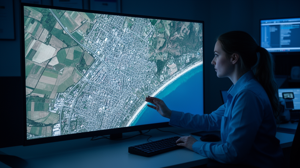
The challenge of segmenting high-resolution remote sensing imagery stems largely from the sheer density of information packed into each scene. Modern aerial and satellite sensors can capture details at resolutions measured in centimeters per pixel, which means that a single urban image may contain thousands of individually distinguishable rooftops, road segments, sidewalks, trees, and vehicles. While this richness is valuable for applications ranging from urban planning to disaster response, it also creates a formidable problem for segmentation algorithms: the boundaries between adjacent objects of different classes are often only a few pixels wide, and any misclassification along these narrow transitions propagates visible errors into the final output. In complex urban environments, where buildings abut roads, vegetation overlaps fences, and shadows blur the distinction between surfaces, these boundary zones become the primary source of segmentation failure.
Traditional approaches to semantic segmentation have treated the problem primarily as one of region classification, assigning a label to every pixel based on its appearance and context. Convolutional neural networks, and later transformer-based architectures, have become remarkably adept at recognizing what objects are present in a scene, but their ability to precisely delineate where one object ends and another begins has lagged behind. This is partly because standard cross-entropy loss functions, which dominate training procedures, treat all pixels equally regardless of their proximity to a boundary. A pixel deep inside a building rooftop contributes the same loss signal as a pixel sitting right at the edge between the roof and the adjacent street. As a result, networks can achieve high overall accuracy while systematically underperforming on the thin, structurally critical boundary regions that human observers use to judge segmentation quality.
The BTSR-Net framework addresses this imbalance by explicitly directing the network’s attention toward boundary neighborhoods and the spatial relationships between structures. Rather than treating boundaries as an afterthought to be cleaned up in post-processing, the architecture integrates boundary awareness into the core representation learning process. The Geometric Boundary-Distance Branch provides the network with a continuous spatial field that encodes how far each pixel lies from the nearest class transition, giving the model a geometric prior that helps it reason about where boundaries should fall even when local appearance cues are ambiguous. This kind of distance-based supervision has parallels in other areas of computer vision, where signed distance functions and boundary-aware losses have been used to sharpen edge predictions in medical imaging and natural scene understanding.
The multi-scale topology-guided structural fusion module tackles a complementary but equally important problem: maintaining the connectivity of elongated structures such as roads, rivers, and linear vegetation corridors. In remote sensing applications, a road that is correctly classified for 95 percent of its length but broken at a few critical junction points is far less useful than one that remains topologically connected throughout. Standard segmentation metrics like overall accuracy or even mean intersection-over-union do not fully capture this kind of topological failure, because a few disconnected pixels along a thin structure represent a vanishingly small fraction of total image area. The centerline Dice coefficient, or clDice, was developed specifically to measure how well tubular or elongated structures preserve their connectivity through segmentation, and its use in this study reflects a growing recognition within the remote sensing community that structural integrity matters as much as pixel-level accuracy for many downstream applications.
The dual-stream structural refinement mechanism represents a further layer of sophistication in the architecture. By confining residual corrections to a narrow band defined by the boundary-distance field, the refinement process avoids the risk of degrading already well-classified interior regions while focusing computational capacity precisely where errors are most likely and most consequential. This targeted approach echoes broader trends in deep learning toward sparse or attention-guided computation, where resources are concentrated on the most informative parts of the input rather than distributed uniformly. In the context of remote sensing, where images can be extremely large and computational efficiency is a practical concern, such selective refinement offers both accuracy and efficiency benefits.
The choice of HRNet-OCR as the backbone architecture is noteworthy in itself. HRNet maintains high-resolution representations throughout the network rather than progressively downsampling and then upsampling as many earlier architectures did, which helps preserve fine spatial detail that is essential for boundary delineation. The object-contextual representation component, originally proposed to model the semantic context of pixels by relating them to object regions rather than just local neighborhoods, adds a layer of global reasoning that helps disambiguate visually similar but semantically distinct areas. Combining these established components with the novel boundary and topology modules allows BTSR-Net to build on proven foundations while introducing targeted innovations where they are most needed.
The ISPRS Potsdam and Vaihingen datasets on which the method was evaluated are among the most widely used benchmarks in the remote sensing segmentation community, which makes the reported improvements directly comparable to a large body of prior work. Potsdam, with its dense historic urban fabric, red-roofed buildings, and complex road networks, presents particular challenges for boundary delineation because many structures share similar spectral signatures with their surroundings. Vaihingen, while also urban, features a somewhat different mix of building types, vegetation patterns, and impervious surfaces, providing a complementary test of generalization. The fact that BTSR-Net shows consistent gains across both datasets, rather than overfitting to the characteristics of one scene type, strengthens the case that the underlying design principles are broadly applicable.
The magnitude of the improvement in boundary-specific metrics deserves particular attention. On Vaihingen, the boundary intersection-over-union improved by 9.39 percentage points over the baseline, which is a substantial margin in a field where incremental gains of one or two points are often considered meaningful. This suggests that the explicit boundary-distance supervision is not merely a marginal refinement but addresses a genuine weakness in how standard architectures handle class transitions. Similarly, the connectivity improvements measured by clDice indicate that the topology-guided fusion module successfully preserves the structural relationships that matter for applications such as road network extraction, where a segmented road map must be navigable and topologically sound to be useful.
Looking at the broader context of remote sensing research, the emphasis on structure-aware segmentation reflects a maturation of the field. Early deep learning approaches to remote sensing largely imported architectures designed for natural images, achieving impressive but sometimes brittle results when applied to the unique characteristics of overhead imagery. Over time, researchers have developed increasingly specialized components that account for the particular challenges of aerial perspectives: the absence of a canonical viewing direction, the prevalence of repetitive textures, the importance of geometric relationships between objects, and the need to reason about structures that span large spatial extents. BTSR-Net’s combination of boundary awareness, topological guidance, and targeted refinement fits squarely within this trend toward domain-specific architectural innovation.
The practical implications of improved boundary and topology segmentation extend across numerous domains. In urban planning, accurate delineation of building footprints and road networks supports infrastructure assessment, property valuation, and growth modeling. In disaster response, rapidly generated and structurally reliable maps of damaged areas can guide emergency operations, where a road network that is incorrectly segmented as connected when it is actually severed could have serious consequences. In environmental monitoring, the connectivity of vegetation corridors and water bodies affects ecological assessments of habitat fragmentation and hydrological flow. In each of these cases, the quality of the segmentation output directly conditions the quality of decisions made downstream, making boundary fidelity and topological correctness not merely aesthetic concerns but functional requirements.
The computational architecture of BTSR-Net also raises interesting questions about the relationship between model complexity and interpretability. By introducing explicit geometric quantities such as boundary distance into the training objective, the method creates intermediate representations that have clear physical meaning, which can aid in understanding why the network makes particular predictions. This contrasts with purely end-to-end approaches where the internal representations remain opaque. For practitioners who need to diagnose failure cases or justify model outputs to stakeholders, having a network component that explicitly encodes distance-to-boundary provides a useful handle for interpretation and debugging.
Training such a model effectively requires careful consideration of how the different loss terms interact. The joint boundary-distance supervision must be balanced against the primary segmentation loss so that the network learns to prioritize boundary accuracy without sacrificing overall region classification. The refinement narrow-band must be wide enough to capture the full extent of boundary ambiguity but narrow enough to avoid unnecessary computation on well-classified areas. These hyperparameter choices, while not always highlighted in architectural descriptions, often determine whether a theoretically sound design translates into practical performance gains. The reported results suggest that the authors navigated these trade-offs successfully, though the sensitivity of performance to these choices remains an area where further ablation studies could provide additional insight.
The broader research community’s growing interest in boundary-aware and topology-aware segmentation is evident across multiple subfields. In medical imaging, where delineating organ boundaries and vascular networks is critical for diagnosis and treatment planning, similar principles of distance-based supervision and connectivity preservation have been developed in parallel. In autonomous driving, lane detection and road segmentation face analogous challenges in maintaining the continuity of thin structures under occlusion and lighting variation. The cross-pollination of ideas between these domains suggests that methods like BTSR-Net, which draw on concepts from multiple areas, may point toward increasingly unified approaches to structure-sensitive segmentation that transcend any single application domain.
As remote sensing data continues to grow in volume, resolution, and availability, the demand for segmentation methods that produce not just accurate but structurally meaningful outputs will only intensify. High-resolution imagery from commercial satellite constellations, drone surveys, and aerial campaigns is being generated at rates that far exceed manual annotation capacity, making automated segmentation the only scalable path to extracting actionable information. In this context, improvements in boundary quality and structural connectivity translate directly into reduced manual correction effort and more reliable downstream analysis. The work represented by BTSR-Net contributes to this broader effort by demonstrating that explicit geometric and topological reasoning, integrated into the architecture and training process, can yield measurable and meaningful improvements on standard benchmarks while remaining grounded in the practical realities of urban scene understanding.
Future directions for this line of research may include extending the boundary-distance framework to handle more complex topological structures such as intersections, loops, and branching networks, where simple connectivity metrics may not fully capture the structural relationships that matter. The integration of temporal information, using multi-date imagery to track how boundaries and structures change over time, could further enhance the utility of structure-aware segmentation for monitoring applications. Additionally, exploring how these refinement mechanisms perform across different sensor modalities, including synthetic aperture radar and hyperspectral imagery, would test the generality of the underlying principles. As the field continues to evolve, the combination of geometric priors, topological constraints, and targeted refinement exemplified by this work is likely to remain a productive direction for advancing the state of the art in remote sensing image analysis.
Subject of Research: Boundary and topology guided structural refinement for high-resolution remote sensing image segmentation
Article Title: BTSR-Net: Boundary–topology guided structural refinement for high-resolution remote sensing image segmentation
Article References: Wang, Z., Wang, W., Hu, Z., Li, Y., & Ma, K. (2026). BTSR-Net: Boundary–topology guided structural refinement for high-resolution remote sensing image segmentation. PLOS One, 21(10), e0360524. https://doi.org/10.1371/journal.pone.0360524
Image Credits: AI Generated
DOI: 10.1371/journal.pone.0360524
Keywords: remote sensing, semantic segmentation, deep learning, BTSR-Net, boundary detection, topology, HRNet-OCR, ISPRS Potsdam, ISPRS Vaihingen, urban mapping, clDice, structural connectivity
Cite Scienmag News
Reid Dalton. (October 16, 2026). New AI Network Sharpens the Fine Lines That Make or Break Satellite Maps. Scienmag. https://scienmag.com/new-ai-network-sharpens-the-fine-lines-that-make-or-break-satellite-maps/
Reid Dalton. "New AI Network Sharpens the Fine Lines That Make or Break Satellite Maps." Scienmag, 16 October 2026, https://scienmag.com/new-ai-network-sharpens-the-fine-lines-that-make-or-break-satellite-maps/. Accessed 16 October 2026.
Reid Dalton. "New AI Network Sharpens the Fine Lines That Make or Break Satellite Maps." Scienmag. October 16, 2026. https://scienmag.com/new-ai-network-sharpens-the-fine-lines-that-make-or-break-satellite-maps/


