


In the Danube Delta, Europe’s largest reed-bed wetland and one of its most dynamic river landscapes, the line between surface water and groundwater is astonishingly thin. A new field study published in the Scientific Annals of the Danube Delta Institute shows that the water table beneath the banks of four delta canals can swing by more than a metre and a half between spring floods and autumn droughts, and that the sediment making up those banks determines how quickly, and how far, the water moves in response. The findings, based on 80 shallow boreholes drilled with nothing more sophisticated than a hand auger, offer a rare ground-truth view of how this vast wetland breathes with the seasons.
The research focused on the phreatic aquifer, the first water-bearing layer beneath the delta’s surface, which sits at remarkably shallow depths and maintains a close connection with the Danube River itself. When the river runs high in spring, water infiltrates the soil and pushes the hydrostatic level upward; when the river drops in autumn, the water table falls in near-lockstep. Because the delta’s water table is so close to the surface, these fluctuations ripple through the entire ecosystem, influencing everything from reed growth to the filtration of contaminants before they reach deeper layers or the Black Sea.
To capture this seasonal pulse, the team measured groundwater levels along the banks of the Crânjală, Mitchina, Letea and Sidor canals during two contrasting hydrological windows: late March and early April 2023, when Danube water levels were high, and late October 2023, when they were low. At each canal, measurements were taken at three profiles, with boreholes planned perpendicular to the canal direction at distances of up to 160 metres from the bank. The terrain, however, had other ideas. Water ponds, muddy ground and dense delta vegetation often made the full drilling programme impossible, particularly on the Mitchina canal, whose northern bank presented itself not as dry land but as a water expanse.
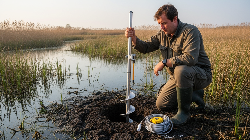
The drilling technique was elegantly simple. Using an Eijkelkamp manual auger set for heterogeneous soils, the operator advanced roughly 20 centimetres at a time, pulled out the auger filled with sediment, cleaned it, and reinserted it repeatedly until the water table was reached. The appropriate Edelman auger, whether designed for sandy, clayey or combined sediments, was selected according to the material encountered. Borehole depths ranged from 15 to 240 centimetres, and the coordinates and altitudes of every drilling were recorded, with bank elevations across the four canals sitting between roughly 1.1 and 2.8 metres above sea level.
One of the study’s most intriguing observations emerged during the drilling itself. When groundwater was encountered in a borehole, the water often began to rise, travelling upward until it reached a stable level. The distance the water climbed before stabilizing varied with sediment type, revealing the hidden role of capillarity and permeability in controlling groundwater movement. On the Crânjală canal during high water, the water table was encountered at depths between 30 and 70 centimetres and stabilized between 15 and 50 centimetres, with the rise before stabilization ranging from 15 to 35 centimetres. During low water, the table dropped dramatically, being identified at depths from 70 to 240 centimetres and stabilizing between 60 and 210 centimetres.
The seasonal contrasts were striking. On the Crânjală canal, water table variations between spring and autumn ranged from 5 to 170 centimetres, corresponding to a canal water level difference of 138 centimetres between the two campaigns. The Mitchina canal showed fluctuations of 90 and 105 centimetres on its two comparable profiles against the same 138-centimetre canal difference. The Letea and Sidor canals, both set on sandy deposits, recorded gentler swings: seasonal variations of 25 to 90 centimetres on Letea and 45 to 80 centimetres on Sidor, each corresponding to a canal water level difference of 60 centimetres. The pattern was clear: the canals in the fluvial delta, connected to Fortuna Lake and floored with fine sediments, behaved very differently from those on the sandy banks.
That difference comes down to granulometry, the distribution of grain sizes in the sediment. The Crânjală and Mitchina canals are underlain by fine-grained clay-silt deposits with only a slight sand content, while the Letea and Sidor canals sit primarily on sands. Clay and silt have far lower permeability than sand and gravel, so aquifers hosted in fine particles restrict groundwater movement, slowing recharge and discharge. Clay’s extremely small pore spaces give it a high water retention capacity, which can even produce impermeable layers acting as barriers between aquifer units. Sand, by contrast, promotes faster groundwater flow and a more uniform hydrostatic level distribution, as its high permeability equalizes pressure within the aquifer and ensures consistent water movement.
The lithology encountered in the boreholes told a parallel story about the surface. In almost all drillings, the uppermost centimetres revealed an organic soil layer rich in plant remains, but its development varied dramatically with local conditions. Along the Crânjală and Mitchina canals, where delta-specific vegetation is abundant, the organic layer was well developed. On the sandy banks of Letea and Sidor, this layer was poorly developed and in many cases completely absent. The team generated hydrogeological profiles and spatial representations from the field data, establishing correlations between sediment granulometry, groundwater fluctuations and hydrological extremes that link surface hydrology to subsurface water dynamics in this complex deltaic environment.
The phreatic aquifer’s importance to the delta’s ecological health is difficult to overstate. It supplies water to numerous aquatic and terrestrial habitats hosting rare and protected species, and the soils and sediments within it act as a natural filter, purifying water from contaminants before they reach deeper layers or surface water bodies. This natural filtration system also helps prevent soil and water salinization, particularly by limiting the infiltration of saltwater from the Black Sea. Evapotranspiration, the combination of evaporation and plant transpiration, adds another seasonal dimension, reducing aquifer recharge during the hot summer months when water demand from the atmosphere is highest.
The study’s authors emphasize that long-term seasonal measurements will be essential for building a comprehensive database capable of quantifying fluctuations in the hydrostatic level of the phreatic aquifer and the hydrological variations that drive them. Wetland management, they note, is closely tied to the characteristics and behaviour of the underlying aquifer, since groundwater discharge ensures a stable water supply during dry periods and influences wetland hydrodynamics. The permeability and porosity of aquifer sediments determine the rate of water exchange between groundwater and surface water, affecting nutrient cycling, vegetation patterns and habitat stability. In an era of intensifying floods and droughts on the Danube, understanding how sediment composition modulates the delta’s groundwater response to seasonal extremes could prove vital for managing one of the continent’s most valuable wetland systems.
Subject of Research: Groundwater hydrostatic level variability along Danube Delta canal banks and its relationship to sediment composition
Article Title: Monitoring hydrostatic level variability on the banks of several canals in the Danube delta
Article References: Livanov, O., Bănescu, A., Pindic, P., Simionov, M., & Anore, C. (2025). Monitoring hydrostatic level variability on the banks of several canals in the Danube delta. Scientific Annals of the Danube Delta Institute, 30, 31-42. https://doi.org/10.3897/saddi.30.160468
Image Credits: AI Generated
Keywords: Danube Delta, groundwater, hydrogeology, phreatic aquifer, wetland management, sediment permeability, seasonal water levels, hand auger, Monitoring, hydrostatic, level, variability
Cite Scienmag News
Violet Maxwell. (October 16, 2026). Hand Augers Reveal How Sediment Controls Groundwater in the Danube Delta. Scienmag. https://scienmag.com/hand-augers-reveal-how-sediment-controls-groundwater-in-the-danube-delta/
Violet Maxwell. "Hand Augers Reveal How Sediment Controls Groundwater in the Danube Delta." Scienmag, 16 October 2026, https://scienmag.com/hand-augers-reveal-how-sediment-controls-groundwater-in-the-danube-delta/. Accessed 16 October 2026.
Violet Maxwell. "Hand Augers Reveal How Sediment Controls Groundwater in the Danube Delta." Scienmag. October 16, 2026. https://scienmag.com/hand-augers-reveal-how-sediment-controls-groundwater-in-the-danube-delta/


