


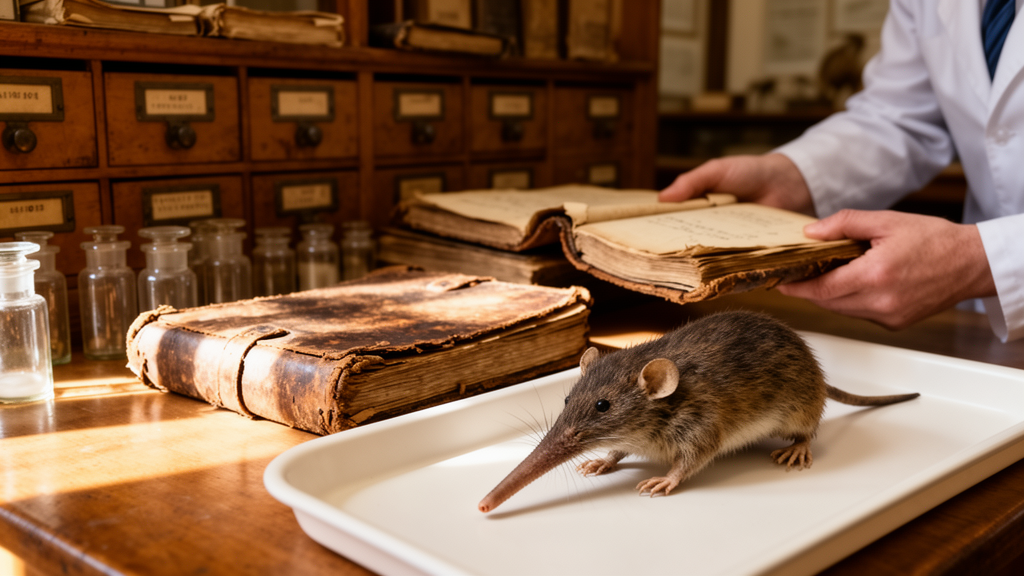
In the mountains of western Mexico, a small and secretive mammal has been quietly puzzling scientists for more than a century. The Mexican shrew, Megasorex gigas, is the only species in its entire genus, an evolutionary oddity that ranks among the largest shrews in the Americas. Yet for nearly 130 years, nobody knew exactly where the first specimens had been collected. The type locality, the geographic anchor that fixes a species’ name to a place on the map, has been recorded as little more than a vague phrase: “Mountains at Milpillas, near San Sebastian, Jalisco.” That ambiguity, new research shows, has real consequences, and a painstaking piece of archival detective work has finally resolved it.
The problem sounds trivial until you start counting. According to Mexico’s National Institute of Statistics and Geography, twenty-two localities in the state of Jalisco include the word Milpillas, and thirteen include San Sebastián. A reference to a place called Milpillas near San Sebastián, written in 1897 without coordinates, could plausibly point to a dozen different spots across a mountainous state larger than Switzerland. Modern attempts at georeferencing have made matters worse. A search of the Global Biodiversity Information Facility returns two coordinate pairs for the type locality that lie more than 200 kilometres apart, and a published restriction to latitude 22.12 degrees north and longitude 104.11 degrees west adds yet another candidate. Meanwhile, three major georeferencing projects for Mexican mammals simply declined to assign coordinates at all.
To untangle the mess, researchers returned to the original paper trail. The Mexican shrew was described in 1897 by Clinton Hart Merriam, based on three specimens gathered by Edward William Nelson and Edward Alphonso Goldman, two legendary field naturalists of the U.S. Biological Survey. Between 1892 and 1906, the pair collected more than 17,000 mammal specimens across Mexico, almost all now held at the Smithsonian Institution. Crucially, they were obsessive note-takers: their field journals and catalogues, preserved in the Smithsonian Institution Archives, record daily distances, compass bearings, elevations, habitats and even meals. The team, whose findings are published in the journal Natural History Collections and Museomics, downloaded the Smithsonian’s specimen database and pored over the handwritten notebooks to reconstruct exactly where the three shrews were caught on 14 and 15 March 1897.
Reading Victorian handwriting is its own challenge, and the researchers brought in unexpected allies. They used Transkribus, a handwritten text recognition platform, to transcribe Nelson’s and Goldman’s field notes, and cross-checked the interpretations with a large language model to enrich and compare readings. They also consulted Goldman’s posthumous book, Biological Investigations in Mexico, which summarises the spatial and temporal context of the expedition. The transcribed itineraries were then laid over modern spatial data, including shapefiles of rural and urban localities and the national road network obtained from Mexico’s National Commission for Biodiversity, and traced in Google Earth Pro and QGIS to assign decimal-degree coordinates to each stop.
The reconstruction begins in late February 1897, when Nelson arrived in Guadalajara and travelled to Ameca, a town that served as the terminus of the Mexican Central Railway and a natural staging post. There he reunited with Goldman, who had arrived earlier that month, and the two spent days packing mules and horses. On 3 March they struck out westward, camping at a ranch before reaching the small town of Atenguillo more than 50 kilometres away. From there the route climbed through steep ridges rising between 300 and 600 metres above the valleys, reaching the old mining town of Talpa de Allende on 7 March, then doubling north through Mascota to a ranch called El Atajo by 12 March.
The decisive leg came the following day. Setting out northwest from El Atajo, the naturalists reached a steep-sided canyon, descended its slopes and arrived at a small settlement of Indigenous huts called Milpillas. Nelson described the site as sitting at just over 1,000 metres of elevation, with coffee and bananas planted around the huts. Goldman noted that sea winds pushed cloud formations into the area, sustaining a heavy oak forest, and that local plots grew coffee, sugarcane, bananas, mangoes and oranges. The pair worked the area until 19 March, when they moved on to San Sebastián del Oeste, which Nelson and Goldman referred to as being just five miles away. That short travel time, the researchers argue, unequivocally identifies the town as San Sebastián del Oeste rather than any of Jalisco’s other San Sebastiáns.
The three shrew specimens that would become the type series of Megasorex gigas were collected on 14 and 15 March, squarely within the Milpillas period. The study therefore restricts the type locality to Las Milpillas, at coordinates 20.742 degrees north and 104.893 degrees west, roughly 4 kilometres southwest of San Sebastián del Oeste, at an elevation of about 1,219 metres, and does so, the authors say, with a high degree of certainty. In total, the San Sebastián region and the nearby village of Milpillas yielded 97 mammal specimens between 14 and 20 March 1897, part of a haul of 397 specimens from Jalisco that also included 217 rodents and 150 bats.
Why does pinning down a point on a map from 1897 matter so much? For one thing, type localities underpin taxonomy itself. Shrews are poorly studied, and when researchers detect high levels of genetic or morphological divergence within a species, they may end up recognising distinct lineages with new names. Knowing precisely where the name-bearing specimens came from ensures that any future species splits are anchored to the right population, preventing misassignment of names. For species described decades or centuries ago, whose original locality descriptions were often just a few words, retrospective georeferencing of this kind is often the only way to restore that anchor.
There is also a conservation dimension. The Mexican shrew is classified as Threatened under Mexico’s Official Standard NOM-059-SEMARNAT-2010, and by the start of this century an estimated two-thirds of its habitat had been lost or rendered unsuitable by land-use change and urban development. Modelling suggests that around 80 percent of its current distribution could be affected by climate change during this century. Yet the IUCN Red List lists the species as Least Concern, citing its broad range and apparent tolerance of some habitat modification, including records from coffee plantations and cornfields. The mismatch illustrates how differing criteria and spatial scales can produce divergent conservation categories, and how sensitive those assessments are to the geographic data that feed them. The species ranges along Mexico’s Pacific slope from Nayarit to Oaxaca, from sea level up to 1,800 metres, favouring humid microhabitats in tropical deciduous, cloud and pine-oak forests.
Perhaps the most striking lesson of the study is what it says about museums and archives. A substantial amount of highly accurate information tied to biological specimens, the authors note, is often not recorded on labels at all, but in the journals, catalogues and correspondence of the collectors who gathered them. As budgets shrink and collection-based science struggles for support, efforts to locate, compile, preserve and digitise these ancillary records become urgent. The precise origin of three shrews caught in a misty oak forest in March 1897 now serves as a baseline for spatiotemporal comparisons across a century of drastic ecological change, in a landscape where type localities are being transformed or even erased. In an era when artificial intelligence can help decipher a Victorian naturalist’s handwriting and lay his mule trail across a satellite map, the humble field notebook has been revealed as one of the most powerful datasets in biodiversity science.
Subject of Research: Retrospective georeferencing of the type locality of the Mexican shrew, Megasorex gigas
Article Title: Origin of the type series and restriction of the type locality of the Mexican shrew, Megasorex gigas ( Mammalia , Soricidae )
Article References: González de La Colina, F. A., Vargas-Cuenca, J., & Guevara, L. (2026). Origin of the type series and restriction of the type locality of the Mexican shrew, Megasorex gigas (Mammalia, Soricidae). Natural History Collections and Museomics, 3, Article e202846. https://doi.org/10.3897/nhcm.3.202846
Image Credits: AI Generated
Keywords: Megasorex gigas, Mexican shrew, type locality, retrospective georeferencing, Nelson and Goldman, Smithsonian Archives, Jalisco, natural history collections, taxonomy, biogeography, conservation, field journals
Cite Scienmag News
Margaret Porter. (October 15, 2026). Century-Old Field Journals Solve the Mystery of Mexico’s Giant Shrew. Scienmag. https://scienmag.com/century-old-field-journals-solve-the-mystery-of-mexicos-giant-shrew/
Margaret Porter. "Century-Old Field Journals Solve the Mystery of Mexico’s Giant Shrew." Scienmag, 15 October 2026, https://scienmag.com/century-old-field-journals-solve-the-mystery-of-mexicos-giant-shrew/. Accessed 15 October 2026.
Margaret Porter. "Century-Old Field Journals Solve the Mystery of Mexico’s Giant Shrew." Scienmag. October 15, 2026. https://scienmag.com/century-old-field-journals-solve-the-mystery-of-mexicos-giant-shrew/


