


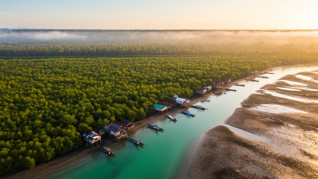
Along the industrial coastline of Gresik Regency in East Java, Indonesia, a quiet accounting exercise has produced a striking verdict: in three of seven coastal subdistricts, the surviving mangrove forests are simply too small to soak up the carbon dioxide that local human activity pumps into the atmosphere. Researchers have now calculated, subdistrict by subdistrict, exactly how many hectares of new mangrove woodland would be needed to close that gap, turning a vague call for restoration into a measurable spatial target. The findings, published in the journal BioRisk, offer one of the most granular looks yet at how blue carbon ecosystems can be matched against anthropogenic emissions at the level where coastal planning actually happens.
The study focused on seven coastal subdistricts—Panceng, Ujungpangkah, Bungah, Sidayu, Manyar, Gresik, and Kebomas—chosen because they harbor the region’s principal mangrove ecosystems while experiencing sharply different levels of urban pressure. Gresik Regency is a strategic and rapidly developing coastal zone where industrialization, urbanization, and transport continue to intensify, placing simultaneous pressure on the atmosphere and on the coastal wetlands that might otherwise buffer it. Indonesia holds the largest mangrove area on Earth, but between 1985 and 2019 the country lost roughly 430,000 hectares of mangroves to aquaculture, agriculture, plantations, and coastal development, a loss that directly erodes the national carbon sink.
The methodology combined ground truth with satellite eyes. In the field, survey teams laid 100-meter transects perpendicular to the shoreline and placed 10 by 10 meter observation plots along each line at 0, 50, and 100 meters. Within these plots they identified mangrove species and measured tree diameters at breast height, feeding those measurements into species-specific allometric equations for genera such as Rhizophora, Avicennia, Sonneratia, Ceriops, Lumnitzera, Xylocarpus, and Bruguiera. Biomass was converted to carbon content using the standard assumption that carbon constitutes half of dry biomass, and carbon stocks were then translated into absorbed carbon dioxide using the atomic mass ratio of CO2 to carbon, a conversion factor of 3.67 derived from the atomic weights of carbon and oxygen.
Space-based analysis relied on 2023 Landsat 8 imagery processed on the Google Earth Engine platform. Cloud-masking algorithms produced a clean annual composite, from which the Normalized Difference Vegetation Index was calculated as an input to machine-learning classification using Random Forest and CART algorithms. Training data came from the field plots, and classification accuracy was verified with a confusion matrix. Thirteen mangrove species were confirmed across the coast, with Avicennia and Rhizophora dominating. The mapping revealed dramatic contrasts: Ujungpangkah Subdistrict held 1,615.54 hectares of mangrove, while Kebomas, one of the most developed areas, retained just 0.75 hectares, with much of its former mangrove land repurposed for development.
On the emissions side, the researchers inventoried carbon dioxide equivalents from transport fuel, livestock and poultry, liquefied petroleum gas consumption, electricity use, and population-related activities, applying standard emission factors such as 2.31 kilograms of CO2 per liter of gasoline and 3 kilograms of CO2 per kilogram of LPG. The totals exposed a stark urban-rural gradient. Gresik Subdistrict, anchored by urban mobility and logistics, emitted the most at 6,795.91 tonnes of CO2-equivalent per year, with transportation alone contributing 5,712.52 tonnes—roughly 84 percent of its total. Registered vehicles in the regency number 801,969, a figure that underscores how rapid motorization drives coastal emissions. At the other extreme, Sidayu, with its traditional fisheries and agriculture, produced the least, at 2,375.30 tonnes per year.
Mangrove carbon performance proved equally uneven, and in an instructive way. Bungah recorded the highest carbon stock density at 189.35 tonnes of carbon per hectare and the highest sequestration rate at 694.91 tonnes of CO2 per hectare per year, yet Ujungpangkah’s sheer extent gave it the largest totals: 264,803.16 tonnes of stored carbon and 971,827.60 tonnes of annual CO2 sequestration. Ujungpangkah’s forests flourish at the estuary of the Bengawan Solo River, whose heavy sediment load—over 1,700 tonnes of suspended material annually—continuously builds new land through accretion. A telling comparison emerged between Manyar and Sidayu: despite having more mangrove area, Manyar stored less carbon overall, showing that stand structure, species composition, density, and productivity matter as much as raw acreage.
Balancing the ledger against local emissions, four subdistricts—Ujungpangkah, Bungah, Manyar, and Sidayu—emerged as net carbon sinks with absorption capacity exceeding their anthropogenic output. Ujungpangkah’s mangroves sequester nearly a million tonnes of CO2 annually against local emissions of just 2,750.34 tonnes, a net balance of minus 969,077.26 tonnes. But Kebomas, Panceng, and Gresik all ran deficits. Gresik Subdistrict’s mangroves, covering only 10.67 hectares, store a mere 346.03 tonnes of carbon and sequester 1,269.92 tonnes of CO2 per year, leaving more than 5,500 tonnes of CO2-equivalent unabsorbed each year. Kebomas, with three-quarters of a hectare of mangrove against 5,220.32 tonnes of annual emissions, is the most ecologically insolvent of all.
The spatial arithmetic of restoration follows directly. To neutralize current emissions, the analysis concluded that Kebomas needs an additional 52.07 hectares of mangrove for annual CO2 sequestration—or 191.08 hectares total to also restore ideal carbon storage. Panceng requires 50.21 additional hectares for sequestration, and Gresik 57.10 hectares, with Gresik needing the largest storage-based expansion at 198.89 hectares beyond its existing 10.67. The authors argue that in these urban-industrial zones, policy must move beyond passive conservation toward active landscape reconstruction, ideally prioritizing fast-growing, high-sequestration species, and that rehabilitation targets should be anchored to minimum area requirements rather than aspiration.
The broader significance of the study lies in its framework as much as its numbers. Few previous works have integrated field-based biomass inventories, satellite-derived mangrove mapping, and comprehensive emission accounting at the subdistrict scale, and fewer still have translated the resulting deficits into concrete hectare targets. Because mangroves sequester carbon in both woody biomass and organic coastal sediments—storing more carbon per unit area than most tropical terrestrial forests and holding it for decades to centuries—they represent one of the most efficient natural climate solutions available to coastal nations. They also deliver co-benefits that engineered offsets cannot: wave damping, shoreline protection against abrasion and sea-level rise, habitat for coastal biota, and filtration of pollutants through their root systems.
For Indonesia, the stakes extend to international commitments under the Paris Agreement and to the integrity of coastal communities facing tidal flooding and erosion. The Gresik results show that even where a regency enjoys an overall carbon surplus, thanks largely to one conserved estuarine forest, urban zones can accumulate unabsorbed emissions as habitat fragmentation and land conversion strip away sink capacity. The researchers frame their hectare-level estimates as a practical planning tool for blue carbon management: site-specific restoration quotas that can guide where to plant, how much to plant, and how to monitor whether restored mangroves are actually closing the emissions gap. In a warming century, the message from this stretch of the Java Sea is that every hectare of mangrove now carries a quantifiable climate price—and that the deficit, in some places, is only about fifty hectares wide.
Subject of Research: Estimating the mangrove area required to offset anthropogenic carbon emissions in coastal Gresik Regency, Indonesia
Article Title: Estimation of mangrove requirements for the absorption and storage of anthropogenic carbon emissions in the coastal area of Gresik Regency, East Java Province, Indonesia
Article References: Estimation of mangrove requirements for the absorption and storage of anthropogenic carbon emissions in the coastal area of Gresik Regency, East Java Province, Indonesia. (n.d.). https://doi.org/10.3897/biorisk.24.189492
Image Credits: AI Generated
DOI: 10.3897/biorisk.24.189492
Keywords: mangroves, blue carbon, carbon sequestration, carbon emissions, Gresik Regency, Indonesia, remote sensing, Landsat, GIS, mangrove restoration, climate change mitigation, coastal management
Cite Scienmag News
Sloane Callahan. (October 15, 2026). Mangroves vs. Emissions: Indonesian Coast Reveals How Much Forest Carbon Neutrality Demands. Scienmag. https://scienmag.com/mangroves-vs-emissions-indonesian-coast-reveals-how-much-forest-carbon-neutrality-demands/
Sloane Callahan. "Mangroves vs. Emissions: Indonesian Coast Reveals How Much Forest Carbon Neutrality Demands." Scienmag, 15 October 2026, https://scienmag.com/mangroves-vs-emissions-indonesian-coast-reveals-how-much-forest-carbon-neutrality-demands/. Accessed 15 October 2026.
Sloane Callahan. "Mangroves vs. Emissions: Indonesian Coast Reveals How Much Forest Carbon Neutrality Demands." Scienmag. October 15, 2026. https://scienmag.com/mangroves-vs-emissions-indonesian-coast-reveals-how-much-forest-carbon-neutrality-demands/


