


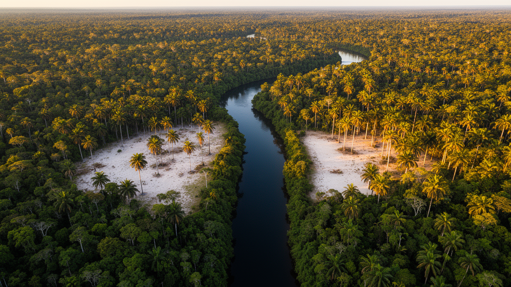
Deep in the eastern Brazilian Amazon, more than 400 kilometers by boat from the nearest city, a team of researchers walked a five-kilometer line through some of the least-studied forest on Earth. What they found there was extraordinary: a palm community so abundant and so tightly governed by the shape of the land and the flow of water that it reads like a natural experiment in how environments sculpt life. The survey, conducted in the Riozinho do Anfrísio Extractive Reserve in the state of Pará, has now documented eighteen palm taxa across ten hectares of continuous forest, filling an approximately 500-kilometer gap in floristic knowledge and providing the first characterization of a palm community for this remote sector of the Iriri River Valley.
The setting itself is remarkable. The reserve spans 737,088 hectares of federally protected forest bounded on the east by the Iriri River, a clear-water tributary of the Xingu. No roads or trails reach the study area; access requires roughly two days of navigation along the Xingu and Iriri rivers from Altamira. This remoteness has long kept botanists away, even though recent remote-sensing analyses based on airborne LiDAR data and deep learning had flagged the region as harboring extensive areas of high canopy palm cover. The new field survey confirms that prediction on the ground, and it does so with numbers that would impress any tropical ecologist.
Walking the transect on foot at roughly one kilometer per hour, at least two experienced observers censused a continuous twenty-meter-wide belt, partitioned into one hundred contiguous sampling units of twenty by fifty meters. In total they recorded 1,506 adult palm individuals belonging to eighteen taxa, seventeen identified to species level and one morphospecies to genus. Four species dominated overwhelmingly: Attalea speciosa with 527 individuals across 85 plots, Euterpe longibracteata with 267, Geonoma baculifera with 263, and Euterpe oleracea with 105. Together these four accounted for more than three-quarters of every palm counted. Species accumulation curves and multiple richness estimators, including Chao, Jackknife, and Bootstrap, converged on eighteen species, indicating that the sampling effort captured nearly the entire local palm flora.
Attalea speciosa, the babassu palm, reached an average density of 52.7 individuals per hectare and local peaks of 270 adult individuals per hectare within a single plot. Its hyperdominance is not merely a botanical curiosity. Palms can constitute up to a quarter of stems exceeding ten centimeters in diameter in some tropical forests, and biomass models developed specifically for palms suggest their carbon fixation capacity may be nearly a third higher than estimates based on dicotyledonous trees. In a region flagged by satellite for exceptional palm abundance, documenting which species dominate and where is directly relevant to understanding forest carbon dynamics in the eastern Amazon.
To understand why palms clustered where they did, the researchers extracted environmental data for the centroid of each sampling unit. From the TOPODATA digital elevation model, derived from Shuttle Radar Topography Mission data at thirty-meter resolution, they obtained altitude, slope, relief, exposure, and terrain shape. From HydroSHEDS they calculated the distance to the nearest perennial stream. And from CBERS-4A satellite imagery they derived the normalized difference vegetation index, or NDVI, a proxy for vegetation greenness and forest structure that ranged from 0.597 to 0.662 along the transect. Crucially, the team also recorded in the field the presence or absence of igarapés, the shallow, narrow, slow-moving streams typical of Amazonian environments that are generally invisible in satellite imagery.
The statistical architecture of the study was rigorous. A Redundancy Analysis linked community composition to the continuous environmental variables, with Variance Inflation Factors confirming no problematic multicollinearity. Species richness was modeled with a Gaussian General Linear Model for continuous predictors and analysis of variance for categorical ones, followed by Tukey’s Honestly Significant Difference tests for pairwise comparisons. For the six most abundant species, Bayesian regression models accommodated different response distributions, including zero-inflated count and presence-absence data, quantifying species-specific habitat associations with credible intervals rather than single point estimates.
The results revealed a striking division of labor among environmental factors. Community composition was significantly associated with NDVI, altitude, and distance to streams, which together explained 17.82 percent of the observed variation, with the first constrained axis accounting for 81.84 percent of the constrained variation. Species richness, by contrast, showed no significant association with any continuous variable but responded strongly to the presence of igarapés and to terrain shape. Plots containing igarapés had significantly higher richness than plots without them, with estimated marginal means of 2.07 versus 1.56 species per plot. Terrain shape mattered too: convex, water-divergent areas and concave, water-neutral areas supported higher richness than flat, water-convergent and flat, water-divergent terrains, and the categorical model explained fully half of the observed variation in richness.
The Bayesian models then exposed the ecological personalities of the dominant species. Attalea speciosa showed the strongest associations of all: its expected abundance decreased with increasing NDVI and was lower in plots containing igarapés, indicating a clear preference for relatively open forest patches away from streams. Geonoma baculifera and Euterpe oleracea displayed the opposite pattern, both positively associated with the presence of igarapés and substantially more abundant in riparian plots. Geonoma baculifera formed dense clusters reaching up to 630 individuals per hectare, comparable to densities reported for seasonally flooded sandy soils elsewhere in the eastern Amazon. Euterpe longibracteata responded more to terrain shape than to greenness, favoring flat water-neutral or convex water-convergent topographic positions. Models for the two Astrocaryum species showed lower explanatory power and broad credible intervals, warranting cautious interpretation.
The hyperdominance of Attalea speciosa carries a deeper historical resonance. In the neighboring Rio Iriri reserve on the opposite bank of the river, the same species was found hyperdominant and associated with historical forest disturbance, where archaeological evidence indicates that this disturbance dates to Indigenous occupation during the eighteenth century. The present-day dominance of babassu in the region may therefore reflect a long-term anthropogenic legacy rather than recent extractive activity, although in the newly surveyed area the relative contributions of natural disturbance regimes and historical human influence remain uncertain, and both may have contributed. This possibility ties the palm community to one of the most compelling narratives in Amazonian science: the recognition that many seemingly pristine forests bear the fingerprints of ancient human management.
The richness documented at RESEX Riozinho, seventeen identified species plus one morphospecies, exceeded that of the two other areas previously surveyed along the eastern margin of the Xingu Basin, where ten species were recorded in the Kayapó Indigenous Territory roughly 400 kilometers to the southwest and eleven near Altamira. This pattern fits the broader westward increase in palm diversity across Amazonia, associated with rising rainfall toward the center and west of the basin. Two widespread palms of the Xingu Basin, Socratea exorrhiza, the famous walking palm adapted to seasonally flooded soils through its stilt roots, and Oenocarpus bataua, long associated with Indigenous management and dispersal, both occurred at comparatively low local abundance, showing that regional hyperdominance is not necessarily mirrored at the plot scale. The occurrence of Iriartea deltoidea, among the most abundant Amazonian tree species despite having been recorded in relatively few floristic inventories, extends its documented distribution within the eastern Amazon.
What does this mean for conservation? Several palm species have been proposed as indicators or surrogates of biodiversity, and describing their local environmental associations may improve their application in conservation planning. The findings may also contribute to future ecological studies, restoration initiatives, and agroforestry projects involving native palms. Yet the researchers are careful about scope. Because these patterns were documented along a single continuous transect, they should be interpreted as spatial associations within the surveyed landscape rather than as general ecological relationships for the eastern Amazon. The relatively low proportion of variation in composition explained by the measured variables suggests that additional factors, such as edaphic properties and disturbance history, also shape the community.
Still, the broader lesson is unmistakable. In one of the least-studied corners of Pará, the architecture of the palm community is written in the language of streams, slopes, and forest greenness. Small watercourses that satellites cannot see turn out to matter more for palm diversity than the perennial rivers that they can, a finding that argues powerfully for the continued value of boots-on-the-ground botany in an age of remote sensing. As the Amazon faces intensifying pressures from deforestation corridors barely a hundred kilometers to the north and east, inventories like this one provide the floristic baselines against which all future change will be measured, and they remind us that the forest’s hidden kingdoms still await their cartographers.
Subject of Research: Palm community structure and its associations with topography, hydrography, and forest structure in the eastern Amazon
Article Title: Palm community structure in relation to topography, hydrography, and forest structure in the Iriri River Valley, eastern Amazon
Article References: Salm, R., von Schmalz, K. E., Ruz, E. H., de Souza, D. A., de Oliveira Jr, A. P., & Pereira, C. C. (2026). Palm community structure in relation to topography, hydrography, and forest structure in the Iriri River Valley, eastern Amazon. Neotropical Biology and Conservation, 21(4), 297-320. https://doi.org/10.3897/neotropical.21.e206551
Image Credits: AI Generated
DOI: 10.3897/neotropical.21.e206551
Keywords: Amazon, palm communities, topography, hydrography, NDVI, species distribution, Palm, community, structure, relation, forest, Iriri
Cite Scienmag News
Gavin Prescott. (October 15, 2026). Hidden Palm Kingdoms of the Iriri River: How Streams and Terrain Shape Amazon Forest Life. Scienmag. https://scienmag.com/hidden-palm-kingdoms-of-the-iriri-river-how-streams-and-terrain-shape-amazon-forest-life/
Gavin Prescott. "Hidden Palm Kingdoms of the Iriri River: How Streams and Terrain Shape Amazon Forest Life." Scienmag, 15 October 2026, https://scienmag.com/hidden-palm-kingdoms-of-the-iriri-river-how-streams-and-terrain-shape-amazon-forest-life/. Accessed 15 October 2026.
Gavin Prescott. "Hidden Palm Kingdoms of the Iriri River: How Streams and Terrain Shape Amazon Forest Life." Scienmag. October 15, 2026. https://scienmag.com/hidden-palm-kingdoms-of-the-iriri-river-how-streams-and-terrain-shape-amazon-forest-life/


