


When engineers design a storm drain, a culvert, or a small dam, they rely on a deceptively simple piece of arithmetic: take the heaviest rainfall expected at a single point, for a given duration and rarity, and scale it to the area they are protecting. The scaling factor, known as the areal reduction factor, or ARF, quietly underpins billions of dollars of water infrastructure worldwide. Yet the factors themselves remain among the most uncertain quantities in hydrology, especially for the brief, violent cloudbursts that overwhelm urban drainage systems in minutes. A new study published in Natural Hazards and Earth System Sciences by Golbarg Goshtasbpour, Jannick Alpers, Kai Schröter, and Hannes Müller-Thomy of Technische Universität Braunschweig now delivers the most detailed empirical picture yet of how these factors behave at the sub-hourly scale, using one of the densest rain gauge networks on Earth.
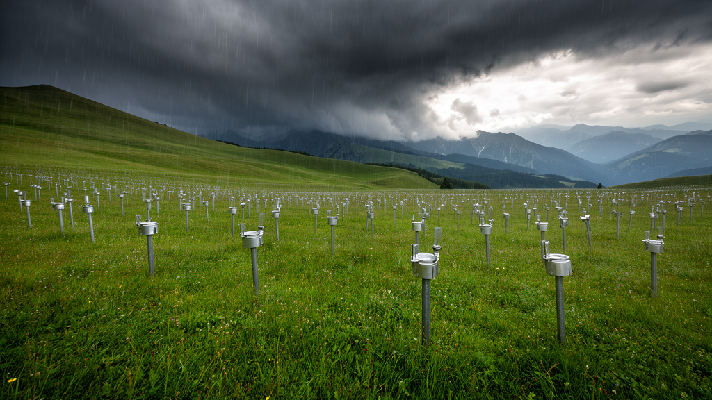
The team turned to the WegenerNet, a climate station network in the Feldbach region of southeastern Austria, where 155 gauges have operated since 2007 within an area of roughly 330 square kilometres. After removing twelve stations that were relocated during the study period, the researchers analysed 143 stations recording precipitation every five minutes from 2007 to 2022. That combination of spatial density and temporal resolution is extraordinarily rare: most national gauge networks are far sparser and log data only hourly or daily, which means short-lived convective storms, the very events that matter most for flash flooding, routinely slip between the gauges unnoticed. In Feldbach, a region where thunderstorms, hail, and severe wind gusts are among the most frequent in Austria, hardly any storm escapes detection.
The methodological logic is straightforward in principle. A point rain gauge records the rainfall at one spot, but a catchment integrates rainfall over its whole surface, and because rain rarely falls uniformly, the average depth over an area is almost always less than the peak depth at the storm’s core. The ARF captures this ratio: multiplying a point design value by the factor yields the areal equivalent. The researchers applied a fixed-area approach, constructing square windows around each station ranging from 1 to 225 square kilometres, computing areal precipitation as the mean of the 200-by-200-metre grid cells within each window, and then running an extreme value analysis on both point and areal series. Because the 15-year record is short, they used a peak-over-threshold sampling scheme with roughly forty extreme events per series, fitting an exponential distribution whose parameters were smoothed across sixteen durations spanning five minutes to twenty-four hours.
The results confirm several long-standing expectations with unprecedented clarity. Areal reduction factors increase as duration lengthens, reflecting the fact that long-lasting storms tend to cover wide areas, and they decrease as the area grows, because averaging over a larger surface increasingly dilutes the localised peak. The five-minute duration produced the lowest factors of all, with a minimum mean value of 0.595 for a one-year return period, meaning that the areal average over the largest areas was barely sixty percent of the point extreme. Seasonal analysis revealed a striking split: the smallest factors occurred in spring and summer, when short, intense convective thunderstorms dominate and rainfall is spatially patchy, while winter, governed by broad, advective weather systems, produced consistently higher factors, sometimes with a substantial fraction of values exceeding one.
But the study’s most consequential finding challenges a comfortable assumption embedded in engineering guidelines. Many national standards, including the widely used German DWA-M 531, allow point precipitation to stand in for areal precipitation on catchments up to 25 square kilometres, treating the deliberate overestimation as a safety margin. The Austrian data show this shortcut is far from harmless. Even for areas of just one square kilometre, the mean ARF fell below one in every season and return period examined, with the largest reduction, 7.2 percent, occurring in spring at a one-year return period. Applying no reduction to a 25-square-kilometre area at a five-minute duration would inflate the areal design rainfall by 26.5 percent, an overestimation the authors describe as excessive when stacked on top of the other conservative margins already built into design practice. Oversized drainage infrastructure is not merely wasteful; it can alter flow regimes and complicate maintenance decisions for decades.
The second surprise concerns return periods, the statistical yardsticks that describe how rare an event is. The conventional wisdom, supported by studies from the United States and elsewhere, holds that ARFs shrink as events become rarer, because the most extreme storms tend to be the most localised. For durations between one and twelve hours and areas above nine square kilometres, the Austrian data do show this decline. For sub-hourly durations, however, the pattern reverses: the factors partially increase with the return period, apparently because the spatial variability of very short storms diminishes as their intensity grows. The authors report that no comparable behaviour could be found in the existing literature, and they attribute the discovery directly to the quality of their data, noting that the WegenerNet appears to be the first station-based data set of this kind ever used to estimate areal reduction factors. Whether the pattern holds elsewhere, or reflects a regional or observational-scale effect, remains an open question.
Topography, by contrast, turned out to matter far less than some earlier studies suggested. The Feldbach landscape, with its elongated hills of the East Styrian foothills rising from about 250 to 598 metres above sea level, might plausibly imprint itself on storm structure. Yet Spearman correlations between the reduction factors and station elevation never exceeded 0.2 in magnitude, and for a ten-year return period the relationship even turned slightly negative. The authors caution that the interpolation scheme used to build the regionalised precipitation grids did not explicitly account for elevation, a defensible choice given the modest relief of the network, so the weak signal should be interpreted with care. Still, the finding contrasts with work in Shenzhen, China, where mountainous terrain produced markedly lower factors than flat coastal zones, underscoring that the geography of these factors is genuinely contested.
That geographic debate gives the study practical urgency. Some analyses have argued that factors derived in one country transfer readily to another, while a nationwide assessment across the United States found high regional variability and warned against arbitrary transposition. The Austrian results sit squarely in the cautionary camp: because the factors depend on duration, area, return period, and season in ways that interact non-trivially, applying a single constant factor across broad regions or treating point and pixel-based estimates, such as radar or satellite retrievals, as interchangeable with gauge measurements risks systematic error. The authors also observed an irregularity at the longest durations, where eighteen- and twenty-four-hour factors occasionally dipped below those of six and twelve hours, possibly because regional-scale storms extended beyond the network’s footprint and were incompletely captured.
The broader lesson is about what it takes to see the atmosphere clearly. Radar offers superb spatial and temporal coverage but performs poorly for rare events because its archives are short; gridded gauge products lack the temporal resolution for sub-daily analysis; sparse gauge networks miss storm centres entirely. Only a dense, high-resolution, long-running gauge network like the WegenerNet can resolve the fine texture of convective rainfall that determines how a point measurement translates to a landscape. The Braunschweig team recommends that comparable networks elsewhere be exploited to test whether the sub-hourly reversal with return period is a universal feature of storm physics or a fingerprint of the Styrian climate, and that alternative fixed-area calculation methods be applied to the same data. For now, the message for practitioners is concrete: even a single square kilometre is not a point, and the humble reduction factor deserves a place in every design calculation, no matter how small the catchment.
Subject of Research: Empirical estimation of areal reduction factors for extreme precipitation using a high-density rain gauge network in Austria
Article Title: Areal reduction factors from high-resolution rain gauges in Austria
Article References: Areal reduction factors from high-resolution rain gauges in Austria. (n.d.). https://doi.org/10.5194/nhess-26-5057-2026
Image Credits: AI Generated
DOI: 10.5194/nhess-26-5057-2026
Keywords: areal reduction factors, extreme precipitation, rain gauges, WegenerNet, Austria, hydrology, design storms, intensity-duration-frequency, convective storms, flood risk, extreme value analysis, urban drainage
Cite Scienmag News
Violet Maxwell. (October 15, 2026). Dense Austrian rain gauge network rewrites the rules of extreme rainfall design. Scienmag. https://scienmag.com/dense-austrian-rain-gauge-network-rewrites-the-rules-of-extreme-rainfall-design/
Violet Maxwell. "Dense Austrian rain gauge network rewrites the rules of extreme rainfall design." Scienmag, 15 October 2026, https://scienmag.com/dense-austrian-rain-gauge-network-rewrites-the-rules-of-extreme-rainfall-design/. Accessed 15 October 2026.
Violet Maxwell. "Dense Austrian rain gauge network rewrites the rules of extreme rainfall design." Scienmag. October 15, 2026. https://scienmag.com/dense-austrian-rain-gauge-network-rewrites-the-rules-of-extreme-rainfall-design/


