


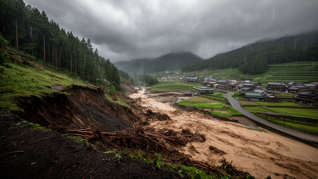
Japan’s steep, mountainous terrain and intense seasonal rainfall make it one of the most landslide-prone countries on Earth, and a new study suggests that a warming climate will sharpen that threat in ways that vary dramatically from one region to another. A research team led by Masamichi Ohba of the Central Research Institute of Electric Power Industry, publishing in the journal Climate Dynamics, has combined high-resolution climate simulations with a machine-learning technique for classifying weather patterns to project how the potential for rainfall-induced sediment disasters will evolve across the Japanese archipelago. Their central finding is sobering but nuanced: the overall potential for sediment-related disasters increases nationwide, yet the magnitude and character of that increase depend heavily on which large-scale weather patterns deliver the rain.
The study addresses a hazard that is often overshadowed by headlines about typhoon winds and flooding. Sediment-related disasters, which include shallow landslides, debris flows, and slope failures, are triggered when rainfall destabilizes hillslopes, sending soil, rock, and woody debris cascading into communities, roads, railways, and critical infrastructure such as power transmission networks. In Japan, where much of the population lives on narrow coastal plains hemmed in by mountains, the distance between a vulnerable slope and a densely populated neighborhood can be measured in hundreds of meters. Understanding how climate change alters the frequency and intensity of the rainfall regimes that trigger these events is therefore not an abstract scientific question but a matter of practical urgency for disaster managers, utilities, and local governments.
To quantify the hazard, the researchers adopted a framework widely used in Japanese operational landslide assessment: sediment-related disaster potential, or SDP. Rather than modeling slope mechanics directly, SDP is built from two complementary measures of effective rainfall, meaning the cumulative precipitation that actually contributes to slope instability after losses to infiltration, evaporation, and other hydrological processes. The first measure uses a short accumulation window of 1.5 hours, capturing the kind of burst-like, high-intensity downpours that can rapidly saturate a shallow soil layer and trigger sudden slope failure. The second uses a long window of 72 hours, capturing the slower buildup of antecedent wetness that primes slopes for failure even when the triggering rain is less intense. Together, these two metrics encode the two classic pathways to landslide initiation: a sudden punch of water and a prolonged soaking.
The climate evidence underpinning the analysis comes from an unusually rich simulation resource. The team drew on large-ensemble climate simulations produced under Japan’s national modeling programs, in which global atmospheric models were run many times with slightly perturbed initial conditions to generate thousands of simulated years of weather, both for the historical climate and for a future climate under continued warming. From this ensemble, the researchers used dynamical downscaling to 5-kilometer horizontal resolution, a grid fine enough to resolve the mountainous topography and coastal geometry that shape Japan’s precipitation. At this scale, the models can represent orographic enhancement of rainfall, the interaction of typhoons with complex terrain, and the localized bands of heavy rain that coarser global models simply cannot capture. Large ensembles are essential for this kind of work because extreme events are by definition rare, and only by pooling thousands of simulated years can researchers distinguish a robust climate-change signal from natural variability.
When the team compared future and present climates, the headline result was a broad increase in sediment-related disaster potential across Japan. Warmer air holds more water vapor, roughly seven percent more per degree Celsius of warming, and this thermodynamic amplification intensifies extreme precipitation in ways that are now well established across the climate literature. But the study’s most valuable contribution lies in its treatment of the spatial heterogeneity of that increase. The projected changes in SDP were not uniform: some regions and some rainfall regimes showed far larger increases than others, and the pattern of change differed between the short-duration and long-duration metrics. A single national number would have hidden precisely the information that regional adaptation planners need most.
To untangle that heterogeneity, the researchers turned to self-organizing maps, an unsupervised neural-network technique originally introduced by the Finnish scientist Teuvo Kohonen. Self-organizing maps take high-dimensional data, in this case daily surface atmospheric circulation fields such as sea-level pressure patterns over and around Japan, and project them onto a two-dimensional grid of nodes, each representing a characteristic weather pattern, or WP. Similar circulation configurations cluster onto neighboring nodes, allowing researchers to compress the endless variety of daily weather into a manageable catalog of archetypal patterns. The method has become a standard tool in climate science for linking large-scale circulation to local extremes, because it makes no prior assumption about which patterns matter and lets the data reveal the natural modes of atmospheric variability.
Applying this technique to both present-day and future simulations, the team identified the dominant weather patterns associated with high sediment-related disaster potential and then evaluated how sensitive each pattern is to climate forcing. The analysis revealed that specific weather patterns act as the key regulators of SDP variability, and, crucially, that different patterns dominate in different parts of the country. Typhoon-type weather patterns, in which a tropical cyclone approaches or makes landfall, contribute predominantly to short-duration heavy rainfall in western Japan, where the steep terrain of Kyushu, Shikoku, and western Honshu sits directly in the path of many storm tracks. Frontal rain-type patterns, associated with the stationary Baiu rain front that stalls over Japan in early summer, dominate the long-duration precipitation that drives elevated SDP in eastern Japan, where prolonged rains can soak slopes for days.
This weather-pattern attribution has direct mechanistic implications. If typhoon-type patterns become more effective at generating short-duration extremes, western Japan faces a future in which flash-triggered slope failures grow more likely, demanding rapid-response warning systems and slope-stabilization measures tuned to intense, fast-onset events. If frontal patterns deliver longer, wetter episodes in eastern Japan, the relevant adaptation there involves antecedent-wetness monitoring, cumulative-rainfall thresholds, and patrol schedules for infrastructure such as power transmission equipment, which is precisely the operational context in which the SDP methodology was originally developed by the research group. The study thus converts a broad climate projection into region-specific guidance: the same national warming signal produces different disaster mechanisms on either side of the archipelago, and adaptation strategies should be designed accordingly.
The research also demonstrates the power of pairing very high-resolution ensembles with pattern-based analysis. Because the 5-kilometer downscaling resolves the terrain that governs where rain actually falls, the weather-pattern statistics derived from the simulations can be interpreted physically rather than treated as statistical artifacts. And because the underlying global ensemble spans thousands of simulated years, the team could assess how frequently each disaster-relevant weather pattern occurs in present and future climates and how the rainfall intensity within each pattern shifts with warming, separating the effects of changing circulation from the effects of a moister atmosphere. This dual attribution, of pattern frequency and pattern intensity, is exactly the kind of decomposition needed to build confidence in regional hazard projections.
For Japan, a nation that has repeatedly experienced catastrophic landslides in events such as the 2018 western Japan floods, the message is that the hazard landscape is shifting in regionally distinctive ways, and that the tools exist to anticipate the shift. The d4PDF ensemble and the 5-kilometer downscaling dataset used in the study are publicly documented and available, allowing other researchers, and potentially operational agencies, to extend the analysis to different warming scenarios, different hazard metrics, or other mountainous regions facing similar threats. As the authors note, the findings provide critical insights for developing region-specific climate adaptation strategies for sediment-related disaster management. In a warming world, the rain that brings down a hillside in Kyushu and the rain that brings down a hillside near Tokyo will arrive under different skies, and protecting the people below those slopes will require plans that know the difference.
Subject of Research: Climate change impacts on rainfall-induced landslide and sediment-disaster potential in Japan
Article Title: Climate change impacts on rainfall-induced sediment-related disaster potential in Japan: a weather-pattern analysis using large-ensemble climate simulations
Article References: Ohba, M., Nomura, M., Kitano, Y., & Hattori, Y. (2026). Climate change impacts on rainfall-induced sediment-related disaster potential in Japan: a weather-pattern analysis using large-ensemble climate simulations. Climate Dynamics, 64(11), Article 457. https://doi.org/10.1007/s00382-026-08417-4
Image Credits: AI Generated
DOI: 10.1007/s00382-026-08417-4
Keywords: sediment-related disasters, landslides, extreme rainfall, climate change, Japan, weather patterns, self-organizing maps, d4PDF, regional climate modeling, typhoons, Baiu rain front, disaster adaptation
Cite Scienmag News
Sloane Callahan. (October 9, 2026). Typhoons and Fronts Drive Japan’s Rising Landslide Risk in a Warming Climate. Scienmag. https://scienmag.com/typhoons-and-fronts-drive-japans-rising-landslide-risk-in-a-warming-climate/
Sloane Callahan. "Typhoons and Fronts Drive Japan’s Rising Landslide Risk in a Warming Climate." Scienmag, 9 October 2026, https://scienmag.com/typhoons-and-fronts-drive-japans-rising-landslide-risk-in-a-warming-climate/. Accessed 9 October 2026.
Sloane Callahan. "Typhoons and Fronts Drive Japan’s Rising Landslide Risk in a Warming Climate." Scienmag. October 9, 2026. https://scienmag.com/typhoons-and-fronts-drive-japans-rising-landslide-risk-in-a-warming-climate/


