


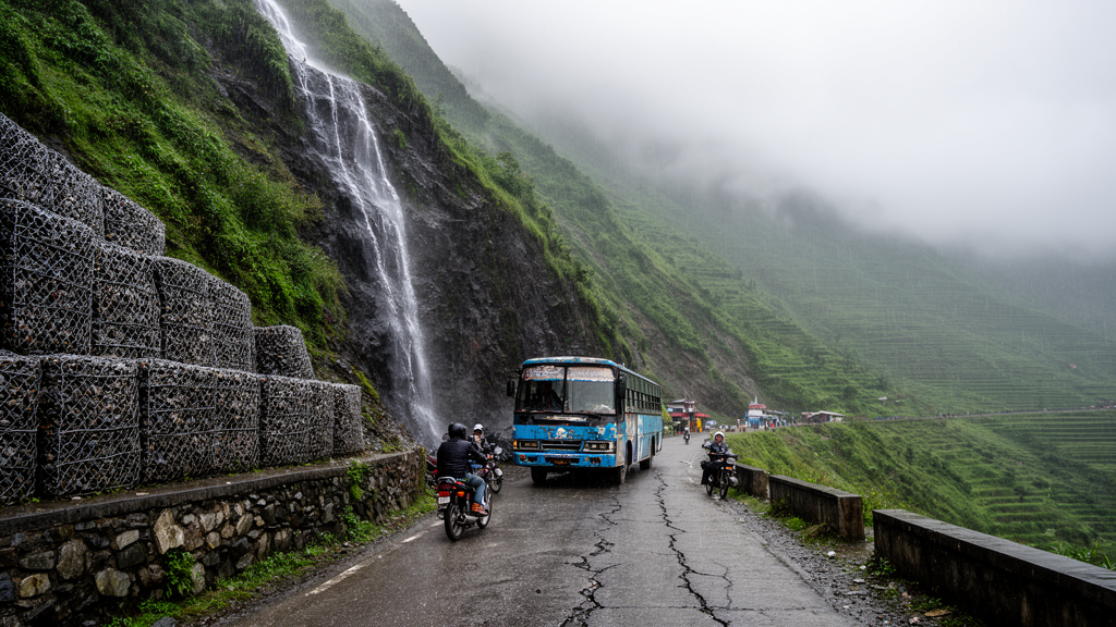
Every monsoon season, the same drama replays along a 36-kilometer stretch of asphalt in central Nepal. Rain hammers the steep hillsides above the Mugling-Narayanghat highway, the saturated slopes let go, and debris buries the only practical road link between the Terai plains and Kathmandu and Pokhara. This corridor is not a minor rural track: it carries more than 90 percent of Nepal’s cross-border freight traffic and handles over 10,000 vehicles a day. When it closes, the economic consequences ripple across the entire country. A new open-access study in Discover Geoscience by Santosh Banjara, Dipesh Jaisi Poudel and Buddhi Raj Joshi of Pokhara University now explains, in the precise language of soil mechanics, exactly why this road keeps failing and what it would take to keep it open.
The team focused on five actively failing slope sections along the corridor, at chainages 16+600, 20+400, 32+300, 34+800 and 35+600, each chosen through field reconnaissance for visible instability markers such as tension cracks, fresh scarps and toe erosion. At each site they excavated test pits between 1.0 and 3.0 meters deep and collected roughly 30 kilograms of disturbed bulk soil, sealed in moisture-tight bags to preserve the in-situ moisture. Disturbed sampling was a necessity rather than a compromise: the coarse, gravelly colluvium that mantles these slopes, in layers typically 2 to 8 meters thick over fractured bedrock, simply cannot yield undisturbed core samples. The shallow investigation depth matches the dominant failure mode, which is shallow translational sliding within the near-surface colluvial mantle rather than deep-seated bedrock movement.
The laboratory program, run to Bureau of Indian Standards codes, produced a classification that is quietly alarming. Wet sieve analysis showed a corridor split between gravel-dominated and sand-dominated materials: the soils at chainages 32+300 and 20+400 are well-graded gravels, while those at 16+600, 34+800 and 35+600 are dominated by sand, with the first two classified as poorly graded, gap-graded sands. Gap grading means the intermediate particle sizes are missing, leaving a metastable skeletal fabric of large, interconnected pores. Water can infiltrate these soils almost unimpeded, and the fine particles may even migrate through the coarse matrix under seepage forces in a process called suffusion, progressively loosening the slope from within. Even the well-graded gravels are highly permeable, with hydraulic conductivities likely exceeding 10^-2 centimeters per second.
The most consequential finding, however, came from the Atterberg limit tests. Although the liquid limits ranged from 17.0 to 23.5 percent, none of the five soils could be rolled into a 3-millimeter thread without crumbling, meaning the plastic limit could not be defined at all. Every sample is non-plastic. That single result reveals the mineralogy: the fines are inert rock flour pulverized from the corridor’s phyllite, quartzite and slate bedrock, not clay minerals capable of providing true chemical cohesion. The strength of these slopes therefore rests entirely on inter-particle friction and on apparent cohesion generated by matric suction, the capillary tension that holds unsaturated grains together. In the dry season this suction is remarkably effective, allowing near-vertical cuts to stand. When the monsoon saturates the pores, it vanishes, and the soil behaves essentially as a cohesionless granular mass on the verge of flowing.
Direct shear tests on specimens remolded to their maximum dry density quantified this precarious strength. Friction angles ranged from 26.1 to 29.1 degrees, and apparent cohesion values from 38.2 to 102.5 kilopascals, measured under normal stresses of 136, 272 and 408 kilopascals corresponding to overburden depths of roughly 7, 14 and 20 meters. The authors are careful to note that this cohesion intercept is apparent rather than true effective cohesion, combining capillary suction with the dilatancy of angular grains during shearing. Because the suction component is destroyed by saturation, they also ran a conservative analysis with cohesion set to zero, under which every section falls well below a factor of safety of one. Compaction testing added further nuance: the well-graded gravel at chainage 32+300 achieved the highest maximum dry density, 2.26 grams per cubic centimeter at just 6.8 percent optimum moisture, while the gap-graded sands needed 11.5 to 12.8 percent water to compact, signaling a strong affinity for water retention that prolongs pore-pressure buildup after rainfall.
The stability calculations used a deliberately transparent, low-cost framework: closed-form infinite slope equations implemented in a spreadsheet, with a representative slip depth of 3.0 meters and pore pressures computed for a water table rising to the slope surface. Under dry conditions, all five sections showed factors of safety above 1.25, apparently stable. Under full saturation, the picture collapsed. The factor of safety dropped by roughly 30 to 36 percent across the critical sections, and at three of the five sites it fell below unity, the mathematical threshold of failure. The worst case was the Mauri Khola debris-flow channel at chainage 20+400, where the factor of safety sank to 0.89, quantitatively confirming the field record of recurrent debris flows there. Chainage 16+600 landed at 1.08, technically stable but far below the 1.3 design standard for permanent highway slopes and vulnerable to any added load.
Because the corridor runs close to the Main Boundary Thrust, one of the major faults of the Himalayan collision zone, the team added a pseudo-static seismic analysis using a horizontal seismic coefficient of 0.15, consistent with a regional peak ground acceleration of about 0.30 g. The result is stark: while dry slopes survive design-level shaking, the combination of full saturation and seismic loading drives the factor of safety down to roughly 0.12 to 0.30 when cohesion is conservatively neglected, with the steep cut at chainage 34+800 the most vulnerable. The governing design condition for the corridor, the authors conclude, is the conjunction of monsoon saturation and earthquake shaking, a scenario that is entirely plausible in a region where the two hazards share a season and a tectonic setting.
The study also isolates a distinctly human fingerprint in the failure record. By comparing inferred pre-widening slope angles with the angles measured after the 2015 to 2021 road-widening project, which was undertaken to bring the highway to Asian Highway standards, the analysis suggests that excavation-induced steepening cut the dry factor of safety by about 25 to 45 percent and roughly halved the saturated value. Field observations reinforce the point: retrogressive sliding at chainage 32+300 began where toe excavation removed lateral confinement, tension cracks on the 55-degree cut at 34+800 signal incipient rotational failure despite installed rock netting, and the temporary metal sheet piling at 35+600 is visibly buckling under active earth pressures. This is the pattern researchers have called Nepal’s bulldozer revolution, in which non-engineered road excavation across the hills resets ancient, metastable colluvial deposits into a fresh state of disequilibrium.
The remedial prescriptions follow directly from the mechanics. For slopes governed by pore pressure, notably Mauri Khola and chainage 16+600, deep horizontal drains are identified as the single most effective intervention, because depressing the water table below the slip plane restores effective stress and recovers the frictional strength lost to saturation. For the steep, cohesionless cuts, soil nailing anchored into stable bedrock, combined with high-tensile netting or fiber-reinforced shotcrete, is proposed to confine the loose surface wedge, with stabilizing piles considered where a deeper rotational surface is suspected. Toe scour zones call for flexible mechanically stabilized earth embankments, and the failing sheet piles at 35+600 should be replaced with permanent gabion or gravity structures. Assessment-level modeling suggests drainage plus nailing can lift the critical cases toward the 1.3 target, though the authors stress that detailed design, numerical verification and instrumentation such as piezometers and extensometers must follow before any of these numbers become design values.
Beyond the specific chainages, the study’s broader argument may prove its most exportable result. Deep borehole campaigns and advanced numerical modeling remain financially out of reach for the road agencies of most developing nations, yet regional landslide hazard maps derived from satellites are too coarse to design a retaining wall for a particular curve. By demonstrating that standard index testing, sieve analysis, Atterberg limits, Proctor compaction and direct shear, combined with simple limit equilibrium equations, can correctly reproduce and even predict the observed failure pattern, the authors offer a middle path: a rigorous, inexpensive diagnostic that lets maintenance budgets be aimed at the slopes most likely to collapse next. For a country whose economic arteries run along some of the most fragile terrain on Earth, that framework may matter as much as any retaining wall.
Subject of Research: Geotechnical investigation and slope stability of rainfall-induced landslides along the Mugling-Narayanghat highway corridor in central Nepal
Article Title: Site specific geotechnical investigation and slope stability assessment of the Mugling-Narayanghat highway corridor, central Nepal
Article References: Banjara, S., Poudel, D. J., & Joshi, B. R. (2026). Site specific geotechnical investigation and slope stability assessment of the Mugling-Narayanghat highway corridor, central Nepal. Discover Geoscience, 4(1), Article 305. https://doi.org/10.1007/s44288-026-00678-0
Image Credits: AI Generated
DOI: 10.1007/s44288-026-00678-0
Keywords: slope stability, landslides, geotechnical engineering, Nepal Himalaya, monsoon rainfall, factor of safety, colluvial soils, matric suction, direct shear test, road widening, seismic loading, Mugling-Narayanghat highway
Cite Scienmag News
Violet Maxwell. (October 9, 2026). Nepal’s Lifeline Highway Is Held Together by Suction That Vanishes Every Monsoon. Scienmag. https://scienmag.com/nepals-lifeline-highway-is-held-together-by-suction-that-vanishes-every-monsoon/
Violet Maxwell. "Nepal’s Lifeline Highway Is Held Together by Suction That Vanishes Every Monsoon." Scienmag, 9 October 2026, https://scienmag.com/nepals-lifeline-highway-is-held-together-by-suction-that-vanishes-every-monsoon/. Accessed 9 October 2026.
Violet Maxwell. "Nepal’s Lifeline Highway Is Held Together by Suction That Vanishes Every Monsoon." Scienmag. October 9, 2026. https://scienmag.com/nepals-lifeline-highway-is-held-together-by-suction-that-vanishes-every-monsoon/


