


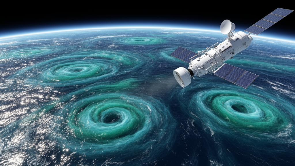
The Surface Water and Ocean Topography satellite, better known as SWOT, has transformed what scientists can see at the ocean’s surface. Its Ka-band Radar Interferometer measures sea surface height across a swath roughly 120 kilometers wide, resolving features as small as about 15 kilometers — a dramatic leap beyond the roughly 7-kilometer effective resolution and one-dimensional ground tracks of conventional nadir altimetry. But raw observations are only the beginning. To turn SWOT’s wide-swath measurements into the gridded sea surface height and current maps that forecasters, climate scientists, and oceanographers actually use, the data must be fused with observations from eight nadir altimeter missions. How that fusion is done, a new study shows, matters enormously — and no single mapping method wins everywhere.
In a paper published in Ocean Science on 28 September 2026, Qifan Wu of Zhejiang University and colleagues compared three experimental Level-4 products that incorporate SWOT wide-swath data: MIOST, a multiscale statistical interpolation framework; 4DvarQG, a variational assimilation scheme constrained by a reduced-order quasi-geostrophic model; and 4DvarNET, a data-driven approach in which both the dynamical prior and the assimilation operator are learned by deep neural networks. All three draw on the same input observations processed through the DUACS system and distributed by AVISO, so differences among the products arise almost entirely from their mapping methodologies — a controlled comparison that isolates the effect of each reconstruction strategy.
The team focused on the North Atlantic between 25 and 50 degrees north and 80 and 10 degrees west, with particular attention to the Gulf Stream, one of the most energetic ocean current systems on Earth. Because all three products share this domain, the region served as a stringent testbed. The evaluation combined three complementary lenses: Eulerian mapping accuracy measured against surface drifters, Lagrangian trajectory prediction skill assessed by forecasting the paths of drifting buoys, and dynamical diagnostics built on the Rossby number and the finite-size Lyapunov exponent, which reveal how well each product captures vorticity and stirring structures across scales.
The drifter-based validation was substantial. A total of 176 drifting platforms deployed between 27 July 2023 and 20 April 2024 provided more than 690,000 velocity samples, which the authors partitioned into three dynamical regimes: a shelf–slope zone, an energetic quasi-geostrophic regime along the Gulf Stream, and a weakly nonlinear open-ocean regime that dominated the sampling. Because drifters measure the total upper-ocean current at 15 meters depth — including wind-driven, tidal, and inertial components — while the mapped products primarily represent geostrophic flow, the team relied on pairwise gain/loss ratios to remove this shared representativeness error and obtain a conservative estimate of relative performance.
The Eulerian results revealed a clear hierarchy in the Gulf Stream region. There, 4DvarQG consistently outperformed both competitors by approximately 4 to 5 percent in region-averaged velocity error, with improvements that were spatially coherent along the current’s core and its downstream extension. The authors attribute this to the quasi-geostrophic dynamical constraints, which are well matched to the mesoscale-dominated, strongly balanced flow of an energetic boundary current. In the weakly nonlinear open ocean, by contrast, 4DvarQG and MIOST performed comparably, while 4DvarNET showed a consistent degradation of about 1 to 2 percent relative to both, suggesting that its learned representations offer little advantage — and may even add noise — when the background flow is weak and the balanced component dominates the error budget.
The Lagrangian experiments told a complementary story. By initializing simulated trajectories from observed drifter positions and integrating them forward for lead times up to 20 days, the team quantified how velocity errors accumulate along predicted paths. For short lead times of roughly 0 to 4 days, 4DvarQG delivered the largest improvement over the DUACS benchmark, reflecting its superior reconstruction of short-timescale velocity variability. MIOST showed smaller gains, and 4DvarNET demonstrated no systematic improvement at any lead time. Beyond about 10 days, when mesoscale transport dominates, MIOST and DUACS outperformed the other products, with separation errors converging to within roughly one degree after 15 days — evidence of their robust representation of the large-scale circulation.
The dynamical diagnostics exposed the most intriguing differences. 4DvarNET exhibited systematically sharper sea surface height gradients, larger Rossby number magnitudes, and more filamentary strain structures in the finite-size Lyapunov exponent fields. In the weakly nonlinear open-ocean regime, its Rossby number enhancement exceeded 60 percent relative to the other products. Yet the authors urge caution: this amplification occurred precisely where the background flow is too weak to sustain intense submesoscale activity, raising the possibility that weak gradients or observational noise are being inflated into high-vorticity signals. The neural network’s training data, drawn from the NATL60 simulation, include no explicit tidal forcing and only partial representation of inertia-gravity waves, so unresolved wave-like variance may be misattributed to vortical structures. With available validation data, the physical realism of these sharpened features simply cannot be confirmed.
Three case studies of individual eddies crystallized the scale-dependent trade-off. For a roughly 100-kilometer mesoscale eddy near the Gulf Stream core, all three products reconstructed the vortex geometry reliably, differing mainly in amplitude fidelity — 4DvarQG smoothed the core, 4DvarNET preserved gradients but distorted the quasi-circular morphology, and MIOST produced the smoothest fields. For an intermediate 50-kilometer eddy embedded in the fast Gulf Stream core, 4DvarQG most accurately reproduced the observed elliptical geometry, though all products underestimated the frontal steepness across the eddy core. The starkest contrast emerged for two roughly 10-kilometer submesoscale vortices south of the Gulf Stream, where only 4DvarNET recovered closed sea surface height anomaly contours matching the SWOT Level-3 observations, with eddy-core position errors of about 0.05 degrees, while MIOST and 4DvarQG failed to resolve the coherent vortex structures at all.
For users, the practical guidance is straightforward. MIOST, the only global-coverage product of the three, offers stable and consistent performance across all regimes and is the recommended choice for researchers who need reliable, well-characterized fields without regime-specific biases. Physical oceanographers studying mesoscale circulation, eddy tracking, or trajectory prediction in energetic midlatitude regions will benefit most from 4DvarQG, while those hunting fine-scale fronts, filaments, or submesoscale eddies may find 4DvarNET more informative — provided its amplified small-scale signals are interpreted with caution. Looking ahead, the authors argue that future mapping systems may best exploit SWOT through hybrid approaches that marry the flexibility of data-driven learning with explicit physical constraints, a balance the satellite altimetry community is only beginning to strike.
Subject of Research: Intercomparison of SWOT-derived Level-4 sea surface height mapping products over the North Atlantic
Article Title: Intercomparison of three SWOT-derived Level-4 products: from mapping accuracy to multi-scale dynamical representation
Article References: Wu, Q., Zhou, C., Liu, B., Wu, W., Li, J., & Yang, J. (2026). Intercomparison of three SWOT-derived Level-4 products: from mapping accuracy to multi-scale dynamical representation. Ocean Science, 22(5), 2939-2956. https://doi.org/10.5194/os-22-2939-2026
Image Credits: AI Generated
Keywords: SWOT, satellite altimetry, sea surface height, ocean currents, submesoscale, mesoscale eddies, Gulf Stream, data assimilation, deep learning, quasi-geostrophic dynamics, Lagrangian drifters, North Atlantic
Cite Scienmag News
Violet Maxwell. (October 9, 2026). Satellite Ocean Maps Face a Scale-Dependent Trade-Off, New SWOT Comparison Shows. Scienmag. https://scienmag.com/satellite-ocean-maps-face-a-scale-dependent-trade-off-new-swot-comparison-shows/
Violet Maxwell. "Satellite Ocean Maps Face a Scale-Dependent Trade-Off, New SWOT Comparison Shows." Scienmag, 9 October 2026, https://scienmag.com/satellite-ocean-maps-face-a-scale-dependent-trade-off-new-swot-comparison-shows/. Accessed 9 October 2026.
Violet Maxwell. "Satellite Ocean Maps Face a Scale-Dependent Trade-Off, New SWOT Comparison Shows." Scienmag. October 9, 2026. https://scienmag.com/satellite-ocean-maps-face-a-scale-dependent-trade-off-new-swot-comparison-shows/


