


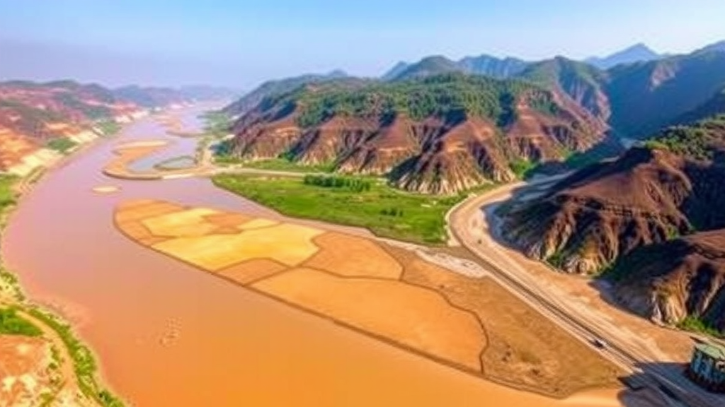
One of China’s most important breadbaskets is heading toward a drier future, according to a new study that combines climate projections, land-use modeling, and hydrological simulation into a single, integrated forecasting framework. Researchers at Xi’an University of Technology have developed a basin-scale assessment system to determine how water yield—the amount of water that a watershed generates as runoff and streamflow—will respond to the twin pressures of climate change and shifting land use in the Wei River Basin of Northwest China. Their findings, published in Natural Resources Research, paint a picture of declining water availability in a region already under severe stress, with the sharpest losses projected under the highest-emission pathway.
The Wei River Basin is the largest tributary of the Yellow River and a lifeline for tens of millions of people. It irrigates extensive cropland, sustains major urban centers, and has historically mediated the delicate balance between agricultural output and ecological health on the semiarid Loess Plateau. Decades of intensified human activity have already reshaped the basin’s hydrological processes, and questions about how much water will be available in the coming decades have become a central concern for planners and policymakers. Previous research has often examined climate change or land-use change in isolation, which leaves a critical gap: the two drivers interact, and their combined effects can differ substantially from what either would produce alone.
To close that gap, the research team—led by Yating Gao, Ganggang Zuo, Jiancang Xie, Ni Wang, Zheng Liu, and Tianfan Wang—built a framework that chains together three complementary modeling tools. The first is the Taylor diagram, a widely used statistical visualization developed by climate scientist Karl Taylor that summarizes how well a model reproduces observed patterns by comparing correlation, variance, and root-mean-square error in a single plot. In this study, the Taylor diagram served as a rigorous screening device for general circulation models, allowing the team to identify which global climate models best captured the basin’s historical climate behavior before trusting their future projections. This step addresses one of the persistent weaknesses in scenario studies: model uncertainty, which can propagate from coarse global simulations all the way into local water-resource estimates.
The second component is the Markov-PLUS model, a land-use simulation approach that merges a Markov chain’s ability to quantify transition probabilities between land categories with the PLUS model’s strength in generating spatially realistic land-change patterns. PLUS, short for patch-generating land use simulation, uses machine learning to understand the drivers behind historical land conversions and then produces future landscapes patch by patch, respecting both neighborhood effects and the underlying suitability of terrain. By coupling Markov-chain projections of how much land will change with PLUS’s determination of where that change will occur, the team generated land-use maps for the future under multiple development trajectories aligned with the shared socioeconomic pathways.
The third and final component is the Soil and Water Assessment Tool, or SWAT, a physically based, semi-distributed hydrological model that has become a global standard for watershed analysis. SWAT divides a basin into sub-basins and further into hydrological response units defined by soil type, land cover, and slope, then simulates the full water balance—including precipitation inputs, evapotranspiration, infiltration, surface runoff, and lateral and groundwater flows. Running SWAT with downscaled climate projections and the simulated future land-use maps allowed the researchers to quantify how water yield evolves across space and time under each scenario combination.
The scenarios examined follow the coupled SSP-RCP framework, which links socioeconomic storylines with representative concentration pathways describing different levels of future radiative forcing. The results on the climate side are unambiguous. Across all scenarios, the study finds increasing trends in precipitation, maximum temperature, and minimum temperature within the basin, with the largest temperature increases occurring under the high-emission SSP585 scenario. While rising precipitation might seem like good news for a water-stressed region, warmer temperatures drive up evapotranspiration—the return of water from soil and vegetation to the atmosphere—so more rainfall does not automatically translate into more available water. The interplay between these competing effects lies at the heart of the water-yield question.
On the land side, the Markov-PLUS simulations captured a consistent structural transformation across all development trajectories: continuous expansion of built-up land at the expense of cropland, with the most pronounced land-use changes again appearing under SSP585. Urbanization seals surfaces, alters infiltration, and changes the routing of water through the landscape, which is precisely why including realistic land dynamics matters for hydrological forecasting. The model’s ability to reproduce the basin’s historical land-use patterns gave the researchers confidence that its future simulations were grounded in credible transition dynamics rather than arbitrary assumptions.
Perhaps the most consequential finding comes from the attribution analysis. When the team separated the effects of climate change from those of land-use change, they found that variations in future water yield are primarily dominated by climatic effects, while land-use effects remain relatively limited in comparison. However, the interaction between the two drivers becomes increasingly significant under the SSP585 scenario, suggesting that in a high-emission world, the way land is managed will matter more as a modulator of hydrological outcomes than it does under milder pathways. This asymmetry carries a practical message: mitigation of greenhouse gas emissions remains the dominant lever for protecting the basin’s water resources, but land-use planning retains a meaningful, and growing, secondary role.
The spatial anatomy of the projections is equally revealing. Water yield in the Wei River Basin follows a clear decreasing gradient from south to north, reflecting the basin’s climatic transition from wetter mountainous headwaters in the south to the drier Loess Plateau in the north. Sub-basins in the central and lower reaches exhibit relatively higher water yield, whereas tributary and upstream areas show lower values. This geographic heterogeneity means that the impacts of declining yield will not be felt uniformly: communities and ecosystems in the northern and upstream portions of the basin, already operating closer to their hydrological margins, face the greatest relative vulnerability.
The temporal projections add urgency to the diagnosis. Annual hydrological water yield is projected to decline under all scenarios over the coming decades, with the greatest reduction occurring under SSP585 and the most pronounced monthly decreases concentrated between February and July. That seasonal window is far from arbitrary—it spans the late winter recession and the critical early growing season, when crops depend on soil moisture and streamflow and when reservoir operations must balance storage against downstream demands. A shrinking yield precisely when agricultural and ecological water needs ramp up compounds the challenge of adapting to climate change in one of China’s most historically water-constrained regions.
The authors frame their work as a contribution to climate-adaptation planning and watershed-scale water-resource assessment, and the integrated design of the framework is its central innovation. By screening climate models with Taylor diagrams, simulating land futures with Markov-PLUS, and translating both into hydrological outcomes with SWAT, the approach systematically captures coupled dynamics that single-driver studies miss. The findings offer scientific grounding for decisions about where to prioritize water conservation, how to schedule reservoir releases, and which sub-basins deserve the most attention in adaptation strategies. They also underscore a sobering reality for the Yellow River system and semiarid basins worldwide: even with somewhat increased precipitation, warming may overwhelm gains, leaving less water flowing through the landscape than the region has come to rely on. For the millions who depend on the Wei River, the study’s message is that the coming decades demand not just awareness of change, but deliberate, spatially informed preparation for it.
Subject of Research: Coupled effects of future climate and land-use change on hydrological water yield in the Wei River Basin, China, assessed under SSP-RCP scenarios
Article Title: Coupled Effects of Climate and Land-Use Changes on Hydrological Water Yield in the Wei River Basin of China under SSP-RCP Scenarios
Article References: Gao, Y., Zuo, G., Xie, J., Wang, N., Liu, Z., & Wang, T. (2026). Coupled Effects of Climate and Land-Use Changes on Hydrological Water Yield in the Wei River Basin of China under SSP-RCP Scenarios. Natural Resources Research. https://doi.org/10.1007/s11053-026-10775-z
Image Credits: AI Generated
DOI: 10.1007/s11053-026-10775-z
Keywords: Wei River Basin, water yield, climate change, land-use change, SSP-RCP scenarios, SWAT model, Markov-PLUS, Taylor diagram, hydrological modeling, Yellow River, climate adaptation, CMIP6
Cite Scienmag News
Violet Maxwell. (September 20, 2026). Climate and Land Use Changes Could Shrink Water Yield in China’s Wei River Basin. Scienmag. https://scienmag.com/climate-and-land-use-changes-could-shrink-water-yield-in-chinas-wei-river-basin/
Violet Maxwell. "Climate and Land Use Changes Could Shrink Water Yield in China’s Wei River Basin." Scienmag, 20 September 2026, https://scienmag.com/climate-and-land-use-changes-could-shrink-water-yield-in-chinas-wei-river-basin/. Accessed 20 September 2026.
Violet Maxwell. "Climate and Land Use Changes Could Shrink Water Yield in China’s Wei River Basin." Scienmag. September 20, 2026. https://scienmag.com/climate-and-land-use-changes-could-shrink-water-yield-in-chinas-wei-river-basin/


