


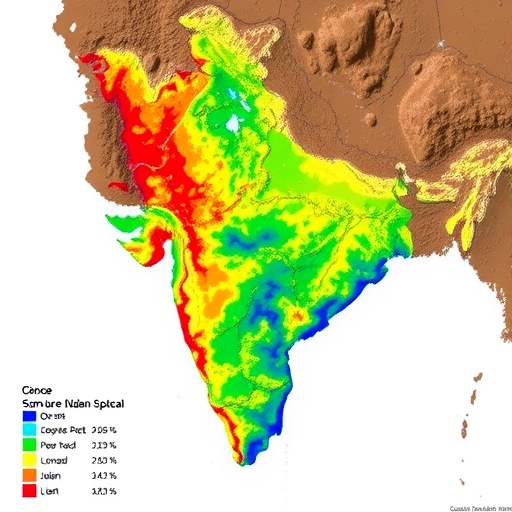
Heavy metals are quietly sinking into the fertile soils of one of India’s most important agricultural and energy-producing regions, and a new study has traced exactly how deep the contamination goes and where it comes from. Researchers examined soils surrounding oil and gas drilling sites in the Krishna–Godavari (K-G) onshore basin, spanning the agriculturally intensive East and West Godavari districts of Andhra Pradesh, India. The region is a striking collision of land uses: fertile alluvial soils support intensive farming, while dense hydrocarbon exploration activity operates across the same landscape. That combination, the study shows, makes the area particularly vulnerable to environmental degradation, with contamination not limited to the surface but extending far down the soil profile.
The research, published in Archives of Environmental Contamination and Toxicology by Babu Mallesh Dasari and Keshav Krishna Aradhi of the CSIR-National Geophysical Research Institute in Hyderabad, presents one of the most comprehensive depth-resolved assessments of metal contamination around drilling sites in the basin. The team collected eighty soil samples from ten drilling locations, sampling at four distinct depth intervals: 0–20 centimetres, 20–30 centimetres, 30–60 centimetres, and 60–90 centimetres. This layered sampling strategy is critical, because most contamination studies examine only surface soils and therefore miss the hidden vertical migration of pollutants into horizons that feed groundwater and plant root systems.
Each sample was analysed using wavelength-dispersive X-ray fluorescence spectroscopy (WD-XRF), a technique that quantifies elemental composition by exciting atoms with X-rays and measuring the characteristic radiation each element emits. Thirteen elements were measured in total, providing a detailed geochemical fingerprint of the soil environment. To evaluate pollution levels, the researchers deployed an unusually broad battery of geochemical indices, including the Geo-accumulation Index (Igeo), Enrichment Factor (EF), Contamination Factor (Cf), Modified Degree of Contamination (mCd), Nemerow Pollution Index (NPI), and Metal Pollution Index (MPI). Using multiple indices simultaneously helps guard against the known limitations of any single metric and allows the researchers to distinguish subtle enrichment from severe contamination.
The results paint a sobering picture. Surface soils showed strong enrichment of copper, zinc, chromium, and lead, a signature typically associated with anthropogenic, or human-caused, inputs rather than natural geological background. But perhaps the most significant finding lay deeper. The study documented notable migration of metals such as barium, nickel, and cobalt into deeper soil horizons, demonstrating that contamination is not staying put. This vertical transport is facilitated by a combination of factors: soil permeability, soil texture, irrigation practices, and the region’s seasonal monsoonal rainfall, all of which enhance leaching and subsurface mobility. The sandy clay and alluvial soils characteristic of the K-G basin appear particularly prone to allowing metals to percolate downward, meaning pollutants deposited at the surface during drilling operations can eventually reach layers that interact with aquifers and deep plant roots.
The spatial and vertical heterogeneity of the contamination was striking. Extreme contamination by copper, zinc, and chromium was observed particularly at drilling-intensive sites, indicating strong anthropogenic influence tied directly to hydrocarbon extraction activity. In areas where drilling operations are concentrated, the accumulation of these metals in surface and subsurface layers was far more pronounced than in less affected locations, suggesting that proximity and intensity of drilling activity are key determinants of environmental risk. Copper, lead, and chromium showed strong enrichment in both surface and subsurface layers, while barium and scandium exhibited geogenic accumulation at deeper horizons, meaning their presence reflects the natural weathering of parent geological material rather than industrial inputs.
To disentangle the sources of contamination, the researchers turned to sophisticated multivariate statistics. Principal component analysis (PCA) and Pearson correlation analysis delineated both geogenic and anthropogenic associations among the thirteen elements, grouping metals that behave in similar ways and often share common origins. But the most powerful tool in the study’s arsenal was positive matrix factorization (PMF) modelling, a receptor-modelling technique originally developed by the U.S. Environmental Protection Agency that apportions measured concentrations among contributing sources by resolving the underlying factor structure of the dataset. The PMF analysis identified six distinct source profiles shaping the metal chemistry of these soils: geogenic weathering of natural bedrock, drilling muds used in hydrocarbon extraction, corrosion by-products from well infrastructure, fertilizer application on farmland, petroleum residues, and the reuse of wastewater.
That six-source fingerprint is significant because it shows the contamination story is not simply “drilling versus nature.” The K-G basin’s soils are being shaped by an overlapping web of pressures. Drilling muds and petroleum residues connect directly to oil and gas operations, corrosion by-products implicate the aging metal infrastructure of wells and pipelines, and fertilizer inputs and wastewater reuse reflect the region’s intensive agricultural economy. The interactions between hydrocarbon residues and metals, along with the soils’ physicochemical properties such as texture and chemistry, were found to influence metal mobility and bioavailability — in other words, how easily metals move through the environment and how readily living organisms can absorb them. Metals that remain locked in mineral lattices pose far less ecological risk than those rendered soluble and plant-available by the chemical conditions of the soil.
The ecological implications are considerable. The East and West Godavari districts are among India’s most productive agricultural regions, and heavy metals such as copper, lead, chromium, and nickel are well-documented toxicants that can accumulate in crops, enter food chains, and degrade soil microbial communities. The finding that irrigation and monsoonal rainfall actively promote leaching means contaminated surface soils can act as ongoing secondary sources, releasing metals toward groundwater long after initial deposition. In a region where both agriculture and drinking-water supplies depend heavily on shallow groundwater, the depth-resolved evidence of subsurface migration elevates the concern from a surface-level nuisance to a potential long-term threat to water security and food safety.
The study also provides something the region has lacked: a scientifically rigorous geochemical baseline. By documenting concentrations and distributions at four depths across ten drilling sites, the researchers have created a reference point against which future changes can be measured. Without such baselines, it is nearly impossible to determine whether observed contamination is new, worsening, or historically established, and equally difficult to assign responsibility or evaluate the effectiveness of any remediation effort. The authors emphasize that the findings underscore the ecological vulnerability of hydrocarbon-rich agricultural zones to drilling-induced contamination and highlight the critical need for scientifically informed waste management, policy enforcement, and remediation planning.
The broader context is a growing global debate over the environmental footprint of hydraulic fracturing and onshore hydrocarbon extraction, particularly when such operations are situated in or near productive farmland. Previous work by the same research group had assessed heavy metal contamination in topsoil around oil and natural gas drilling sites in Andhra Pradesh; the new study extends that picture downward, revealing that the problem cannot be understood by looking at surface layers alone. As India continues to expand domestic hydrocarbon production to meet energy demands, studies like this one suggest that the regulatory conversation must encompass not just the wellhead but the entire soil column beneath and around it — including the pathways by which monsoon rains, irrigation water, and permeable alluvial soils carry industrial metals toward the aquifers that millions of people and farms depend upon.
For now, the message from the K-G basin is clear: the heavy metal footprint of drilling is three-dimensional, multi-sourced, and mobile. Protecting one of India’s agricultural heartlands will require depth-aware monitoring, source-specific pollution controls — from better drilling waste handling to fertilizer management — and remediation strategies designed with the vertical movement of contaminants in mind. The researchers argue that these findings provide the depth-resolved geochemical evidence base essential for sustainable land-use practices, groundwater protection, and long-term environmental monitoring in petroleum extraction zones, offering a template that could be applied to drilling-adjacent farmland far beyond India’s borders.
Cite Scienmag News
Sloane Callahan. (September 9, 2026). Soil Heavy Metals Linked to Fracturing Mapped by Depth in Indian Basin. Scienmag. https://scienmag.com/soil-heavy-metals-linked-to-fracturing-mapped-by-depth-in-indian-basin/
Sloane Callahan. "Soil Heavy Metals Linked to Fracturing Mapped by Depth in Indian Basin." Scienmag, 9 September 2026, https://scienmag.com/soil-heavy-metals-linked-to-fracturing-mapped-by-depth-in-indian-basin/. Accessed 9 September 2026.
Sloane Callahan. "Soil Heavy Metals Linked to Fracturing Mapped by Depth in Indian Basin." Scienmag. September 9, 2026. https://scienmag.com/soil-heavy-metals-linked-to-fracturing-mapped-by-depth-in-indian-basin/


