


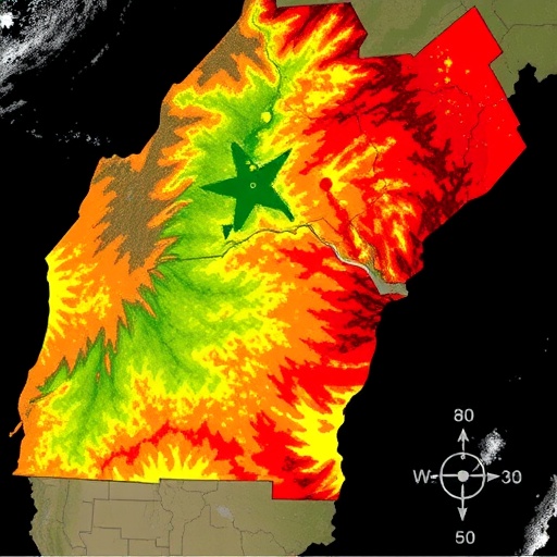
Wildfires in the Mediterranean basin are among the most closely watched indicators of a warming, drying climate, yet in many parts of North Africa the basic bookkeeping of burned land has long been incomplete. A new study published in Environmental Monitoring and Assessment changes that picture for northern Morocco, offering a four-decade, high-resolution reconstruction of forest fire scars built entirely from satellite imagery and machine learning. The work demonstrates that a carefully trained algorithm, applied to the Landsat archive, can reproduce official burned-area statistics with near-perfect fidelity while also revealing the small fires that coarse global datasets routinely miss.
Led by Mostafa Bimouhen of Sultan Moulay Slimane University’s Data4Earth Laboratory in Beni Mellal, with collaborators including Alexandre Roy of the University of Québec at Trois-Rivières, the team set out to solve a stubborn problem. Global burned-area products, such as those derived from the Moderate Resolution Imaging Spectroradiometer (MODIS), typically map fire at pixel sizes of 250 to 500 meters. In the fragmented, mountainous landscapes of the Rif and neighboring ranges in northern Morocco, where forest patches are small and burn perimeters irregular, that resolution is too coarse. Small scars get smoothed away or absorbed into neighboring land-cover classes, and long-term burned-area accounting becomes uncertain at exactly the scale where forest managers need it most.
The researchers’ solution was to constrain their analysis to the forest domain itself. Using an official 2018 forest inventory as an anchor, they generated Landsat-derived forest masks at 30-meter resolution, ensuring that every subsequent detection step applied only to areas that actually supported forest cover. This forest-constrained design is one of the study’s key technical contributions: rather than asking the classifier to distinguish burned from unburned land across the entire landscape, where confusion with agriculture, shrubland, and urban surfaces inflates error rates, the algorithm operates within a bounded, well-defined ecological domain.
For the fire detection itself, the team turned to the physics of burned vegetation. Fire fundamentally alters the spectral signature of forest canopies and soils. Charred surfaces absorb strongly across the visible and shortwave-infrared portions of the spectrum, while the loss of chlorophyll and leaf structure collapses reflectance in the near-infrared. To capture this shift, the researchers constructed paired pre-fire and post-fire image composites from the Landsat archive, which spans 1984 to 2025 for this study, excluding 2012 due to data gaps. From each pair of composites, they computed three change metrics: the differenced Normalized Burn Ratio (ΔNBR), the differenced Mid-Infrared Burn Index (ΔMIRBI), and the differenced Burned Area Index (ΔBAI). The NBR combines near-infrared and shortwave-infrared bands to quantify vegetation moisture and vigour, so a large negative change signals fresh burning; MIRBI exploits the strong shortwave-infrared absorption of char; and BAI is designed to maximize contrast between burned surfaces and their surroundings in the red and near-infrared bands.
These three spectral change predictors fed a supervised machine-learning pipeline in which five different classifiers were evaluated. Critically, the team enforced a strict chronological validation design rather than the random cross-validation more common in remote-sensing studies. Data from 2001 to 2018 served as the training set, 2019 to 2021 was reserved for validation and hyperparameter tuning, and the years 2022 to 2024 formed an independent test period that the models never saw during development. This temporal separation guards against subtle forms of leakage, since fire regimes, land-cover conditions, and even sensor characteristics shift over time, and it provides a more honest estimate of how the system would perform operationally on new fire seasons.
The winner was a calibrated radial-basis-function support vector machine, a classifier that finds an optimal nonlinear boundary between burned and unburned samples by mapping the spectral-change features into a high-dimensional space. Its performance on the independent test period was striking: a precision-recall area under the curve of 0.988, a receiver operating characteristic AUC of 0.989, an F1 score of 0.948, and a Brier score of 0.035, which measures how well the model’s probability outputs are calibrated rather than merely how well it ranks samples. The researchers applied a fixed operating threshold of 0.50 to convert probabilities into burned-or-not decisions, favoring simplicity and reproducibility in an operational monitoring context.
With the classifier validated, the team produced an annual burned-area record for the forest domain of northern Morocco spanning 1984 through 2025. The resulting dataset reveals dramatic interannual variability: the median annual forest burned area was 609 hectares, but the range stretched from just 135 hectares in the quietest year to 19,451 hectares in the worst. That hundredfold swing underscores how episodic fire activity is in this part of the Mediterranean, where a handful of hot, dry, wind-driven years can account for the majority of cumulative burned forest.
Perhaps the most persuasive validation came from comparison with official Moroccan burned-area statistics. The satellite-derived record correlated with the official figures at r = 0.998, with a normalized root-mean-square error of 16.97 percent and a small positive bias of +4.17 percent. In other words, a fully automated, imagery-based reconstruction matched ground-based administrative accounting almost exactly, year after year, without access to any of the field reports or incident databases behind those official numbers. This kind of agreement matters because it establishes remote sensing not as an approximate substitute but as a credible, independent ledger for fire accounting in regions where institutional records may be incomplete or inaccessible.
The study also positions itself within a broader and increasingly urgent scientific conversation. Recent research has shown that climate change has raised the odds of extreme regional fire years globally, and that coarse-resolution burned-area datasets severely underestimate fire-related forest loss, particularly in Africa, where small fires contribute disproportionately to total burned area and carbon emissions. By working at 30-meter resolution with Landsat, the Moroccan reconstruction captures the small and medium fires that 500-meter products miss, providing a template that could be transferred to other fragmented Mediterranean landscapes across the southern and eastern basin.
The authors are candid about the limits of their approach. Uncertainties remain largest for very small fires, where the spectral signal may be faint or rapidly obscured by vegetation regrowth; for years with limited clear-sky Landsat observations, since persistent cloud cover can delay or prevent the acquisition of a usable post-fire image; and for validation based on point-based records rather than exhaustive burned-perimeter surveys. The exclusion of 2012 from the record also reflects the practical realities of the Landsat archive during a transition period between sensors. Yet none of these caveats undermines the central result: a rigorous, spatially explicit, four-decade baseline for forest burned-area accounting in a region where none previously existed at this resolution.
The practical implications extend well beyond academic bookkeeping. Mediterranean forests in northern Morocco, including cork oak woodlands, cedar stands, and pine plantations in the Rif Mountains, face mounting pressure from climate warming, land-use change, and rural depopulation that alters fuel loads. Fire recurrence interacts with time since last fire to shape ecosystem services, and repeated burning can push some communities toward degradation thresholds from which recovery is slow or incomplete. A reliable annual burned-area dataset gives managers the spatially explicit evidence needed to prioritize post-fire restoration, calibrate fire-risk models, and evaluate the effectiveness of prevention policies. It also creates a baseline against which future fire seasons can be judged, a necessity as climate projections for the region point toward hotter, drier summers.
Methodologically, the study adds to a growing body of work showing that classic machine-learning approaches, when paired with well-designed spectral change features and honest temporal validation, remain formidable even in the era of deep learning. Support vector machines are computationally efficient, work well with modest training samples, and, once calibrated, produce probabilities that can be interpreted directly as confidence levels. The team’s strict chronological split, with three full years of independent testing, sets a standard that many operational burned-area mapping efforts could adopt. The researchers note that their derived annual forest-domain masks, burned-area estimates, and analysis code are available from the corresponding author upon reasonable request, while the underlying Landsat, FIRMS active-fire, MODIS MCD64A1, and FireCCI5.1 data are all publicly accessible, making the workflow reproducible for other regions.
As wildfires intensify across the Mediterranean and beyond, the northern Moroccan reconstruction offers a quietly powerful message: with patience, careful validation, and the decades of free imagery already collected by the Landsat program, even data-poor regions can build world-class fire monitoring from scratch. The scars of forty years of burning are written in the landscape, and now they have been read.
Cite Scienmag News
Teresa Odom. (September 6, 2026). Landsat-based machine learning reconstructs forest fire history in northern Morocco. Scienmag. https://scienmag.com/landsat-based-machine-learning-reconstructs-forest-fire-history-in-northern-morocco/
Teresa Odom. "Landsat-based machine learning reconstructs forest fire history in northern Morocco." Scienmag, 6 September 2026, https://scienmag.com/landsat-based-machine-learning-reconstructs-forest-fire-history-in-northern-morocco/. Accessed 6 September 2026.
Teresa Odom. "Landsat-based machine learning reconstructs forest fire history in northern Morocco." Scienmag. September 6, 2026. https://scienmag.com/landsat-based-machine-learning-reconstructs-forest-fire-history-in-northern-morocco/


