


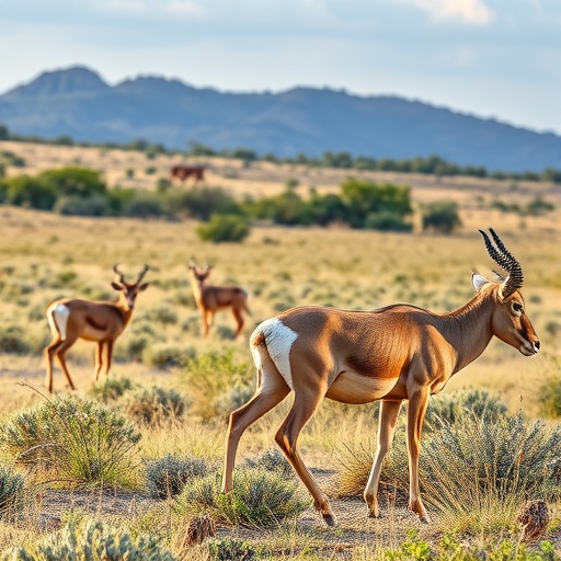
In the arid heartlands of southern Iran, one of the Middle East’s most elegant and imperiled antelopes is quietly rewriting what scientists think they know about how animals respond to human pressure. The goitered gazelle (Gazella subgutturosa), a medium-sized ungulate that once ranged from the Arabian Peninsula across Central Asia to Mongolia and China, has been sliding toward extinction for decades. Downgraded from “Near Threatened” to “Vulnerable” on the IUCN Red List in 2006, the species has been steadily squeezed by agricultural expansion, road construction, livestock overgrazing, and poaching. Yet a new comparative study conducted in two of the species’ last southern Iranian strongholds reveals something unexpected: the factors that determine where these gazelles thrive appear to shift dramatically depending on how strictly the land is protected. In one landscape, roads dominate the story. In the other, it is elevation and rainfall that call the shots. The findings carry implications that stretch far beyond Iran’s borders, offering a rare window into how wide-ranging ungulates negotiate the fractured mosaic of protection and peril that defines so much of the modern conservation landscape.
The research, published in the journal Environmental Challenges, was conducted by a team of Iranian wildlife biologists led by Farid Shahidinejad, who set out to address a persistent blind spot in habitat modeling. Most species distribution studies for ungulates have focused on flagship national parks and strictly protected reserves, leaving populations that live in multi-use landscapes — areas with partial protection such as no-hunting zones — largely unexamined. “Habitat quality generally increases with conservation status,” the authors note in their introduction, citing broad-scale assessments showing that the most valuable habitats cluster inside strictly protected boundaries while quality declines most rapidly in human-dominated buffer zones. But almost no studies have directly compared, within the same region and the same species, how the relative weight of environmental versus anthropogenic drivers changes across management regimes of differing security levels. That gap matters because only an estimated 2.6 to 5.9 percent of goitered gazelle range in Iran currently falls within protected areas, meaning the fate of the species rests substantially on lands where formal protection is weaker or incomplete.
The team chose two contrasting sites in Fars Province. Bamu National Park, covering 48,594 hectares roughly ten kilometers northeast of Shiraz, is a strictly protected area on the northern slopes of the southern Zagros Mountains, with elevations ranging from about 1,500 meters on the lowland plains to 2,660 meters at the summit of Mount Bamu. Its mosaic of open steppe plains and dry shrubland supports not only a substantial gazelle population but also wild sheep, wild goat, and one of the region’s most important strongholds of the Endangered Persian leopard — a nearly complete large-mammal assemblage that makes the park a vital refuge. Basiran No-Hunting Area, by contrast, spans approximately 76,120 hectares in northern Fars Province and carries a lower tier of statutory protection. Its cold montane landscape, reaching nearly 3,900 meters and experiencing 89 frost days a year, combines plains, hills, and rugged mountains with a wetland system that draws migratory waterbirds in wet years. Both sites harbor gazelles, but they differ sharply in enforcement infrastructure and human use intensity — precisely the gradient the researchers wanted to test.
Fieldwork was deliberately designed to avoid one of the most common biases in wildlife surveys: over-sampling near roads. During the spring of 2024, three trained biologists accompanied by local rangers walked more than 195 kilometers of line transects across both areas over 28 field days, conducting roughly 135 hours of active observation entirely on foot. Surveys were timed to the gazelles’ peak activity windows in the early morning and late afternoon, with observations made from a distance using binoculars and spotting scopes to avoid disturbing the animals before detection. After spatial filtering to a minimum nearest-neighbor distance of 250 meters to reduce clustering and autocorrelation, each site yielded exactly 21 presence points — a modest sample size, but one the researchers handled with unusually careful statistical restraint. The exact coordinates are intentionally withheld from publication to shield this vulnerable species from poachers.
The modeling framework paired two structurally different machine-learning algorithms: Maximum Entropy (MaxEnt) and Random Forest. Rather than blending them into an ensemble — which the authors argue can mask algorithm-specific behavior — they ran the models in parallel to see whether two very different architectures would independently converge on the same conclusions. To guard against overfitting given the small sample, the MaxEnt regularization multiplier was raised to 2.0, favoring smooth, generalized response curves over complex fitted ones, and ten bootstrap replicates with a 75:25 train-test split were used to assess stability. The Random Forest classifier, configured with 500 decision trees, resisted overfitting through bagging, Out-Of-Bag error estimation, and randomized feature selection, with 210 pseudo-absence points maintaining a 1:10 ratio to presences. Nine environmental predictors were standardized to a common 30-meter resolution: elevation, slope, and aspect derived from a NASA digital elevation model; NDVI from Sentinel-2 imagery as a proxy for forage greenness; annual precipitation and isothermality from WorldClim; and distances to roads, rivers, and settlements from OpenStreetMap and provincial records. No pairwise correlation among predictors exceeded the standard 0.70 multicollinearity threshold.
The models performed superbly. In Bamu National Park, MaxEnt achieved an average AUC of 0.994 and a True Skill Statistic of 0.90, while Random Forest reached an AUC of 0.995. In Basiran, the figures remained firmly in the “excellent” class at 0.953 and 0.982 respectively. But the real story lay in which variables the models flagged as decisive. In the strictly protected park, “Distance to roads” was the single most influential predictor — 33.1 percent importance in the Random Forest model and a dominant contribution in MaxEnt — followed by NDVI and distance to settlements. The response curve was stark: habitat suitability was negligible near roads and rose steadily, plateauing only beyond roughly 5,000 to 6,000 meters from linear infrastructure. Suitability also increased monotonically with distance from settlements, was restricted to gentle slopes below about 8 degrees, and peaked at intermediate precipitation of 150 to 250 millimeters and elevations of 1,000 to 1,500 meters.
In Basiran, the hierarchy inverted. Annual precipitation (23.7 percent) and elevation (21.2 percent) took the top spots in the Random Forest model, with road distance demoted to third place at 17.6 percent. The MaxEnt jackknife tests corroborated this shift, showing the highest training gain for precipitation, elevation, and isothermality, with road distance contributing far less individually than it had in Bamu. The response curves pointed toward the area’s mid-elevation plateaus and gentle northern plains as the zones of highest suitability. The authors are careful about interpretation: because Basiran is inherently a high-altitude landscape, this pattern may reflect an association with the available terrain matrix rather than an active behavioral retreat uphill. They explicitly acknowledge that confounding factors — livestock grazing patterns at lower elevations, poaching pressure, and differences in baseline habitat availability — could all contribute to the observed associations. Still, the contrast between the two regimes is difficult to dismiss: in the park, human infrastructure dominated the model; in the multi-use landscape, the models leaned on terrain and climate.
The findings resonate with a growing body of evidence from across arid Asia. Comparable spatial relationships between roads and gazelle distribution have been documented for Przewalski’s gazelle around Qinghai Lake, where railways and highways reduce habitat accessibility, and in the Kalamaili Mountain Ungulate Nature Reserve, where road construction and mining fragmented high-suitability patches. A 2024 study in Iran’s Mond Protected Area likewise found that anthropogenic barriers shrank the accessible range of the related Gazella marica, producing fragmented pockets of suitability despite the presence of usable resources elsewhere. The new study adds a critical nuance to this picture: even the designation of “national park” does not necessarily neutralize the influence of internal road networks. Site-specific assessment of traffic and access, the authors suggest, may be needed to determine whether mitigation measures such as wildlife underpasses or traffic restrictions are warranted — a sobering thought for park managers worldwide who assume that boundary lines alone confer safety.
The conservation implications are direct and spatially explicit. In Bamu, the models identified a continuous, elongated belt of high and very high suitability running northwest to southeast through the park’s central plains and rolling hills, far from boundaries and major roads — a core habitat zone both algorithms agreed on, despite Random Forest producing slightly more fragmented patches. In Basiran, suitable habitat concentrated in the northern plains and central low-lying sectors, with the rugged central and southern mountains largely classified as unsuitable. The authors propose context-dependent actions for each regime: road-related mitigation and disturbance management inside the park, and protection of the northern plateau habitat in the no-hunting area where enforcement is thinner. They also recommend that future work incorporate GPS-tracking, seasonal predictors such as multi-temporal NDVI, and multi-scale analyses, since gazelles exhibit pronounced dietary and spatial flexibility across seasons — shifting from forbs in spring to shrubs and graminoids in winter — meaning the map of “suitable habitat” almost certainly redraws itself throughout the year.
For a species whose survival now hinges disproportionately on a handful of regional strongholds, the message from Fars Province is both cautionary and constructive. Protection matters, but it is not a switch that can be flipped and forgotten: even within strictly guarded boundaries, the ghost of the road network shapes where life can flourish. And where protection is weaker, animals may lean on topography and climate in ways that models built for parks simply do not capture. As human pressure intensifies across the world’s arid steppes, understanding these regime-specific dynamics may prove to be the difference between a gazelle population that persists and one that quietly vanishes from the map.
Cite Scienmag News
Margaret Porter. (September 3, 2026). Human pressure and terrain shape goitered gazelle habitats across management zones. Scienmag. https://scienmag.com/human-pressure-and-terrain-shape-goitered-gazelle-habitats-across-management-zones/
Margaret Porter. "Human pressure and terrain shape goitered gazelle habitats across management zones." Scienmag, 3 September 2026, https://scienmag.com/human-pressure-and-terrain-shape-goitered-gazelle-habitats-across-management-zones/. Accessed 11 September 2026.
Margaret Porter. "Human pressure and terrain shape goitered gazelle habitats across management zones." Scienmag. September 3, 2026. https://scienmag.com/human-pressure-and-terrain-shape-goitered-gazelle-habitats-across-management-zones/


