

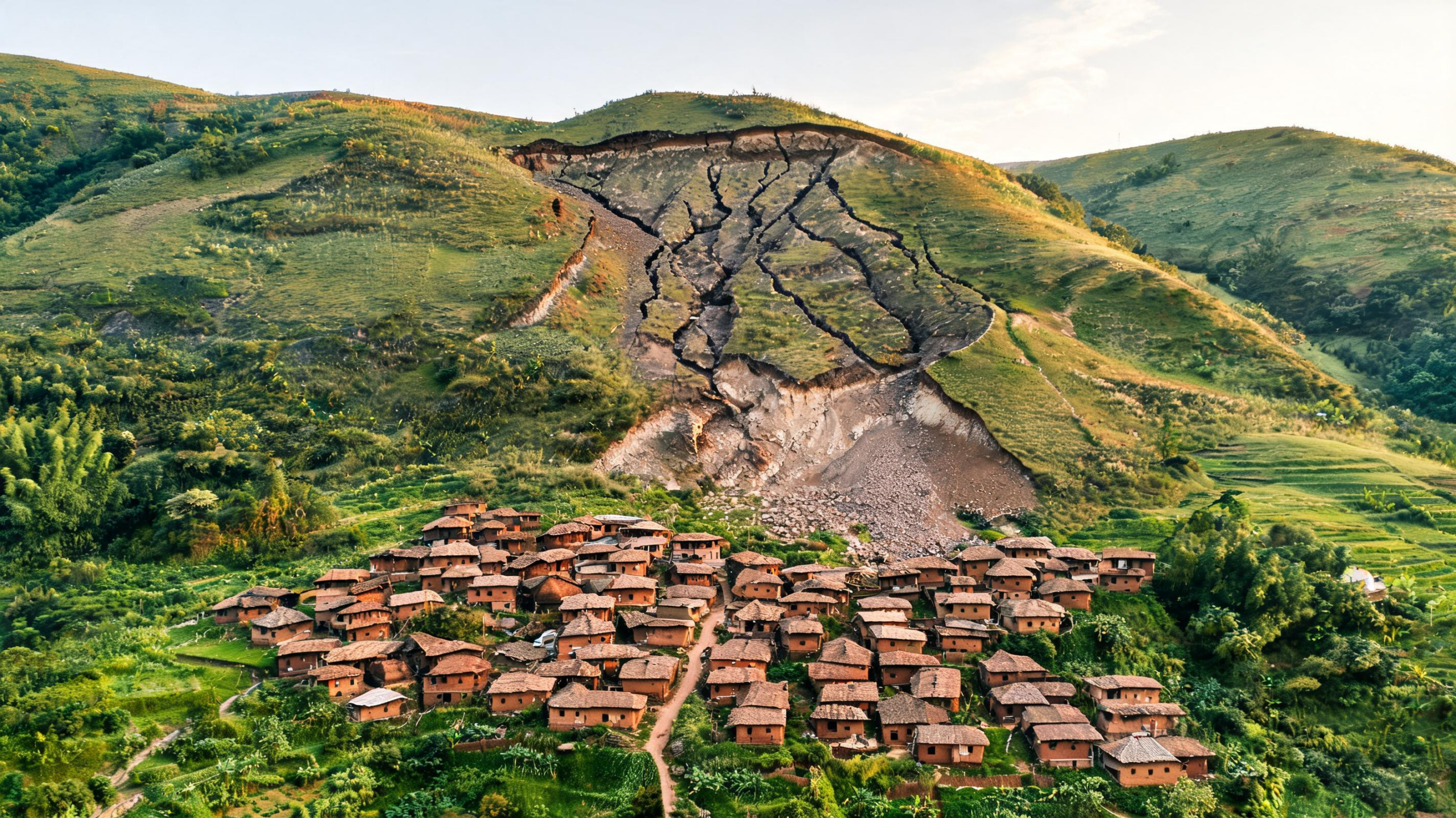
A landslide that struck the Western Ghats of India in July 2021 left behind a hazard larger and more complicated than its most obvious scar, according to a detailed drone survey around the hamlet of Miraswadi. Researchers mapped the failed slope in three dimensions and found long cracks, active slumping, ground settlement and tilted vegetation beyond the original landslide boundary. The features indicate that parts of the hillside overlooking the settlement may still be deforming years after the initial collapse. The findings, published in Discover Geoscience, show how unmanned aerial vehicles can reveal small but potentially important changes that conventional satellite imagery or ground inspections may miss. Miraswadi, in Satara district, Maharashtra, sits below steep hillsides formed from weathered basalt. About 53 households occupy the hamlet, which lies close to the route taken by debris during the 2021 event. No casualties were reported then, but the continuing deformation identified above the settlement raises concerns about future failures, especially during intense monsoon rainfall. The study offers a high-resolution picture of a landscape where the first visible landslide may not mark the full extent of the danger.
The Western Ghats are naturally susceptible to rainfall-triggered landslides because several risk factors overlap. The region has steep, deeply dissected terrain, weathered basaltic rocks and soil-like regolith that can lose strength when saturated. Miraswadi receives approximately 1,733 millimetres of rain annually, much of it during the southwest monsoon. During prolonged or unusually intense storms, water infiltrates the slope, raises groundwater levels and increases pore-water pressure between grains. That pressure reduces the friction and effective stress holding the material together, lowering its shear strength. Surface runoff can then concentrate in channels, erode exposed soil and mobilize loose debris. The July 2021 event occurred during an extreme rainfall episode that triggered thousands of landslides across Maharashtra’s Western Ghats. The local landscape also includes agricultural terraces, settlements, drainage modifications and other human changes that can redirect runoff or alter infiltration. The researchers did not identify these activities as the primary cause of the Miraswadi failure, but they concluded that such modifications may influence local susceptibility when combined with steep slopes, weathered materials and exceptional rainfall. Seismic activity in the nearby Koyna–Varna zone may contribute to long-term fracturing, although rainfall remains the principal trigger in this setting.
To reconstruct the terrain, the team flew a DJI Phantom 4 Pro equipped with a 20-megapixel, one-inch sensor camera at roughly 200 metres above ground level. The mission collected 283 georeferenced high-resolution images, with about 80 per cent forward overlap and 30 per cent side overlap between photographs. Overlapping images allow photogrammetry software to identify the same surface points from multiple viewpoints and calculate their three-dimensional positions. The resulting dataset produced an orthomosaic, a digital elevation model, contour information and a dense point cloud containing approximately 31 million points. Its mean ground sampling distance was 5.52 centimetres, meaning that individual image-derived cells represented only a few centimetres of ground surface. Image calibration was reported as 100 per cent successful, with a mean reprojection error of approximately 0.143 pixels. Handheld GPS measurements supplied ground control points to improve positional consistency and elevation calibration. The researchers emphasize that the products were intended primarily for relative geomorphological analysis rather than survey-grade geodetic measurement. Recreational-grade GPS accuracy and the absence of a pre-failure drone survey limit the precision with which surface movement and lost volume can be interpreted. Even so, the model provided sufficient detail to identify cracks, scarps, slumps and debris pathways across a hazardous slope.
The mapped landslide began approximately 125 metres northeast of Miraswadi on 23 July 2021. Its visible failure area covered about 1.34 hectares, while the associated debris spread extended across roughly 2.95 hectares. From crown to toe, the movement reached approximately 255 metres, with widths ranging from 112 to 162 metres. The researchers estimated that between 42,050 and 46,076 cubic metres of material had been displaced, presenting the result as a range because the pre-failure surface had to be reconstructed from surrounding undisturbed terrain. Morphological evidence suggests that the event began as a debris slide, in which weathered soil and rock moved downslope as a relatively coherent mass. Once the material entered a pre-existing second-order drainage channel, it became more confined and flow-like, evolving into a channelized debris movement. The terrain model divided the slope into an initiation zone between approximately 747 and 690 metres above mean sea level, a transport zone from about 690 to 665 metres, and a deposition zone from roughly 665 to 642 metres. The upper initiation area included steep slopes exceeding 45 degrees and locally surpassing 60 degrees. Lower gradients allowed transported soil, rock fragments and uprooted vegetation to accumulate across the broader depositional area.
The most consequential discovery was not confined to the old landslide scar. Immediately upslope of the habitation, researchers identified a deformation area containing three to four major tension cracks between approximately 70 and 90 metres long and up to half a metre wide. Several cracks coincided with localized ground settlement and slumping, with vertical displacement reaching about 0.5 metres. Their roughly slope-parallel alignment and position on a hillside directly above homes indicate that the ground has continued to adjust after the 2021 failure. A second area, above the original crown, contained two or three smaller cracks approximately 10 to 15 metres long and 0.1 metres wide. These may represent instability propagating upslope, although the study does not establish a precise rate or direction of movement. Field inspections confirmed active slumping, regolith displacement, minor scarps, surface undulations and additional cracks within the weathered soil. Tilting vegetation supplied another visible sign that the ground beneath roots may be shifting. The researchers carefully distinguish these observations from pre-failure warning signs: because the survey was conducted after the landslide, the features document ongoing post-failure deformation rather than proven precursors. Their location nevertheless matters for risk assessment. A hazard map drawn only around the original scar could overlook unstable ground that threatens the settlement from above.
The team also compared land use in satellite imagery from 2011 and 2022 to examine how the surrounding landscape had changed. Settlement area increased from approximately 8,014 square metres to 15,403 square metres, an expansion of about 92 per cent. Over the same period, terrace farming declined from about 454,746 to 409,114 square metres, while barren or fallow land decreased from approximately 115,372 to 105,709 square metres. Forest cover increased from about 170,695 to 218,601 square metres, suggesting that vegetation expanded overall even as localized changes occurred near the hamlet. The researchers observed the growth of residential structures, modifications to agricultural terraces and exposed soil surfaces, particularly on slopes northeast of the settlement where active instability was detected. These changes can affect how water travels across a hillside. A building platform, track, terrace or altered drainage line may concentrate runoff in one place, increase infiltration in another or remove material that previously protected the soil. The study does not claim that settlement growth caused the landslide. Instead, it presents human landscape modification as a factor that can interact with natural controls and increase exposure. In a small rural community, even modest expansion can place more homes, fields and livestock facilities beneath an unstable slope.
The findings have immediate implications for monitoring and preparedness, but the authors caution against treating their preliminary recommendations as final engineering plans. The deformation zone above the hamlet should receive continued attention, particularly during and after periods of intense rainfall. Repeated drone surveys could compare successive digital elevation models and orthomosaics to detect crack widening, new scarps, changing vegetation tilt or accelerated ground displacement. Field observations remain essential because dense vegetation, shadows and image geometry can obscure features in aerial data. Surface drainage management may reduce water concentration and infiltration in unstable areas, while vegetation-based measures could help control erosion and reinforce shallow soil. Retaining structures might be appropriate in selected locations, but their design would require detailed geotechnical, hydrogeological and engineering investigations. The study also identifies a potential temporary refuge area chosen using topography, distance from unstable slopes, access and proximity to agricultural and livestock resources. That site is not validated as a permanent rehabilitation location; no dedicated land-suitability, geotechnical or hydrogeological assessment was performed. Because many residents depend on farming and livestock and maintain strong ties to their homes, temporary evacuation during extreme rainfall may be more realistic than immediate permanent relocation. Warning signs such as widening cracks, renewed slumping or rapidly increasing deformation could help guide such decisions.
Miraswadi illustrates both the power and the limits of high-resolution remote sensing in landslide science. Regional susceptibility maps can identify broad patterns of danger, but they cannot always show whether a particular crack runs behind a house, whether a drainage channel links a scar to a settlement or whether deformation extends beyond a mapped failure. A drone can be deployed quickly over a relatively small area and generate detailed terrain information without exposing surveyors to the most hazardous ground. Yet a single post-event flight cannot reveal how fast the slope is moving, what is happening underground or whether another failure will occur. The study therefore calls for repeated UAV acquisitions combined with rainfall records, hydrological monitoring, geotechnical testing, geophysical surveys and analysis of rainfall thresholds. Such integration could turn a detailed snapshot into an early-warning system. For communities across the Western Ghats and other tropical mountain regions, the approach offers a practical way to document landslides after extreme storms and identify danger zones that remain active after the debris has stopped moving. In Miraswadi, the central message is straightforward: the end of a landslide’s visible movement does not necessarily mean the slope has stabilized. High-resolution mapping can make that hidden continuation visible before the next monsoon tests the hillside again.
Subject of Research: UAV mapping of landslide morphology and post-failure slope instability in Miraswadi, India
Article Title: UAV based assessment of landslide morphology and slope instability in Miraswadi, Western Ghats, India
Article References: Shirke, A. V., Khandge, A., Umrikar, B. N., & Asim, M. (2026). UAV based assessment of landslide morphology and slope instability in Miraswadi, Western Ghats, India. Discover Geoscience, 4(1), Article 334. https://doi.org/10.1007/s44288-026-00707-y
Image Credits: AI Generated
DOI: 10.1007/s44288-026-00707-y
Keywords: landslides, UAV mapping, Western Ghats, slope instability, debris flows, remote sensing, monsoon rainfall, hazard mitigation, based, assessment, landslide, morphology
Cite Scienmag News
Scienmag. (August 29, 2026). Drone Mapping Reveals Hidden Slope Instability Above Indian Hamlet. https://scienmag.com/drone-mapping-reveals-hidden-slope-instability-above-indian-hamlet/
Scienmag. "Drone Mapping Reveals Hidden Slope Instability Above Indian Hamlet." Scienmag, 29 August 2026, https://scienmag.com/drone-mapping-reveals-hidden-slope-instability-above-indian-hamlet/. Accessed 29 August 2026.
Scienmag. "Drone Mapping Reveals Hidden Slope Instability Above Indian Hamlet." Scienmag. August 29, 2026. https://scienmag.com/drone-mapping-reveals-hidden-slope-instability-above-indian-hamlet/


