


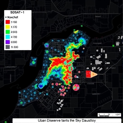
Artificial light is transforming the night sky above Türkiye’s astronomical observatories, and a new satellite study has revealed that the most dangerous source of pollution may not always be the largest or brightest city. Researchers using multispectral nighttime imagery from SDGSAT-1 have mapped how urban lighting is changing around two of the country’s most important dark-sky sites: the TÜBİTAK National Observatory, or TUG, near Antalya, and the Eastern Anatolia Observatory, known as DAG, near Erzurum. Their results expose a surprising paradox. Although Antalya has a larger illuminated footprint, the calculated overall atmospheric scattering risk around Erzurum was substantially higher. The finding suggests that protecting observatories will require more than simply reducing brightness. Authorities may also need to control the color and spectral composition of outdoor lighting.
The study, published in Experimental Astronomy, develops a complete workflow for converting raw satellite signals into information about the environmental and astronomical consequences of artificial light. The researchers began with data from the SDGSAT-1 Glimmer Imager, a sensor designed to observe nighttime illumination at much finer spatial and spectral detail than widely used global night-light products. Unlike conventional satellite measurements that primarily record broadband brightness, multispectral observations can help distinguish lighting technologies. This matters because a low-pressure sodium lamp, a high-pressure sodium lamp, and a white light-emitting diode can produce very different effects in the atmosphere even when their total visible brightness appears similar. Their wavelengths determine how efficiently light is scattered and how strongly it contributes to skyglow above a protected observatory.
One of the central challenges was restoring the satellite imagery without erasing the weakest signals. Nighttime remote sensing is vulnerable to detector noise, striping, calibration errors, geometric misalignment, and variations in atmospheric conditions. In many image-processing workflows, faint pixels are treated as unwanted noise and suppressed. For dark-sky research, however, those faint signals may represent exactly the low-level stray light that travels across rural landscapes and reaches an observatory. The team therefore developed a radiance-based restoration procedure designed to preserve weak illumination while correcting artifacts. Radiance refers to the amount of light traveling from a source toward the sensor over a defined area and direction. Maintaining this physical quantity allowed the researchers to compare satellite observations with measurements made on the ground rather than relying only on visual image enhancement.
The restored SDGSAT-1 data were tested against in-situ Sky Quality Meter observations collected near the observatory regions. Sky Quality Meters estimate night-sky brightness by measuring light in a broad spectral band and typically report the result in astronomical units of magnitude per square arcsecond. The researchers found a strong log-linear relationship between satellite-derived radiance and SQM measurements, with a correlation coefficient of approximately −0.94. The negative sign reflects the astronomical magnitude scale: darker skies have numerically larger magnitudes, while brighter skies have smaller ones. A correlation this strong indicates that the satellite workflow was capable of tracking variations in sky brightness over the study areas, including subtle emissions that could have disappeared during aggressive denoising.
The multispectral classification produced the clearest evidence of a lighting transition in Antalya. Commercial and urban areas around TUG showed a growing presence of white LEDs, which accounted for approximately 9.2 percent of the classified lighting coverage. White LEDs are often promoted as efficient replacements for older lamps because they can deliver more visible illumination using less electricity. Yet their environmental impact depends strongly on their spectral power distribution, the way their emitted energy is distributed across wavelengths. Many white LEDs contain a strong blue component, and shorter wavelengths are scattered more efficiently by molecules and aerosols in the atmosphere than longer red wavelengths. That scattering can spread urban light across wide distances, creating a diffuse glow over areas that may be far beyond the city itself.
Erzurum presented a contrasting picture. More than 77 percent of its classified lighting infrastructure remained spectrally homogeneous high-pressure sodium lighting. These lamps are dominated by yellow-orange wavelengths and generally contain less short-wavelength output than many modern white LEDs. From a spectral perspective, this could make distant sources less efficient at generating broad atmospheric skyglow. But the location of the urban core created a more immediate danger for DAG. The observatory is positioned close to the main concentration of Erzurum’s artificial light, meaning that even lighting with comparatively lower scattering efficiency can produce a powerful local impact. Light emitted near an observatory does not need to travel through a long atmospheric path to contaminate the sky above the telescope.
To quantify that distinction, the researchers introduced a physically based atmospheric scattering risk model. The model accounts for factors including the radiance of individual or grouped light sources, their distance from the observatory, the wavelengths they emit, and the way atmospheric particles redirect light. Rayleigh scattering, caused by air molecules, is especially important at shorter wavelengths and increases rapidly as wavelength decreases. Aerosols, dust, and other particles can also scatter and redirect light through Mie scattering, a process that is less strongly dependent on wavelength but can become significant in hazy or polluted conditions. The model therefore treats artificial light as both a geometric and a spectral threat. A nearby source may be dangerous because of its distance and intensity, while a distant blue-rich source may remain important because its light is scattered efficiently across the atmosphere.
The resulting risk scores overturned what a simple brightness map might suggest. Erzurum recorded a total modeled risk of about 76,069, compared with approximately 56,947 for Antalya. The higher Erzurum score was driven primarily by geometric exposure: the city’s bright core lies closer to DAG. In Antalya, by contrast, the wider urban and coastal footprint generated a stronger spectral concern. White LEDs in commercial districts can send proportionally more short-wavelength light into the atmosphere, allowing distant sources to contribute to skyglow over TUG even when they are not immediately adjacent to the observatory. The result is a warning against ranking light-pollution threats by city size, total illuminated area, or satellite brightness alone. The physical pathway from a lamp to the observatory can be just as decisive as the amount of light emitted.
The study’s practical message is unusually specific. Where the primary danger is intensity and proximity, as at DAG, the most effective interventions are likely to involve strict shielding, better fixture design, reduced upward light, lower operating levels, and carefully timed curfews. Shielding prevents light from escaping above the horizontal plane, where it can enter the atmosphere and telescope lines of sight. Where the dominant danger is spectral, as in parts of Antalya, simply dimming lights may not be enough. Municipalities could instead prioritize warmer LED technologies, reduce blue emission, apply spectral filters, and restrict high-intensity commercial lighting. Such measures could lower scattering efficiency while preserving essential illumination for roads, businesses, and public safety. The researchers argue that dark-sky conservation should therefore move toward differentiated, source-specific strategies rather than a single nationwide lighting standard.
SDGSAT-1 also offers a new way to monitor these changes over time. The satellite’s detailed nighttime imagery can identify roads, commercial zones, urban expansion, and changes in lighting technology that are difficult to detect with coarse-resolution global products. The team supplemented the satellite observations with VIIRS VNP46A2 nighttime-light data and OpenStreetMap vectors to connect illuminated patterns with likely source categories. This combination can help planners determine whether a new glow comes from a highway, an industrial site, a residential district, or a coastal commercial corridor. Repeated observations could reveal whether a city’s transition to LEDs is reducing electricity demand while unintentionally increasing blue-rich emissions over protected landscapes. They could also provide a way to evaluate the success of shielding rules and lighting retrofits without depending solely on occasional ground surveys.
For astronomers, the implications are immediate. Artificial skyglow raises the background level against which faint celestial objects must be detected, reducing contrast and forcing longer exposures. It can interfere with photometry, spectroscopy, and surveys that depend on precise measurements of weak astronomical signals. For ecosystems and human communities, the consequences extend beyond observatories: artificial light at night can alter insect behavior, migration, predator-prey interactions, circadian rhythms, and landscape connectivity. The Türkiye study does not claim that satellite imagery can replace ground-based measurements or detailed lamp inventories. Instead, it demonstrates how space-based multispectral data can connect regional urban development with the physics of atmospheric light propagation. Its most striking conclusion is also its most shareable: the city that looks less threatening from space may be the one posing the greater risk on the ground, while a distant city can become a serious danger when its lighting spectrum is optimized for atmospheric scattering. Protecting the world’s observatories may ultimately depend not only on turning lights down, but on choosing the right colors, directions, and distances for every lamp.
Cite Scienmag News
Russell Cooper. (August 26, 2026). SDGSAT-1 Glimmer Imagery Maps Urban Lighting, Atmospheric Impacts on Dark-Sky Preserves. Scienmag. https://scienmag.com/sdgsat-1-glimmer-imagery-maps-urban-lighting-atmospheric-impacts-on-dark-sky-preserves/
Russell Cooper. "SDGSAT-1 Glimmer Imagery Maps Urban Lighting, Atmospheric Impacts on Dark-Sky Preserves." Scienmag, 26 August 2026, https://scienmag.com/sdgsat-1-glimmer-imagery-maps-urban-lighting-atmospheric-impacts-on-dark-sky-preserves/. Accessed 3 September 2026.
Russell Cooper. "SDGSAT-1 Glimmer Imagery Maps Urban Lighting, Atmospheric Impacts on Dark-Sky Preserves." Scienmag. August 26, 2026. https://scienmag.com/sdgsat-1-glimmer-imagery-maps-urban-lighting-atmospheric-impacts-on-dark-sky-preserves/


