


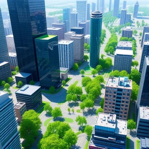
Urban researchers are calling for a fundamental shift in how cities are understood, modeled and governed as population change, climate pressure and rapid technological development transform urban life. At the inaugural Urban Systems Forum, held on 19 July 2026 at the University of Hong Kong (HKU), international scholars argued that cities can no longer be studied through isolated case studies or static maps. Instead, they said, urban science must combine artificial intelligence, remote sensing, digital twins, mobility data and ecological monitoring to reveal how social, environmental and infrastructural systems interact across space and time.
Hosted by HKU’s Urban Systems Institute (USI) in collaboration with the Institute for Climate and Carbon Neutrality, the State Key Laboratory of Subtropical Building and Urban Science Hong Kong Base, the Otto Poon Charitable Foundation Smart Cities Research Institute, The Hong Kong Polytechnic University and the IEEE Geoscience and Remote Sensing Society Hong Kong Chapter, the forum brought together researchers working across geography, ecology, economics, sociology, engineering and computer science. Its central message was that sustainable cities will require models capable of connecting neighborhood-scale changes with regional and global forces, including migration, capital flows, climate risk and resource consumption.
In his opening address, HKU Vice-President for Academic Development Professor Peng Gong said conventional urban research often depends too heavily on qualitative descriptions and narrowly defined case studies. Such approaches, he argued, are poorly suited to cities whose systems are nonlinear, interconnected and constantly changing. He called for an urban research framework built on interdisciplinary integration, quantitative modeling and a global perspective. Mathematical and computational models should not replace human judgment, he said, but should provide empirical evidence for it, allowing researchers to evaluate multiple objectives at once, including economic prosperity, social inclusion, public health, environmental quality and carbon reduction.
Gong also introduced a proposed “Exquisite City” framework for sustainable Chinese urban development. Rather than measuring progress mainly through gross domestic product, the framework evaluates urban performance through inputs such as labor, capital, land and carbon footprint, together with 48 indicators covering health, inclusivity, prosperity, ecology and livability. Drawing on ten years of data from 148 Chinese cities, the approach is designed to identify whether development is becoming more efficient, equitable and environmentally sustainable. Its proponents say such multidimensional assessment could help cities move from broad growth targets toward more precise, low-carbon and quality-oriented planning.
Demographic change emerged as another major force reshaping urban systems. Professor Cindy Fan of the University of California, Los Angeles, examined China’s sustained population and fertility decline, linking it to structural changes in families, education, employment and housing costs. The one-child era produced a “4-2-1” family structure in which one child may eventually support two parents and four grandparents, increasing the cost of care and weakening incentives to have larger families. Fan emphasized that higher female educational attainment, workforce participation, urbanization and expensive living conditions are deeply connected to fertility decisions. Financial incentives alone, she suggested, are unlikely to reverse the trend without broader reforms in social welfare, family support and care institutions.
A parallel transformation is taking place in the field of urban informatics, described by Professor John Wenzhong Shi of The Hong Kong Polytechnic University as a discipline with five interconnected dimensions: urban science, urban sensing, urban big-data infrastructure, urban computing, and urban systems and applications. Technologies such as GeoAI, mobile three-dimensional mapping and digital twins can now integrate observations from satellites, sensors, vehicles and human activity. These tools make it possible to simulate urban conditions and test interventions before they are implemented. Examples presented at the forum included spatiotemporal prediction of pandemic risk and detailed real-world modeling of streets, buildings and infrastructure.
Mobility data was identified as a critical missing variable in many traditional urban studies. Professor Bo Huang of HKU argued that static population counts and land-use statistics cannot adequately describe cities in which people move continuously between homes, workplaces, schools and services. His Geographically and Temporally Weighted Regression model, known as GTWR, incorporates changing relationships across both location and time. Applications involving pandemic transmission and heatwave exposure showed how mobility data can identify vulnerable populations and reveal gaps in urban governance. The approach could support more targeted public-health responses, transport planning and low-carbon strategies in densely populated cities.
Artificial intelligence was presented not merely as a tool for processing information, but as a potential research partner. Professor Yong Li of Tsinghua University described an “AI Urban Scientist” system that combines tens of thousands of research papers with multiple urban datasets. The system can generate research hypotheses, fuse spatiotemporal information, conduct simulations and empirical calculations, and produce evidence-based conclusions. Other researchers applied AI to long-term street monitoring, tree-canopy analysis and health-risk mapping. Five years of street-view imagery from Xining, totaling more than 225 gigabytes, revealed how annual monitoring can expose overlooked renewal needs and environmental decline. Satellite imagery analyzed with the U-Net deep-learning architecture enabled individual tree crowns to be segmented and measured across large landscapes, providing detailed evidence of ecological disturbance and urban forest resilience.
The forum also highlighted the value of linking urban models to physical materials, ecosystems and human health. Researchers presented studies showing that mixed urban forests can provide greater ecological benefits than single-species stands, while multi-sector models can connect land expansion with carbon budgets using satellite observations, road networks and industrial statistics. Other projects examined how the built environment influences shared-mobility behavior across macro-, meso- and micro-scales; how Bayesian inference can detect hidden structures in noisy transportation networks; and how real-time geographic information systems can map environmental exposure and health risks hour by hour. Low-carbon building materials, including bio-based products, low-carbon concrete and stabilized earth blocks, were assessed for their potential to meet future housing demand without undermining climate goals.
During two roundtable discussions, participants addressed both the promise and the risks of increasingly automated urban science. Artificial intelligence, large-scale models, network inference and real-time GIS could accelerate discovery and improve planning, but they also raise concerns about algorithmic bias, energy consumption, computing costs and the interpretability of model outputs. Speakers argued that human expertise remains essential, particularly when models influence decisions about vulnerable communities, housing, transport or public health. Closing the forum, Gong stressed that accurate information about population distribution, demographic structure and human mobility is the foundation of effective policy. He added that robotics and AI may help societies respond to aging populations and labor shortages, but insisted that the ultimate purpose of urban systems research is to convert scientific knowledge into practical governance that respects Earth’s ecological limits and supports sustainable human settlements.
News Publication Date: 19 July 2026
Cite Scienmag News
Courtney Benton. (August 6, 2026). Urban Systems Forum Highlights Advanced Modeling for Sustainable City Development. Scienmag. https://scienmag.com/urban-systems-forum-highlights-advanced-modeling-for-sustainable-city-development/
Courtney Benton. "Urban Systems Forum Highlights Advanced Modeling for Sustainable City Development." Scienmag, 6 August 2026, https://scienmag.com/urban-systems-forum-highlights-advanced-modeling-for-sustainable-city-development/. Accessed 5 September 2026.
Courtney Benton. "Urban Systems Forum Highlights Advanced Modeling for Sustainable City Development." Scienmag. August 6, 2026. https://scienmag.com/urban-systems-forum-highlights-advanced-modeling-for-sustainable-city-development/


