


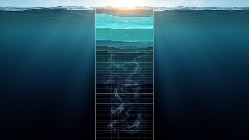
Deep in the South Atlantic, some of the coldest water on Earth creeps northward along the seafloor, a slow-motion river of Antarctic Bottom Water that helps drive the global overturning circulation and regulates how the ocean stores heat and carbon. For decades, the computer models that scientists rely on to project climate change have struggled to reproduce this abyssal limb of the circulation. Now a new study published in Ocean Science by Daniel M. C. Santos of the University of São Paulo and colleagues at the Alfred Wegener Institute suggests a surprisingly simple reason: the models may be looking at the deep ocean through the wrong grid. In a series of carefully controlled numerical experiments, the team found that adding more vertical layers near the seafloor dramatically improves how models represent cold, dense abyssal waters and their pathways between ocean basins, while simply making the horizontal grid finer can actually make things worse.
The stakes are considerable. Antarctic Bottom Water forms when dense shelf water, chilled by contact with Antarctic air and ice, spills off the continental shelf around Antarctica, plunging down the slope and mixing with overlying deep water. In the Weddell Sea, this process produces Weddell Sea Deep Water and the even colder Weddell Sea Bottom Water. The deep water overflows the South Scotia Ridge into the Scotia Sea, threads through passages around South Georgia, and pools in the Argentine Basin, where its core properties hover near a potential temperature of −0.10 °C and a salinity of 34.67. From there, the only significant exit toward the equator is the Vema Channel, a narrow, deep trench near 31° S that funnels the coldest bottom water into the Brazil Basin and, eventually, toward the North Atlantic. Every link in this chain matters for the Atlantic Meridional Overturning Circulation, yet direct observations of the abyssal limb remain sparse, limited to a handful of trans-basin moored arrays and repeated shipboard sections.
That observational scarcity is precisely why ocean models and reanalyses carry so much weight. Reanalyses such as ECCO, SODA, and GLORYS blend observations into a numerical simulation to produce a continuous picture of the ocean, while forward models like OFES evolve freely under prescribed atmospheric forcing. Santos and his colleagues began by auditing four such products against the World Ocean Atlas 2018 climatology and against in situ measurements, including thirteen years of conductivity–temperature–depth casts along the SAMBA-West line at 34.5° S and temperature records from three moorings deployed within the Vema Channel. The verdict was sobering. All four simulations broadly captured the large-scale distribution of abyssal water masses, but each displayed persistent warm biases in the deep ocean, and none clearly reproduced the cascading of dense shelf water down the Antarctic continental slope. Most tellingly, all of them showed a discontinuity in abyssal properties between the Argentine and Brazil Basins, as if the cold water simply failed to make it through the Vema Channel.
The temperature–salinity diagrams told the story in stark terms. In the Argentine Basin, the reference climatology shows a well-defined curve extending to waters colder than −0.5 °C. In the Brazil Basin, that curve shifts toward warmer, lighter values, because sills along the Vema Channel block the coldest water and mixing erodes what passes through. The models, however, exaggerated this transition artificially. ECCO, SODA, and OFES shifted their entire deep temperature–salinity curves toward lighter densities north of the channel, while GLORYS lost a striking fraction of its densest water classes. In the channel itself, the picture was even worse: ECCO represented the passage with a single column of grid points, SODA contained no points there at all, and even the higher-resolution products misaligned, widened, or shallowed the trench, leaving no water colder than 0.0 °C inside it.
Because the four simulations differed in so many respects—atmospheric forcing, data assimilation schemes, bathymetry, and sea-ice representation—the intercomparison alone could not pin the blame on any single culprit. So the team turned to the Finite-volumE Sea ice–Ocean Model, FESOM 2, an unstructured-mesh model developed at the Alfred Wegener Institute that is at least nine times faster than its finite-element predecessor. They built a reference configuration, FESOM R, designed to mimic the vertical grid of OFES, with 105 vertical levels and horizontal spacing of about 30 kilometers over most of the globe, refined to 10 kilometers in the South Atlantic. Then they ran three targeted variants, changing nothing else: FESOM V added twenty vertical levels concentrated between 3800 and 5350 meters, bringing the spacing near the seafloor down to roughly 50 meters; FESOM H refined the horizontal grid to 7.5 kilometers in the South Atlantic and 4 kilometers around the Vema Channel; and FESOM VH combined both refinements.
The results were unambiguous. FESOM V, the vertically refined experiment, delivered the largest basin-scale improvement. Cold waters below −0.7 °C spread across a broader swath of the central Weddell Sea, waters at or below 0.0 °C filled the entire Argentine Basin, and a colder class of bottom water finally flowed through the Vema Channel into the Brazil Basin. The warm bias that plagued every configuration shrank and became spatially uniform, without the abrupt basin-to-basin discontinuities seen in the reference run. The density evolution of the deep basins also became more coherent: in FESOM R and FESOM H, entire density classes of abyssal water vanished from the Argentine and Brazil Basins within decades of the simulation, whereas the vertically refined runs retained them. The mechanism is physical rather than numerical sleight of hand. Colder abyssal layers extend upward through the lower water column, allowing the coldest water to reach the depth of the Vema Channel sill and spill northward, instead of being trapped below the deepest model level connected through the passage.
FESOM H, by contrast, was the weakest performer of the four. Refining the horizontal grid alone produced warmer abyssal layers, erased the coldest waters from the central Weddell Sea, and left the Argentine Basin without any water below 0.0 °C. The likely explanation lies in the delicate balance between resolved and parameterized turbulence. The Gent–McWilliams eddy parameterization, which stands in for mesoscale eddies the model cannot explicitly resolve, scales its diffusivity with grid spacing. When the grid becomes fine enough to partially resolve eddies but the parameterization is not retuned, the model can end up double-counting eddy effects, distorting the very mixing that shapes abyssal water masses. The authors caution that this interpretation remains speculative, since they deliberately kept all parameterizations unchanged to isolate the effect of resolution, but the lesson is clear: horizontal refinement without recalibration of mixing schemes can be actively harmful in the deep ocean.
The combined experiment, FESOM VH, offered a more nuanced picture. At the basin scale it did not outperform vertical refinement alone, and its abyssal waters ran slightly warmer than FESOM V’s. But in the Vema Channel it achieved something no other configuration could: a realistic representation of the channel’s geometry, complete with a cold bottom-intensified core deflected toward the eastern wall. That eastward deflection is a genuine dynamical feature, attributed to Ekman transport driven by bottom friction, and it is consistently observed in moored measurements and regional simulations of Antarctic Bottom Water flow. Capturing it required sufficient resolution in both dimensions—vertical refinement to cool the water column and horizontal refinement to resolve the narrow trench—demonstrating that the two grid directions play complementary roles.
Comparisons with the moorings and CTD stations reinforced the hierarchy. Across three historical mooring periods in the Vema Channel, the vertically refined configurations FESOM V and FESOM VH systematically reduced warm biases and reproduced the observed variability more faithfully, while FESOM H consistently produced the largest warm biases. Along the SAMBA-West line, FESOM V again provided the closest match to observed mean temperatures at Sites C and D, though all configurations overestimated the observed warming trend. Correlations with individual mooring time series remained modest across the board, a reminder that even a well-resolved global model cannot be expected to nail phase agreement at single points in the abyss. What vertical resolution reliably controls is the mean state and variance of deep temperature—the very quantities that determine whether cold bottom water survives its journey across bathymetric barriers.
The implications reach well beyond the South Atlantic. Global ocean models feed climate projections, sea-level estimates, and carbon budgets, and the abyssal ocean absorbs a substantial share of the excess heat that the climate system accumulates. If the deep thermal structure is systematically too warm because the vertical grid is too coarse, those biases propagate into every downstream product. Previous studies had hinted that enhanced vertical resolution improves the representation of dense water masses and baroclinic modes, but this study provides an unusually clean demonstration, holding everything constant except the grid. Its message to model developers is direct: before spending scarce computing resources on ever-finer horizontal meshes, invest in the vertical grid near the seafloor, and when horizontal resolution does increase, retune the mixing parameterizations that quietly govern the deep ocean. The coldest waters on the planet, it turns out, live or die in the last fifty meters of a model’s water column.
Subject of Research: The effect of horizontal and vertical grid resolution on the representation of Antarctic Bottom Water and abyssal ocean properties in global numerical ocean models
Article Title: Impact of grid resolution on the abyssal ocean representation in numerical models
Article References: Santos, D. M. C., Van Caspel, M., Timmermann, R., & Sato, O. T. (2026). Impact of grid resolution on the abyssal ocean representation in numerical models. Ocean Science, 22(5), 3079-3104. https://doi.org/10.5194/os-22-3079-2026
Image Credits: AI Generated
Keywords: Antarctic Bottom Water, ocean modeling, grid resolution, FESOM 2, Vema Channel, Weddell Sea, Atlantic Meridional Overturning Circulation, abyssal ocean, ocean reanalysis, vertical resolution, Argentine Basin, deep ocean warming
Cite Scienmag News
Violet Maxwell. (October 8, 2026). Vertical Resolution, Not Horizontal Zoom, Holds the Key to Simulating the Abyssal Ocean. Scienmag. https://scienmag.com/vertical-resolution-not-horizontal-zoom-holds-the-key-to-simulating-the-abyssal-ocean/
Violet Maxwell. "Vertical Resolution, Not Horizontal Zoom, Holds the Key to Simulating the Abyssal Ocean." Scienmag, 8 October 2026, https://scienmag.com/vertical-resolution-not-horizontal-zoom-holds-the-key-to-simulating-the-abyssal-ocean/. Accessed 8 October 2026.
Violet Maxwell. "Vertical Resolution, Not Horizontal Zoom, Holds the Key to Simulating the Abyssal Ocean." Scienmag. October 8, 2026. https://scienmag.com/vertical-resolution-not-horizontal-zoom-holds-the-key-to-simulating-the-abyssal-ocean/


