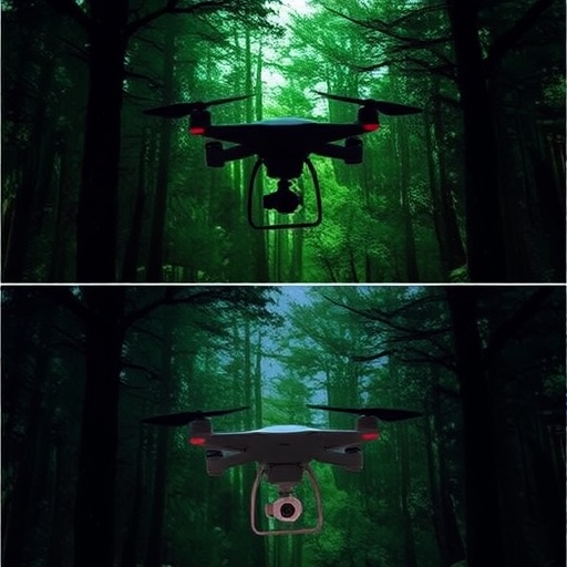
Recent advancements in drone technology are revolutionizing the way researchers study and monitor forest ecosystems. A groundbreaking study led by De Oliveira and colleagues dives deep into the use of Unmanned Aerial Vehicles (UAVs) for mapping forest successional stages, particularly in seasonal tropical forests. This transformative research not only harnesses the capabilities of UAVs but also compares the effectiveness of RGB and multispectral imagery in capturing the nuanced changes in forest structures over time.
The concept of forest succession is pivotal in understanding the dynamics of ecosystems. It describes the gradual process of change in species composition and community structure in a given area following a disturbance. In tropical regions, where biodiversity is staggering, identifying and monitoring these successional stages can provide invaluable insights into forest health and resilience, carbon storage capabilities, and the overall impacts of climate change.
The researchers employed high-resolution drones capable of capturing RGB (Red, Green, Blue) and multispectral images of the forest canopy. RGB imagery, which offers a visible spectrum of colors, is valuable for basic assessments of forest cover and health. Conversely, multispectral imagery enables scientists to capture additional wavelengths, which are essential for identifying specific vegetation types and assessing their health status through indicators like the Normalized Difference Vegetation Index (NDVI).
One of the primary advantages of UAVs is their ability to cover large geographical areas with high efficiency. Traditional methods of forest mapping, such as ground surveys or satellite imagery, can be time-consuming, labor-intensive, and often limited by weather conditions. In stark contrast, UAVs can be deployed quickly and frequently, allowing researchers to gather data at different points in time and monitor the changes in forest successional stages effectively.
In the study, the researchers meticulously analyzed the data collected from UAV flights over various seasonal tropical forests. By focusing on specific areas undergoing different stages of succession, they were able to produce detailed maps that highlighted the variations in species composition and canopy structure. This granular level of detail is especially crucial in tropical forests, where diverse species often coexist within small spatial parameters.
The comparative analysis of RGB versus multispectral imagery provided illuminating results. While RGB images were effective in offering a general overview of forest cover, the multispectral images revealed critical information about plant health and species distribution that RGB could not capture. For instance, certain plant types exhibit distinct reflectance properties in specific wavelengths that can be detected using multispectral sensors.
Furthermore, the use of UAVs facilitates the study of transient ecological phenomena, such as seasonal changes in foliage density or flowering patterns. These phenomena play a crucial role in forest dynamics, impacting everything from carbon sequestration rates to wildlife habitats. By continuously monitoring these changes, researchers can develop a deeper understanding of how different species respond to environmental stressors and adapt over time.
The research highlights another significant benefit of utilizing UAVs in forest monitoring: the ability to conduct surveys over challenging terrains that are often unreachable by ground teams. Tropical forests are teeming with biodiversity and often have dense undergrowth, making traditional surveys logistically complicated and costly. UAVs, however, can easily navigate through these environments, providing a wealth of data that can be used for conservation efforts and sustainable land management.
The implications of this research extend far beyond academic theory; they influence practical decision-making in environmental management. Governments, conservation organizations, and landowners can use the detailed maps generated from UAV imagery to implement better forest management practices, track deforestation trends, and develop targeted conservation strategies. This is critical in the fight against climate change, as forests play a significant role in sequestering carbon and supporting global biodiversity.
Moreover, the integration of advanced image-processing algorithms can allow for automated classification of forest types and conditions, further enhancing the efficiency of forest monitoring. As machine learning and artificial intelligence continue to evolve, the potential to analyze vast datasets generated by UAVs increases, promising unprecedented insights into forest ecosystems and their dynamics.
In conclusion, the work spearheaded by De Oliveira and his colleagues marks a significant breakthrough in forest ecology and remote sensing. By leveraging the unique advantages of UAV technology and combining it with advanced imagery techniques, this research opens new avenues for understanding our planet’s complex ecosystems. As we grapple with the challenges posed by climate change, such innovative approaches will be crucial in preserving our vital forest resources and fostering sustainability for future generations.
This study represents a pivotal step forward in integrating technology with ecological research, providing a blueprint for future investigations into forest dynamics. The potential to apply these methods in a variety of ecological contexts is immense, creating opportunities for enhancing our understanding of the natural world while reinforcing our commitment to environmental stewardship.
It is evident that we are only beginning to tap into the capabilities of UAVs in ecological research, and as technology advances, the methods of studying our forests will continue to evolve. This promises a future where we can anticipate forest responses to climate variables and anthropogenic pressures with greater accuracy, ultimately leading to better-informed conservation practices and policies.
The implications for conservation, biodiversity management, and climate resilience are profound, and as this field of research expands, it urges us to reconsider how we monitor and protect our planet’s remaining natural resources.
With a world increasingly reliant on data-driven decision-making in environmental management, the findings presented in this study could serve as a cornerstone for future research endeavors, promoting sustainability and ecological integrity across global landscapes.
Subject of Research: UAVs in forest successional stage mapping
Article Title: Mapping forest successional stages with UAVs: comparing RGB and multispectral imagery in seasonal tropical forests
Article References:
De Oliveira, A.d., Sperandio, H.V., de Azevedo, M.L. et al. Mapping forest successional stages with UAVs: comparing RGB and multispectral imagery in seasonal tropical forests.
Environ Monit Assess 197, 1254 (2025). https://doi.org/10.1007/s10661-025-14730-y
Image Credits: AI Generated
DOI: 10.1007/s10661-025-14730-y
Keywords: UAV, RGB imagery, multispectral imagery, forest succession, tropical forests, remote sensing, ecological research, conservation.


