

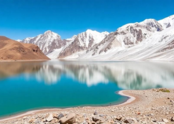
Himalayan Glacial Lakes Triple in Number as Warming Reshapes the Upper Indus Basin
An automated satellite analysis using Google Earth Engine reveals that glacial lakes in the Upper Indus Sub-Basin tripled from 255 ...
An automated satellite analysis using Google Earth Engine reveals that glacial lakes in the Upper Indus Sub-Basin tripled from 255 ...

A district-level analysis of 471 Indian districts using satellite-derived MNDWI and NDVI indices shows that temperature anomalies significantly reduce both ...
A three-decade Landsat analysis of Ara city, India, shows urban expansion significantly eroding vegetation and wetland health while reshaping the ...
A two-decade machine-learning analysis of Landsat imagery shows vegetation cover in Malawi's Chia Lagoon catchment fell by 189 square kilometres ...

Embark on a thrilling journey of discovery with Scienmag.com—your ultimate source for cutting-edge breakthroughs. Immerse yourself in a world where curiosity knows no limits and tomorrow’s possibilities become today’s reality!