As the 2025 Atlantic hurricane season approaches, meteorologists and emergency management officials brace for what could be the most intense and impactful storm season recorded to date. Forecasts predict above-normal hurricane activity, signaling increased risks of flooding and coastal destruction caused by surges and heavy rainfall. These extreme water events, like the 15-foot flooding experienced in Florida during Hurricane Helene in 2024, pose significant threats to human life, infrastructure stability, and ecological balance. Accurate and timely prediction of these water level extremes is critical for effective disaster response, yet remains challenging due to the complexity of modeling such events.
Traditional hydrodynamic and physical-based flood models depend heavily on extensive, high-resolution environmental data inputs, including detailed weather patterns, topographical features, and oceanographic conditions. The computational demand and the prerequisite for comprehensive data archives often limit these models’ usability to well-monitored regions equipped with sophisticated infrastructure. Areas lacking consistent tide gauge records or subject to equipment failure during storms face significant hurdles in producing reliable flood forecasts, restricting equitable disaster preparedness worldwide.
In response to these challenges, a team of researchers from Virginia Tech and Vrije Universiteit Brussel has unveiled an innovative deep learning-based framework termed Long Short-Term Memory Station Approximated Models (LSTM-SAM). This model employs advanced transfer learning techniques to harness storm data from data-rich locations and extrapolate predictive insights to less-monitored regions. By learning temporal dependencies and complex water level dynamics in one geographic area, LSTM-SAM can provide robust flood forecasts even when local observational data are scarce or incomplete.
LSTM-SAM operates by analyzing historical water level time series data using Long Short-Term Memory (LSTM) networks — a form of recurrent neural network that excels at capturing sequential and time-dependent patterns. The model prioritizes extreme water level changes during training, enhancing its ability to identify critical inflection points like the rapid rise or fall during storm surges. This nuanced learning approach differentiates it from previous models that often rely on repetitive pattern recognition and struggle with rare but consequential extreme events.
One of the most compelling features of LSTM-SAM is its transfer learning capability. Transfer learning enables the model, pre-trained on abundant data from well-instrumented tide gauge stations along the U.S. Atlantic coast, to adapt to predicting water levels in other locations where observational infrastructure is limited or has failed. This adaptability opens new avenues for flood risk assessment in developing regions and in areas where hurricane-induced damage has compromised monitoring equipment.
The robustness of the model was tested extensively at multiple tide gauge stations notorious for hurricane impact, including Sandy Hook, New Jersey. During Hurricane Sandy in 2012, the Sandy Hook station’s monitoring equipment failed, resulting in data loss. LSTM-SAM not only accurately reconstructed the missing water level data at this site but also successfully predicted the temporal evolution of storm surges at various stations, including their onset, peak, and recession phases. Such performance demonstrates the model’s potential to augment or substitute traditional gauge data during critical events.
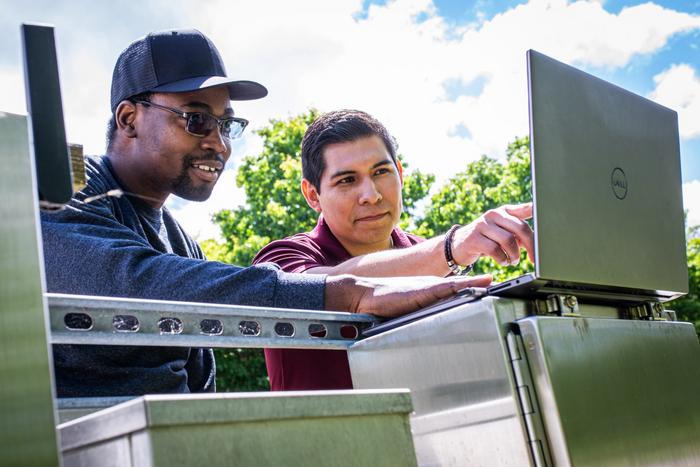
Running on modest computational resources, LSTM-SAM delivers rapid predictions that can be generated on standard laptops within minutes. This low barrier to entry is key for smaller municipalities and countries with limited access to high-performance computing clusters. With the model’s open-source code available through the CoRAL Lab’s GitHub repository, emergency planners, researchers, and policy-makers worldwide can leverage this technology to improve regional flood preparedness, making state-of-the-art storm surge forecasting accessible beyond academia and specialized agencies.
In practice, LSTM-SAM’s predictions provide actionable insights vital for determining evacuation timing, optimizing the deployment of emergency equipment and personnel, and guiding infrastructure protection strategies ahead of incoming tropical cyclones. By offering near-real-time forecasts with improved reliability over conventional models, this technology empowers stakeholders to make data-driven decisions that could substantially reduce the human and economic toll of hurricanes.
The increasing intensity and frequency of extreme weather events under climate change underscore the urgent necessity for innovations like LSTM-SAM. As coastal populations grow and urbanize, vulnerability to compound flooding—resulting from the confluence of rainfall and storm surges—increases. Advanced deep learning frameworks that efficiently integrate heterogeneous data and adapt to analytics-sparse environments represent a critical leap forward in resilience science and disaster risk reduction.
Future directions for the research team include deploying LSTM-SAM operationally throughout the forthcoming 2025 hurricane season, aiming to validate and refine its predictive capacities in live storm scenarios. This real-time application will enable continuous benchmarking against observed water levels, ultimately enhancing model accuracy and robustness. Additionally, expanding the model’s geographical and temporal training datasets can further improve generalizability and performance across diverse climatic and coastal regimes.
The convergence of machine learning techniques with hydrological and atmospheric sciences exemplified by LSTM-SAM signals a paradigm shift in environmental monitoring and hazard mitigation. By transcending traditional data limitations and computational constraints, this approach paves the way for smarter, faster, and more inclusive flood forecasting systems—essential tools in confronting the new normal of increasing climatic uncertainty.
This research owes much to the collaborative efforts bridging academic institutions and international expertise, supported by the National Science Foundation, CAS-Climate Program, and the Virginia Sea Grant Fellowship. Together, they herald a new chapter in harnessing artificial intelligence for the protection of lives and livelihoods from the escalating threat of hurricanes and extreme water events.
Subject of Research: Predictive Modeling of Extreme Water Levels During Hurricanes Using Deep Learning and Transfer Learning Techniques
Article Title: Predicting the Evolution of Extreme Water Levels With Long Short-Term Memory Station-Based Approximated Models and Transfer Learning Techniques
News Publication Date: 14-Mar-2025
Web References:
References: Daramola, S., Muñoz, D. F., Saksena, S., Irish, J., & Muñoz, P. (2025). Predicting the Evolution of Extreme Water Levels With Long Short-Term Memory Station-Based Approximated Models and Transfer Learning Techniques. Water Resources Research. DOI: 10.1029/2024WR039054
Image Credits: Photo by Peter Means for Virginia Tech
Keywords: Hurricanes, Storms, Weather, Flood Control, Water Management, Natural Disasters, Floods, Geography, Hydrosphere, Cyclones, Extreme Weather Events


