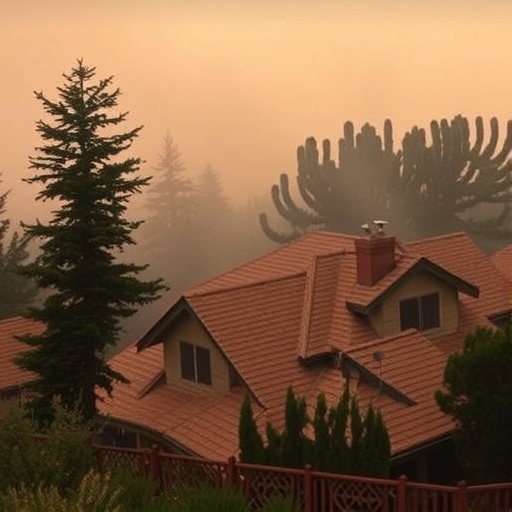
In recent years, California has witnessed an alarming increase in the frequency and intensity of wildfires, particularly in areas where urban developments meet wildlands—commonly referred to as the Wildland-Urban Interface (WUI). Researchers have now turned their attention to understanding the fire risk to structures situated in this precarious zone, driven by the imperative need to mitigate losses and enhance community resilience. A breakthrough study published in Nature Communications delivers fresh insights into the intricate dynamics governing fire spread and its devastating impact on human settlements bordering California’s vast wildlands.
The study dives deeply into the spatial and environmental factors shaping fire behavior at the wildland-urban boundary. California’s unique topography, marked by a rugged landscape with steep slopes and diverse vegetation types, creates a complex canvas on which fires propagate unpredictably. These researchers have leveraged advanced computational modeling techniques that combine historical fire data, vegetation mapping, and meteorological variables to simulate how flames merge with urban structures. Their approach reveals the heightened vulnerability of homes and commercial buildings exposed to certain wind patterns, fuel types, and structural proximities, illuminating weak points in current fire prevention strategies.
A central concern addressed by the investigation is the changing climate’s role in exacerbating wildfire threats. Intensified drought conditions, record-breaking heat waves, and lengthened dry seasons all conspire to create a tinderbox environment that primes the landscape for massive infernos. The study meticulously quantifies how these climatic shifts not only increase fire ignition events but also amplify fire intensity, thereby challenging traditional firefighting tactics and urban planning paradigms. By integrating climate projection data, the researchers forecast that without substantial intervention, fire damage to properties in the WUI will escalate dramatically in the coming decades.
Beyond just modeling fire spread mechanics, the researchers have uniquely focused on the built environment itself—specifically, how building materials, architectural design, and spatial arrangement influence fire resilience. Their findings indicate that many structures, especially those constructed with flammable materials such as untreated wood siding, remain highly susceptible to ember attack and direct flame contact. Conversely, structures employing fire-resistant materials in combination with defensible space — cleared zones around properties — demonstrated significantly improved odds of survival. This points to a critical need for updated building codes tailored to wildfire risks and enhanced community education about home hardening measures.
One of the innovative aspects of the study is its exploration of feedback loops between human settlement patterns and fire risk. As urban sprawl pushes further into wildland areas, natural firebreaks are eroded, and more homes are placed in harm’s way. This encroachment not only places residents in danger but also complicates firefighting logistics by increasing the length and complexity of firelines that must be established during emergencies. The research emphasizes that strategic land-use planning, aimed at limiting unchecked expansion into fire-prone zones, could play a pivotal role in reducing cumulative fire exposure over time.
Meteorological conditions emerge as another critical determinant of fire risk in the WUI. Seasonal wind systems common to California, such as the Diablo and Santa Ana winds, are notorious for driving flames rapidly through dry vegetation and across urban boundaries. The study’s simulations illustrate how these winds can create ignition points miles away from the original fire source, complicating evacuation efforts and heightening structural vulnerability. Understanding the nuanced interplay between wind topography and fire behavior is thus fundamental for the implementation of early-warning systems and for informing situational firefighting tactics.
Embers, often carried by gusting winds, represent one of the most insidious threats to structures in wildland-urban zones. The study highlights that even when flames themselves do not reach homes, these tiny burning fragments can ignite rooftops, gutters, and debris with deadly efficiency. This ember cast effect disrupts earlier assumptions that direct flame contact is the primary cause of structural loss. Instead, the research underscores the importance of enhancing architectural details such as ember-resistant vents, non-combustible roofing, and routine removal of flammable materials in property surroundings to bolster defenses against ember showers.
The research team also evaluates how community-level interventions, including fuel treatments and landscape management, influence fire risk at the interface. Their models show that the strategic removal or reduction of flammable vegetation adjacent to neighborhoods can significantly slow fire progression and reduce heat intensity, creating safer zones for both residents and firefighters. However, such treatments require careful balancing to avoid ecological degradation and must be maintained regularly to remain effective. This highlights the interconnectedness of ecological stewardship and fire risk management in building long-term resilience.
To execute their simulations, the researchers harnessed high-resolution satellite imagery combined with ground-based data collection—a novel fusion facilitating unprecedented precision in fire risk mapping. By integrating multiple data streams, they produced granular maps depicting areas of extreme fire threat down to individual parcels. This level of detail empowers emergency planners and residents alike to prioritize interventions in the most vulnerable locations. Moreover, the approach provides a scalable model applicable to other fire-prone regions globally, suggesting a promising blueprint for future wildfire risk assessment methodologies.
Significantly, the study challenges conventional fire response protocols by illustrating the limitations of reactive firefighting alone. Their analysis argues for a paradigm shift toward proactive risk reduction measures, particularly through community-based engagement and cross-sector collaboration. Embracing a holistic framework that incorporates fire science, urban design, social behavior, and policy reform offers improved prospects for mitigating catastrophic fire outcomes in the WUI. This integrated model reflects contemporary understanding that wildfire resilience demands multi-dimensional solutions, rather than isolated technical fixes.
The researchers further explore socioeconomic disparities in fire risk exposure, noting that vulnerable communities often face heightened dangers due to inadequate resources for fireproofing or evacuation. The intersection of social vulnerability and fire risk underscores the necessity for equitable policy interventions that ensure all residents receive appropriate support and information. Implementing subsidized home retrofitting programs, community fire education, and inclusive planning processes could reduce inequities and foster more resilient, informed populations capable of navigating wildfire hazards.
Technological advances also play a prominent role in the study’s vision for improved wildfire management. The deployment of real-time fire monitoring systems, drones for rapid fire mapping, and AI-enhanced predictive algorithms emerges as transformative tools. Such innovations enable faster, more accurate fire detection and resource allocation, potentially saving lives and property. Integrating these technologies with community risk assessments can form the backbone of next-generation wildfire response strategies, signifying a progressive melding of technology and traditional firefighting tenets.
Beyond technological tools, the researchers stress the importance of building a culture of preparedness that embraces the highest standards of risk communication and public awareness. Clear, credible, and timely information dissemination before, during, and after wildfires empowers residents to make informed decisions, reducing panic and facilitating orderly evacuations. This cultural dimension of wildfire risk management complements structural and ecological defenses, representing an indispensable ingredient for overall success in safeguarding lives and assets.
Looking ahead, the study’s projections highlight the urgency of climate mitigation and adaptation actions. Unless greenhouse gas emissions are brought under control, the frequency of extreme fire weather events is likely to increase even further, overwhelming existing preparedness and response capacity. The authors advocate for integrated climate and wildfire policy frameworks that align land use, energy, conservation, and emergency management sectors under shared objectives. Achieving such alignment at local, state, and federal levels remains a complex but crucial challenge in fostering a safer interface between wildlands and urban developments.
Ultimately, this landmark research offers a comprehensive and nuanced understanding of California’s wildfire crisis at the wildland-urban intersection. Its blend of sophisticated modeling, environmental science, and social analysis furnishes policymakers, firefighters, urban planners, and residents with powerful tools to confront an increasingly volatile fire landscape. By revealing the interdependencies of natural, engineered, and human systems in fire risk propagation, it beckons a future where informed action and innovation converge to safeguard communities against one of nature’s most formidable threats.
Subject of Research: Fire risk to structures in California’s Wildland-Urban Interface
Article Title: Fire risk to structures in California’s Wildland-Urban Interface
Article References:
Zamanialaei, M., San Martin, D., Theodori, M. et al. Fire risk to structures in California’s Wildland-Urban Interface. Nat Commun 16, 8041 (2025). https://doi.org/10.1038/s41467-025-63386-2
Image Credits: AI Generated
