In a groundbreaking study released in 2026, researcher H. Ikemi delves deep into the complex interplay between climate and tectonics as expressed through the topographic and erosional patterns of the Otoishi River watershed. This work, published in Environmental Earth Sciences, casts new light on the asymmetric geomorphic features of fluvial landscapes, revealing how subtle variations in environmental and geological forces can sculpt river basins over millennia.
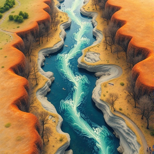
The Otoishi River watershed presents a particularly intriguing case for geomorphologists due to its marked topographic asymmetry. While river basins often develop in relatively symmetrical forms, the Otoishi’s distinct landscape variations on opposing sides suggest a dynamic history of environmental shaping forces. Ikemi’s study meticulously dissects these differences, connecting them to the intertwined effects of climatic variables and tectonic activity that govern erosion and sediment transport processes.
Ikemi’s analysis begins with a detailed examination of the watershed’s elevation profiles, identifying a pronounced asymmetry between the north and south flanks of the Otoishi River valley. This elevation disparity is not merely superficial; underlying it are differences in fluvial incision rates and erosion intensity, implying that river dynamics have been responding differently to environmental factors on either side. Such insights hint that differential uplift or subsidence along fault zones might be a significant driver of this asymmetry.
Moreover, the research incorporates high-resolution digital elevation models and hydrological data to quantify erosion rates, channel gradients, and sediment fluxes within the watershed. Through this integrative approach, Ikemi reveals that the side exhibiting steeper slopes and more vigorous erosion is aligned spatially with areas of recent tectonic uplift. This relationship underscores the powerful control that tectonic deformation exerts on river morphology, influencing the pace and pattern of landscape evolution.
However, climate exerts an equally pivotal influence in modulating erosional processes. The study highlights how variations in precipitation patterns and storm frequency across the watershed contribute to differential runoff and sediment transport. For instance, the windward side of the watershed experiences higher rainfall totals, intensifying surface erosion and channel incision. Conversely, the leeward side, with more arid conditions, registers reduced erosion rates, further amplifying the topographic imbalance.
The coupling between tectonics and climate emerges as the central theme of the paper. Ikemi adeptly models how episodic tectonic uplift alters gradient thresholds, which in turn shift erosional dynamics and drainage patterns. Meanwhile, climatic forces either exacerbate or mitigate these effects by controlling water availability, which drives the erosive power of runoff. This dual control framework moves beyond traditional geomorphic models that prioritize one factor over the other, offering a more nuanced understanding of watershed evolution.
Intriguingly, Ikemi’s work also explores the role of rock type and lithology in shaping erosional asymmetry. Variations in bedrock resistance to weathering and mass wasting influence how the land surface responds to both tectonic stresses and hydrological forces. Softer rock units are more readily eroded, potentially creating localized depressions that alter river courses and sediment deposition zones.
Another significant contribution of the study is the identification of erosional asymmetry as a useful proxy for deciphering past tectonic and climatic conditions. By interpreting fluvial landforms and sedimentary record through the lens of topographic asymmetry, researchers gain clues about historic uplift rates, climate shifts, and landscape stability, offering a retrospective window into Earth’s dynamic surface processes.
The data collected and analyzed by Ikemi fuse remote sensing techniques with ground-based geomorphic surveys, illustrating the power of integrating multidisciplinary methodologies. This methodological advance not only enhances our ability to characterize erosion patterns in mountainous watersheds but also sets a new standard for catchment-scale geomorphic research.
Importantly, the findings have broader implications for hazard assessment and environmental management. Understanding erosion and sediment flux controls informs predictions of landslide susceptibility, sediment-related flooding, and river channel migration – critical factors in developing mitigation strategies in riverine and mountainous environments prone to natural disasters.
The study’s approach also elevates the conversation around climate change impacts on fluvial systems. By establishing baselines of how current climate and tectonics interact to shape river watersheds, we can better anticipate how future climatic fluctuations might remodel these sensitive landscapes, influencing their hydrological functions and ecological attributes.
Ikemi emphasizes that asymmetric erosional processes in watersheds like the Otoishi serve as natural laboratories for testing geodynamic theories. These landscapes, shaped by the slow but persistent forces of uplift and erosion, encapsulate the feedback loops between lithospheric movements and surface processes, revealing the temporal scales at which Earth’s topography responds to internal and external stimuli.
Furthermore, the study draws attention to the importance of scale in geomorphology. While tectonic forces operate over vast spatial and temporal domains, their immediate expression through erosion is modulated by local climatic patterns and lithological conditions. This scale-dependent interplay demands that future research tackle multi-scalar analyses to fully capture the complexity of landscape evolution.
Ikemi’s research also prompts a re-evaluation of the existing models of river basin development, encouraging the inclusion of asymmetry as a structural component rather than an outlier. Recognizing erosional asymmetry not as an anomaly but an intrinsic landscape signature could lead to more accurate modeling of sediment budgets and geomorphic thresholds.
In sum, this landmark study by H. Ikemi expands our comprehension of fluvial geomorphology by elucidating how topographic and erosional asymmetries act as sensitive indicators of the intricate dance between climate and tectonics. Its implications resonate across Earth sciences, offering vital insights for geologists, hydrologists, and environmental planners striving to unravel the complexities of mountainous river systems and their ongoing evolution amidst changing climatic and tectonic regimes.
Subject of Research: Topographic and erosional asymmetry in river watersheds with focus on climatic and tectonic influences.
Article Title: Topographic and erosional asymmetry in the Otoishi River watershed: climatic and tectonic insights.
Article References:
Ikemi, H. Topographic and erosional asymmetry in the Otoishi River watershed: climatic and tectonic insights. Environ Earth Sci 85, 24 (2026). https://doi.org/10.1007/s12665-025-12754-8
Image Credits: AI Generated
