


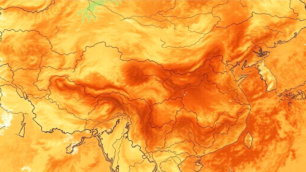
Drought is one of the most stubborn and destructive natural hazards on Earth, and nowhere is its fingerprint more consequential than in the semi-arid belt of northern China known as the Loess Plateau. Spanning roughly 630,000 square kilometers between about 100°54′–114°33′E and 33°43′–41°16′N, this vast region of wind-deposited silt, dissected gullies, and fragmented terrain is both one of the country’s most ecologically fragile landscapes and the flagship arena for its largest vegetation restoration effort, the Grain-for-Green Program. A new open-access study published in Environmental Earth Sciences by Jing Zhou, Wanyun Huang, Kelin Wang, Pingda Lu, Mengyun Liu, Xiaoping Wang and colleagues now delivers a sharper set of eyes for watching this landscape dry and recover, combining multiple streams of satellite data into a single, physically grounded drought index that outperforms every individual indicator used before it.
The core problem the researchers set out to solve is a familiar one in remote sensing science: no single spectral index can capture drought across a landscape as heterogeneous as the Loess Plateau. Indices built on visible, near-infrared, and shortwave-infrared reflectance, such as the normalized difference vegetation index (NDVI) and the normalized difference water index (NDWI), track vegetation vigor and surface water content but are easily confounded by soil background and atmospheric noise. Thermal infrared approaches, including the temperature condition index and the normalized difference temperature index, respond rapidly to vegetation water stress through surface energy balance but say little about soil moisture directly. Hybrid indices such as the temperature vegetation drought index (TVDI), which exploits the triangular feature space formed by land surface temperature and a vegetation index, perform well in some settings but degrade where vegetation cover is sparse or highly variable. Because the Loess Plateau transitions from semi-humid conditions in the southeast to arid conditions in the northwest, with vegetation types shifting accordingly, any one-dimensional view of drought was bound to miss part of the story.
The team’s solution was a comprehensive drought index, or CDI, that fuses three complementary indicators, each chosen for its strengths under a particular surface condition. The normalized difference drought index (NDDI), computed from NDVI and NDWI, captures real-time surface dryness in densely vegetated areas. The soil moisture monitoring index (SMMI), derived from a shortwave-infrared and near-infrared spectral feature space, is largely independent of the soil background line and excels at monitoring surface soil moisture in sparsely vegetated terrain. The TVDI, calculated from the modified soil adjusted vegetation index (MSAVI) and daily land surface temperature from the MODIS MOD11A1 product, provides a normalized measure of relative drought severity across zones of variable vegetation cover. All inputs were drawn from the MOD09GA surface reflectance product, resampled to a uniform one-kilometer grid, and aggregated from daily to monthly values using the maximum value composite method.
Crucially, the researchers did not simply average the three indices. They weighted them using the analytic hierarchy process, a structured decision-making technique in which a judgment matrix is built from two explicit criteria: the correlation of each index with field-measured soil moisture, and the known suitability of each index for different vegetation cover conditions. The eigenvector method yielded the final weights, and a consistency ratio below 0.1 confirmed that the judgments were internally coherent. The resulting formula, CDI = 0.12·NDDI + 0.23·SMMI + 0.65·TVDI, gives dominant weight to the temperature-vegetation component, reflecting its broad applicability across the plateau’s mixed cover, while retaining meaningful contributions from the soil-moisture and vegetation-water indices. Drought was then classified into five levels, from no drought (CDI ≤ 0.40) through mild, moderate, and severe, up to extreme drought (CDI above 0.80).
Validation came from the ground, quite literally. In August 2023, the team measured surface soil moisture at 34 representative sites across the Huangfuchuan Basin, a landscape of dense, crisscrossing ravines and diverse vegetation types that makes it a demanding test bed for any drought index. Soil samples from the top 10 centimeters were recorded with a portable soil nutrient detector, each point geolocated with GPS. When the field measurements were regressed against the monthly CDI values for August 2023, the result was a strong negative correlation with a coefficient of determination of 0.71. For comparison, the individual indices lagged behind: TVDI reached an R² of 0.58, SMMI 0.47, and NDDI 0.44. The integrated index, in other words, explained substantially more of the real variability in soil moisture than any of its components alone, confirming that the fusion approach captures moisture deficits more faithfully under diverse vegetation cover conditions.
Armed with this validated index, the researchers reconstructed drought conditions across the plateau for every year and season from 2001 to 2022. The picture that emerged was one of moderate but persistent dryness, with the annual mean CDI ranging between 0.57 and 0.65. Seasonally, the region split cleanly in two: spring and summer bore the brunt of severe drought, with severe conditions covering 56.60 percent of the plateau in spring and 46.17 percent in summer, while autumn and winter were dominated by mild and moderate drought, with moderate drought peaking at 44.32 percent of the area in autumn. Spring is the season when most vegetation on the plateau begins its growth cycle and physiological drought resistance is at its weakest, making the extensive spring droughts particularly threatening to ecosystem stability. The spatial footprint of extreme drought peaked in spring 2009, marking an exceptional event that year, and declined gradually after 2013.
Trend analysis told a more nuanced story. Using Theil-Sen Median trend analysis to estimate pixel-wise slopes and the Mann-Kendall test to assess their statistical significance, the team found that the annual mean CDI exhibited a gradual, significant declining trend, with seasonal slopes ranging from −0.020 to 0.040 per year. In plain terms, the plateau has been slowly getting wetter over the past two decades. But that wetting was far from uniform. Drying trends dominated the northwestern and southeastern plateau, while a pronounced wetting corridor ran along the northeast-southwest axis through the central region, where higher precipitation has largely mitigated drought. Summer displayed the most extensive wetting, autumn remained relatively stable, and winter saw the largest expansion of drying conditions. The authors attribute the overall mitigation to a synergy between large-scale ecological restoration since 1999, which has increased vegetation cover, enhanced soil moisture retention, and modified the surface energy balance, and favorable climatic shifts, including rising mean annual precipitation documented in earlier studies of the region.
The most provocative finding, however, concerns the future. The team applied the Hurst index, a statistical measure of long-term memory and persistence derived from rescaled range analysis, to the 22-year CDI record. Across most of the plateau, Hurst values fell below 0.5, with seasonal means as low as 0.39 in spring and 0.41 in summer, signaling strong antipersistence: a high probability that future drought trends will reverse the direction of recent ones. In other words, the wetting observed since 2001 is likely to give way to drying across most of the region in the coming decades. Only about 14.53 percent of the plateau showed potential future wetting in spring, concentrated in the northwest and south, while winter exhibited the most extensive areas of continuous future drying, predominantly in the northwest. Less than a quarter of the region showed any likelihood that current wetting trends would persist. Previous validation work has reported Hurst-based drought projection accuracies of up to 91.7 percent, lending weight to this sobering forecast.
The implications ripple outward from the Loess Plateau itself. As one of China’s most important agricultural regions and a global showcase for ecological restoration, the plateau’s water future is tightly coupled to national food security and the durability of decades of revegetation investment. The study’s authors are candid about the limitations of their validation data, which were limited in spatial coverage and temporal representativeness, and they call for long-term, multi-depth, and spatially extensive soil moisture observations to further test the CDI’s general applicability. They also note that remote sensing indices remain subject to uncertainties from atmospheric interference and sensor calibration drift, and that improved atmospheric correction, multi-sensor data fusion, and ground-truth integration are priorities for future research. Even so, the message is clear: a slow wetting trend is no guarantee of a dry future averted. For the ecologically fragile gullies and loess hills of northern China, the satellite record suggests the region’s recent respite from drought may be exactly that, a respite, and early-warning systems built on tools like the CDI may prove essential for what comes next.
Subject of Research: Development and validation of a multi-source remote sensing comprehensive drought index for monitoring spatiotemporal drought dynamics on the Loess Plateau
Article Title: Development of drought index and quantitative assessment of spatiotemporal distribution characteristics of the Loess Plateau using multi-source remote sensing
Article References: Zhou, J., Huang, W., Wang, K., Lu, P., Liu, M., & Wang, X. (2026). Development of drought index and quantitative assessment of spatiotemporal distribution characteristics of the Loess Plateau using multi-source remote sensing. Environmental Earth Sciences, 85(16), Article 416. https://doi.org/10.1007/s12665-026-13145-3
Image Credits: AI Generated
DOI: 10.1007/s12665-026-13145-3
Keywords: Loess Plateau, drought monitoring, remote sensing, comprehensive drought index, MODIS, TVDI, soil moisture, Hurst index, Theil-Sen trend analysis, Mann-Kendall test, ecological restoration, climate change
Cite Scienmag News
Violet Maxwell. (September 30, 2026). New Satellite Drought Index Reveals Hidden Future Drying Across China’s Loess Plateau. Scienmag. https://scienmag.com/new-satellite-drought-index-reveals-hidden-future-drying-across-chinas-loess-plateau/
Violet Maxwell. "New Satellite Drought Index Reveals Hidden Future Drying Across China’s Loess Plateau." Scienmag, 30 September 2026, https://scienmag.com/new-satellite-drought-index-reveals-hidden-future-drying-across-chinas-loess-plateau/. Accessed 4 October 2026.
Violet Maxwell. "New Satellite Drought Index Reveals Hidden Future Drying Across China’s Loess Plateau." Scienmag. September 30, 2026. https://scienmag.com/new-satellite-drought-index-reveals-hidden-future-drying-across-chinas-loess-plateau/


