Groundwater is one of the most precious resources for human survival, yet its potential is often underutilized, especially in tropical lateritic terrains, where complex geological formations can obscure the availability of this vital resource. As populations grow and demand for water increases, the need for efficient mapping and management of groundwater resources has never been more critical. In this context, advanced technologies such as machine learning have emerged as powerful tools for enhancing our understanding of groundwater potential. A new study by Appukuttan and Reghunath introduces a pioneering approach that applies machine learning techniques, specifically self-organizing maps and random forests, to create comprehensive groundwater potential maps in these challenging environments.
The research highlights the crucial role of machine learning in analyzing historical groundwater data and related environmental factors to identify zones of high groundwater potential. Traditional methods often fail to account for the intricate relationships between the various factors influencing groundwater availability. By harnessing the power of machine learning, this study provides a far more accurate and detailed approach to mapping and understanding groundwater resources.
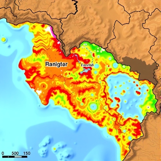
In their methodology, the researchers conducted an extensive review of environmental factors that influence groundwater availability in tropical lateritic terrains. These factors include topography, land use, soil types, rainfall patterns, and geological characteristics. Understanding the interplay among these variables is essential, as they collectively determine the distribution and abundance of groundwater. The study’s pioneering aspect lies in its application of self-organizing maps, which allow for the visualization of complex data patterns. This technique clusters data points to reveal underlying trends that might not be immediately apparent through conventional analysis.
Once the environmental data was collected and processed using self-organizing maps, the next step involved the integration of this information with the random forest algorithm. This machine learning model is particularly well-suited for predictive analytics, as it builds a multitude of decision trees during training and outputs the mode of the classes for classification problems. In this case, random forests were utilized to forecast potential groundwater zones based on the clustered data from earlier analyses.
The results of the study are not only promising but also crucial for policymakers and environmental managers. The groundwater potential maps generated by this study provide an invaluable resource for effective water resource management, especially in areas facing socio-economic pressures and climate variability. By pinpointing high-potential areas for groundwater extraction, stakeholders can make informed decisions that balance environmental sustainability with the increasing water demands of a growing population.
Moreover, the methodology proposed by Appukuttan and Reghunath presents a scalable model that can be applied to various regions across the globe. This flexibility is particularly beneficial as different terrains may present distinct challenges. The researchers’ use of machine learning allows for the adaptation of their models to account for local geological and ecological variations, making it a viable solution for groundwater mapping in diverse environments.
The significance of this research extends beyond mere data collection and mapping; it ushers in an era where technology can aid in sustainable development. As the global community grapples with issues like water scarcity and climate change, the techniques described in this study offer innovative pathways for resource management. By integrating cutting-edge technology with environmental science, the researchers take a significant step towards optimizing groundwater resource utilization.
In addition, the rigorous approach adopted in the study underscores the importance of interdisciplinary collaboration. Input from hydrologists, geologists, environmental scientists, and data analysts is crucial to enhance the accuracy of predictive models. It is this synergy of expertise that empowers researchers to delve deeper into understanding the intricate mechanisms governing groundwater availability.
As we ponder the implications of Appukuttan and Reghunath’s findings, it becomes increasingly evident that machine learning is not merely a trend but a transformative force in environmental studies. The ability to process and analyze large datasets in real-time equips researchers and decision-makers with the tools they need to anticipate challenges and craft effective strategies.
The implications for community-level water management are profound. Local governments can utilize the findings to prioritize areas for exploration or conservation efforts. Additionally, this work provides a foundation for further research, potentially inspiring additional studies that explore machine learning applications in other aspects of natural resource management.
Looking ahead, the future of groundwater resource management may very well hinge on the successful integration of technological innovations like those described in this study. As the world moves towards more sustainable practices, such advances will play a vital role in ensuring that this critical resource can meet the needs of populations and ecosystems alike. The study by Appukuttan and Reghunath is a critical step in this direction, paving the way for more robust and effective groundwater management strategies in a rapidly changing environment.
Ultimately, this research signifies a breakthrough in how we perceive and interact with groundwater resources. It challenges conventional approaches while promising a more data-driven, efficient methodology for resource mapping. As such, it sets a new standard for future studies, inspiring further exploration and application of machine learning techniques in environmental science.
While we continue to navigate the complexities of climate change and its impacts on water resources, studies like these embody hope and opportunity. They remind us that through innovation, we can address some of the most pressing challenges of our time.
Subject of Research: Machine learning techniques for groundwater potential mapping in tropical lateritic terrains.
Article Title: Machine learning-based groundwater potential mapping and factor analysis in tropical lateritic terrains using self-organizing maps and random forest.
Article References:
Appukuttan, A., Reghunath, R. Machine learning-based groundwater potential mapping and factor analysis in tropical lateritic terrains using self-organizing maps and random forest.
Environ Monit Assess 197, 1340 (2025). https://doi.org/10.1007/s10661-025-14779-9
Image Credits: AI Generated
DOI: https://doi.org/10.1007/s10661-025-14779-9
Keywords: Machine learning, groundwater potential mapping, self-organizing maps, random forest, environmental assessment.
