


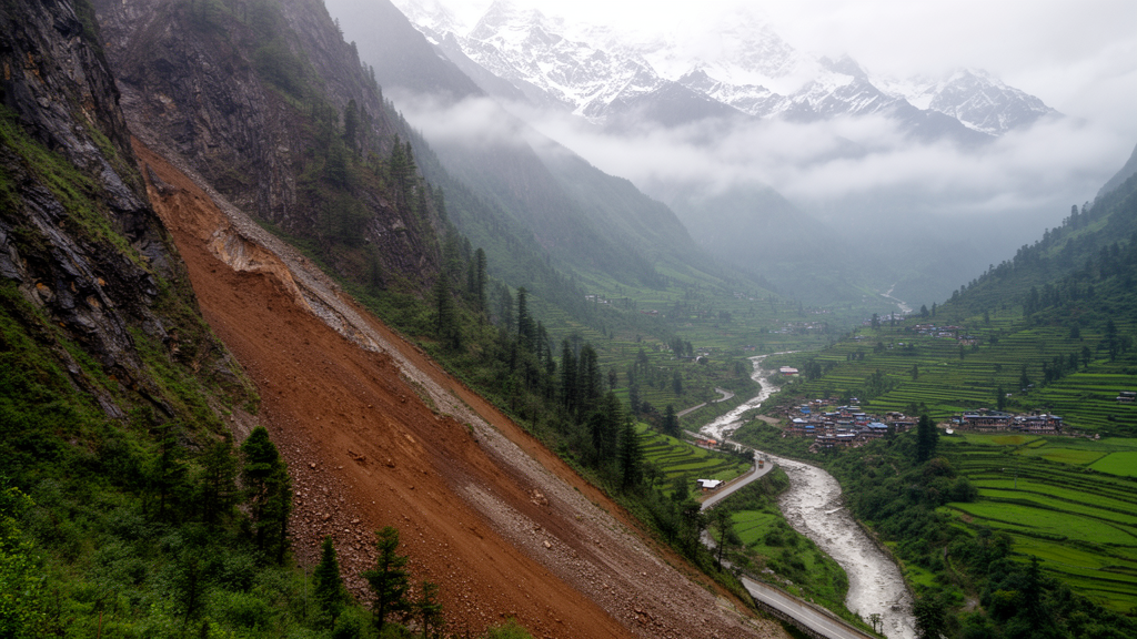
A new national-scale study published in Geoenvironmental Disasters demonstrates that climate change is primarily redistributing landslide susceptibility across the Nepal Himalaya rather than causing a uniform increase in extreme hazard zones. By integrating a Random Forest machine learning model with bias-corrected precipitation projections from the Coupled Model Intercomparison Project Phase 6 (CMIP6), researchers assessed how future climatic conditions might alter the spatial distribution of landslide risk and population exposure. The study, led by Tulasi Ram Bhattarai and Netra Prakash Bhandary, provides a comprehensive framework for evaluating how shifting precipitation patterns interact with static environmental factors to influence slope stability across the region.
The research addresses a significant gap in traditional landslide susceptibility assessments, which have typically relied on static environmental variables that do not account for future climatic shifts. With extreme precipitation expected to rise in both frequency and intensity due to climate change, the need for dynamic modeling has become critical. The team developed a Random Forest classification model using 13,912 historical landslide records and 15 geo-environmental predictors. These predictors included topographic, geological, anthropogenic, and hydrological variables, such as slope, elevation, lithology, and distance to faults. The model demonstrated strong predictive performance, achieving an area under the receiver operating characteristic curve (AUC) of 0.93, indicating high accuracy in distinguishing between landslide-prone and non-landslide areas.
To simulate future conditions, the researchers applied the model to precipitation projections under two Shared Socioeconomic Pathways: SSP2-4.5, representing intermediate emissions, and SSP5-8.5, representing high emissions. The projections were evaluated for two future periods: the near future, centered on 2040, and the far future, centered on 2085. The precipitation data were derived from an ensemble of 32 General Circulation Models and underwent bias correction using ground-based observations from 138 meteorological stations across Nepal. This correction process was essential to reduce systematic errors associated with coarse-resolution climate simulations, achieving a high coefficient of determination of 0.986 between corrected model outputs and observed rainfall patterns.
The results indicate that while the total area of high-susceptibility zones remains relatively stable, there is a significant spatial redistribution of risk. Under baseline conditions, approximately 21.9% of Nepal’s land falls within High to Very High susceptibility classes. However, under future climate scenarios, the Moderate susceptibility class expands consistently, particularly in the Siwalik belt and mid-hill regions. The Very Low and Low susceptibility classes tend to contract, while the High and Very High zones largely persist in historically unstable areas. This pattern suggests that climate change is modifying the spatial organization of susceptibility rather than amplifying extreme classes uniformly across the country.
CMIP6 projections show moderate increases in mean annual precipitation of 3–9% under the SSP2-4.5 scenario, with substantially larger increases of up to 24% under the SSP5-8.5 scenario. These changes in precipitation intensity and distribution are driving the observed shifts in susceptibility. The study highlights that the rainfall-landslide relationship is inherently nonlinear, meaning that increases in precipitation do not translate proportionally into increased susceptibility. Instead, the changes are concentrated in transition zones where modest increases in susceptibility coincide with densely populated and infrastructure-rich areas, leading to disproportionately higher risk in these specific locations.
Population exposure analysis reveals that climate change influences landslide risk primarily through the redistribution of exposure toward Moderate and High susceptibility classes. The study treated the population as spatially static across all scenarios to isolate hazard-driven changes from demographic growth or urban expansion. Under future climate scenarios, exposure in the Very Low susceptibility class decreases slightly, while exposure in the Moderate and High classes shows consistent gains. The maximum increase in population exposure within High-susceptibility zones is estimated at 4.1% under the SSP2-4.5 near-future scenario. These changes are spatially concentrated in the mid-hills and Siwalik belt, where even small increases in susceptibility can result in significant impacts on local communities and critical infrastructure.
The validation of the susceptibility maps using a dual framework based on landslide occurrence frequency and area confirms the robustness of the model. The Very High susceptibility class, which occupies only about 8.9–9.3% of the total area, contains more than 90% of landslide occurrences and over 70% of the total landslide area. This strong concentration of landslides in the highest susceptibility classes indicates that the model effectively captures the spatial distribution and relative concentration of hazards. The frequency ratio analysis further supports these findings, with values exceeding 9.7 for landslide counts in the Very High class, demonstrating a clear and physically meaningful correlation between susceptibility and actual landslide events.
Several limitations of the study are acknowledged by the authors. First, the susceptibility classes were derived using the Jenks natural breaks method, representing relative rather than absolute thresholds. Second, the population exposure assessment used a static dataset, which does not account for demographic dynamics such as population growth or urban expansion over time. Additionally, future land use and land cover changes were not considered, although these factors play a significant role in landslide occurrence. Precipitation was treated as the primary climatic driver, while other relevant factors such as snow cover, ground temperature, and antecedent soil moisture were not included due to data limitations. The CMIP6 precipitation data, while bias-corrected, represent long-term climatic forcing rather than event-scale triggers, and key controls such as rainfall intensity and duration were not fully captured.
Despite these limitations, the study offers valuable insights for long-term disaster preparedness and infrastructure planning in Nepal’s mountainous regions. The integration of machine learning with climate projections provides a robust framework for climate-sensitive landslide risk assessment. The model successfully captures both spatial variability and temporal changes in landslide susceptibility under future climate conditions. The findings highlight the importance of climate-informed susceptibility and exposure modeling for supporting resilient development in hazard-prone environments. By identifying both persistent high-susceptibility areas and emerging transition zones, the study provides a realistic and policy-relevant basis for climate-informed land-use planning and disaster risk reduction.
The research contributes to the growing body of literature on the intersection of climate change and geohazards. It demonstrates that at national scales, static terrain and geological controls tend to constrain aggregate susceptibility changes, while climate signals are primarily expressed through spatial reconfiguration. This perspective is consistent with recent large-scale studies from other mountainous regions, which have also observed that future susceptibility changes are typically modest in magnitude but significant in their spatial distribution. The study’s unified framework, combining bias-corrected climate projections, machine learning-based susceptibility modeling, and exposure assessment, offers a transferable approach for assessing landslide risk in other mountainous regions facing similar climatic challenges.
The study’s methodological approach distinguishes between landslide susceptibility and hazard, a critical nuance for interpreting the results. Susceptibility refers to the spatial propensity for landslide occurrence, controlled by intrinsic environmental factors such as topography, geology, and land cover. In contrast, hazard incorporates the temporal probability of triggering events, such as extreme rainfall. By incorporating CMIP6-derived precipitation as a conditioning factor, the model evaluates how changing climate regimes may modify susceptibility patterns rather than explicitly predicting event-based hazard occurrence. This distinction ensures that the output reflects changes in susceptibility under evolving climatic conditions, avoiding the direct prediction of landslide-triggering events that would require different temporal data.
Feature importance analysis using SHapley Additive exPlanations (SHAP) identified rainfall, slope, elevation, and distance to faults as the dominant predictors of landslide susceptibility. Rainfall reflects large-scale climatic forcing, while slope and elevation represent primary terrain controls, with higher susceptibility associated with steeper and low- to mid-elevation areas. Geological factors also exert a strong influence, whereas vegetation and land-surface variables contribute secondary effects. These patterns are physically consistent and support the robustness of the Random Forest model, which outperformed other algorithms such as Gradient Boosting, Support Vector Machine, Logistic Regression, Naïve Bayes, and k-Nearest Neighbors in cross-validation tests.
The selection of conditioning factors was rigorously evaluated to ensure model stability. Multicollinearity among the 15 selected variables was assessed using Pearson correlation matrices and Variance Inflation Factor (VIF) values. No variable pair exceeded the commonly accepted threshold of |r| > 0.8, and all VIF values remained well below the critical threshold of 10, confirming that the predictors are sufficiently independent. This lack of redundancy ensures that the model does not overfit due to correlated inputs, allowing for a comprehensive representation of topographic, hydrological, geological, vegetation, and anthropogenic controls on landslide occurrence in the Nepal Himalaya.
The spatial distribution of baseline susceptibility aligns with known geological and topographic vulnerabilities. High and Very High susceptibility zones are primarily concentrated along the Siwalik range, mid-hill belt, and parts of the eastern Himalaya. These areas are characterized by steep slopes, weak lithology, dense drainage networks, and intense monsoon rainfall. The persistence of these high-susceptibility zones across all future scenarios highlights the dominant influence of relatively stable terrain and geological controls. While climate change drives spatial redistribution, it does not override the fundamental constraints imposed by the region’s geology and topography, which remain the primary determinants of where landslides are most likely to occur.
Seasonal precipitation indices were analyzed to contextualize the projected hydroclimatic changes. The data indicate substantial increases in monsoon and post-monsoon precipitation, particularly in the far future, with increases exceeding 30–60% in some regions. Maximum seasonal and annual precipitation values also show a consistent increase, especially under the SSP5-8.5 scenario. These results suggest an intensification of the hydrological regime in Nepal, providing increased hydroclimatic forcing relevant to landslide processes. The bias correction process, which achieved a coefficient of determination of 0.986, ensures that these projections are consistent with observed spatial patterns, reducing the risk of artificial spatial detail introduced by coarse-resolution climate models.
The study’s findings are consistent with recent large-scale research from other mountainous regions, including Iran and Italy, where susceptibility changes under future climate scenarios were typically modest in magnitude but involved clear spatial redistribution. This global pattern suggests that at broad spatial scales, static terrain and geological controls tend to constrain aggregate susceptibility changes, while climate signals are primarily expressed through spatial reconfiguration. The nonlinear relationship between rainfall and landslide susceptibility further explains the absence of large national-scale increases, as intense or prolonged rainfall may enhance erosion or material depletion rather than uniformly increasing instability. This context reinforces the importance of focusing on transition zones for risk management and planning.
Subject of Research: Integration of machine learning model and CMIP6 analysis for climate change impact-led landslide susceptibility and population exposure assessments in the Nepal Himalaya
Article Title: Integration of machine learning model and CMIP6 analysis for climate change impact-led landslide susceptibility and population exposure assessments in the Nepal Himalaya
Article References: Bhattarai, T. R., & Bhandary, N. P. (2026). Integration of machine learning model and CMIP6 analysis for climate change impact-led landslide susceptibility and population exposure assessments in the Nepal Himalaya. Geoenvironmental Disasters, 13(1), Article 30. https://doi.org/10.1186/s40677-026-00382-8
Image Credits: AI Generated
DOI: 10.1186/s40677-026-00382-8
Keywords: Integration, machine, learning, model, CMIP6, analysis, climate, change, impact-led, landslide, susceptibility, population
Cite Scienmag News
Teresa Odom. (November 11, 2026). Machine Learning Maps Climate-Driven Landslide Risk in Nepal. Scienmag. https://scienmag.com/machine-learning-maps-climate-driven-landslide-risk-in-nepal/
Teresa Odom. "Machine Learning Maps Climate-Driven Landslide Risk in Nepal." Scienmag, 11 November 2026, https://scienmag.com/machine-learning-maps-climate-driven-landslide-risk-in-nepal/. Accessed 11 November 2026.
Teresa Odom. "Machine Learning Maps Climate-Driven Landslide Risk in Nepal." Scienmag. November 11, 2026. https://scienmag.com/machine-learning-maps-climate-driven-landslide-risk-in-nepal/




