


Tokyo, a sprawling megacity of over 37 million residents, faces a persistent and formidable threat from earthquakes due to its location on one of the most seismically active zones in the world. Among the many dangers posed by these seismic events, soil liquefaction stands out as an insidious phenomenon with the potential to inflict catastrophic damage. Soil liquefaction occurs when saturated and loosely packed soil momentarily loses its strength during intense shaking, effectively transforming solid ground into a fluid-like state. This sudden weakening can lead to severe ground deformation, jeopardizing buildings, infrastructure, and human lives. Dramatic events such as the 1995 Great Hanshin-Awaji Earthquake, the 2011 Great East Japan Earthquake, and the more recent 2024 Noto Peninsula Earthquake have all underscored the devastating impact of liquefaction in Japan.
Despite the well-documented risks, current approaches to assessing soil liquefaction hazards in urban environments like Tokyo are hindered by insufficient data resolution and oversimplified modeling techniques. Traditional hazard maps rely heavily on geostatistical methods paired with limited borehole data points, resulting in coarse maps with grid sizes typically no finer than 500 meters. This resolution inadequacy is especially problematic in geographic areas characterized by heterogeneous subsurface geology, such as Tokyo’s expansive reclaimed coastal areas and sediment-filled river floodplains. Such conditions demand more sophisticated approaches that can precisely capture rapid spatial variability in soil layers and characteristics.
Responding to this urgent need, researchers at Shibaura Institute of Technology (SIT), led by Professor Shinya Inazumi, have developed a groundbreaking methodology that leverages artificial neural networks (ANNs) to produce high-resolution, three-dimensional liquefaction hazard maps of Tokyo at a remarkable 200-meter grid scale. The work, recently published in the journal Results in Engineering, represents a significant leap forward by integrating extensive geotechnical borehole data within machine learning frameworks to unify geological modeling and hazard assessment. This fusion of traditional engineering data with cutting-edge AI algorithms has opened new frontiers for proactive earthquake risk management.
The innovative ANN model was trained on a massive dataset consisting of 13,926 borehole records, making it one of the largest machine learning applications in geotechnical hazard analysis undertaken in Japan. These borehole samples provided crucial information about soil stratigraphy, soil types, and Penetration Test N-values—an indicator widely used to measure soil density and strength. Machine learning’s ability to ingest and learn from this voluminous dataset allowed the researchers to interpolate soil properties across unsampled locations throughout the Tokyo metropolitan region, ensuring highly detailed spatial coverage relevant for urban planners and hazard mitigation specialists.
A key advantage of the ANN-based approach is its capacity to model nonlinear relationships within complex subsurface conditions—something traditional linear geostatistical methods often fail to capture with precision. Their model surpassed both classic techniques and alternative machine learning methods, achieving superior regression accuracy when predicting N-values and classifying soil types. This enables the creation of refined maps depicting nuanced changes in subsurface geology that are critically important in understanding and predicting liquefaction susceptibility.
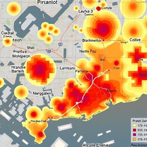
Leveraging these predictive outputs, the team calculated liquefaction potential indices, enabling a quantitative assessment of hazard levels at unprecedented spatial detail. The resulting hazard maps vividly delineate high-risk zones, particularly in Tokyo’s reclaimed coastal regions and river basins vulnerable to liquefaction during seismic events. One notable example is Koto Ward—an area previously underestimated in conventional hazard assessments but precisely flagged as a hotspot of liquefaction risk through this novel modeling framework.
This enhanced mapping precision offers considerable practical benefits. It equips urban planners, architects, and civil engineers with vital data to make informed decisions related to foundational design, site selection, and soil reinforcement strategies tailored to localized hazards. Moreover, the researchers emphasize the model’s scalability and adaptability, suggesting it can be integrated with geographic information system (GIS) platforms for interactive and dynamic hazard visualization. This holds promise for bolstering public awareness campaigns and disaster prevention programs by providing clear, accessible hazard interpretations to residents and policymakers alike.
Professor Inazumi highlights the broader implications of the study, stating that their research “offers a robust, scalable model that not only enhances earthquake risk management in Tokyo but also serves as a transferable methodology for other megacities facing similar geohazard challenges worldwide.” Indeed, many global urban centers located in seismic zones with complex geological settings can benefit from adopting such advanced AI-driven approaches to urban resilience.
While primarily focused on machine learning and computational modeling, this study underscores a crucial paradigm shift in disaster risk assessment: the integration of big data and AI to overcome traditional limitations of geotechnical investigations. By harnessing the power of artificial intelligence, the research significantly reduces uncertainties and enhances predictive accuracy, paving the way for the development of safer cities through science-informed planning.
In addition to its technical accomplishments, the research from SIT is a testament to the value of interdisciplinary collaboration between geoscientists, engineers, and computer scientists. Professor Inazumi’s extensive expertise in geotechnical and geo-disaster engineering combined with innovative data science methods exemplifies how cross-domain knowledge can drive breakthroughs in understanding and mitigating natural hazards.
The implications of this research extend beyond Tokyo, offering a model blueprint for urban centers worldwide confronting seismic soil hazards. In a world increasingly challenged by urban population growth, climate change, and evolving geotechnical risks, such pioneering work represents a critical stride toward resilient and sustainable development.
Ultimately, the fusion of geotechnical engineering with artificial neural networks demonstrates the transformative potential of AI technologies in natural disaster mitigation—turning abundant raw data into actionable insights that protect lives and infrastructure. As global urban populations continue to expand in seismically active regions, adopting advanced tools like this one will be essential to safeguarding the cities of tomorrow.
News Publication Date: 12-Sep-2025
References: DOI: 10.1016/j.rineng.2025.107262
Cite Scienmag News
Violet Maxwell. (September 30, 2025). Machine Learning Enhances Earthquake Risk Maps for Tokyo. Scienmag. https://scienmag.com/machine-learning-enhances-earthquake-risk-maps-for-tokyo/
Violet Maxwell. "Machine Learning Enhances Earthquake Risk Maps for Tokyo." Scienmag, 30 September 2025, https://scienmag.com/machine-learning-enhances-earthquake-risk-maps-for-tokyo/. Accessed 6 September 2026.
Violet Maxwell. "Machine Learning Enhances Earthquake Risk Maps for Tokyo." Scienmag. September 30, 2025. https://scienmag.com/machine-learning-enhances-earthquake-risk-maps-for-tokyo/


