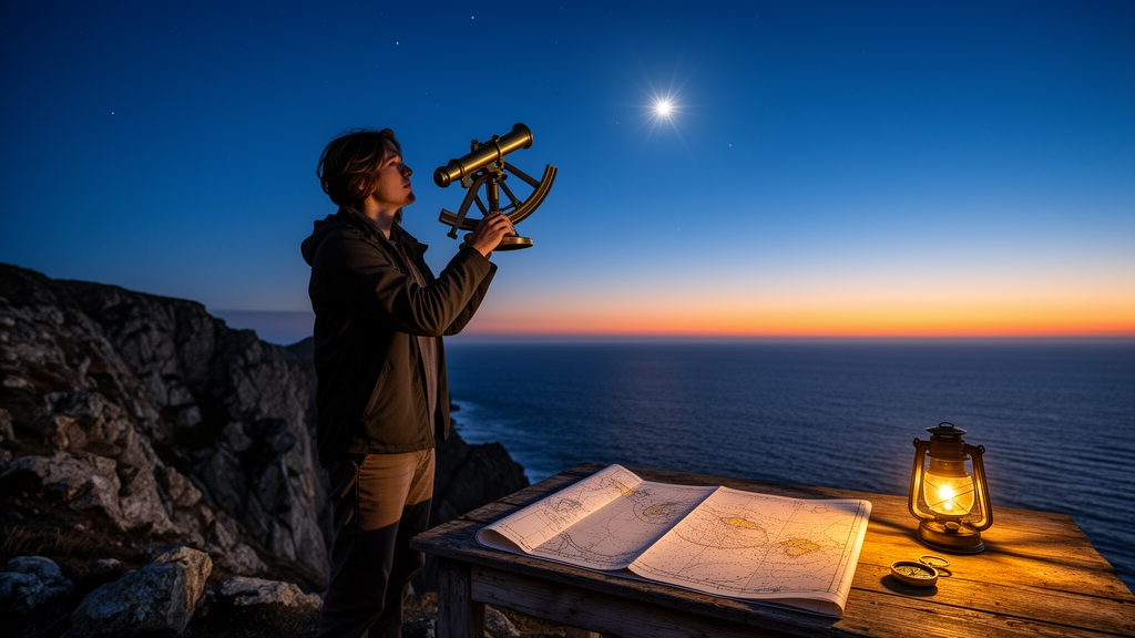
The study, published as an open-access original article in AAPPS Bulletin on 30 December 2025, describes what the authors call the “Rami Model,” a set of equations that converts the horizontal coordinates of any celestial body with known motion into precise geographic coordinates for the observer.
The core idea is elegantly simple in principle but demanding in execution. Every celestial body sits directly above exactly one point on Earth’s surface at any given moment — its zenith point. If an observer measures the altitude and azimuth of, say, the Sun or a bright star, and knows that object’s equatorial coordinates (right ascension and declination) at that instant, spherical trigonometry can bridge the two reference frames. The authors derive the observer’s longitude from the relationship between sidereal time and right ascension, then solve for latitude using the sine rule and Napier’s analogies applied to a spherical triangle connecting the observer, the north pole, and the celestial body’s zenith point. Where the direct cosine formula would require numerical iteration, the team shows it can be solved with Python’s “fsolve” function from the SciPy library.
What makes the method genuinely practical is that it works in broad daylight. Because the Sun casts shadows, its horizontal coordinates can be exploited during daytime hours: the solar azimuth angle and its corresponding shadow direction (360 degrees minus the azimuth) serve as a reference line on the horizon. The researchers demonstrated this from Cairo, with approximate coordinates of 30 degrees north, 30 degrees east, calculating the direction of Makka — whose latitude and longitude were taken as 21.4225 degrees and 39.8262 degrees — both from the Sun’s shadow and from true north, and additionally using the directions of visible planets.
Determining directions is where the model may prove most immediately useful. Because azimuth is defined as the clockwise angle of a celestial body from geographic north, measuring any body’s azimuth instantly reveals true north — the deviation is simply the negative of the azimuth. From there, any desired direction on Earth can be expressed as the difference between the target bearing and the celestial body’s azimuth, with positive values indicating a turn to the right and negative values a turn to the left. Notably, the authors point out that atmospheric refraction correction is unnecessary for this purpose, since refraction displaces only the altitude, not the azimuth angle, of the observed object.
The paper situates the method against the well-known shortcomings of existing alternatives. Polaris, the classic pole star, cannot be seen from the Southern Hemisphere, sits slightly offset from the true celestial pole, and drifts over long timescales due to precession, nutation, and parallax — indeed, during the era of the ancient Egyptians, Thuban (alpha Draconis) served as the pole star instead. Magnetic compasses suffer from magnetic declination that shifts over time, electromagnetic interference from nearby metals and electronics, vibration errors, and space-weather influences such as the solar wind. Correction models like the Kalman Filter and the World Magnetic Model help, but require continuous updates. Global Navigation Satellite Systems — GPS, BDS, BeiDou, Galileo, and GLONASS — are accurate but extraordinarily costly to develop and maintain, and their signals can be degraded by environmental conditions or deliberately restricted by manufacturers.
Beyond point navigation, the team developed a full sky-mapping capability. Using an equidistant (linear) projection, they convert altitude and azimuth into Cartesian pixel coordinates on a two-dimensional circle simulating the visible hemisphere, excluding any objects below the horizon. A second, vertical sky map simulates what an observer sees facing any chosen direction, retaining celestial bodies within 90 degrees of the target bearing and applying either a “relative distance preservation” method or the Shirley-Chiu transformation to convert square coordinate grids into a circular sky view. In a demonstration, the researchers generated a sky map toward the Qibla from Cairo at 11:17:19 on May 3, 2025, showing that any bright star lying along the great circle connecting the zenith to the target direction can serve as a guidepost — amateurs can orient directly toward it, while specialists can compute the precise angular deviation.
The study’s second major contribution addresses solar energy hardware. Existing solar trackers, whether built on light-dependent resistor sensors or astronomical calculations, do not reliably yield true geographic directions or the Sun’s exact altitude and azimuth. The authors propose a new device built entirely from photovoltaic cells, exploiting the physical principle that a PV cell generates maximum current when sunlight strikes it perpendicularly, with output falling as the cosine of the incidence angle. Because real-world current includes diffuse sky radiation and ground-reflected albedo radiation that vary with weather, the team folds these into a single “sky current” term, approximated by the smallest current reading among the cells. Under cloudy, isotropic diffuse conditions, differently oriented cells produce currents differing by less than 5 percent, consistent with published diffuse-radiation behavior.
The proposed geometry is striking: at least three panels arranged in a pyramidal shape, or five in a cubic configuration, each tilted at a fixed predetermined angle — 90 degrees for the cube — with identical surface areas and therefore identical maximum currents. For even better coverage, the authors favor a geodesic dome tiling of triangular cells with tilt angles around 18 degrees, reducing blind spots. The first panel must be aligned to true geographic north to anchor the azimuth determination. From the ratio of currents between adjacent panels, a system of equations emerges that can be solved numerically — via least-squares fitting, the Levenberg–Marquardt algorithm, fsolve, or Newton–Raphson — to recover the Sun’s altitude and azimuth. The result, the authors write, is real-time, hardware-independent Sun tracking suitable for embedded systems and photovoltaic performance monitoring.
The authors are candid about the method’s precision limits. Accurate coordinate calculation demands the celestial body’s true position, corrected for proper motion, precession, nutation, polar motion, aberration, and atmospheric refraction — the last being most pronounced near the horizon, where refraction can lift the apparent position of the Sun or Moon by more than half a degree. Corrections depend on atmospheric pressure, temperature, and elevation above sea level, and calculations grow more accurate as the observed body climbs higher in the sky. Because the computed geographic coordinates at a given epoch are not aligned with the International Terrestrial Reference Frame, they theoretically require a polar-motion correction, whose omission introduces deviations at the sub-arc-second level. Equatorial coordinates can alternatively be pulled from ephemeris models such as Astropy or JPL Horizons, though the authors report that feeding observed altitude and azimuth directly into their equations yields the most precise results.
The potential applications span engineering, religion, and wilderness survival. Astronomical observatories cannot function without the north–south alignment; masjids must face the Qibla direction toward the Holy Kaaba in Makka; some churches require an eastward orientation; and healthy, sustainable buildings must be oriented with respect to both sunlight and prevailing winds. Scouts, hikers, and amateur astronomers — anyone who may find themselves without a working GPS signal or a trustworthy compass — gain a free, always-available fallback written in the sky itself. The Python source code behind the study has been released on GitHub under the name “ground based navigation,” inviting anyone with a clear view of the heavens to test the mathematics for themselves. As the authors emphasize, the method is time-dependent — the sky’s reference frame shifts continuously — but that very motion is what makes it a clock, a compass, and a map all at once.
Subject of Research: A mathematical model and photovoltaic device for ground-based celestial navigation and solar incidence-angle measurement
Article Title: The ground-based navigations and solar incidence angle
Article References: Eltohamy, I., Mahdy, M. R., Mawad, R., Abdul Rahim, A. R., Ali, A., & Owis, A. H. (2025). The ground-based navigations and solar incidence angle. AAPPS Bulletin, 35(1), Article 38. https://doi.org/10.1007/s43673-025-00168-4
Image Credits: AI Generated
DOI: 10.1007/s43673-025-00168-4
Keywords: celestial navigation, geographic coordinates, solar azimuth, photovoltaic cells, GNSS-free positioning, sky maps, spherical trigonometry, solar trackers, Qibla direction, atmospheric refraction, sidereal time, AAPPS Bulletin
Cite Scienmag News
Grant Pearson. (October 30, 2026). Lost Without GPS? New Celestial Math Finds Your Position Using the Sun and Stars. Scienmag. https://scienmag.com/lost-without-gps-new-celestial-math-finds-your-position-using-the-sun-and-stars/
Grant Pearson. "Lost Without GPS? New Celestial Math Finds Your Position Using the Sun and Stars." Scienmag, 30 October 2026, https://scienmag.com/lost-without-gps-new-celestial-math-finds-your-position-using-the-sun-and-stars/. Accessed 30 October 2026.
Grant Pearson. "Lost Without GPS? New Celestial Math Finds Your Position Using the Sun and Stars." Scienmag. October 30, 2026. https://scienmag.com/lost-without-gps-new-celestial-math-finds-your-position-using-the-sun-and-stars/