


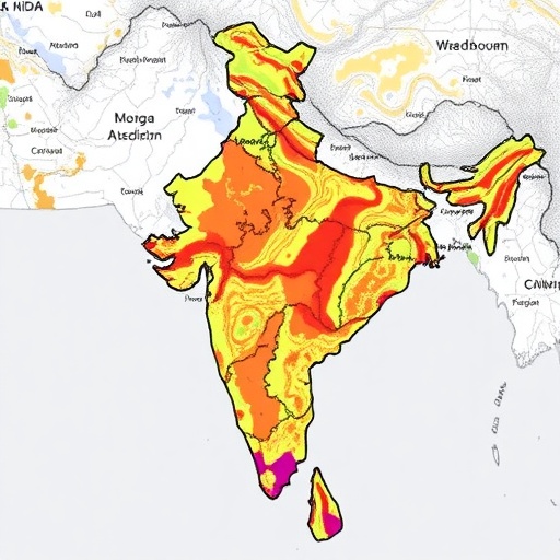
In a groundbreaking study that fuses cutting-edge geospatial analytics with the transformative capabilities of eXplainable Artificial Intelligence (XAI), researchers Shetkar, Das, Desai, and their colleagues have unveiled an unprecedented landslide susceptibility map for the western coastal districts of India. This remarkable advancement, published in Environmental Earth Sciences, volume 84, heralds a new era in natural disaster risk assessment by ingeniously combining spatial datasets with transparent AI modeling techniques. The study not only pinpoints vulnerable zones with remarkable precision but also demystifies the decision-making processes of AI models, promising to revolutionize how disaster preparedness and land-use planning address the ever-looming threats posed by landslides.
The Indian western coastline, stretching along the Arabian Sea, is characterized by its complex geomorphology, varied climatic patterns, and a patchwork of geological formations susceptible to landslide occurrences. Historically, this region has witnessed devastating landslides resulting from monsoonal rains, seismic activities, and anthropogenic interventions such as deforestation and unregulated construction. Traditional hazard mapping techniques have struggled to capture the multidimensional interplay of these factors. However, the integration of sophisticated geospatial data layers, ranging from topographic variables to soil properties and rainfall intensity, paired with interpretative AI models, offers a systemic approach to unraveling these complexities.
At the core of this study lies the use of eXplainable Artificial Intelligence—an emergent subset of AI research focused on transparency and interpretability. While conventional machine learning models often operate as "black boxes," producing predictions without intelligible rationale, XAI elucidates the reasoning pathways behind each prediction. This transparency is crucial when decisions influence public safety and infrastructure development. The authors leveraged this technology to create a landslide susceptibility model that policymakers and local authorities can trust, assess, and deploy with confidence, paving the way for data-driven mitigation strategies.
To generate their susceptibility map, the research team first amassed a diverse compendium of spatial datasets. These included Digital Elevation Models (DEMs) depicting topographic gradients, lithological maps outlining rock types, land-use and land-cover (LULC) datasets, soil texture classifications, rainfall intensity and distribution patterns, and historical landslide inventory records. Each dataset was carefully pre-processed and standardized, ensuring compatibility and reducing uncertainties commonly encountered in multi-source geospatial modeling.
The methodological innovation arises from the fusion of these geospatial layers via an Ensemble Learning framework augmented by XAI methods. Ensemble Learning amalgamates the strengths of multiple machine learning algorithms, thereby enhancing predictive accuracy and robustness compared to singular models. Simultaneously, the researchers implemented Shapley Additive Explanations (SHAP) to attribute and rank the influence of individual factors on landslide susceptibility, thereby revealing the underlying drivers of slope instability in an intuitive manner.
Applying this combined approach, the model identified slope steepness, rainfall intensity, and soil texture as the triad of dominant contributors to landslide risk in the western coastal districts. Steeper slopes exhibited significantly elevated susceptibility, corroborating the classical geomorphological understanding that gravitational pull intensifies failure potential. Moreover, seasonal monsoon rains were found to modulate risk dynamically, underscoring the need for temporal-aware hazard assessments. These insights not only confirm empirical knowledge but also quantitatively establish the weight of each factor in triggering landslides.
Apart from validating known causes, the model uncovered surprising interactions among environmental variables. For instance, the presence of certain soil types in conjunction with moderate slopes amplified susceptibility more than previously anticipated. This nuanced interdependence highlights the inadequacy of linear heuristics in hazard prediction and demonstrates the strength of AI models in uncovering complex, nonlinear relationships.
The geospatial visualization outputs from the study provide a continuous susceptibility gradient, delineating high-risk zones that demand immediate attention for disaster mitigation measures such as slope reinforcement, afforestation, and early warning systems. These susceptibility maps enable planners to optimize resource allocation by prioritizing critically vulnerable areas, thereby reducing economic losses and safeguarding human lives. Furthermore, the transparent nature of the XAI models facilitates stakeholder engagement by allowing non-specialists to comprehend the basis of risk classification, enhancing community resilience.
This research also accentuates the evolving paradigm in geohazard science where interdisciplinarity drives innovation. By combining remote sensing technology, geoinformatics, geology, and artificial intelligence within a transparent framework, the authors exemplify how scientific collaboration transcends traditional disciplinary boundaries. Their rigorous analytical pipeline—from data acquisition, preprocessing, AI model training, to explainability assessment—sets a new benchmark for geospatial hazard studies worldwide.
The implications of this research extend beyond the immediate geographic focus. Coastal regions across the tropics face similar challenges linked to steep topography, intense precipitation, and human encroachment. Consequently, the methodologies and insights generated in this study could be adapted to other vulnerable regions, fostering global advancements in landslide risk mapping. As climate change intensifies weather extremes, such predictive tools become indispensable components of disaster risk reduction strategies.
Moreover, the incorporation of eXplainable AI addresses an often-overlooked challenge in applying AI for natural hazards: the lack of interpretability undermines trust and operational acceptance. By illuminating how each factor causally influences risk predictions, Shetkar and colleagues enable transparent knowledge transfer and iterative model refinement—crucial prerequisites for long-term monitoring and management applications.
From a technical standpoint, the study also makes important contributions to the geospatial data science community. Their approach addresses common data challenges, including multicollinearity among input variables, spatial autocorrelation, and data sparsity in landslide occurrence points. By employing robust feature selection and validation strategies, the model ensures generalizability, mitigating the risk of overfitting and enhancing reliability across spatial scales.
The publication rigorously details the performance metrics of the developed models, reporting high values in Area Under the Curve (AUC), precision, recall, and F1-score. This robust validation framework was complemented by spatial cross-validation schemes to ensure stability and replicability of results—critical for credible scientific outcomes. The model’s success attests to the promising synergy between explainable AI paradigms and geospatial hazard modeling.
In sum, this pioneering work offers a crucial synthesis of technological innovation, scientific rigor, and practical applicability. It stands as a beacon for future multidisciplinary endeavors seeking to harness AI’s potential for environmental hazard assessment while maintaining transparency and accountability. The impact of such research is profound, promising safer human settlements, smarter infrastructure design, and enhanced climate resilience in landslide-prone regions of India and potentially beyond.
As the scientific community continues to grapple with the dual challenges of increasing natural disasters and burgeoning data complexity, the work by Shetkar, Das, Desai et al. forms a vital cornerstone for integrating machine intelligence with earth system sciences. Their holistic, transparent AI-assisted workflow aligns perfectly with the urgent need for actionable intelligence, empowering governments and communities to navigate the precarious terrain of climate change and geological hazards.
Looking forward, the research suggests intriguing avenues for enhancement such as incorporating real-time monitoring data from IoT sensors, advancing temporal predictive modeling, and integrating socio-economic vulnerability indices. Such expansions could amplify the utility of landslide susceptibility maps into comprehensive risk assessment frameworks, fostering truly holistic disaster management approaches.
Ultimately, this fusion of geospatial methodologies and eXplainable AI not only enhances our understanding of landslide dynamics but also democratizes access to critical information, equipping all stakeholders with the knowledge required to foster resilience in the face of evolving natural threats. The map that emerges from this study is more than cartography—it is a roadmap toward safer futures shaped by insight, transparency, and innovative science.
Shetkar, D.A., Das, B., Desai, S. et al. Landslide susceptibility mapping for western coastal districts of India using geospatial techniques and eXplainable artificial intelligence.
Environ Earth Sci 84, 327 (2025). https://doi.org/10.1007/s12665-025-12343-9
Cite Scienmag News
Violet Maxwell. (May 27, 2025). Landslide Mapping in Western India Using AI. Scienmag. https://scienmag.com/landslide-mapping-in-western-india-using-ai/
Violet Maxwell. "Landslide Mapping in Western India Using AI." Scienmag, 27 May 2025, https://scienmag.com/landslide-mapping-in-western-india-using-ai/. Accessed 4 September 2026.
Violet Maxwell. "Landslide Mapping in Western India Using AI." Scienmag. May 27, 2025. https://scienmag.com/landslide-mapping-in-western-india-using-ai/


