


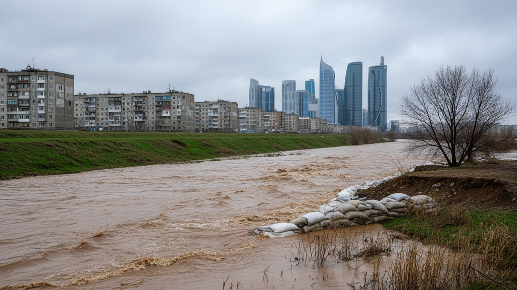
Every spring, melting snow transforms the rivers of Central Kazakhstan from docile streams into destructive torrents, and nowhere is this annual threat more acute than in the Nura River basin. A new study published in Frontiers in Water has now delivered the most comprehensive quantitative assessment to date of the flood hazard in this 978-kilometer-long river system, combining nearly nine decades of hydrological records with engineering analysis of reservoirs, channels, and a little-known hydraulic quirk that could send floodwater directly toward the outskirts of Kazakhstan’s capital, Astana. The findings suggest that the region’s existing defenses are fundamentally mismatched with the scale of the danger.
The research team, drawn from the L.B. Goncharov Kazakh Automobile and Road Institute and the Kazakh National Agrarian Research University, confronted a basin that is almost perfectly engineered to produce floods. The Nura drains a catchment of roughly 58,100 square kilometers in a sharply continental climate where snowmelt dominates the hydrological cycle. Between 80 and 90 percent of the river’s annual runoff arrives during the brief spring flood period, creating short, violent pulses of water rather than the gradual rises seen in rain-fed river systems. Its floodplain stretches 10 to 15 kilometers wide in places, and during spring inundation, water depths can reach 1.5 to 3 meters across land that in summer appears safely above any river’s reach.
To translate this hazard into engineering numbers, the researchers applied the Kritsky–Menkel frequency-analysis method, a three-parameter gamma distribution framework that remains the standard tool in hydrological practice across Kazakhstan and other former Soviet states. They assembled records from gaging stations such as Sheshenkara and Sergiopolskoye, which have been operating since the 1930s, and the Romanovskoye station, whose measurements began in 1916. Because the Irtysh–Karaganda Canal, commissioned in 1975, has been adding up to 130 million cubic meters of water annually to the Nura and thereby altering the river’s regime, the team treated the combined 90-year record as an integrated historical dataset spanning both natural and regulated conditions, a choice they openly acknowledge as a methodological compromise.
The design flood estimates that emerged are sobering. For a 1 percent exceedance probability, the so-called hundred-year flood, the study calculates peak spring discharges of 752 cubic meters per second at Sheshenkara, 1,220 cubic meters per second at Sergiopolskoye, and a staggering 2,360 cubic meters per second at Romanovskoye, near the bifurcation zone. At Romanovskoye, this design flood is nearly five times the long-term average maximum discharge of just 502 cubic meters per second. The volumes are equally imposing: the 1 percent spring flood carries 600 million cubic meters of water past Sergiopolskoye and 1.62 billion cubic meters past Romanovskoye. The team validated their chosen distribution against generalized extreme value and lognormal alternatives using Kolmogorov–Smirnov and Anderson–Darling statistics along with Akaike and Bayesian information criteria, and found the Kritsky–Menkel framework held up well at most stations, though the choice of probability model matters increasingly in the rare-event tail that matters most for protection design.
Perhaps the study’s most striking conclusion is how little the basin’s reservoir network can actually do about these floods. The Nura basin contains 25 reservoirs of varying size and regulation type, but their combined storage is dwarfed by the flood volumes arriving each spring. The 1 percent design flood volume at Romanovskoye alone, 1.62 billion cubic meters, exceeds what the entire reservoir system, including the Sherubaynura, Samarkand, and Intumak reservoirs, can meaningfully absorb. Even the more modest 10 percent flood volume of 870 million cubic meters overwhelms available active storage. During rare extreme events, the reservoirs may blunt flood peaks temporarily, but the bulk of the water must simply pass downstream, and where it goes next is the crux of the region’s flood problem.
That destination is the Nura–Ishim bifurcation zone, a roughly 20-kilometer stretch where the two river systems are hydraulically connected through low-lying terrain and a network of distributary channels named Sarkyrama, Kozgosh, and Mukyr. The watershed separating the rivers is alarmingly low: its lowest points rise just 1.5 to 2 meters above the Nura’s low-water level, while spring flood stages at Romanovskoye can exceed 5 meters. An embankment raised in 1974 to about 3 meters at the Sarkyrama distributary entrance was meant to hold the line, but the study estimates that overflow into the Ishim basin begins once the Nura reaches roughly 800 cubic meters per second, with a plausible range of 750 to 850 cubic meters per second. That threshold, notably, is lower than the 10 percent design flood at Romanovskoye, meaning hydraulic connection between the basins can begin well before a flood is even considered rare.
History bears this out. Records and residents’ accounts confirm that Nura water entered the interfluve in 1928, 1941, 1945, 1948, 1949, 1960, 1972, 1988, 1990, 1991, 1993, 1996, 2001, and 2002. During the 1972 flood, when the maximum recorded discharge at Romanovskoye hit 1,064 cubic meters per second, the interfluve was predominantly inundated by Nura water. The arithmetic of an extreme event is what concerns the researchers most: under a 0.1 percent exceedance probability scenario, daily inflow from the Nura into the interfluve could reach about 350 million cubic meters, while the Ishim River downstream of Astana can convey only roughly 100 to 150 million cubic meters per day due to the Ishim hydraulic complex within the city. The interfluve itself can store around 400 million cubic meters, so in a severe event the system saturates within days, and the surplus backs up toward the southwestern and western districts of the capital.
The spring flood of 2024 provided a live demonstration of the mechanism. Overtopping occurred simultaneously at multiple locations: water levels exceeded bank elevations in the upstream pool of the Samarkand Reservoir, and flooding below the dam inundated the villages of Chkalovo, Gagarinskoye, Andronikovo, Tengizhol, Rostovka, and Bereznyaki. Near the under-construction Intumak Reservoir, calculated maximum flood levels were also exceeded, flooding Intumak, Prudy, Samarskoye, and other settlements. Emergency authorities in Karaganda Region list dozens of settlements across Abay, Bukhar-Zhyrau, and Shet districts as flood-risk zones, along with critical highway sections including parts of the Karaganda–Balkhash and Pavlodar–Kyzylorda routes. Beyond the damage to property and transport, the study documents ecological costs: abrupt pulse releases from the Alva liman system drown fish eggs and larvae stranded on flooded meadows, while receding waters strand adult fish in oxbows that freeze solid in winter.
To chart a way forward, the authors turned to Austrian flood-risk management, widely regarded as a model of integrated practice. Austria’s approach does not attempt to wall floods entirely out of the landscape; instead, it treats embankments, reservoirs, managed floodplains, and designated retention basins as components of a single basin-scale redistribution system. The Krems-Au flood retention basin, for example, is deliberately reserved as an inundation zone activated when flows exceed defined thresholds, with land-use restrictions legally binding the territory to that purpose. The contrast with the Nura basin is stark: the Nura–Ishim interfluve already performs the hydrological function of a retention zone, absorbing up to 400 million cubic meters, but it does so without operational rules, formal designation, or spatial planning controls. The difference, the study argues, lies not in hydrological potential but in institutionalization.
The proposed remedy for the Nura basin is accordingly threefold. Earth embankments should be constructed and upgraded to withstand floods of 1 percent exceedance probability or rarer, but designed with controlled overflow sections that release excess water in a managed way rather than failing catastrophically. Vulnerable channel reaches should receive riprap bank protection to resist erosion and wave action during high flows. And mobile water-filled barriers should be stockpiled for rapid deployment when waters rise faster than permanent defenses can respond. The authors caution that their estimates are basin-scale planning values, not site-specific inundation predictions: the analysis lacks formal non-stationary frequency methods, change-point testing, detailed two-dimensional hydraulic modeling, and the resolution to map flood extents around individual buildings. Climate change effects, too, were deliberately left outside the scope. Still, the study delivers something the region has lacked: a defensible quantitative basis for deciding where water will go when the snow melts too fast, and a compelling argument that the interfluve between the Nura and the Ishim, currently a liability, could become the basin’s most valuable asset if it is managed rather than merely endured.
Subject of Research: Spring flood risk assessment and flood protection in the snowmelt-dominated Nura River basin of Kazakhstan
Article Title: Flood risk assessment and protection measures in the Nura River basin, Kazakhstan
Article References: Botantayeva, B., Vagapova, A., Kaliyeva, K., Mukhanov, Y., Kossenko, I., Baratova, T., Yelemes, D., Bektursunova, G., & Shogelova, N. (2026). Flood risk assessment and protection measures in the Nura River basin, Kazakhstan. Frontiers in Water, 8, Article 1816895. https://doi.org/10.3389/frwa.2026.1816895
Image Credits: AI Generated
DOI: 10.3389/frwa.2026.1816895
Keywords: flood risk, Nura River, Kazakhstan, snowmelt floods, flood-frequency analysis, Kritsky-Menkel method, Nura-Ishim bifurcation, reservoir regulation, Astana, flood protection, integrated river basin management, Central Asia
Cite Scienmag News
Violet Maxwell. (October 15, 2026). Kazakhstan’s Nura River Poses Flood Threat to Its Own Capital. Scienmag. https://scienmag.com/kazakhstans-nura-river-poses-flood-threat-to-its-own-capital/
Violet Maxwell. "Kazakhstan’s Nura River Poses Flood Threat to Its Own Capital." Scienmag, 15 October 2026, https://scienmag.com/kazakhstans-nura-river-poses-flood-threat-to-its-own-capital/. Accessed 15 October 2026.
Violet Maxwell. "Kazakhstan’s Nura River Poses Flood Threat to Its Own Capital." Scienmag. October 15, 2026. https://scienmag.com/kazakhstans-nura-river-poses-flood-threat-to-its-own-capital/


