The National Institute for Environmental Studies (NIES), in collaboration with Japan’s Ministry of the Environment (MOE) and the Japan Aerospace Exploration Agency (JAXA), has marked a significant milestone in climate science research with the successful launch and initial operation of the Global Observing SATellite for Greenhouse gases and Water cycle, known as “IBUKI GW” or GOSAT-GW. This satellite, launched in the early hours of June 29, 2025, represents a cutting-edge advancement in the remote sensing of atmospheric components, particularly greenhouse gases such as carbon dioxide and methane, which are central to understanding and mitigating global climate change.
IBUKI GW carries a sophisticated suite of instruments, most notably the Total Anthropogenic and Natural emissions mapping SpectrOmeter-3 (TANSO-3), designed to conduct precise and high-frequency observations of the Earth’s atmosphere. Since its deployment, TANSO-3 has undergone initial functional verifications confirming its sensors and systems operate according to design specifications. The satellite’s first operational observations took place between July 14 and July 20, 2025, successfully capturing critical data that not only validate the platform’s capabilities but also promise to enhance global greenhouse gas monitoring efforts.
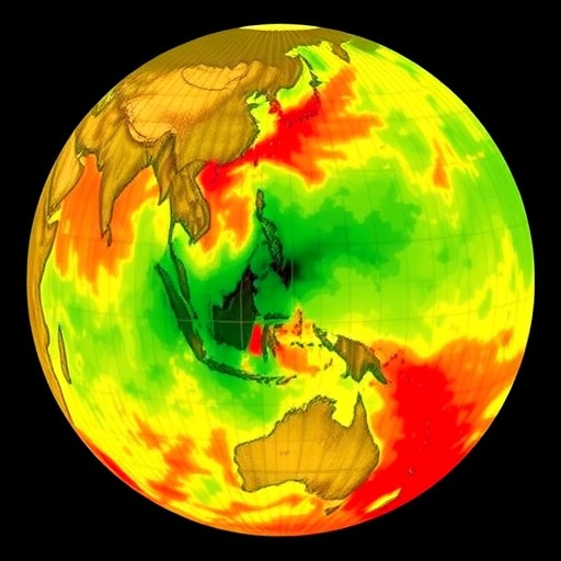
The TANSO-3 instrument offers two distinct observational modes that enable a versatile approach to atmospheric measurement. Its Wide Mode is engineered to scan the entire globe in three days, offering a broad swath width exceeding 900 kilometers and spatial resolution in the order of 10 kilometers. This mode is optimized for frequent global mapping, a capability that is unparalleled by any other satellite sensor presently in orbit. The sheer scale and frequency of data acquisition represent a crucial leap forward in tracking the temporal and spatial dynamics of greenhouse gases worldwide.
Complementing this is TANSO-3’s Focus Mode, optimized for high-resolution observations over targeted urban or regional areas. In this mode, the instrument narrows its swath width to approximately 90 kilometers but significantly refines spatial resolution down to between 1 and 3 kilometers. This capability allows for detailed monitoring of densely populated or industrial regions where anthropogenic emissions vary rapidly and are critical to understanding localized environmental impacts and guiding policy interventions.
The spectrometric data obtained during these observation periods cover wavelengths primarily in the range of 750 to 780 nanometers, with emphasis on bands sensitive to gases such as carbon dioxide, methane, nitrogen dioxide, and oxygen. These measurements hinge on detecting the subtle absorption features in sunlight as it traverses the atmosphere, providing an indirect but highly informative proxy for gas concentrations at various altitudes and locations on Earth’s surface.
One of the groundbreaking aspects of TANSO-3’s design is its capacity to analyze spectral data with spatial context. The instrument captures two-dimensional arrays where one axis corresponds to wavelengths, revealing absorption signatures, and the orthogonal axis spatially maps across the Earth’s surface. This multidimensional data structure allows researchers to dissect variations both spectrally and geographically, unveiling complex patterns of emissions and natural atmospheric processes that were previously difficult to discern at such a scale.
Initial global observations demonstrated TANSO-3’s capacity to achieve comprehensive coverage within a mere three-day window, a cadence essential for capturing dynamic atmospheric phenomena such as episodic emission events, seasonal fluxes, and transport dynamics influenced by weather and climate patterns. Meanwhile, Focus Mode observations over Tokyo and other hotspot regions confirmed the instrument’s capability to acquire comparatively fine-scale data, crucial for urban environmental management and compliance verification related to greenhouse gas reduction initiatives.
The collaborative nature of this project underscores Japan’s commitment to advancing Earth observation technology for the global good. By integrating expertise from environmental science, aerospace engineering, and remote sensing among NIES, MOE, and JAXA, the GOSAT-GW project exemplifies how interdisciplinary scientific alliances can drive forward tools that empower policymakers and researchers worldwide.
Following the completion of the initial functional verification over the next three months from launch, the GOSAT-GW team plans to undertake rigorous sensor accuracy assessments and instrument calibrations. These procedures are vital to ensure data reliability and consistency over the satellite’s operational lifespan. Once these steps are finalized, the satellite will transition into its nominal operational phase, with plans to disseminate data to relevant stakeholders by the end of 2025.
The implications of this enhanced observational capability are far-reaching. As global climate negotiations intensify and nations commit to reducing greenhouse gas emissions, access to near-real-time, high-fidelity atmospheric data becomes indispensable. The comprehensive datasets generated by TANSO-3 will not only fortify global climate models but will also advance our understanding of anthropogenic versus natural emissions, enabling more targeted and effective climate action.
This latest success by Japan’s space and environmental agencies highlights an era where satellite remote sensing technology moves beyond simple monitoring towards enabling actionable intelligence for climate change mitigation. By capturing data across multiple spectral bands and spatial scales, GOSAT-GW sets a new standard in atmospheric science and provides a model for future satellite missions dedicated to sustaining Earth’s environmental health.
The TANSO-3 instrument’s unique ability to switch between Wide and Focus Modes empowers researchers with both the breadth and depth needed to tackle the complex dynamics of the Earth’s atmosphere. These dual observational modes bridge a critical gap in environmental monitoring by addressing large-scale patterns and localized emission sources simultaneously, facilitating comprehensive analyses that could not be achieved with previous satellites.
In conclusion, the initial operations of IBUKI GW and its TANSO-3 spectrometer herald a new chapter in global environmental observation. The integration of innovative technologies, meticulous calibration processes, and a commitment to open data availability will allow this mission to profoundly influence climate science and international emission tracking. As the satellite moves into full operational status, the scientific community and policymakers alike eagerly anticipate the insights and progress that will emerge from this powerful observational platform.
Subject of Research: Not applicable
Image Credits: JAXA/MOE/NIES
Keywords: Greenhouse gases, atmospheric observation, satellite remote sensing, carbon dioxide monitoring, methane detection, TANSO-3, GOSAT-GW, climate science, spectral data analysis, environmental monitoring, Japan Aerospace Exploration Agency, climate change policy
