


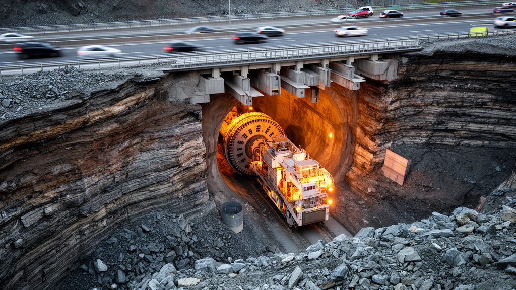
An analytic network process assessment of an operating urban tunnel found that geological conditions carried the greatest weight in the modeled risk affecting the side of the structure that remained open to traffic during in-situ expansion. In the single-project case study, adverse geological conditions received a comprehensive weight of 0.300, followed by surrounding rock quality and fault fracture zones, each at 0.133. Construction quality ranked fourth at 0.102. Despite these weighted indicators, the researchers calculated an overall score of 2.882, placing the project in the study’s Level 3, or “general risk,” band. Construction deformation monitoring served as a limited consistency check and showed neither crown settlement nor clearance convergence associated with Level 4 or Level 5 states.
The engineering study examined an approximately 200.5-metre-long, four-arch urban tunnel with an overall span of about 35.4 metres, originally carrying four traffic lanes in two directions. Constraints from the existing road boundary and surrounding buildings and structures led to a double-deck expansion design, with the upper level constructed mainly by underground excavation. The underground section had a maximum burial depth of approximately 15 metres and passed mainly through weathered granite, with surrounding rock described as predominantly Grade V. The existing tunnel also showed lining cracks, voids behind the lining, local water leakage and deterioration of drainage facilities. A staged construction arrangement first strengthened the tunnel side that would continue carrying traffic while expansion proceeded on the opposite side. Once the expanded side was ready, traffic was transferred and construction proceeded on the other side. Under this arrangement, the traffic-maintaining side could be affected by excavation disturbance, existing structural deterioration, geology and operational traffic loads.
The authors characterized the risk as a compound process rather than the product of one isolated trigger. They summarized its evolution as disturbance by hazard-inducing factors, loss of system equilibrium, spatial and temporal development of hidden hazards, and the triggering of losses. Excavation unloading, removal of existing lining, support conversion and construction vibration may alter the stress state of the original surrounding rock-support system. Pre-existing cracks, voids, leakage and inadequate strength can reduce a retained structure’s resistance to those disturbances, allowing defects to propagate or deformation and local instability to develop. Rainfall, groundwater, surrounding rock quality, cover geometry and traffic loads may further influence that process. The model therefore considered interactions among hazard-inducing factors, risk-bearing bodies and hazard-forming environments, rather than treating a single indicator as an isolated physical cause of an accident.
Risk indicators were assembled through a literature review, statistical analysis of tunnel accidents and fishbone diagram analysis. Researchers initially retrieved 82 accident records and retained 35 that were directly related to operational tunnel safety or traffic, had sufficiently traceable descriptions of causes, triggers and consequences, and offered mechanisms transferable to the traffic-maintaining side of in-situ expansion. Duplicate, incomplete, poorly traceable or weakly relevant records were excluded. Multi-label coding allowed a single accident to contribute to more than one risk category. Existing tunnel factors appeared in 13 of the 35 retained cases, environmental factors in 10, geological factors in 19 and design and construction factors in 10, corresponding to occurrence frequencies of 37.1%, 28.6%, 54.3% and 28.6%. A case was counted only once within a category, even if several factors in that category were present. These accident statistics helped identify relevant risk domains but did not, by themselves, determine their weights in the engineering assessment.
The final index system contained four groups and 12 indicators. Existing tunnel factors comprised lining quality and existing defects. Environmental factors included the cover-to-span ratio, climatic conditions and tunnel traffic conditions. Geological factors covered surrounding rock quality, fault fracture zones, adverse geological conditions and in-situ stress. Design and construction factors represented the expansion excavation method, construction quality and deformation monitoring frequency. Each indicator was scored from 1 to 5 using explicit criteria. Ratings were assigned preferentially from field inspections, geological investigations, design and construction documents, meteorological records, traffic surveys and monitoring records. Relevant standards, engineering documents and defined state descriptions were used for factors that were difficult to express quantitatively. The cover-to-span ratio, for example, was evaluated from burial depth and excavation span, while traffic conditions were assessed from road class and survey data expressed in passenger-car units per day.
To represent relationships among the indicators, the authors used the analytic network process, or ANP, a multicriteria method organized as a network rather than a strictly independent hierarchy. The 17-node model included one overall risk objective, four category nodes and 12 indicator nodes. Some links represented engineering dependencies, including the modeled influence of surrounding rock, fault fracture zones, adverse geological conditions and in-situ stress on existing lining quality and defects. Other links connected selected indicators to the overall evaluation objective. These evaluative feedback links are features of the decision network and do not mean that the overall risk state physically causes geological conditions, traffic loads or other indicators. ANP combines local pairwise judgments into a supermatrix, applies cluster weights and uses power iteration to calculate limiting indicator priorities. The study emphasized that these weights describe priority transmission in the assessment model and should not be interpreted as deterministic causal relationships among engineering variables.
The judgments came from 19 valid questionnaires completed by senior professionals with more than 10 years of experience in tunnel design, construction or research. Respondents compared relevant elements using Saaty’s 1–9 scale, and the authors aggregated individual judgments with geometric means. Aggregated comparison matrices were considered acceptably consistent when their consistency ratios were below 0.1. The weighted supermatrix was checked for non-negativity and column stochasticity before power iteration. Convergence met the specified threshold of 1 × 10⁻⁸ at the 47th iteration. The resulting category weights were 0.594 for geological factors, 0.142 for environmental factors, 0.135 for existing tunnel factors and 0.129 for design and construction factors. Within the environmental group, the cover-to-span ratio had the largest indicator weight, while construction quality dominated the design-and-construction group. These priorities arose from the network specification, expert comparisons and project-specific scores rather than from accident frequency alone.
Applying the model to the project produced a mixture of high current ratings and different weight rankings. Surrounding rock quality, the cover-to-span ratio and tunnel traffic conditions were each rated Level 5. Adverse geological conditions had the highest network weight but received a current rating of Level 2, producing a weighted contribution of 0.600. Surrounding rock quality generated the largest individual weighted contribution, 0.664, followed by the cover-to-span ratio at 0.404. Construction quality was rated Level 2 and contributed 0.203, while existing lining quality was rated Level 4 and existing tunnel defects Level 3. Fault fracture zones and in-situ stress were each rated Level 1, with weighted contributions of 0.133 and 0.029. A high network weight therefore identifies an indicator’s importance within the assessment model, while its project rating represents its evaluated condition at the time of assessment; the two are distinct.
Construction monitoring offered a limited engineering consistency check rather than independent validation of the method. Crown settlement on the traffic-maintaining side was mainly associated with Level 2 risk, with a membership degree of 0.418. Clearance convergence was also mainly associated with Level 2, with a membership degree of 0.406. Neither deformation measure exhibited a Level 4 or Level 5 state, broadly matching the model’s conclusion that the overall project risk was manageable. The authors noted that monitoring chiefly reflected actual structural deformation, whereas the ANP assessment included existing structural conditions, environmental conditions, geology, construction and traffic. ANP also supplied relatively stable baseline weights rather than acting as a time-series prediction model. Dynamic risk could instead be represented by reassessing individual indicator states as construction conditions, geological exposures, traffic organization or monitoring results changed. A substantial change in the construction scheme would require the dependencies and weights to be reassessed.
A one-factor-at-a-time sensitivity analysis indicated that the project’s overall classification remained stable within the tested perturbations. Increasing or decreasing each individual indicator weight by 20%, followed by renormalization, moved the comprehensive score from 2.824 to 2.938. Raising or lowering each individual risk level by one point produced a wider range of 2.582 to 3.181. Every tested result remained within the Level 3 interval of 2.5 to 3.5. The analysis supported the model’s classification under the specified perturbations, but the indicator system has important limitations. Its selection and coding rested on 35 cases, relevant literature and the proposed risk-formation mechanism, without independent double coding, inter-coder reliability assessment or independent expert content validation. The results therefore describe the selected case and the modeled traffic-maintaining context more securely than they establish generalizability to all tunnel-expansion projects. They also show how a structured, network-based assessment can separate indicator importance from the current condition of a specific project, while leaving the dynamic monitoring of risk states to subsequent engineering review.
Subject of Research: Analytic-network-process assessment of risk to the traffic-maintaining side during in-situ tunnel expansion
Article Title: Risk factor identification and ANP-based risk assessment for the traffic-maintaining side during in-situ tunnel expansion
Article References: Zhang, J., Yuan, F., Huang, Y., Xu, H., Jin, Y., Jia, C., & Kuang, H. (2026). Risk factor identification and ANP-based risk assessment for the traffic-maintaining side during in-situ tunnel expansion. Frontiers in Built Environment, 12, Article 1922785. https://doi.org/10.3389/fbuil.2026.1922785
Image Credits: AI Generated
DOI: 10.3389/fbuil.2026.1922785
Keywords: tunnel expansion, traffic-maintaining side, analytic network process, risk assessment, geological hazards, surrounding rock, fault fracture zones, construction quality, deformation monitoring, urban tunnels, Risk, factor
Cite Scienmag News
Violet Maxwell. (October 21, 2026). Geology dominates modeled risk in tunnel expansion under traffic. Scienmag. https://scienmag.com/geology-dominates-modeled-risk-in-tunnel-expansion-under-traffic/
Violet Maxwell. "Geology dominates modeled risk in tunnel expansion under traffic." Scienmag, 21 October 2026, https://scienmag.com/geology-dominates-modeled-risk-in-tunnel-expansion-under-traffic/. Accessed 21 October 2026.
Violet Maxwell. "Geology dominates modeled risk in tunnel expansion under traffic." Scienmag. October 21, 2026. https://scienmag.com/geology-dominates-modeled-risk-in-tunnel-expansion-under-traffic/


