


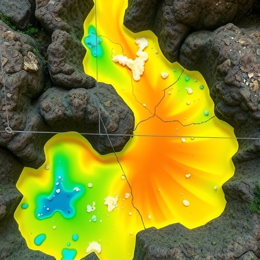
In one of the largest limestone terrains on Earth, an invisible threat is slipping through a maze of underground channels—and for the first time, artificial intelligence can map where it will strike with startling precision. A research team in China has built a machine learning framework that predicts arsenic and lead contamination in karst groundwater with coefficients of determination of 0.8937 for arsenic and 0.8877 for lead, performance that single-model approaches have struggled to reach in these notoriously complex aquifers. The study, published on 19 August 2026 in Frontiers of Environmental Science & Engineering, does not stop at prediction. By transforming model output into high-resolution spatial risk maps, it estimates that 12.69 percent of the study area faces high arsenic risk and 10.70 percent faces high lead risk, potentially exposing about 9.27 million and 10.26 million residents, respectively. Because arsenic is a potent carcinogen and lead a neurotoxin with no known safe exposure level, the results carry immediate implications for how wells are screened, how monitoring networks are placed and how water safety is managed across a region where karst springs and wells are a backbone of the daily water supply.
Karst terrains are born when rainwater, slightly acidified by carbon dioxide, dissolves limestone and dolomite over geological time. The process leaves behind some of the most spectacular and most vulnerable landscapes on the planet: sinkholes that swallow streams whole, caverns that channel flow through pipes rather than pores, and springs that can turn murky within hours of a distant storm. Hydrologically, this architecture is a double-edged sword. The same conduits that make karst aquifers extraordinarily productive also strip away the natural defenses that protect ordinary groundwater. In a sand or clay aquifer, long residence times and reactive minerals give water a chance to filter, adsorb and chemically degrade contaminants. In karst, water can race from a sinkhole to a supply well in days or even hours, with little filtration and limited natural attenuation along the way. Southwestern China sits atop one of the world’s largest continuous karst belts, where carbonate rocks host essential water resources for the region—and where the same geology creates fast lanes for whatever industrial, agricultural or urban pollution washes into the ground.
Predicting where arsenic and lead will appear in such a system is a formidable data problem. Contamination patterns in karst are spatially patchy in ways that defy smooth interpolation: two wells a few hundred meters apart can yield radically different chemistry because one taps a clean fracture network and the other sits downgradient of a pollutant highway. Monitoring networks are sparse and expensive to expand, so any predictive tool must squeeze maximum insight from limited sampling points. Machine learning has become the workhorse of groundwater prediction, but the field’s standard practice—training one model, however sophisticated—hides a subtle flaw. Every algorithm carries structural biases: tree-based ensembles excel at capturing nonlinear thresholds but extrapolate poorly, kernel-based methods such as support vector machines impose smooth surfaces that can wash out sharp contamination fronts, and connectionist models like neural networks demand data volumes that sparse well networks cannot provide. Whichever single model a study adopts, it inherits that model’s blind spots, and previous efforts to map groundwater threats have had to live with the consequences.
The new framework, called a TOPSIS-based regression ensemble, or TRE, attacks that weakness head-on. The team assembled seven base learners chosen for algorithmic diversity, drawing from tree-based lineages such as random forests and gradient-boosted trees, kernel-based machines, and connectionist networks—families whose individual errors are statistically different enough to cancel out when combined intelligently. The crucial innovation lies in how the combination is done. Conventional stacking trains a meta-learner on the base models’ predictions, a strategy that can easily overfit when training data are scarce. TRE instead borrows TOPSIS—the Technique for Order of Preference by Similarity to Ideal Solution, a multicriteria decision-making method long used in engineering and management—to compute aggregation weights objectively. Each base learner is evaluated across multiple performance criteria, and an entropy weighting scheme determines how much each criterion matters, giving greater influence to metrics that genuinely discriminate between models. TOPSIS then measures each learner’s distance from an ideal and an anti-ideal solution, converting those distances into weights that reward models performing well across the board. The result is an ensemble that suppresses individual structural biases while remaining transparent about how much each member contributes—an interpretable alternative to black-box stacking.
When trained on hydrogeological, climatic and anthropogenic predictor data from the study region, the ensemble delivered R² values of 0.8937 for arsenic and 0.8877 for lead, meaning the models explained nearly nine-tenths of the variance in measured concentrations despite the sparse sampling. Converting those continuous predictions into risk classes, the researchers mapped where contaminants plausibly exceed concern thresholds. The maps show that 12.69 percent of the study area carries high arsenic risk and 10.70 percent carries high lead risk. Overlaying population density revealed the human stakes: approximately 9.27 million residents live in areas of potential arsenic exposure and roughly 10.26 million in areas of potential lead exposure. In the world’s largest karst region, the authors note, more than ten million people face the prospect of arsenic or lead in their groundwater. Notably, the two hazard maps do not simply overlap, which itself is a scientific finding: arsenic and lead, the study shows, follow different rules underground.
That difference emerged from the framework’s explainability analysis, which decomposes each prediction into contributions from individual variables and their interactions. For arsenic, the leading driver was precipitation, accounting for 36.18 percent of predictive importance, followed closely by population density at 33.64 percent—a strikingly even split between climatic and anthropogenic control. Arsenic in these aquifers, the analysis suggests, is governed both by natural hydrological and geochemical processes, in which rainfall patterns modulate recharge, redox conditions and the mobilization of geogenic arsenic, and by human pressures that add or release contamination. Lead told a blunter story. Population density dominated at 59.90 percent of importance, with precipitation contributing 15.10 percent and the karst network development index—a measure of how extensively conduits and fractures permeate the rock—adding 14.40 percent. In other words, lead contamination is overwhelmingly a human signature, amplified wherever dense development coincides with well-developed karst plumbing that shuttles pollutants underground with minimal natural cleansing. By probing feature interactions as well as single-variable effects, the team showed that these drivers do not act in isolation but combine to intensify risk in the most vulnerable zones.
The mechanistic picture fits decades of hydrogeological understanding. Arsenic is a geogenic troublemaker: it lurks in aquifer sediments and rock, and shifts in pH, redox state and dissolved organic matter—conditions influenced by rainfall, irrigation and land use—can liberate it into water. The strong precipitation signal in the model echoes this sensitivity to water fluxes, while the population signal reflects human activities that perturb redox chemistry and introduce additional arsenic sources. Lead, by contrast, enters the environment through mining, smelting, industry and urban runoff, and regional studies have documented substantial lead emissions from lead and zinc smelting operations in China. Once deposited at the surface, lead is usually immobilized by soil minerals—unless the soil layer is bypassed entirely. Karst conduits act as express routes that circumvent the clays, oxides and organic matter that would otherwise adsorb the metal, which is precisely why the karst network development index ranks among the top predictors. Where urbanization presses against a mature conduit network, the study concludes, contamination reaches the aquifer faster and travels farther than conventional vulnerability models would predict.
The public health dimension is sobering. Chronic arsenic exposure is linked to cancers of the skin, lung and bladder as well as cardiovascular disease, and global assessments published in Science have identified groundwater arsenic as one of the largest mass poisoning threats in human history. Lead exposure, meanwhile, damages the developing nervous system, and toxicologists maintain that no level of exposure is safe, particularly for children. Against that backdrop, the study’s maps function as a triage instrument. Rather than testing every well across a vast and inaccessible terrain, water managers can direct scarce sampling and treatment resources to the roughly one-tenth of the landscape flagged as high risk, prioritizing wells near dense settlements atop well-developed karst networks. The framework also offers a monitoring blueprint: because the model identifies which variables drive risk, agencies can judge where rainfall-triggered sampling campaigns or density-linked industrial controls would yield the greatest protection. The authors frame the approach as a route to spatially targeted management of heavy metal contamination in karst regions, replacing broad-brush policies with surgically placed interventions.
The implications reach far beyond the Chinese study area. Karst aquifers underlie large portions of Europe, North America, the Middle East and Southeast Asia, supplying drinking water to a substantial share of humanity, and most of these regions face the same curses of heterogeneity and sparse data that the ensemble was built to overcome. Because the TRE framework is modular, its recipe—diverse base learners, entropy-weighted multicriteria evaluation and TOPSIS aggregation—can be retrained on local data wherever wells and springs are monitored, and its interpretability layer turns each regional model into a hypothesis generator about contaminant sources. The study was led by Jiayi Deng and Shengyan Pu of the State Key Laboratory of Geohazard Prevention and Geoenvironment Protection at Chengdu University of Technology, together with Min Wu of the same laboratory and Qiang Tang of the Scientific Research Academy of Guangxi Environmental Protection, with support from the National Natural Science Foundation of China and the National Key Research and Development Program of China. The researchers caution that their maps are data-driven inferences rather than direct measurements, and that denser field validation remains essential. But as climate change intensifies rainfall extremes and development pushes deeper into karst terrain, tools that can see contamination coming—before it reaches the glass—may soon become indispensable.
Cite Scienmag News
Blake Davidson. (August 29, 2026). Explainable AI predicts toxic arsenic and lead in karst groundwater. Scienmag. https://scienmag.com/explainable-ai-predicts-toxic-arsenic-and-lead-in-karst-groundwater/
Blake Davidson. "Explainable AI predicts toxic arsenic and lead in karst groundwater." Scienmag, 29 August 2026, https://scienmag.com/explainable-ai-predicts-toxic-arsenic-and-lead-in-karst-groundwater/. Accessed 3 September 2026.
Blake Davidson. "Explainable AI predicts toxic arsenic and lead in karst groundwater." Scienmag. August 29, 2026. https://scienmag.com/explainable-ai-predicts-toxic-arsenic-and-lead-in-karst-groundwater/


