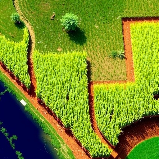
In the ever-evolving landscape of agricultural science, harnessing the power of technology to enhance crop yield and sustainability has become paramount. The research led by Pratiwi, Indarto, and Hakim brings forward a groundbreaking approach to rice yield estimation through the use of advanced vegetation indices derived from Sentinel-2 imagery. This innovative study is set to significantly contribute to sustainable agricultural practices, providing farmers and agronomists with the tools they need to optimize resource management and improve crop productivity.
The foundation of the study rests upon the utilization of Sentinel-2, a European Space Agency satellite equipped with high-resolution imaging capabilities. Sentinel-2’s ability to capture multispectral, ray-rich images allows farmers and researchers alike to analyze various vegetation parameters over large areas with unprecedented accuracy. This technology not only streamlines data collection but also enables real-time monitoring of crop health and growth cycles, paving the way for smarter agricultural practices.
Vegetation indices, particularly the Normalized Difference Vegetation Index (NDVI) and the Enhanced Vegetation Index (EVI), play a crucial role in this research. These indices serve as quantitative measures of the amount and health of vegetation, leveraging satellite imagery to assess plant growth accurately. By employing these indices, the researchers can glean insights into the vital stages of rice growth, including sowing, tillering, and ripening, facilitating timely interventions when necessary.
In the study, the authors meticulously examined how these vegetation indices correlate with rice yield. By analyzing historical data, they established a strong relationship between the indices derived from Sentinel-2 imagery and actual yield outcomes. This correlation not only underscores the potential accuracy of satellite-based assessments but also provides a reliable basis for yield prediction models, which can be invaluable to rice farmers striving for improved production amidst climate challenges.
Moreover, one of the compelling motivations behind this research is the quest for sustainability in agriculture. The world faces increasing pressures to produce more food while conserving natural resources. The findings of this study empower farmers to make informed decisions based on precise data, ultimately leading to a decrease in resource wastage and minimizing environmental impacts. This aligns perfectly with the global goal of achieving sustainable development—ensuring food security without compromising the planet’s health.
The implications of this research extend beyond yield estimation alone. By adopting satellite-based methodologies, researchers and farmers can better understand the spatial variability of crop health across different fields. This understanding can lead to tailored farming practices that suit the unique requirements of specific plots of land, promoting better soil health and more efficient resource use. The act of mapping out areas that require more attention or intervention can truly transform how agricultural operations are planned and executed.
From a technological standpoint, the advent of remote sensing techniques like those employed in this research signifies a major leap forward for precision agriculture. The integration of big data analytics and machine learning algorithms with satellite data can further enhance the predictive capabilities of yield models, allowing for even more refined insights. As computational power continues to increase, the potential for real-time data analysis will be a game-changer for farmers worldwide.
The researchers also delve into the limitations of traditional agricultural practices, which have often relied on physical sampling methods. These conventional methods can be labor-intensive, time-consuming, and sometimes inaccurate. In contrast, the use of satellite-derived indices possesses the ability to provide a more comprehensive overview of crop conditions across expansive regions in a fraction of the time, enabling quicker responses to potential issues.
In an era defined by climate change and unpredictable weather patterns, resilience in agriculture is crucial. The insights gathered from this research can assist farmers in adapting to these changes by allowing them to anticipate plant needs based on emerging growth conditions, thus mitigating potential yield losses. Proactive measures supported by data can strengthen food systems and protect the livelihoods of farmers who depend on consistent yields for survival.
Looking ahead, the application of this research transcends rice cultivation alone. While the study focuses specifically on rice, the methodologies and technologies used are highly adaptable and may be applied to various crops. As more agricultural sectors embrace satellite technology, the collective knowledge garnered can lead to enhanced agricultural sustainability on a global scale. This could signify a shift towards more ecologically friendly practices that benefit farmers, consumers, and the environment alike.
In summary, the research conducted by Pratiwi, Indarto, and Hakim highlights the transformative potential of satellite imagery and vegetation indices in the agricultural sector. Through empirical analysis and innovative methodologies, the study stands as a testament to how science can address food security challenges while promoting sustainable farming practices. The ambitious vision presented in their work not only inspires confidence in the future of agriculture but also reinforces the importance of technological advancement in ensuring a resilient food system.
As we continue to navigate the complexities of global food production, studies like this illuminate the path forward, blending agriculture with cutting-edge technology to foster a healthier planet. Indeed, this intersection of technology and sustainable practices may very well form the backbone of future agricultural strategies, empowering farmers to cultivate the land while protecting it for generations to come.
Subject of Research: Rice yield estimation using vegetation indexes
Article Title: Rice yield estimation using vegetation indexes derived from Sentinel-2 imagery for sustainable agriculture.
Article References:
Pratiwi, G.R., Indarto, I., Hakim, F.L. et al. Rice yield estimation using vegetation indexes derived from Sentinel-2 imagery for sustainable agriculture.
Discov Sustain 6, 1048 (2025). https://doi.org/10.1007/s43621-025-01743-3
Image Credits: AI Generated
DOI: 10.1007/s43621-025-01743-3
Keywords: Sustainable agriculture, Rice yield, Satellite imagery, Vegetation indices, Sentinel-2, Precision agriculture.


