In the world of environmental science, understanding the complexities of soil erosion, land degradation, and landscape management is more pertinent than ever. A groundbreaking study conducted in the Shafe catchment area of the South Ethiopian Rift Valley sheds light on these critical issues. Authored by Abeje, Tsegaye, and Bayu, the research presents a detailed geospatial assessment of erosion intensity, highlighting the urgent need to prioritize vulnerable areas to implement effective soil conservation measures.
The study’s focus is rooted in the recognition that erosion has far-reaching implications not only for agricultural productivity but also for overall ecosystem health. The Ethiopian Rift Valley, characterized by its unique geological features and biodiversity, is under increasing pressure from human activities and climate change. This research emerges at a pivotal moment when sustainable land management practices are desperately needed to avert further degradation.
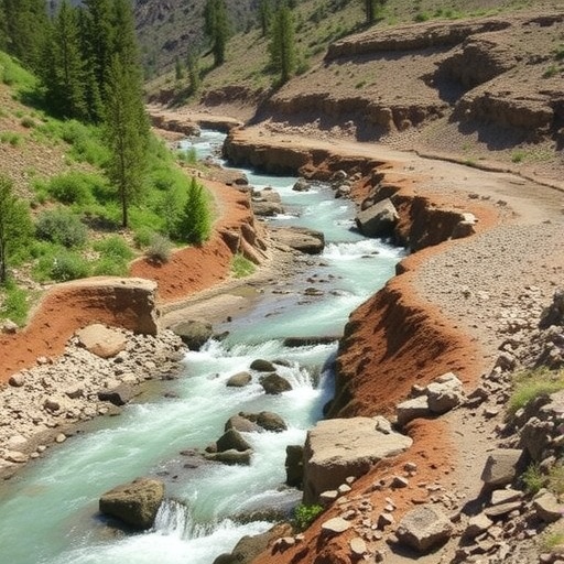
At the heart of the study lies an advanced geospatial analysis, a method employed to visualize and quantify the spatial distribution of erosion across the Shafe catchment. Utilizing satellite imagery and geographic information systems (GIS), the researchers could assess a range of factors contributing to erosion, including land use patterns, vegetation cover, and topography. This sophisticated approach allowed them to create detailed erosion intensity maps that serve as vital tools for policymakers and conservationists alike.
The findings revealed a stark reality: certain regions of the Shafe catchment are disproportionately affected by erosion, indicating areas that are highly vulnerable and in need of immediate attention. By identifying these critical zones, the researchers provide essential data to guide conservation efforts effectively. For instance, areas with steep slopes and minimal vegetation cover were highlighted as hotspots for erosion, suggesting that targeted interventions could yield substantial benefits.
Furthermore, the research emphasizes the need for a multidisciplinary approach to soil conservation. By integrating traditional ecological knowledge with modern technology, the study offers a comprehensive framework for addressing erosion issues. Engaging local communities, whose livelihoods depend on the land, is crucial for ensuring the success of any conservation strategy. The researchers advocate for participatory planning, where the input of local stakeholders is considered integral to developing sustainable solutions.
One of the key technical innovations in this study is the use of erosion prediction models. These models, built on the ground-truth data collected through field surveys, allow for a more accurate anticipation of erosion processes under various scenarios, including changes in land use and climatic conditions. This predictive capability is invaluable for long-term land management planning, providing a roadmap for mitigating erosion effectively over time.
Moreover, this research does not merely dwell on the problems associated with erosion but extends to potential solutions. The authors propose several mitigation strategies, such as reforestation, contour farming, and the establishment of erosion control barriers. By implementing these measures in the identified vulnerable areas, the potential to enhance soil health and restore degraded land significantly increases, leading to improved agricultural outputs and ecosystem resilience.
The implications of this study are profound, especially in a country like Ethiopia, where agriculture plays a central role in the economy. Protecting and enhancing soil health is not just an environmental issue; it is a matter of food security and economic stability. By prioritizing areas that are most susceptible to erosion, the state can ensure that farmers are better equipped to cope with the challenges posed by climate variability and change.
Additionally, the research contributes to the broader discourse on sustainability within the context of the United Nations Sustainable Development Goals (SDGs). The connection between soil preservation, reducing poverty, and promoting sustainable land use practices aligns closely with several of the SDGs, particularly those focused on life on land, zero hunger, and responsible consumption and production. The study furthers the understanding of how local actions can contribute to achieving global objectives.
As the researchers continue to share their findings, they hope to ignite a broader conversation about the importance of geospatial technologies in environmental management. The potential applications of such technologies extend beyond erosion, encompassing areas such as water management, biodiversity conservation, and urban planning. This study is a testament to how innovative research can illuminate pathways toward sustainable development in vulnerable regions.
In conclusion, this landmark study in the Shafe catchment area serves as a clarion call for action against the pressing issue of soil erosion. By harnessing the power of geospatial analysis, the authors have not only mapped the erosion intensity but also provided a strategic framework for mitigating its effects. The urgency of their findings underscores the critical need for immediate and sustained efforts in soil conservation, which could have a lasting impact on the environment and society.
As this research gains traction, there is an opportunity for collaborative efforts among governments, NGOs, and local communities to realize its recommendations. Implementing the suggested strategies could lead to transformative changes in land management practices, fostering a healthier environment for future generations. The urgency and relevance of this work cannot be overstated as we confront the realities of environmental degradation and strive for a more sustainable future.
Strong leadership, integrated approaches, and a commitment to innovation will be essential as we move forward. The geospatial assessment of erosion intensity presented by Abeje and his colleagues is a stellar example of how science can guide effective intervention strategies in the face of pressing environmental challenges. It is indeed a vital contribution to the broader field of sustainable land management, setting a precedent for future research.
The study is a call to arms, urging stakeholders at all levels to take immediate action in combatting soil erosion and safeguarding the fragile ecosystems that sustain humanity. By acting on these insights, we can foster a paradigm shift towards responsible land stewardship that not only protects the environment but also enhances the livelihoods of those who depend on it.
Through continued research and collaboration, the insights from this study stand to reverberate across the region and beyond, influencing policies and practices that address erosion and land management challenges globally. The urgency of these issues demands our immediate attention and action.
Subject of Research: Geospatial assessment of erosion intensity and identification of vulnerable areas in the Shafe catchment.
Article Title: Geospatial assessment of erosion intensity and prioritization of vulnerable areas in the Shafe catchment, South Ethiopian rift Valley.
Article References:
Abeje, A., Tsegaye, D. & Bayu, T.Y. Geospatial assessment of erosion intensity and prioritization of vulnerable areas in the Shafe catchment, South Ethiopian rift Valley.
Discov Sustain 6, 911 (2025). https://doi.org/10.1007/s43621-025-01868-5
Image Credits: AI Generated
DOI:
Keywords: Erosion, Geospatial analysis, Sustainable land management, Soil conservation, Ethiopian Rift Valley.
