In an era where sustainable management of natural resources has become an urgent global priority, the recent environmental zoning study of the Formoso River watershed in Bonito, Mato Grosso do Sul, Brazil, by Medeiros and Silva opens new frontiers in watershed conservation and policy-making. Published in Environmental Earth Sciences, this seminal work elucidates the intricate balance between ecological preservation and socio-economic development within one of Brazil’s ecologically significant river basins. By deploying advanced spatial analysis and multi-criteria evaluation techniques, the researchers have crafted a comprehensive environmental zoning framework that promises to guide sustainable land use planning, mitigate environmental hazards, and enhance biodiversity conservation in the region.
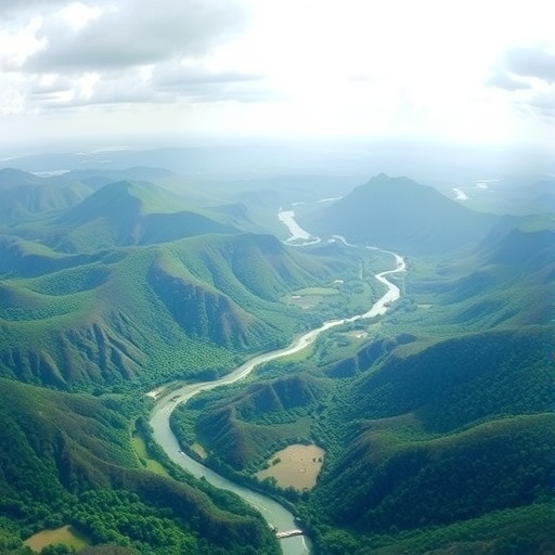
The Formoso River watershed, located in the heart of Mato Grosso do Sul, is renowned for its rich biodiversity, unique karst landscapes, and crystal-clear waters that sustain local communities and numerous endemic species. However, increasing anthropogenic pressures, including agricultural expansion, urbanization, and tourism, threaten the watershed’s delicate hydrological and ecological integrity. The environmental zoning approach presented by Medeiros and Silva acknowledges these multifaceted challenges, integrating diverse datasets such as soil types, vegetation cover, hydrology, and human activities to delineate zones appropriate for specific environmental protections and land-use regulations.
Crucially, the study utilizes Geographic Information Systems (GIS) to overlay environmental attributes with socio-economic variables, allowing fine-scale discrimination of vulnerability and conservation priorities across the watershed. This spatially explicit method provides an indispensable tool for decision-makers, enabling the identification of critical hotspots where intervention can maximize ecological benefits while minimizing human displacement or economic loss. By mapping areas with high erosion risk, sensitive aquatic habitats, and zones prone to pollution, the researchers propose targeted conservation strategies that preserve natural capital while fostering sustainable livelihoods.
Moreover, the incorporation of environmental zoning into local land management policies represents a paradigm shift away from one-size-fits-all approaches toward more tailored and adaptive frameworks. The study highlights how zoning can reconcile competing land uses—such as agriculture, forestry, and eco-tourism—by allocating areas according to their ecological vulnerability and regenerative capacity. This nuanced system aims to reduce land degradation, improve water quality, and maintain ecosystem services essential for both nature and humanity. In regions like the Formoso watershed, where indigenous communities and traditional practices coexist with modern development pressures, such zoning frameworks are key enablers of inclusive and resilient governance.
The technical rigor of the study also stands out for its integration of hydrological modeling with environmental sensitivity indices, providing predictive insights into how land use changes might affect watershed dynamics under different scenarios. This forward-looking perspective is critical, given the impacts of climate change, which may amplify hydrological variability and ecological stress in subtropical watersheds globally. The zoning map produced by Medeiros and Silva offers a spatial blueprint capable of guiding adaptive management in the face of such emerging uncertainties, making it a vital contribution to watershed science.
Notably, the authors emphasize the importance of incorporating community engagement and stakeholder participation in the zoning process. By involving local residents, farmers, policymakers, and environmental NGOs, the proposed zoning scheme not only gains legitimacy but also facilitates knowledge exchange that enriches the scientific basis for environmental stewardship. Capacity-building efforts and education campaigns are suggested as complementary measures, fostering an environmental ethic that aligns local aspirations with ecological imperatives.
Beyond immediate regional benefits, the research also carries broader implications for environmental zoning methodologies worldwide. By demonstrating the efficacy of integrating multidisciplinary data sets within GIS frameworks, Medeiros and Silva showcase a replicable model applicable to other river basins facing similar conservation-development dilemmas. The adaptability of their approach to diverse geographic and socio-economic contexts underlines its potential to enhance global efforts in safeguarding freshwater resources amid mounting human and climatic pressures.
The study further contributes to academic discourse by addressing critical gaps in the spatial planning literature, where watershed-scale zoning remains underexplored compared to urban and coastal zones. Their work reinforces the notion that environmental zoning is not merely a regulatory tool but a dynamic instrument for ecosystem-based management that aligns scientific understanding with governance needs. In this regard, the Formoso River watershed case study serves as an inspiring example of translational science—where empirical research informs practical solutions addressing real-world environmental challenges.
Additionally, Medeiros and Silva’s methodological innovations include the use of high-resolution remote sensing data, which enhances the precision of land cover classification and environmental sensitivity assessment. These technological advancements enable continuous monitoring and updating of zoning maps, facilitating responsive management as conditions evolve. The fusion of remote sensing, GIS, and participatory approaches embodies a modern paradigm of integrated watershed management necessary for the Anthropocene era.
The article also underscores the critical role of institutional coordination among municipal, state, and federal agencies in implementing environmental zoning effectively. The complexity of governance in Brazil, characterized by overlapping jurisdictions and diverse stakeholders, demands coherent policies and clear mandates supported by scientific evidence. The proposed zoning framework offers a common platform to harmonize actions, reduce conflicts, and optimize resource allocation for conservation and development initiatives alike.
From an ecological perspective, the zoning framework helps safeguard the integrity of the Formoso River’s riparian corridors, which are vital for maintaining habitat connectivity and supporting aquatic biodiversity. The preservation of these natural buffers is essential for regulating sediment flux, filtering pollutants, and sustaining the river’s renowned water clarity. By identifying priority conservation areas within the watershed, the zoning plan directly contributes to the protection of endemic fish species and aquatic invertebrates with limited distribution ranges.
The study’s emphasis on sustainable tourism also merits attention, given Bonito’s status as an eco-tourism hotspot attracting thousands of visitors annually. The zoning guidelines inform the spatial distribution of tourism infrastructure and activities to minimize environmental footprints and avoid degradation of sensitive sites. This balance between economic opportunity and ecological stewardship exemplifies the potential of environmental zoning as a mediator of sustainable development models.
Furthermore, the research integrates climate resilience into environmental zoning by factoring in the anticipated hydrological impacts of increased temperature and altered precipitation patterns. This approach ensures that land use recommendations remain viable under future climate scenarios, reducing vulnerability to droughts, floods, and other extreme weather events. The forward-thinking integration of climate adaptation within watershed zoning elevates the study’s relevance amid a rapidly changing planet.
On a socio-economic plane, the zoning framework addresses the livelihoods of agricultural communities dependent on the watershed’s resources. By designating zones for conservation and sustainable use, the plan encourages adoption of best management practices that reduce soil erosion, conserve water, and enhance productivity without compromising ecosystem health. This linkage between environmental sustainability and rural development strategies is key to fostering long-term resilience and poverty alleviation in the region.
In conclusion, Medeiros and Silva’s comprehensive environmental zoning of the Formoso River watershed represents a landmark achievement in integrated watershed management. The study’s robust scientific foundation, coupled with pragmatic policy recommendations, offers an inspiring blueprint for reconciling ecological and human needs in a biodiversity-rich yet vulnerable landscape. Its wide-ranging implications—from advancing geospatial methodologies to informing climate-sensitive governance—mark it as an essential reference point for scholars, practitioners, and policymakers committed to sustainable natural resource stewardship.
The Formoso River watershed zoning initiative exemplifies how cutting-edge science can be harnessed to nurture harmony between human aspirations and ecological boundaries. It is a clarion call to embrace environmental zoning not merely as a technical exercise, but as a transformative strategy central to safeguarding our planet’s freshwater treasures for generations to come.
Subject of Research: Environmental zoning and sustainable land use planning of the Formoso River watershed, Brazil.
Article Title: Environmental zoning of the Formoso river watershed, Bonito – Mato Grosso do Sul/Brazil.
Article References:
Medeiros, R., Silva, C. Environmental zoning of the Formoso river watershed, Bonito – Mato Grosso do Sul/Brazil. Environ Earth Sci 84, 476 (2025). https://doi.org/10.1007/s12665-025-12479-8
Image Credits: AI Generated
