


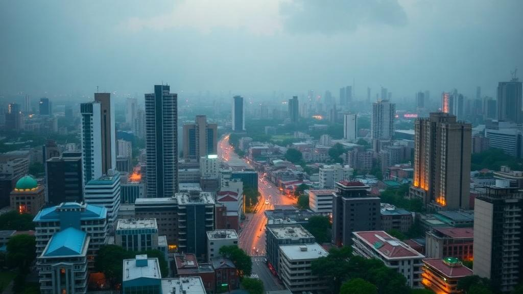
Dhaka, one of the fastest-growing megacities on Earth, has undergone a thermal transformation so dramatic that researchers describe it as the near-total disappearance of the city’s cool zones. A new study published in Discover Geoscience has tracked more than three decades of land-use change and surface warming across the Dhaka City Corporation area, combining satellite imagery, cloud-based geospatial analysis and multivariate statistics to answer a deceptively simple question: where, when and why does extreme heat emerge in this densely packed deltaic capital? The answer, quantified with unusual precision, is that urban land nearly tripled between 1990 and 2024 while the natural surfaces that once kept the city cool largely vanished, pushing the overwhelming majority of the city above 40 degrees Celsius during the pre-monsoon season.
The research team, led by scientists at the University of Barishal with a collaborator at the University of Dhaka, used the Google Earth Engine platform to process multi-temporal Landsat imagery spanning 1990 to 2024, drawing on Landsat 5 Thematic Mapper data for the earlier epochs and Landsat 8 OLI/TIRS data for recent years. All images were restricted to the peak summer period from March to June with cloud cover below ten percent, ensuring that comparisons across decades captured the same seasonal window. Land cover was mapped into four classes using a Random Forest classifier, with spectral indices such as the Normalized Difference Vegetation Index, the Normalized Difference Built-up Index, the Modified Normalized Difference Water Index and a bare-soil index added as input bands to sharpen class separation. The number of decision trees in the classifier was tuned independently for each year, and validation was rigorous: overall classification accuracy exceeded 92 percent in every epoch, Kappa coefficients stayed above 89 percent, and ten-fold cross-validation scores topped 95 percent.
The land-cover results are stark. Built-up area expanded by 92.37 square kilometers, an increase of 194.54 percent, spreading from the dense southern wards of the city toward the north. This growth came almost entirely at the expense of vegetation, which fell by 45.99 percent, and water bodies, which collapsed by 75.57 percent. The losses were not gradual or uniform. Vegetation declined most sharply between 1994 and 1999, a period of major infrastructure development, while water bodies suffered their two worst losses in 1990 to 1994 and again between 2019 and 2024, when half of the remaining surface water disappeared in just five years. A large water body in the city’s central-eastern zone, visible in the 1990 imagery, was progressively filled with bare land as development pushed into previously aquatic terrain. Bare land and other surfaces, often a signature of active land-clearing and sand-filling ahead of construction, increased by 228 percent over the study period.
Land surface temperature, retrieved from the thermal bands using a radiative transfer-based method with emissivity corrections derived from vegetation cover, tells the corresponding story. In 1990, nearly 78 percent of the study area registered temperatures below 25 degrees Celsius and no location exceeded 35 degrees. By 2024, the sub-25-degree zones had vanished entirely, areas above 40 degrees covered 70.06 percent of the city, and 4.44 percent of the land surface exceeded 45 degrees. The turning point came between 2003 and 2007, when the share of the city hotter than 30 degrees jumped from 6.41 percent to 76 percent in a single epoch. The team validated its temperature retrievals against NASA’s MODIS Terra product, finding correlation coefficients between 0.71 and 0.79, and confirmed that no abrupt discontinuity appeared at the 2007-to-2014 transition between the two Landsat sensors, indicating that the observed warming signal, which exceeds 15 degrees Celsius in urban areas, dwarfs any cross-sensor calibration differences.
Each land-cover class warmed, but not equally. Water bodies, once the city’s thermal anchor with a mean surface temperature of 22.69 degrees in 1990, climbed to 36.44 degrees by 2024, a sign that their cooling efficiency is eroding under cumulative thermal stress. Vegetation, still the coolest class, rose from a mean of 23.96 degrees to 39.28 degrees. Urban surfaces escalated from 25.99 degrees to a mean of 42.48 degrees, with a maximum of 52 degrees, while bare land proved the hottest category of all, averaging 42.23 degrees and peaking at a scorching 53.12 degrees. The widening thermal gap between natural and built surfaces is the classic fingerprint of an intensifying surface urban heat island, in which concrete, asphalt and exposed soil absorb and re-emit solar radiation that vegetation and water once dissipated through evapotranspiration and high thermal inertia.
The heat island analysis itself, calculated as the difference between mean urban surface temperature and that of an equally sized rural buffer ring around the city, revealed a troubling diurnal shift. Using separate daytime and nighttime MODIS observations from 2003 to 2024, the researchers found that both day and night heat island intensity rose steadily, but in recent years the nighttime values surpassed the daytime ones. This means Dhaka is no longer merely heating up under the sun; it is failing to cool down after dark. The likely culprits are the high thermal mass of building materials that store heat through the day and release it slowly at night, combined with anthropogenic heat from traffic, industry and air conditioning. For residents, persistent nighttime heat is particularly dangerous because it denies the body the overnight recovery period that normally protects against heat stress.
To move beyond description and identify causes, the team sampled 1,000 random points across the 2024 scene and ran both Pearson correlation analysis and an Ordinary Least Squares multiple regression, with Variance Inflation Factor diagnostics to guard against multicollinearity. The built-up index emerged as the strongest positive correlate of surface temperature, with a correlation coefficient of 0.869, while vegetation showed a strong negative correlation of minus 0.749. Building height, nighttime light density and population density all correlated positively with heat, and proximity to major roads and industrial zones added further warming. The full regression model explained 80.1 percent of the variation in land surface temperature, with the built-up index, population density and nighttime lights as the dominant positive drivers, and distance to water and vegetation both raising temperatures as those cooling features receded. One intriguing anomaly, a positive regression coefficient for the vegetation index despite its negative bivariate correlation, was traced to mixed-pixel effects in Dhaka’s hyper-dense fabric, where small pocket gardens and roadside trees are spectrally entangled with surrounding hot concrete, masking their independent cooling signal at medium resolution.
The authors frame their findings as a diagnostic blueprint rather than a lament. They recommend adapting the 3-30-300 rule as a spatial benchmark for Dhaka’s neighborhoods, so that every resident can see at least three trees from home, every ward achieves at least 30 percent tree canopy cover, and everyone lives within 300 meters of quality green space. They call for strict enforcement against the illegal filling of wetlands and canals, restoration of the Buriganga, Turag, Shitalakshya and Balu rivers and internal drainage channels, and deployment of Sponge City infrastructure such as retention ponds and permeable pavements to boost evaporative cooling. Cool-roof ordinances with reflective coatings for industrial zones and high-density hotspots, plus green walls and passive ventilation retrofits in the historic neighborhoods of Old Dhaka, round out the mitigation package.
Because the entire workflow runs on free, open-access satellite archives and publicly available demographic datasets within Google Earth Engine, the framework is deliberately replicable for other rapidly urbanizing cities of the Global South facing similar pressures. With the United Nations projecting that 68 percent of humanity will live in urban areas by 2050, and with Dhaka’s own population approaching twenty million, the study offers both a warning and a method: the drivers of deadly urban heat can be measured, ranked and targeted, but only if cities act before their last cool zones disappear the way Dhaka’s did.
Subject of Research: Spatiotemporal dynamics and drivers of surface urban heat island intensity in Dhaka, Bangladesh, assessed with geospatial remote sensing
Article Title: Spatiotemporal dynamics and drivers of surface urban heat island intensity in Dhaka, Bangladesh using geospatial remote sensing
Article References: Saha, S. C., Satil, U. A., Paul, N., Nath, D. C., Nepa, F. R., Alam, M. M. T., & Goswami, S. (2026). Spatiotemporal dynamics and drivers of surface urban heat island intensity in Dhaka, Bangladesh using geospatial remote sensing. Discover Geoscience, 4(1), Article 396. https://doi.org/10.1007/s44288-026-00767-0
Image Credits: AI Generated
DOI: 10.1007/s44288-026-00767-0
Keywords: urban heat island, land surface temperature, Dhaka, remote sensing, Google Earth Engine, land use land cover change, Landsat, urbanization, climate resilience, vegetation loss, water bodies, Bangladesh
Cite Scienmag News
Violet Maxwell. (October 11, 2026). Dhaka’s Heat Island Explodes as City Triples Its Built-Up Footprint Since 1990. Scienmag. https://scienmag.com/dhakas-heat-island-explodes-as-city-triples-its-built-up-footprint-since-1990/
Violet Maxwell. "Dhaka’s Heat Island Explodes as City Triples Its Built-Up Footprint Since 1990." Scienmag, 11 October 2026, https://scienmag.com/dhakas-heat-island-explodes-as-city-triples-its-built-up-footprint-since-1990/. Accessed 11 October 2026.
Violet Maxwell. "Dhaka’s Heat Island Explodes as City Triples Its Built-Up Footprint Since 1990." Scienmag. October 11, 2026. https://scienmag.com/dhakas-heat-island-explodes-as-city-triples-its-built-up-footprint-since-1990/


