


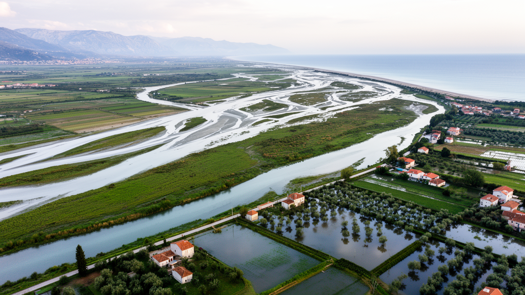
On the eastern coast of the Adriatic Sea, the Neretva River delivers fresh water from a mountainous catchment in Bosnia and Herzegovina into a low-lying delta on Croatian territory, forming one of the most valuable remaining wetlands in the Mediterranean region. A new study published in Estuarine Management and Technologies has quantified, in detail, what happens when that river floods. Using calibrated hydrodynamic models, researchers simulated flood events with return periods ranging from 5 to 1,000 years, mapped the extent and depth of inundation, and calculated the potential damage and human toll. The results reveal a delta where flood protection has improved dramatically over the past half century, yet where a low-probability flood could still cover roughly 110 square kilometers and inflict material damage of approximately 250 million Euros.
The Neretva River rises southeast of the Zelengora Mountain in Bosnia and Herzegovina at an elevation of 1,095 meters above sea level and flows approximately 220 kilometers to the Adriatic, of which only the final 22 kilometers lie within Croatia. Its topographic catchment spans roughly 10,975 square kilometers, mostly across the Dinaric Mountain massif, with only 692 square kilometers in Croatian territory. The delta itself developed over an alluvial area of about 190 square kilometers, formed during the last ice age when rising sea levels flooded karst areas along the river. Gravel and sand carried from upstream deposited in the valley, gradually raising the ground level. The delta existed in a largely natural state until the end of the 19th century, when the first regulatory works began, initially focused on maintaining the waterway from the sea to Metković for commercial transport. During the 20th century, numerous embankments, dams, and other hydrotechnical facilities were constructed and wetland reclamation transformed much of the former wetland into agricultural land, significantly altering the natural character of the area.
A defining feature of the Neretva system is its hydropower infrastructure. In the second half of the 20th century, a series of hydroelectric power plants with reservoirs were built in the upstream basin, including Jablanica in 1954 with a dam height of 85 meters and a reservoir volume of 318 million cubic meters, Rama in 1969, Grabovica and Salakovac in 1981, and Mostar in 1985. At the beginning of the 21st century, additional plants such as Peć Mlini on the Tihaljina tributary and Mostarsko Blato were commissioned, while the construction of the Ulog plant has begun and Konjic is planned. The Trebišnjica River basin, interconnected with the Neretva through deep and underexplored underground karst, carries its own substantial hydropower developments, including the large Bileća reservoir with a volume of 1,277 million cubic meters. These structures exert a dominant influence on the frequency, extent, and duration of floods in the downstream delta, and they also reduce sediment delivery to the valley, deepening the riverbed and worsening problems of water and soil salinity.
The hydrological regime of the basin reflects a transition between moderate continental and maritime influences. Average annual precipitation ranges from 1,000 millimeters on the coast to 1,900 millimeters in the mountainous parts of the catchment, with maxima exceeding 2,900 millimeters in elevated areas. The rainiest quarter of the year is November through January, which is also the period when high waters in watercourses are most frequent; the highest recorded monthly precipitation in this quarter at Metković was 400 millimeters in November 2021. Most precipitation in the Dinaric karst quickly sinks underground, accumulating in the subterranean system before reemerging through numerous springs along the edges of the valley, feeding the Neretva, Mala Neretva, and Norin watercourses. This interaction of surface and underground water produces stretched runoff hydrographs and means that floods in the delta are caused primarily by inflow of large waters from the upstream basin, with smaller contributions from karst springs and the sea, and the least impact from precipitation falling directly on the delta area.
Historical measurements at Metković, the furthest upstream hydrological station in Croatia, located approximately 21 kilometers from the river mouth, illustrate how the hydropower construction changed the flood regime. The highest water levels, exceeding 430 centimeters, were recorded in the 1950s before the construction of the Jablanica and Rama plants. After 1961, the highest recorded water level was 414 centimeters in December 2010, an event that flooded a large part of the valley. Because tidal influence prevents unambiguous determination of flows at Croatian stations, the study relied on statistical analysis of maximum annual water levels. Five theoretical distribution functions were tested, and the log-normal function was selected for Metković and Prud, while log-Pearson was chosen for the sea boundary. Calculated high waters for the 1,000-year return period reached 548 centimeters at Metković, 163 centimeters at the sea station, and 182 centimeters at Prud on the Norin River.
For the hydraulic simulation, the researchers built one-dimensional and coupled one-dimensional/two-dimensional hydrodynamic models using the MIKE 11 and MIKE FLOOD program packages from DHI, covering the Neretva River and its banks from the Croatian state border to the mouth. Calibration and verification were carried out separately for four areas due to the complexity of the system, using registered water levels from boundary stations and treating central stations as control points. Manning roughness coefficients ranged from 0.033 for the riverbed to 0.050 for inundation areas. The difference between modelled and measured water levels was mostly within an interval of plus or minus 5 centimeters, with larger deviations occurring only rarely during rapid water level changes. The authors attribute residual inaccuracies to insufficiently precise terrain geometry and to marginal karst springs whose variable inflows were not defined as boundary conditions but were indirectly incorporated through calibration against measured levels.
The simulations classified flood extent into three statistical probability levels. A high-probability flood, corresponding to a 25-year return period, would cover 51 square kilometers; a medium-probability 100-year event would inundate 62 square kilometers; and a low-probability 1000-year flood would spread across 110 square kilometers. The most endangered zone is the Vid–Norin area, where the city of Metković has expanded significantly and many residential, economic, and infrastructure facilities are at risk. The mouth of the Norin is a particularly sensitive location, allowing Neretva flood waters to enter that area. The Kuti area, a swampy zone intersected by numerous canals and influenced by karst springs fed from the underground hinterland, also has a high probability of flooding, though the risk there is moderated by low population density. The Opuzen-Ušće area, protected by numerous embankments following the course of the Neretva and Mala Neretva, carries the lowest risk.
Damage calculations considered seven categories, including populated areas, economic areas, agricultural areas, permanent plantations, green areas, water management facilities, and potential human victims. For the 1,000-year flood, total damage amounted to 250 million Euros, while a 100-year flood would cause 93 million Euros in damage. Populated areas would account for more than 90 percent of the total, with the greatest territorial losses expected in the wider area of Metković on both banks. The estimated delta damage represents approximately 1 percent of the total potential flood damage for the entire Republic of Croatia and about 6 percent of the damage for the Adriatic basin area. Flood risk, defined as the product of probability and adverse consequences, was expressed as an average annual potential number of victims of 0.67 per year and an average annual damage of 11.63 million Euros under conditions of 2015, before the construction of the Jerkovac embankment in Metković.
Climate change simulations modified both boundary conditions, assuming sea level rise at the downstream edge and increased inflow at Metković. The greatest predicted mean sea level increase was 87 centimeters, or 61 percent, for the end of the 21st century at the 1,000-year return period, accompanied by a 23 percent increase in discharge. Under these conditions, the average annual number of potential victims would rise to 0.88 and total potential average damage to 16.5 million Euros, increases of 31 and 41 percent respectively compared to the 2015 baseline. Based on a multi-criteria analysis, the researchers proposed optimal protective measures, including construction of an embankment on the right bank near Metković, a concrete defensive wall with a mobile barrier in the town, embankments on Mislina and near Krvavac, rehabilitation of riverbanks in critical sections, and a self-regulating gate at the junction of the Norin and Neretva rivers. Implementation would reduce the average annual potential number of victims by 70 percent, to 0.2 per year, and average annual damage by 83 percent, to approximately 2 million Euros, with a benefit-cost ratio of 18.04.
The study acknowledges limitations, including reliance on hydrological series ending in 2013 and the use of digital terrain models in certain areas instead of geodetic measurements, which introduces topographic inaccuracy. Extending the input series and defining hydrographs for marginal karst springs are identified as priorities for future work. Nevertheless, the researchers argue that the methodology is universal and can be applied to similar estuary and delta systems worldwide. Beyond flood defense, the quantified hydrological parameters such as water depth, flow rate, flood duration, and salinity can support ecological studies, which is particularly important given recommendations to preserve natural wetlands in the Mediterranean region. Because the Neretva basin spans two countries with separate protocols and professional services, transboundary cooperation in water management remains essential for reducing flood risks and improving conditions across the entire delta.
Subject of Research: Fluvial flood risk assessment and damage modelling in the Neretva River Delta, Croatia
Article Title: Delta flood risk analysis: case study from the Neretva River (Croatia)
Article References: Ljubenkov, I., Kvesić, D., & Erceg, J. (2024). Delta flood risk analysis: case study from the Neretva River (Croatia). Estuarine Management and Technologies, 1, 69-93. https://doi.org/10.3897/emt.1.137829
Image Credits: AI Generated
DOI: 10.3897/emt.1.137829
Keywords: Neretva River Delta, flood risk, hydrodynamic modelling, MIKE FLOOD, return period, climate change, sea level rise, Mediterranean deltas, karst hydrology, flood protection, damage assessment, Croatia
Cite Scienmag News
Violet Maxwell. (October 17, 2026). Delta flood risk analysis: case study from the Neretva River (Croatia). Scienmag. https://scienmag.com/delta-flood-risk-analysis-case-study-from-the-neretva-river-croatia/
Violet Maxwell. "Delta flood risk analysis: case study from the Neretva River (Croatia)." Scienmag, 17 October 2026, https://scienmag.com/delta-flood-risk-analysis-case-study-from-the-neretva-river-croatia/. Accessed 17 October 2026.
Violet Maxwell. "Delta flood risk analysis: case study from the Neretva River (Croatia)." Scienmag. October 17, 2026. https://scienmag.com/delta-flood-risk-analysis-case-study-from-the-neretva-river-croatia/


