


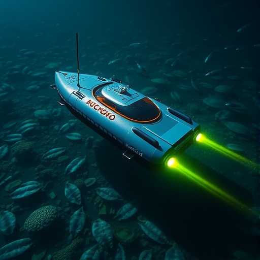
An underwater robot has learned to hunt for the ocean’s richest patches of microscopic plant life, using new measurements to decide where it should travel next. In trials off the coast of Norway, an autonomous underwater vehicle (AUV) repeatedly redirected its path toward layers containing elevated concentrations of chlorophyll A, the light-absorbing pigment used as a proxy for phytoplankton biomass. The approach could give marine scientists a faster way to locate biological “hotspots” that are easily missed by satellites, fixed sampling stations or pre-programmed survey routes. The system, developed by researchers at the Norwegian University of Science and Technology, combines real-time sensing, statistical modeling and onboard path planning. Instead of mapping the entire ocean uniformly, it concentrates effort where the biological signal is strongest while still exploring unfamiliar waters for undiscovered hotspots.
Phytoplankton are microscopic organisms that form the foundation of marine food webs and contribute more than half of the oxygen produced by Earth’s biosphere. Their distribution, however, is far from smooth. Ocean currents, eddies, internal waves, sunlight, nutrients, temperature and grazing by zooplankton can gather them into transient patches that shift through space and time. These structures may extend horizontally across kilometers but vary sharply with depth, sometimes forming narrow layers below the surface. Chlorophyll A is useful because its concentration generally tracks the amount of phytoplankton present, although the relationship depends on species and environmental conditions. Satellite ocean-color measurements can reveal broad surface patterns, but clouds, suspended particles and dissolved organic matter can obscure the signal. More importantly, satellites cannot reliably see blooms that begin deep underwater. An AUV carrying a fluorometer can instead measure chlorophyll directly while moving through the water column.
The new system treats the changing chlorophyll field as a four-dimensional problem: north-south position, east-west position, depth and time. Its statistical engine is a Gaussian random field, a mathematical model that represents how measurements at nearby locations are related. The researchers modeled the logarithm of chlorophyll A rather than the raw concentration, a transformation that helps accommodate strongly skewed biological data and allows the modeled quantity to vary across the full real-number line. Before the mission begins, the model is given a depth-dependent mean and correlation scales describing how quickly chlorophyll patterns change laterally, vertically and over time. The correlations in the horizontal plane and depth follow Matérn functions, which can represent moderately smooth environmental variation, while the time correlation follows an exponential form suited to less predictable fluctuations. Every new fluorometer reading updates the model, changing both the predicted chlorophyll level and the uncertainty at nearby unvisited locations.
The vehicle then evaluates possible future trajectories using a decision rule called expected improvement. At each candidate point, the algorithm estimates the probability that the vehicle will find a chlorophyll value higher than the best one observed so far, as well as the size of the potential gain. Mathematically, if the predicted log-chlorophyll value has mean (m), uncertainty (v), and the current maximum measurement is (x_{text{max}}), expected improvement combines the term ((m-x_{text{max}})Phi((m-x_{text{max}})/v)) with an uncertainty term involving the normal probability density. The result rewards both exploitation—returning to areas likely to contain intense chlorophyll—and exploration, where uncertainty is large enough that a previously unknown hotspot might be discovered. This balance is crucial. A strategy based only on predicted intensity can become trapped around a local maximum, while a strategy based only on variance may spend too little time sampling the biologically important regions.
Path selection is divided into two linked stages designed to match the limitations of an underwater robot. First, while near the surface, the AUV chooses among seven possible lateral directions arranged like the spokes of a spider web. It selects the direction whose prospective transect offers the greatest expected improvement. The second stage chooses depths along that route. The vehicle’s diving angle limits how rapidly it can move vertically; in the Norwegian trials, a 10-degree limit allowed roughly 17 meters of vertical movement for every 100 meters traveled laterally. Nine possible depth profiles were evaluated during each transect. The vehicle also returned to the surface after 800 meters or 15 minutes, whichever came first, so that it could obtain a GPS position and correct accumulated navigation error. This surface reset sacrifices some sampling time, but it prevents uncertainty in dead-reckoned position from growing too large, particularly in strong currents.
A major engineering challenge was making the calculations fast enough for a relatively small onboard computer. Conventional spatio-temporal models often rely on dense grids covering an entire survey area. Updating a Gaussian model on such a grid can require matrix operations whose computational cost rises approximately as the cube of the number of conditioning measurements. The researchers therefore used a grid-free design. The AUV retained observed locations and values rather than maintaining a permanent high-resolution map, and it generated only the small sets of points needed to compare candidate paths immediately ahead. The system also thinned the stored data when the mission became computationally demanding, removing redundant nearby observations and measurements far from the vehicle. Because spatially distant data have limited influence on local predictions—a property related to the screening effect in kriging—this reduction was designed to preserve useful accuracy while keeping response times manageable. The onboard platform was a Light Autonomous Underwater Vehicle equipped with an NVIDIA Jetson TX2 and integrated with robotic software used to exchange sensor and navigation data.
Before going to sea, the team tested the strategy in 100 simulated chlorophyll landscapes, each covering a 4-by-4-kilometer area and extending to 75 meters depth. The virtual vehicle had four hours to survey, traveled at 1 meter per second and periodically surfaced. Expected improvement was compared with maximum variance, maximum expected intensity, probability of improvement and a systematic lawnmower pattern. The principal test classified a hotspot as a location above the 90th percentile of chlorophyll values across the simulated field and mission. Expected improvement increased the fraction of time spent in these top-concentration areas more rapidly than the other adaptive methods and eventually stabilized at the highest level. It also explored hotspot clusters more effectively than the strategy based on maximum expected intensity, which sometimes remained focused on one region after finding a promising signal. Maximum variance visited slightly more clusters overall, but did not examine them as thoroughly. The results indicate that the best strategy depends on the goal: broad uncertainty reduction across an entire field favored systematic or variance-driven paths, whereas locating and characterizing intense patches favored expected improvement.
The field demonstration took place in the Frohavet region near Mausund, roughly 100 kilometers from Trondheim, during two missions on June 6 and 7, 2024. The vehicle used a RBR Tuner Cyclops7 fluorometer to guide its decisions and carried additional instruments for offline comparison, including a conductivity-temperature-depth sensor and a SilCam imaging system for zooplankton. After an initial dive to 70 meters, the adaptive controller directed the AUV mainly toward depths between about 10 and 30 meters, where chlorophyll readings were highest. On the first day, the strongest layer occupied approximately 0 to 25 meters; on the second, it was centered slightly deeper, around 10 to 30 meters, and appeared narrower. The observations also revealed a sharp transition in temperature and salinity near 40 meters, consistent with a seasonal thermocline separating warmer, fresher surface water from colder, saltier water below. Chlorophyll declined rapidly beneath the well-mixed upper layer, suggesting that the robot was tracking a biologically distinct near-surface structure rather than simply responding to a gradual vertical trend.
The researchers also found evidence that phytoplankton-rich water was associated with concentrations of the copepod Calanus finmarchicus, a common zooplankton grazer and an important food source for larger marine animals. The SilCam photographed a small illuminated volume of water at one frame per second, and images were later segmented and classified with a convolutional neural network. The clearest relationship appeared at depths of roughly 10 to 25 meters and at chlorophyll readings around 2 to 4 in the study’s measurement scale, where images contained more suspected Calanus individuals. The result is consistent with copepods gathering where phytoplankton is abundant, although it does not yet provide a calibrated estimate of population size or biomass. Motion blur caused by the AUV’s operating speed made species identification difficult, and copepods may have avoided the vehicle’s hydrodynamic disturbance. The authors therefore describe the relationship as suggestive rather than definitive. Future versions could assimilate chlorophyll, temperature, salinity and image-derived plankton data simultaneously, allowing robots to seek regions that satisfy several biological objectives at once. For now, the work shows how an underwater robot can turn sparse observations into an adaptive biological survey, seeking not merely to pass through the ocean but to follow its most important living signals.
Cite Scienmag News
Denise Maddox. (August 28, 2026). Autonomous Underwater Vehicle Samples Chlorophyll-a Hotspots. Scienmag. https://scienmag.com/autonomous-underwater-vehicle-samples-chlorophyll-a-hotspots/
Denise Maddox. "Autonomous Underwater Vehicle Samples Chlorophyll-a Hotspots." Scienmag, 28 August 2026, https://scienmag.com/autonomous-underwater-vehicle-samples-chlorophyll-a-hotspots/. Accessed 11 September 2026.
Denise Maddox. "Autonomous Underwater Vehicle Samples Chlorophyll-a Hotspots." Scienmag. August 28, 2026. https://scienmag.com/autonomous-underwater-vehicle-samples-chlorophyll-a-hotspots/


