In the dense, often overlooked landscapes of Michigan’s Upper Peninsula, a groundbreaking discovery is rewriting the narrative of indigenous agriculture in North America. Despite the region’s notoriously harsh climate, brief growing seasons, and thick forest cover, new research spearheaded by Dartmouth College reveals the sophisticated and expansive farming practices of ancestral Native American communities at the Sixty Islands archaeological site along the Menominee River. This ancient agricultural system, preserved beneath the forest canopy, emerges as the most comprehensive example of indigenous farming ever documented in the eastern United States.
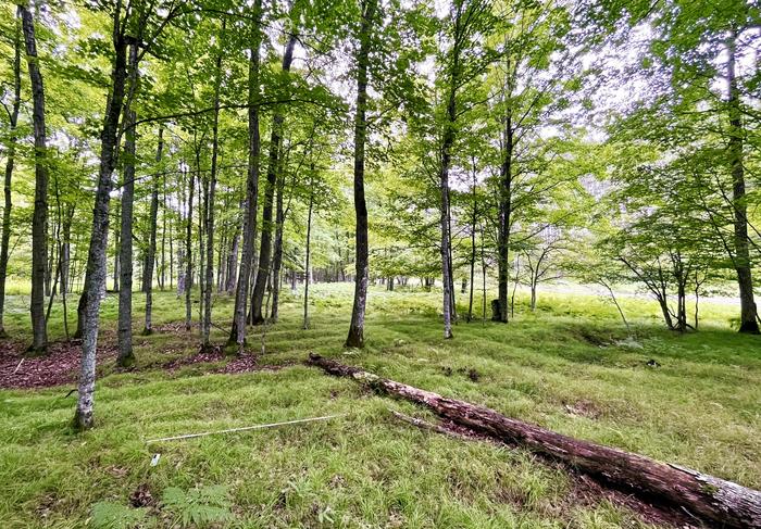
The site itself boasts a raised ridge field system dating from roughly the 10th century through the 1600s, much of which astonishingly remains intact. These fields comprise a series of clustered ridged garden beds, varying in height from four to twelve inches. Constructed and maintained by ancestors of the Menominee Indian Tribe of Wisconsin, these ridges were instrumental for cultivating staples such as corn, beans, squash, and various other plants integral to their diet and culture. The scale and preservation of this agricultural landscape challenge long-standing assumptions about prehistoric subsistence strategies in the region.
Published in the prestigious journal Science, this new study dramatically increases previous estimates of the extent of indigenous agriculture in eastern North America by a factor of ten. Madeleine McLeester, lead author and assistant professor of anthropology at Dartmouth, emphasizes the transformative impact of these findings on our understanding of agriculture on both local and global scales. The sheer size of the farming system suggests a level of social organization and labor investment typically associated with large, state-level societies, contradicting existing beliefs about the small, egalitarian communities historically thought to inhabit this region.
Covering approximately 330 acres, the researchers utilized cutting-edge drone-based lidar technology to penetrate the dense forests and generate a highly detailed topographical map of the ancient fields. This technique employs laser pulses to create a three-dimensional “point cloud” of the landscape, which can then be filtered to remove vegetation data and reveal man-made features beneath the canopy. The high-resolution data unveiled an intricate matrix of parallel ridges stretching across the site in quilt-like patterns, reflecting the adaptive strategies and spatial organization of indigenous farmers rather than simple environmental constraints.
Senior author Jesse Casana, a professor of anthropology renowned for his expertise in remote sensing, underscores the revolutionary nature of drone lidar in archaeological research. Unlike traditional aerial lidar, which often lacks the resolution necessary to detect subtle features, drone-mounted systems offer unprecedented detail, enabling archaeologists to reveal hidden anthropogenic landscapes within heavily vegetated environments where conventional imaging falls short.
Beyond the agricultural ridges, the lidar survey exposed a wealth of archaeological features, including a circular dance ring, a rectangular structure hypothesized to have been a colonial trading post, remnants of two 19th-century logging camps, and multiple burial mounds—some previously unknown or believed destroyed. These discoveries highlight a complex cultural landscape reflecting centuries of human activity, from ritual gatherings to economic exchanges, deeply intertwined with the natural environment.
In August 2023, complementary archaeological excavations targeted three of the raised ridges, sourced at varying distances from the Menominee River. Radiocarbon dating of charcoal samples found within soil strata indicated that these ridges were continuously maintained and periodically rebuilt over a 600-year span, starting around the year 1000, coincident with the Late Woodland period. This continuity suggests not only the longevity of these farming practices but also the resilience and adaptation of the indigenous communities within this challenging ecosystem.
The excavations also yielded charcoal fragments, ceramic sherds, and other artifacts, implying a sophisticated system of soil enrichment and nutrient recycling involving domestic refuse and controlled burns. Charcoal and household waste likely served as compost additives, while incorporation of wetland soils would have improved moisture retention and fertility, optimizing conditions for crops like maize that were cultivated near the northern limits of their natural growth range. This evidence illustrates a deep ecological knowledge and manipulation of local environments by the ancestral Menominee.
The research team’s partnership with the Menominee Indian Tribe of Wisconsin was central to the study’s success, combining community collaboration with advanced scientific methods. Tribal historic preservation officers and consulting archaeologists worked alongside Dartmouth researchers, ensuring the ethical stewardship of culturally significant sites while expanding scholarly understanding of indigenous land use and sustainability practices.
Lidar technology’s contribution to this discovery cannot be overstated. In landscapes where dense forests obscure surface features, the ability to virtually "strip away" the canopy exposes archaeological formations that would otherwise remain invisible. This facilitates a holistic understanding of ancient land management and spatial organization, offering new perspectives on how indigenous peoples transformed and thrived within their environments.
The findings compel a reevaluation of the agricultural history of not only Michigan’s Upper Peninsula but potentially much of eastern North America. The existence of extensive raised-field farming systems suggests that precolonial deforestation and landscape modification were far more widespread than previously acknowledged. Consequently, current forest cover and soil conditions may only represent a fraction of the original anthropogenic environments shaped by indigenous agricultural practices over centuries.
Conclusions drawn from this research challenge entrenched paradigms about the scale and complexity of precontact Native American societies in the northern Midwest. They reveal a dynamic and organized community capable of engineering large-scale modifications to the land to secure food sustainability. This reshapes our understanding of the environmental legacy of these groups and underscores the intricate relationship between cultural practices and ecological contexts.
As the Dartmouth team continues their collaborative work with the Menominee tribe, plans are underway for expanded surveying and excavation aimed at uncovering additional ancestral villages. These endeavors promise to further illuminate the social, economic, and spiritual dimensions of indigenous life in this region prior to European colonization.
Through a combination of ancient technologies, modern remote sensing, and respectful tribal partnership, this study opens a remarkable window into indigenous ingenuity, resilience, and land stewardship critical for redefining North America’s precolonial past. The Sixty Islands site stands as a testament to the enduring legacy of the Menominee and provides a powerful reminder of the continent’s deep, vibrant human history hidden just beneath our feet.
Subject of Research:
Not applicable
Article Title:
Archaeological Evidence of Intensive Indigenous Farming in Michigan’s Upper Peninsula, USA
News Publication Date:
5-Jun-2025
Web References:
https://www.science.org/doi/10.1126/science.ads1643
References:
10.1126/science.ads1643
Image Credits:
Photo by Madeleine McLeester
Keywords:
Agriculture, Archaeological sites, Historical archaeology, Food production, Social sciences, Cultural anthropology, Crops, Maize, Food crops, Remote sensing, Lidar, Ethnicity, Land use, Cropland, Land management, Human geography
